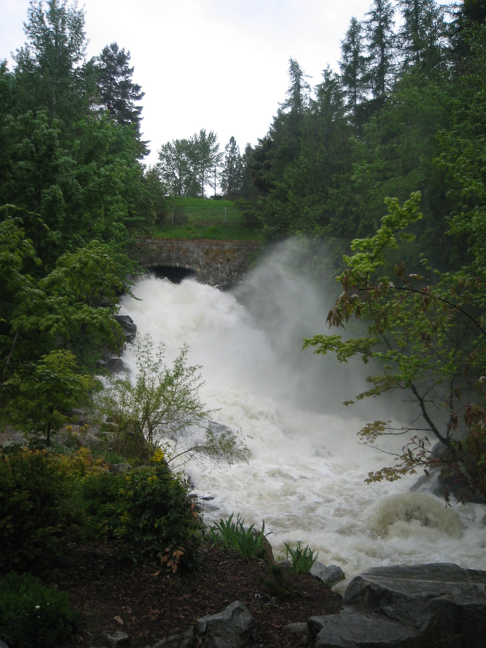
Cottonwood Falls
British Columbia • Stein Valley Nlaka'pamux Heritage Park • 15 m
By Armen Suny · Last verified Jun 2026
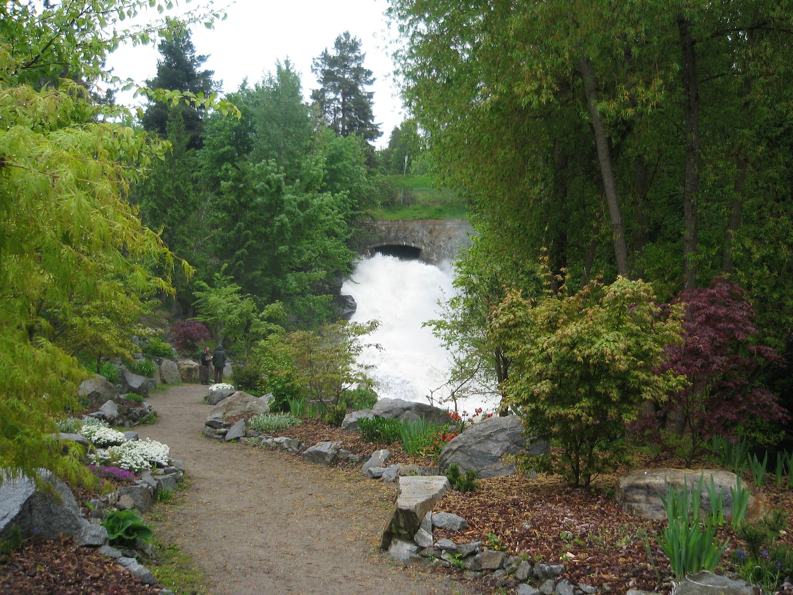
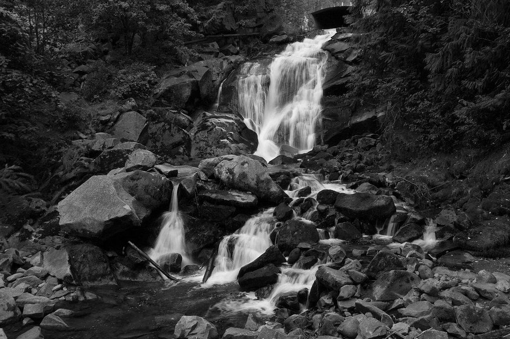
Photo Credits (3)
Difficulty
Hard
Trail Type
Out And Back
About Cottonwood Falls
Cottonwood Falls is a small, locally known waterfall located in the interior of British Columbia roughly 19.6 miles (by road) south of Lillooet (coordinates 50.3088, -121.9632). There is limited formal signage or maintained infrastructure at the site; the fall appears on a forested tributary and is likely seasonal with highest flows during spring snowmelt and after heavy rain. Detailed measurements and a formally recorded trail description are not available from official park sources, so details below are conservative and reflect what visitors commonly report for similar backcountry roadside falls in the region.
The Setting
Cottonwood Falls sits at 733 metres within Stein Valley Nlaka'pamux Heritage Park, in the hills of British Columbia. The falls drop 15 metres.
Why This Waterfall Exists
Cottonwood Falls flows over hard intrusive rock laid down about 23-101 million years ago. These resistant rocks form a durable ledge that water cannot easily wear away, creating a 49-foot drop where softer material downstream has already eroded.
Trail & Hike Details
Trail Description
There does not appear to be an established, maintained trail to Cottonwood Falls. Access is likely a short, unmarked scramble from a nearby pullout or logging road. Expect informal footpaths, brush, roots, wet and slippery surfaces, and possible short steep sections near the creek banks. Route-finding skills and care crossing slippery rocks are recommended.
What to Expect
The falls drop 15 metres over hard intrusive rock.
Accessibility
The trail involves steep, uneven terrain with significant elevation change and is not accessible to mobility devices.
Frequently Asked Questions
🐶 Are Dogs Allowed at Cottonwood Falls?
❌ Dogs are not allowed
Are There Any Fees or Permits Required?
🆖 No fees required
🏊 Is There Swimming at Cottonwood Falls?
❌ Swimming is not allowed
When to Visit
Late spring to early summer for fullest flows (snowmelt). Early fall can offer lower crowds and pleasant conditions. Winter may produce icy approaches and hazardous conditions; use caution or avoid during freeze/thaw periods.
Seasonal Access
The best time to visit is Spring, Summer, Fall, and Winter. Check with Stein Valley Nlaka'pamux Heritage Park for current conditions.
Safety Information
Hazards include slippery rocks and steep creek banks, sudden changes in water flow (flashy creeks after rain), limited or no cell coverage, loose or falling rocks near cliffs, and potential for encountering wildlife. Winter conditions can create ice and unstable footing. Always tell someone your plan, carry navigation, and avoid approaching the edge of cliffs or fast water. Be cautious of private property and logging activity on nearby roads.
Current Water Conditions
Based on a Water Survey of Canada gauge 34.8 km away
2,510.0 m³/s
Current discharge — how much water is flowing
About average for this time of year
Based on 73 years of record
3.52 m
Water depth at gauge
7-Day Discharge Trend
What does this mean for your visit?
Flow is about average for this time of year.
About This Gauge
This gauge is on a regional waterway. Conditions at the falls may differ, especially after local rain.
7-Day Flow Outlook
Based on the WSC gauge FRASER RIVER ABOVE TEXAS CREEK (35 km away).
Today
Moderate
2510 m³/s
6/10Tomorrow
Moderate
2527 m³/s
6/10Tue
Moderate
2577 m³/s
6/10Wed
Moderate
2552 m³/s
6/10Thu
Moderate
2577 m³/s
6/10Fri
Moderate
2502 m³/s
6/10Sat
Moderate
2620 m³/s
5/10Best window: Today — moderate flow, cloudy (trip score 6/10).
Best time of year: this gauge typically runs highest from early May to early August, peaking in June.
How we calculate this
This is a transparent outlook, not a precise forecast. We take the waterfall's current flow strength (how it ranks against its historical normal for today, from the nearest WSC stream gauge), carry that ranking forward along the gauge's seasonal curve, and nudge it for forecast rain. Confidence is highest for the next day or two and falls further out. Always check official conditions and your own judgment before visiting — high flows can be dangerous.
Know when to go.
Get a free email alert when waterfalls near Lillooet hit peak flow. We only send when conditions are worth the trip — no weekly newsletters, no spam.
Weather Forecast
Location & Access
Getting There
From Lillooet, travel approximately 19–21 miles south toward the coordinate point 50.3088, -121.9632. Access may be via a secondary/forestry road or a roadside pullout off the main highway; exact approach can require driving on unpaved roads and some route-finding. Expect limited signage and spotty cell service. Check local road and forest service updates before travel.
Get Directions on Google MapsParking
No formal visitor lot is known. Parking is likely a roadside pullout or informal space on a gravel/forestry road. A high-clearance vehicle may be helpful on unpaved approaches; use caution and avoid blocking roads or private driveways.
Elevation
733 metres above sea level
Coordinates
50.308769° N, -121.963169° W
Land Management
Managed by Government of British Columbia
Visitor Tips & Gear
1) Treat access as backcountry: wear sturdy, grippy footwear and be prepared for uneven, slippery terrain. 2) Do not rely on signage or trail markers, bring a map/GPS and note the coordinates before you go. 3) Respect private property and any posted closures; park off the road without blocking traffic. 4) Expect limited or no facilities (no toilets or trash service), pack out everything. 5) Watch for changing weather and high flows; avoid the creek during or immediately after heavy rain.
Where to Stay
Browse vacation cabins and private rentals nearby
Unique outdoor stays — tents, yurts, and treehouses
Rent a campervan or RV for your waterfall road trip
Some links are affiliate links. We may earn a commission at no extra cost to you.
Nearby Campground
Cottonwood Camp
0.4 km away
Additional Information
Nearby Attractions
Town of Lillooet (services, history), scenic drives along regional highways/forestry roads, local hiking and fishing opportunities. Check regional provincial park listings for formal trails and day-use areas.
Wildlife
Typical interior-BC species: black bear, deer, small mammals, birds, and possibly cougars. Ticks and biting insects may be present in warmer months.
Cities near Cottonwood Falls
Nearby Waterfalls
Other waterfalls named Cottonwood Falls
3 other waterfalls share this name across Canada.
Writing about Cottonwood Falls? Embed this waterfall on your site for free.