Photo Credits (5)
Difficulty
Moderate
Trail Length
2.4 miles
Trail Type
Out And Back
Elevation Gain
350 ft
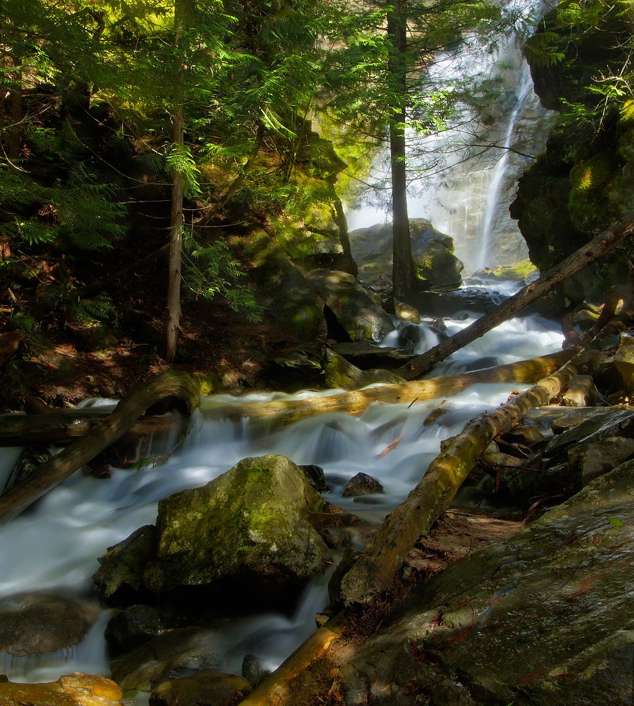
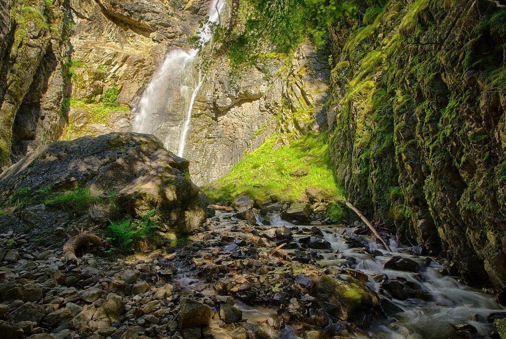
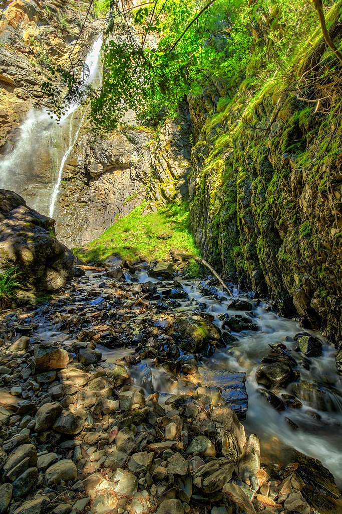
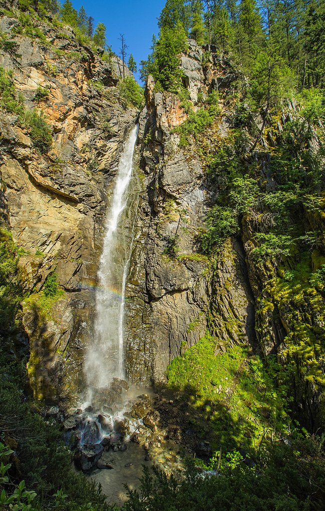
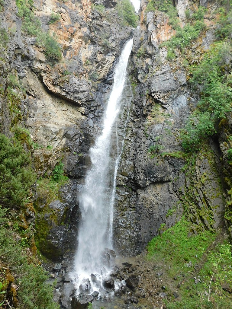
About Copper Falls
Copper Falls is a picturesque waterfall located in the Idaho Panhandle National Forests. It is known for its serene setting, surrounded by lush forest and rocky terrain. The waterfall cascades over a series of rocks, creating a tranquil and scenic spot for visitors.
The Setting
Copper Falls sits at 3,442 feet within Kaniksu National Forest, fed by the Moyie River, in the mountains of Idaho.
Trail & Hike Details
The Approach
The moderate hike follows Copper Falls (#201), a 2.4-mile out-and-back trail over natural surface. Expect 350 feet of elevation gain with grades of 12-20%. The trail is highly developed (Class 4).
USFS Trail
COPPER FALLS #201
Trail Class
Highly Developed
Surface
Avg Grade
USFS Segment
0.66 miTrail Description
The trail to Copper Falls is short and well-maintained, making it accessible for most visitors. It winds through a forested area and leads directly to a viewing platform near the base of the waterfall.
What to Expect
Dogs are welcome.
Accessibility
The trail is not wheelchair accessible. Uneven terrain and elevation changes require steady footing.
Frequently Asked Questions
🐶 Are Dogs Allowed at Copper Falls?
✅ Dogs are allowed
Are There Any Fees or Permits Required?
🆖 No fees required
🏊 Is There Swimming at Copper Falls?
❌ Swimming is not allowed
When to Visit
Spring and early summer are ideal times to visit, as the waterfall is typically at its fullest due to snowmelt.
Seasonal Access
The best time to visit is Spring, Summer, and Fall. Winter access may be limited. Check with Kaniksu National Forest for seasonal road closures.
Safety Information
Exercise caution near the waterfall, as rocks can be slippery. Be aware of wildlife and carry bear spray if hiking in the area. Check weather conditions before visiting, as the trail may be muddy or icy.
Current Water Conditions
413 ft³/s
Current discharge — how much water is flowing
Lower than usual for this time of year
Based on 96 years of record
4.22 ft
Water depth at gauge
7-Day Discharge Trend
What does this mean for your visit?
Flow is lower than usual for this time of year.
About This Gauge
7-Day Flow Outlook
Based on the USGS gauge MOYIE RIVER AT EASTPORT ID (4 km away).
Today
Barely Flowing
446 cfs
3/10Tomorrow
Low
467 cfs
3/10Tue
Low
431 cfs
4/10Wed
Low
393 cfs
4/10Thu
Barely Flowing
355 cfs
5/10Fri
Low
366 cfs
3/10Sat
Barely Flowing
331 cfs
5/10Best window: Thu — barely flowing flow, mostly sunny (trip score 5/10).
Best time of year: this gauge typically runs highest from early April to early July, peaking in May.
How we calculate this
This is a transparent outlook, not a precise forecast. We take the waterfall's current flow strength (how it ranks against its historical normal for today, from the nearest USGS stream gauge), carry that ranking forward along the gauge's seasonal curve, and nudge it for forecast rain. Confidence is highest for the next day or two and falls further out. Always check official conditions and your own judgment before visiting — high flows can be dangerous.
Know when to go.
Get a free email alert when waterfalls near Moyie Springs hit peak flow. We only send when conditions are worth the trip — no weekly newsletters, no spam.
Weather Forecast
Location & Access
Getting There
Copper Falls is located near the town of Clark Fork, Idaho. From Clark Fork, take Forest Road 419 (also known as Lightning Creek Road) for approximately 8 miles. The trailhead is marked and accessible via a short drive on a gravel road.
Get Directions on Google MapsParking
There is a small parking area near the trailhead, suitable for a limited number of vehicles.
Elevation
3,442 feet above sea level
Coordinates
48.971619° N, -116.142143° W
Land Management
Managed by USFS
Visitor Tips & Gear
Visit early in the day to avoid crowds, especially during summer weekends. Wear sturdy shoes as the trail may be muddy or slippery after rain. Bring insect repellent during warmer months.
As an Amazon Associate, we earn from qualifying purchases.
With 2.4 miles and 350 ft of elevation gain, sturdy boots and trekking poles will help on this moderate trail. Sun exposure on the trail makes good sun protection a must in summer.

Polarized Sunglasses (Knockaround)
Cuts glare off the water so you actually see the falls — and your photos turn out better too.

Columbia Watertight II Rain Jacket
Packs into its own pocket, seam-sealed, and keeps you dry from spray and surprise rain.

Earth Pak Waterproof Dry Bag
Keeps your phone and gear dry when waterfall mist soaks everything else.

Waterproof Phone Pouch (AiRunTech)
Cheap insurance — take photos right next to the falls without killing your phone.

Timberland Euro Sprint Mid Waterproof
Trusted waterproof boot with premium leather and grippy rubber sole — reliable on rocky, wet trails.

TrailBuddy Trekking Poles
Lightweight aluminum, cork grips, and flip-locks that actually hold — a best-seller for good reason.
Where to Stay

Skimmerhorn Inn

Quiet Log Cabin • Gazebo • Near River & Trails

Mountain View Retreat

Log Inn Bonners Ferry
Browse vacation cabins and private rentals nearby
Unique outdoor stays — tents, yurts, and treehouses
Rent a campervan or RV for your waterfall road trip
Some links are affiliate links. We may earn a commission at no extra cost to you.
Nearby Campground
SNYDER GUARD STATION (ID)
6.2 miles away · 1 sites
Overview Snyder Guard station, located on the banks of the scenic Moyie River, has been listed on the National Register for Historic places since 1982. The complex of seven buildings includes a residence, two log cabins, a cookhouse, warehouse, corrals, a machinery shed and a garage. The facility is spread across 10 lovely acres and is perfect for large groups of up to 70 people or small family getaways. The buildings on the property were constructed from 1906 to 1936, and most structures are ava
Book on Recreation.govAdditional Information
Nearby Attractions
Nearby attractions include the town of Clark Fork, Lake Pend Oreille, and other hiking trails in the Idaho Panhandle National Forests.
Wildlife
The area is home to various wildlife, including deer, birds, and small mammals. Be cautious of bears and carry bear spray if hiking in the area.
Cities near Copper Falls
Other waterfalls named Copper Falls
2 other waterfalls share this name across the U.S.
Writing about Copper Falls? Embed this waterfall on your site for free.