Copper Falls
By Armen Suny · Last verified Mar 2026
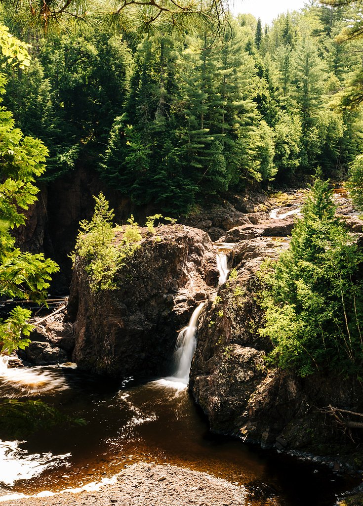
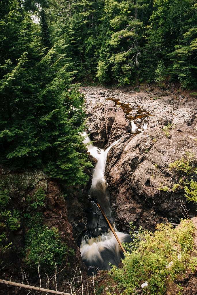
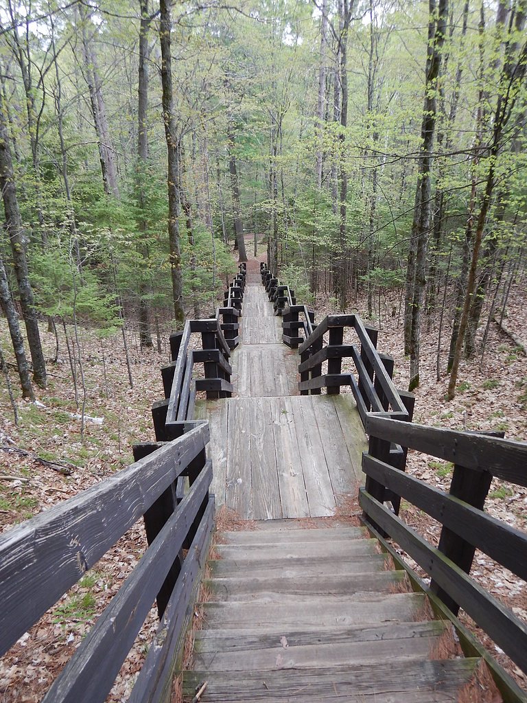
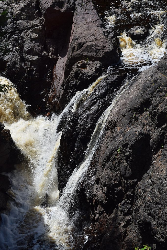

Photo Credits (5)
Difficulty
Easy
Trail Length
1.7 miles
Trail Type
Loop
Elevation Gain
150 ft
About Copper Falls
Copper Falls is a stunning waterfall located within Copper Falls State Park in northern Wisconsin. It is part of the Bad River and features a series of cascades and drops surrounded by rugged, forested terrain. The waterfall is known for its picturesque beauty and is a popular destination for hikers and nature enthusiasts.
The Setting
Copper Falls sits at 1,030 feet within Copper Falls State Park, fed by the Bad River, in the foothills of Wisconsin.
Nearby Falls Worth Visiting
Potato River Falls (90 ft) lies 8.1 miles to the northeast.
Trail & Hike Details
The Approach
The easy 1.7-mile loop trail gains 150 feet of elevation on the way to the falls.
Trail Description
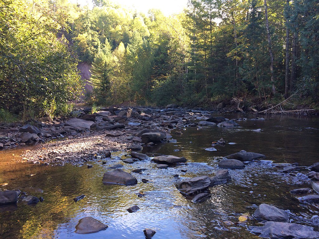
The Doughboys Nature Trail is the most popular route to view Copper Falls. This loop trail is well-maintained and offers several scenic viewpoints of the falls and surrounding gorge. The trail is relatively short and features gentle elevation changes, making it accessible for most visitors.
What to Expect
Dogs are welcome.
Accessibility
The trail is not wheelchair accessible. Uneven terrain and elevation changes require steady footing.
Frequently Asked Questions
🐶 Are Dogs Allowed at Copper Falls?
✅ Dogs are allowed
Are There Any Fees or Permits Required?
🤑 Fee: $0.00
🏊 Is There Swimming at Copper Falls?
❌ Swimming is not allowed
When to Visit
The best time to visit is in the spring when water flow is at its peak, or in the fall when the surrounding foliage is vibrant with autumn colors. Winter visits offer a unique experience with frozen waterfalls and snow-covered trails.
Seasonal Access
The best time to visit is Spring, Summer, Fall, and Winter.
Safety Information
Stay on designated trails and observation platforms, as the gorge edges can be steep and slippery. Be cautious during wet or icy conditions. Carry water and be prepared for changing weather.
Current Water Conditions
14 ft³/s
Current discharge — how much water is flowing
Much lower than usual for this time of year
6.38 ft
Water depth at gauge
7-Day Discharge Trend
What does this mean for your visit?
Flow is well below normal for this time of year, so the waterfall may be a trickle.
About This Gauge
7-Day Flow Outlook
Based on the USGS gauge BAD RIVER AT US HIGHWAY 169 NEAR MELLEN, WI (4 km away).
Today
Low
16 cfs
3/10Tomorrow
Low
17 cfs
3/10Tue
Low
17 cfs
3/10Wed
Low
17 cfs
3/10Thu
Low
17 cfs
3/10Fri
Low
17 cfs
3/10Sat
Low
17 cfs
3/10Best window: Today — low flow, slight chance showers and thunderstorms (trip score 3/10).
How we calculate this
This is a transparent outlook, not a precise forecast. We take the waterfall's current flow strength (how it ranks against its historical normal for today, from the nearest USGS stream gauge), carry that ranking forward along the gauge's seasonal curve, and nudge it for forecast rain. Confidence is highest for the next day or two and falls further out. Always check official conditions and your own judgment before visiting — high flows can be dangerous.
Know when to go.
Get a free email alert when waterfalls near Mellen hit peak flow. We only send when conditions are worth the trip — no weekly newsletters, no spam.
Weather Forecast
Location & Access
Getting There
Copper Falls is located within Copper Falls State Park, near the town of Mellen, Wisconsin. The park is accessible via State Highway 169. Follow signs to the park entrance, where parking is available.
Get Directions on Google MapsParking
Ample parking is available at the state park near the trailheads. A Wisconsin State Park vehicle admission sticker is required to park.
Elevation
1,030 feet above sea level
Coordinates
46.373005° N, -90.639906° W
Land Management
Managed by SDNR
Visitor Tips & Gear
Arrive early during peak seasons (summer and fall) to secure parking and avoid crowds. Wear sturdy footwear, as some sections of the trail may be uneven or slippery. Bring a camera to capture the stunning scenery.
As an Amazon Associate, we earn from qualifying purchases.
This easy 1.7 miles hike is straightforward — comfortable trail shoes and plenty of water should do. Icy conditions are common in winter — traction cleats are a smart addition.

Columbia Watertight II Rain Jacket
Packs into its own pocket, seam-sealed, and keeps you dry from spray and surprise rain.

Polarized Sunglasses (Knockaround)
Cuts glare off the water so you actually see the falls — and your photos turn out better too.

Earth Pak Waterproof Dry Bag
Keeps your phone and gear dry when waterfall mist soaks everything else.

Waterproof Phone Pouch (AiRunTech)
Cheap insurance — take photos right next to the falls without killing your phone.

Kahtoola MICROspikes
Cult-favorite traction cleats that grip ice and wet rock — essential for winter waterfall hikes.

JOBY GorillaPod Starter Kit
Wraps around railings and rocks for long-exposure waterfall shots — no flat surface needed.
Where to Stay

Snow Otter Haus - 2

Snow Otter Haus - 1

Quality Inn Ironwood

Davos Chalet
Browse vacation cabins and private rentals nearby
Unique outdoor stays — tents, yurts, and treehouses
Rent a campervan or RV for your waterfall road trip
Some links are affiliate links. We may earn a commission at no extra cost to you.
Nearby Campground
MINERAL LAKE
10.7 miles away · 10 sites
Overview We apologize, this campground is currently closed. Recreation Boating, swimming and fishing are popular activities among visitors. A boat ramp to the lake is provided off of Forest Service Road 187, about a mile from the campground. Anglers can expect a catch of a variety of freshwater lake and river species, including musky, bass, walleye and pan fish. Eagle watching is also a popular pastime. The forest is home to hundreds of miles of off-road vehicle, hiking and mountain biking trails
Book on Recreation.govAdditional Information
Nearby Attractions
Nearby attractions include Brownstone Falls, Tyler Forks Cascades, and the North Country National Scenic Trail.
Wildlife
The area is home to a variety of wildlife, including deer, black bears, and numerous bird species. Visitors may also spot smaller mammals and amphibians along the trails.
Cities near Copper Falls
Nearby Waterfalls
Other waterfalls named Copper Falls
2 other waterfalls share this name across the U.S.
Writing about Copper Falls? Embed this waterfall on your site for free.