
Photo Credits (5)
Difficulty
Easy
Trail Length
0.4 miles
Trail Type
Out And Back
Elevation Gain
50 ft
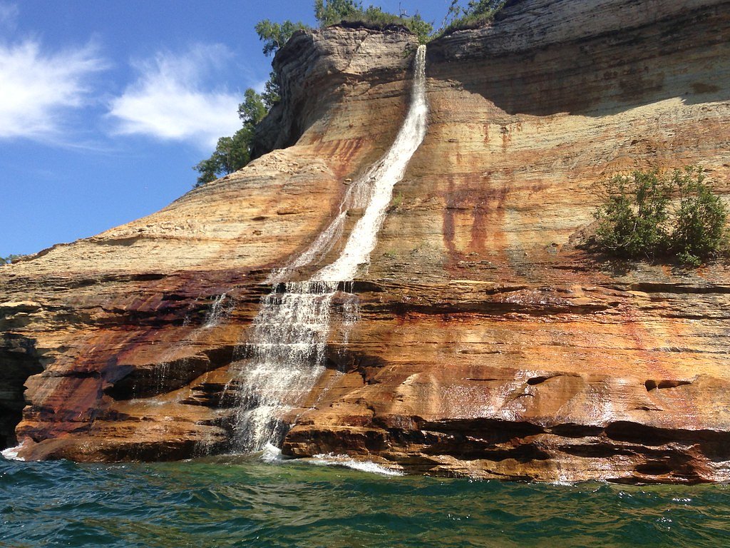
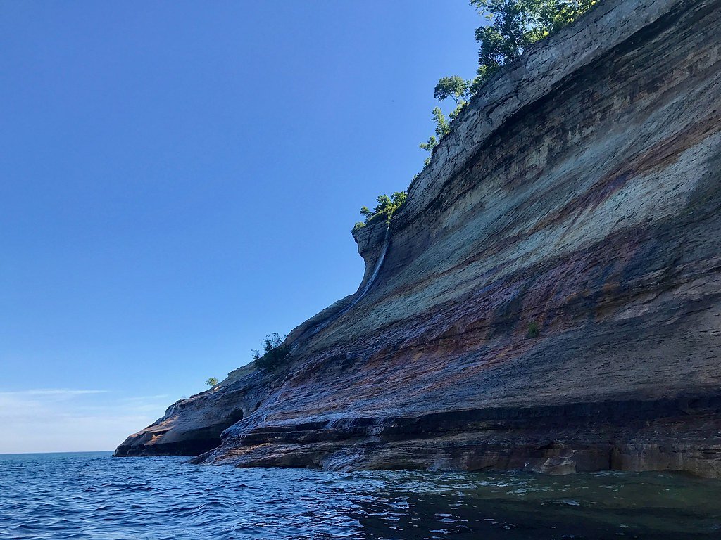
About Bridalveil Falls
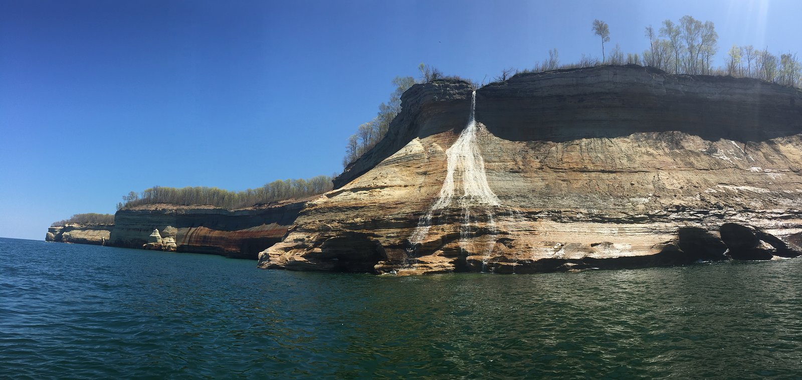
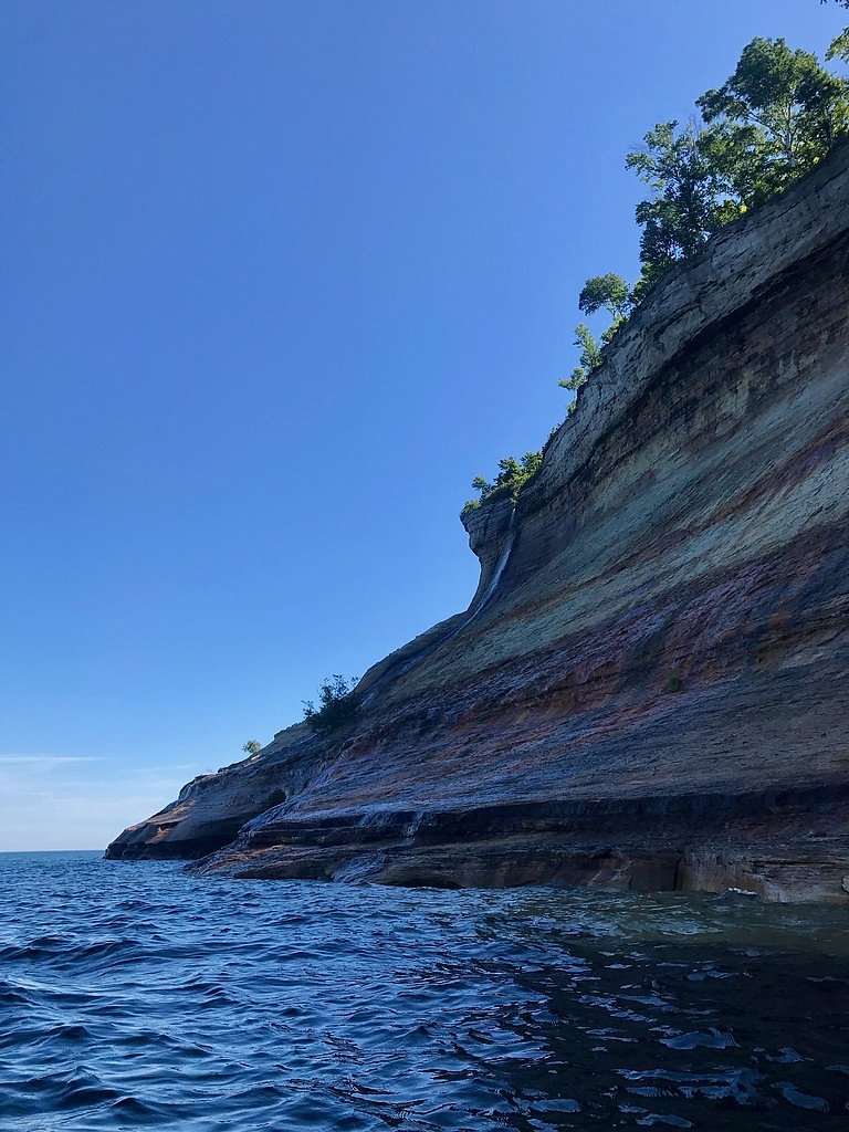
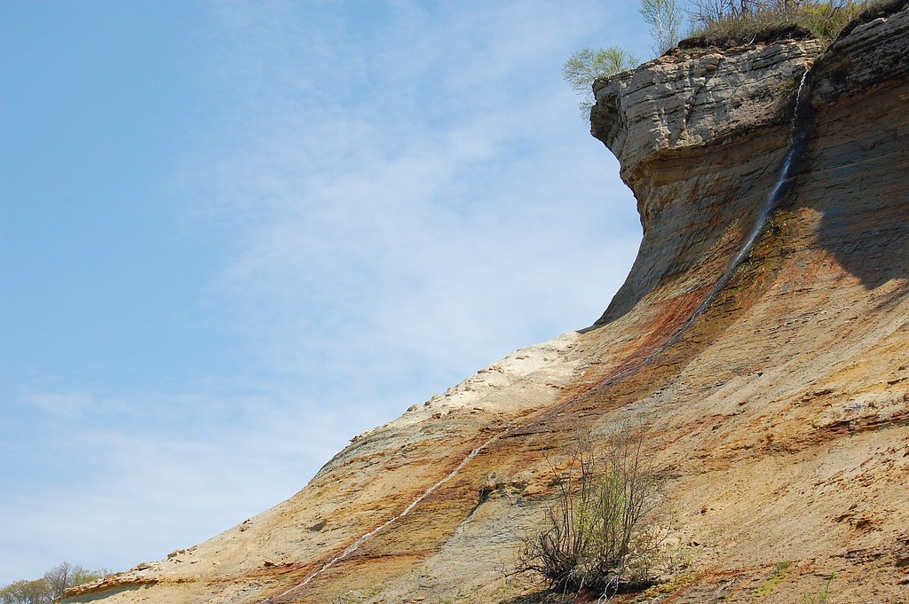
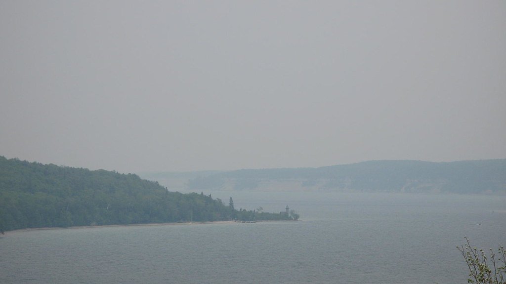
Bridalveil Falls sits along the Lake Superior shoreline near Munising in Michigan’s Upper Peninsula, tucked inside Pictured Rocks National Lakeshore. The falls live up to their name — a term often used for cascades that observers feel resemble a bride’s veil — as a delicate ribbon of water slipping toward the lake. The site is on land owned by DESG and managed by the National Park Service as part of a designated MPA, so visitors should follow park regulations when approaching viewpoints. A short, easy out-and-back route (about 0.4 miles with roughly 50 feet of elevation gain) provides a convenient on‑land viewing spot, though many visitors also enjoy seeing Bridalveil from the water or along the shoreline when lake levels allow. If you plan to camp nearby, Little Duck Campsite on Grand Island is about 9.76 km away and makes a nice base for combining a trip to the falls with broader Pictured Rocks adventures.
The Setting
Bridalveil Falls sits at 758 feet within Pictured Rocks National Lakeshore, fed by the Miners River, in the foothills of Michigan.
Nearby Falls Worth Visiting
Spray Falls (70 ft) lies 6.4 miles to the northeast. Also nearby: Chapel Falls (60 ft, 4.0 mi) and Munising Falls (50 ft, 7.5 mi).
Trail & Hike Details
The Approach
The easy 0.4-mile out-and-back trail gains 50 feet of elevation on the way to the falls.
Trail Description
Length: ~0.4 miles (out-and-back) Elevation gain: ~50 feet Difficulty: Easy Trail type: Out-and-back Surface/grade/class: Not provided in source data Notes: The short, low-grade route is suitable for most hikers and leads to a close viewing area for Bridalveil Falls within Pictured Rocks National Lakeshore (managed by the NPS) on DESG-owned land designated as an MPA. Many visitors also view the falls from the water or along the shoreline depending on conditions.
What to Expect
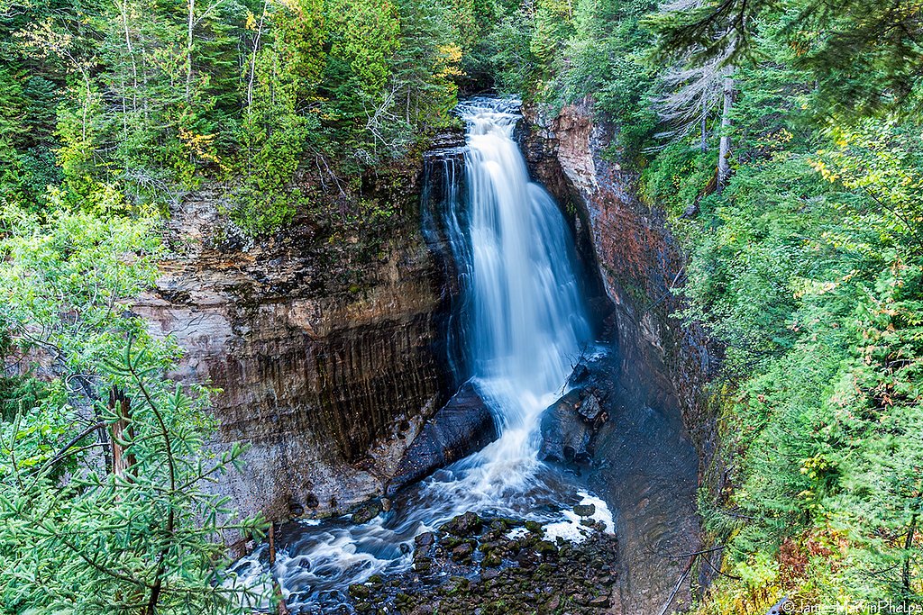
Expect a stunning waterfall cascading down sandstone cliffs into Lake Superior. The flow of the falls may vary depending on the season and recent rainfall.
Accessibility
The trail is short and relatively flat, but the surface may be uneven. Contact the managing agency for accessibility details.
Frequently Asked Questions
🐶 Are Dogs Allowed at Bridalveil Falls?
❌ Dogs are not allowed
Are There Any Fees or Permits Required?
🤑 Fee: $0.00
🏊 Is There Swimming at Bridalveil Falls?
❌ Swimming is not allowed
When to Visit
Spring and early summer are the best times to visit Bridalveil Falls, as water flow is usually at its peak during these seasons.
Seasonal Access
The best time to visit is Spring, Summer, and Fall. Winter access may be limited.
Safety Information
Be cautious of changing weather conditions on Lake Superior, as the lake can become rough quickly. Always wear a life jacket if kayaking or boating.
Current Water Conditions
1.36 ft
Water depth at gauge
About This Gauge
7-Day Flow Outlook
Based on the USGS gauge MINERS RIVER NR MUNISING, MI (3 km away).
Best time of year: this gauge typically runs highest from late March to early June, peaking in May.
How we calculate this
This is a transparent outlook, not a precise forecast. We take the waterfall's current flow strength (how it ranks against its historical normal for today, from the nearest USGS stream gauge), carry that ranking forward along the gauge's seasonal curve, and nudge it for forecast rain. Confidence is highest for the next day or two and falls further out. Always check official conditions and your own judgment before visiting — high flows can be dangerous.
Know when to go.
Get a free email alert when waterfalls near Munising hit peak flow. We only send when conditions are worth the trip — no weekly newsletters, no spam.
Weather Forecast
Location & Access
Getting There
Bridalveil Falls is located along the Pictured Rocks National Lakeshore and is most easily viewed by boat or kayak. It can also be seen from a distance along the lakeshore, but there is no direct trail leading to the falls.
Get Directions on Google MapsParking
Parking is available at nearby trailheads or boat launch areas, such as the Munising Falls Visitor Center or Sand Point.
Elevation
758 feet above sea level
Coordinates
46.508333° N, -86.523056° W
Land Management
Managed by NPS
Visitor Tips & Gear
For the best views, consider taking a boat tour or kayaking along the Pictured Rocks National Lakeshore. Spring and early summer are ideal times to visit when water flow is typically higher.
As an Amazon Associate, we earn from qualifying purchases.
For this easy 0.4 miles trail, lightweight trail shoes and a water bottle are usually sufficient. Sun exposure on the trail makes good sun protection a must in summer.

Polarized Sunglasses (Knockaround)
Cuts glare off the water so you actually see the falls — and your photos turn out better too.

Columbia Watertight II Rain Jacket
Packs into its own pocket, seam-sealed, and keeps you dry from spray and surprise rain.

Earth Pak Waterproof Dry Bag
Keeps your phone and gear dry when waterfall mist soaks everything else.

Waterproof Phone Pouch (AiRunTech)
Cheap insurance — take photos right next to the falls without killing your phone.

JOBY GorillaPod Starter Kit
Wraps around railings and rocks for long-exposure waterfall shots — no flat surface needed.

Osprey Daylite Daypack
Light, organized, and just the right size for a day hike — fits water, snacks, and layers.
Where to Stay

Comfort Inn & Suites Munising-Lakefront

Roam Inn

Quality Inn & Suites Munising

Scotty's Motel
Browse vacation cabins and private rentals nearby
Unique outdoor stays — tents, yurts, and treehouses
Rent a campervan or RV for your waterfall road trip
Some links are affiliate links. We may earn a commission at no extra cost to you.
Nearby Campground
Little Duck Campsite on Grand Island
6.1 miles away · 0 sites
Grand Island, a Congressionally designated National Recreation Area (NRA), boasts massive 300-foot wave-cut sandstone cliffs; 13,500 acres of lush forest; beaches of fine sand; winter ice caves; and historic buildings and artifacts dating back as far as 2,000 BC, to name just a few of its highlights! The island's scenic natural beauty and interesting history make it an attractive place for camping and other outdoor activities.This site is hike in, bike in or boat in only. Public vehicles are not
Book on Recreation.govAdditional Information
Nearby Attractions
Nearby attractions include Munising Falls, Miners Castle, and the Pictured Rocks National Lakeshore scenic drive.
Wildlife
The area is home to a variety of wildlife, including birds, deer, and small mammals. Keep an eye out for bald eagles along the lakeshore.
Cities near Bridalveil Falls
Nearby Waterfalls
Other waterfalls named Bridalveil Falls
1 other waterfall shares this name across the U.S.
Writing about Bridalveil Falls? Embed this waterfall on your site for free.