Big Creek Falls
By Armen Suny · Last verified Mar 2026
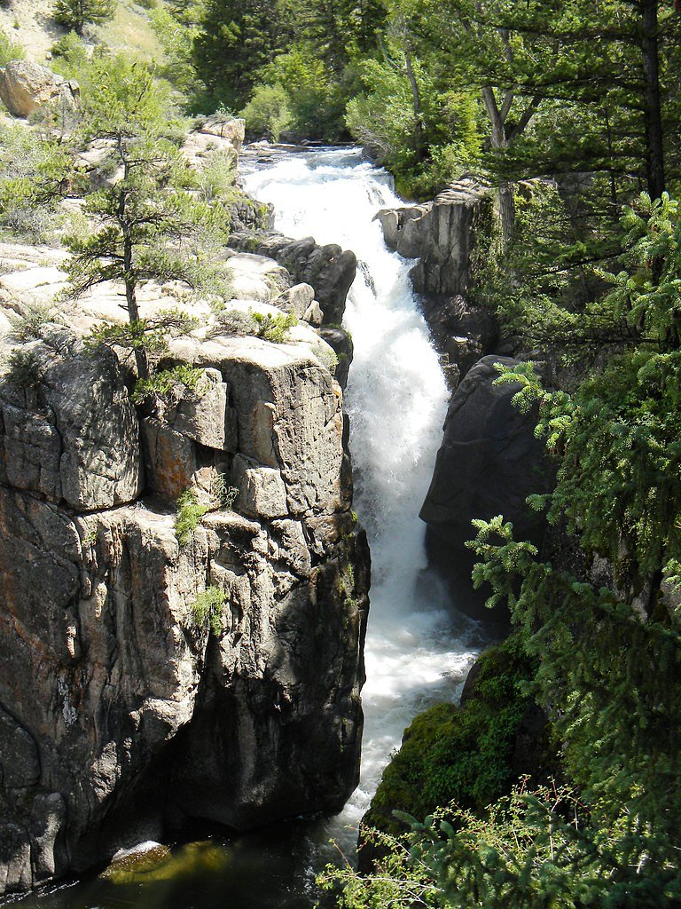
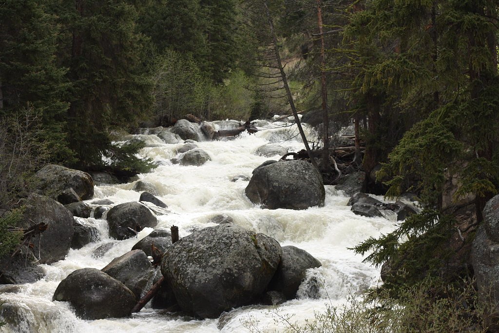
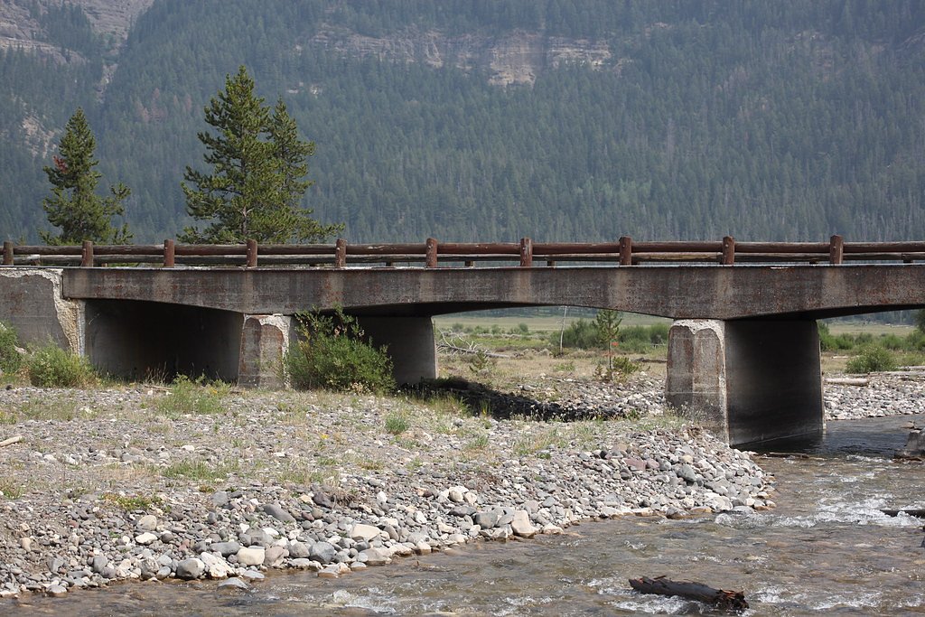
Photo Credits (5)
Difficulty
Moderate
Trail Length
3.0 miles
Trail Type
Out And Back
Elevation Gain
500 ft
About Big Creek Falls
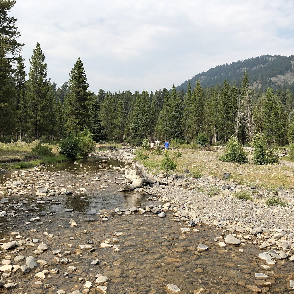
Big Creek Falls tumbles through a forested gorge in Wyoming’s Shoshone National Forest, managed by the U.S. Forest Service. Framed by lodgepole and mixed-conifer stands, the falls are reached via the Big Cr Trail (USFS Trail #761.5), and make a rewarding destination for hikers looking for a relatively short, scenic outing in a less-developed corner of the national forest. The most common approach is an out-and-back day hike of about 3.0 miles with roughly 500 feet of elevation gain, rated moderate. Follow the signed Big Cr Trail into quiet woods to reach viewpoints of the cascade; the route is popular with local day-hikers and offers a peaceful, backcountry feel while still being managed and maintained by the Forest Service.
The Setting
Big Creek Falls sits at 9,754 feet within Shoshone National Forest, fed by the North Fork Shoshone River, in the high alpine of Wyoming.
Trail & Hike Details
The Approach
The moderate hike follows Big Cr Trail (#761.5), a 3.0-mile out-and-back trail over natural surface. Expect 500 feet of elevation gain with grades of 12-20%. The trail is minimally developed (Class 1).
USFS Trail
BIG CR TRAIL #761.5
Trail Class
Minimally Developed
Surface
Avg Grade
USFS Segment
8.48 miTrail Description
Trail: BIG CR TRAIL (USFS Trail #761.5). Type: out-and-back. Distance: 3.0 miles (round trip as commonly hiked). Elevation gain: ~500 ft. Difficulty: Moderate. Surface: native material (natural tread). USFS trail class: 1 (foot trail). Typical grade: 12–20% on the steeper pitches. USFS GIS record lists 8.48 miles for the trail alignment; the frequently used route to the falls is a 3.0-mile hike with uneven, natural tread and short steep sections.
What to Expect
Dogs are welcome.
Accessibility
The trail is not wheelchair accessible. Uneven terrain and elevation changes require steady footing.
Frequently Asked Questions
🐶 Are Dogs Allowed at Big Creek Falls?
✅ Dogs are allowed
Are There Any Fees or Permits Required?
🆖 No fees required
🏊 Is There Swimming at Big Creek Falls?
❌ Swimming is not allowed
When to Visit
The best time to visit is late spring through early fall when the trail is clear of snow and the waterfall flow is at its peak.
Seasonal Access
The best time to visit is Spring, Summer, and Fall. Access roads and trails may close during winter due to snow. Check with Shoshone National Forest for seasonal road closures.
Safety Information
Be prepared for changing weather conditions. Carry bear spray and know how to use it. Watch for slippery rocks near the waterfall.
Current Water Conditions
2,670 ft³/s
Current discharge — how much water is flowing
About average for this time of year
Based on 36 years of record
5.50 ft
Water depth at gauge
7-Day Discharge Trend
What does this mean for your visit?
Flow is about average for this time of year.
About This Gauge
This gauge is on a nearby waterway and may not reflect exact conditions at the falls.
7-Day Flow Outlook
Based on the USGS gauge NORTH FORK SHOSHONE RIVER AT WAPITI, WY (19 km away).
Today
Moderate
2907 cfs
6/10Tomorrow
Strong
3234 cfs
7/10Thu
Strong
3372 cfs
7/10Fri
Strong
3323 cfs
7/10Sat
Strong
3056 cfs
7/10Sun
Moderate
2698 cfs
6/10Mon
Moderate
2719 cfs
6/10Best window: Tomorrow — strong flow, partly sunny then showers and thunderstorms (trip score 7/10).
Best time of year: this gauge typically runs highest from late April to late July, peaking in June.
How we calculate this
This is a transparent outlook, not a precise forecast. We take the waterfall's current flow strength (how it ranks against its historical normal for today, from the nearest USGS stream gauge), carry that ranking forward along the gauge's seasonal curve, and nudge it for forecast rain. Confidence is highest for the next day or two and falls further out. Always check official conditions and your own judgment before visiting — high flows can be dangerous.
Know when to go.
Get a free email alert when waterfalls near Cody hit peak flow. We only send when conditions are worth the trip — no weekly newsletters, no spam.
Weather Forecast
Location & Access
Getting There
Big Creek Falls is accessible via the Bridger-Teton National Forest. The trailhead is located near the town of Pinedale, Wyoming. Visitors should follow signs for the Big Sandy Trailhead, which provides access to the area.
Get Directions on Google MapsParking
Parking is available at the trailhead, but spaces may be limited during peak seasons. Arrive early to secure a spot.
Elevation
9,754 feet above sea level
Coordinates
44.582921° N, -109.599495° W
Land Management
Managed by USFS
Visitor Tips & Gear
Wear sturdy hiking shoes and bring plenty of water. Bug spray is recommended during warmer months. Arrive early to avoid crowds and secure parking.
This trail sits at 9,754 ft — the air is noticeably thinner
High AltitudeSome visitors experience headaches, fatigue, or shortness of breath at this elevation. Take it slow, stay hydrated, and consider supplemental oxygen if you're coming from a lower altitude.
As an Amazon Associate, we earn from qualifying purchases.

Coppertone Sport SPF 50 Sunscreen
UV intensity jumps ~4% per 1,000 ft — at this elevation you can burn in half the time.

Sun Bum SPF 30 Lip Balm (3-Pack)
Lips have almost no natural UV protection and burn fast in thin, dry mountain air.

Liquid I.V. Electrolyte Packets
You lose moisture ~2x faster at elevation — electrolytes help you absorb water efficiently.

ROCKNIGHT Polarized UV400 Sunglasses
High-altitude glare off rock and water is intense — UV400 lenses block 99%+ of UVA/UVB.

Boost Oxygen 10L Canister (2-Pack)
Portable supplemental oxygen for quick relief from headaches and shortness of breath.

Altitude Rx OxyBoost Complex
Antioxidant formula designed to support your body's natural altitude acclimation.
As an Amazon Associate, we earn from qualifying purchases.
With 3.0 miles and 500 ft of elevation gain, sturdy boots and trekking poles will help on this moderate trail. Sun exposure on the trail makes good sun protection a must in summer.

Polarized Sunglasses (Knockaround)
Cuts glare off the water so you actually see the falls — and your photos turn out better too.

Columbia Watertight II Rain Jacket
Packs into its own pocket, seam-sealed, and keeps you dry from spray and surprise rain.

Earth Pak Waterproof Dry Bag
Keeps your phone and gear dry when waterfall mist soaks everything else.

Waterproof Phone Pouch (AiRunTech)
Cheap insurance — take photos right next to the falls without killing your phone.

Timberland Euro Sprint Mid Waterproof
Trusted waterproof boot with premium leather and grippy rubber sole — reliable on rocky, wet trails.

TrailBuddy Trekking Poles
Lightweight aluminum, cork grips, and flip-locks that actually hold — a best-seller for good reason.
Where to Stay

Green Creek Inn and RV Park

The Historic Wapiti Lodge

Bill Cody Ranch

Cody Cowboy Village
Browse vacation cabins and private rentals nearby
Unique outdoor stays — tents, yurts, and treehouses
Rent a campervan or RV for your waterfall road trip
Some links are affiliate links. We may earn a commission at no extra cost to you.
Nearby Campground
WAPITI CAMPGROUND
8.2 miles away · 40 sites
Overview Wapiti Campground is located is located along the Buffalo Bill Scenic Byway about 30 miles west of Cody, in northwestern Wyoming. It is 22 miles east of the east entrance to Yellowstone National Park. The surrounding area offers many outdoor recreational opportunities, including fishing, hiking and viewing local wildlife.Recreation Great opportunities for hiking, fishing, scenic driving and wildlife viewing are available around the campground. The North Fork of the Shoshone River is a po
Book on Recreation.govNearby Hot Springs
Hot springs near Cody, Wyoming

Buffalo Bill Reservoir Springs
Buffalo Bill Reservoir Springs flows at 5,390 feet elevation along the southern margins of Buffalo Bill Reservoir, classified a...

Buffalo Bill Reservoir Springs
Buffalo Bill Reservoir Springs emerges at 5,530 feet along the shores of Buffalo Bill Reservoir in Park County, classified as w...
Buffalo Bill Reservoir Springs
Buffalo Bill Reservoir Springs emerges at 5,390 feet along the extensive shoreline of Buffalo Bill Reservoir, classified as war...

Needle Hot Springs
Needle Hot Springs discharges at 75 degrees Fahrenheit—32 degrees above ambient—along Buffalo Bill Reservoir's shoreline at 5,0...

Shoshone Hot Springs
Shoshone Hot Springs flows at 95 degrees Fahrenheit along the North Fork Highway beside Buffalo Bill Reservoir at 5,106 feet el...

De Maris Springs
De Maris Springs emerges at 97 degrees Fahrenheit along the North Fork of the Shoshone River at 4,934 feet elevation, where USG...
Looking for a soak after your hike? Explore more hot springs near Cody, Wyoming on SoakingSprings.
Explore Wyoming springsAdditional Information
Nearby Attractions
Nearby attractions include Fremont Lake, the Wind River Range, and the town of Pinedale.
Wildlife
The area is home to wildlife such as deer, elk, and various bird species. Be cautious of bears and carry bear spray.
Cities near Big Creek Falls
Nearby Waterfalls
Other waterfalls named Big Creek Falls
1 other waterfall shares this name across the U.S.
Writing about Big Creek Falls? Embed this waterfall on your site for free.