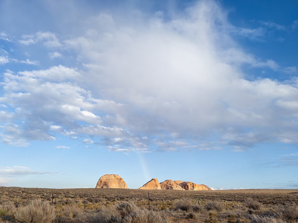
Big Creek Falls
By Armen Suny · Last verified Mar 2026

Photo Credits (5)
Difficulty
Moderate
Trail Length
4.8 miles
Trail Type
Out And Back
Elevation Gain
600 ft
About Big Creek Falls
Big Creek Falls is a peaceful cascade tucked into Routt National Forest and managed by the U.S. Forest Service. The falls are a rewarding destination for hikers who appreciate quiet mountain streams and conifer-shaded scenery. Many visitors reach the overlook by following the Big Creek corridor, where the rush of water and the surrounding forest create a classic Colorado backcountry setting. Access to the falls is most commonly done via the USFS Big Creek Lakes Loop (Trail #1125.1A). The route to the falls is typically done as a moderate 4.8-mile out-and-back with roughly 600 feet of elevation gain; the USFS records the trail segment as GIS 2.0 miles for the loop portion. This relatively short hike delivers a sense of remoteness without requiring technical scrambling, making it a great choice for day hikers looking to experience Routt National Forest stewardship and scenery managed by the U.S. Forest Service.
The Setting
Big Creek Falls sits at 9,249 feet within Routt National Forest, fed by the North Platte River, in the high alpine of Colorado.
Trail & Hike Details
The Approach
The moderate hike follows Big Creek Lakes Loop (#1125.1A), a 4.8-mile out-and-back trail over natural surface. Expect 600 feet of elevation gain with grades of 12-20%. The trail is moderately developed (Class 2).
USFS Trail
BIG CREEK LAKES LOOP #1125.1A
Trail Class
Moderately Developed
Surface
Avg Grade
USFS Segment
2.00 miTrail Description
Trail: Big Creek Lakes Loop (USFS Trail #1125.1A) — USFS/Route Info: NF (Routt National Forest), managed by the U.S. Forest Service. Length & profile: Commonly done as a 4.8-mile out-and-back to the falls with ~600 ft elevation gain; USFS GIS mileage for the loop segment is 2.0 miles. Difficulty: moderate; Trail type: out-and-back. Surface & class: Native-material tread (NAT) with typical grade sections of 12–20%. Trail class: 2 (non-technical; may include simple off-trail moves). The route follows Big Creek and travels through forested terrain on mostly natural footing—expect root-and-rock sections and steady uphill stretches on the approach.
What to Expect
Dogs are welcome.
Accessibility
The trail is not wheelchair accessible. Uneven terrain and elevation changes require steady footing.
Frequently Asked Questions
🐶 Are Dogs Allowed at Big Creek Falls?
✅ Dogs are allowed
Are There Any Fees or Permits Required?
🆖 No fees required
🏊 Is There Swimming at Big Creek Falls?
❌ Swimming is not allowed
When to Visit
The best time to visit is late spring through early fall when the trail is most accessible and the waterfall flow is at its peak.
Seasonal Access
The best time to visit is Spring, Summer, and Fall. Access roads and trails may close during winter due to snow. Check with Routt National Forest for seasonal road closures.
Safety Information
Be prepared for changing weather conditions, and carry a map or GPS device as cell service may be limited. Watch for slippery rocks near the waterfall.
Current Water Conditions
Based on a USGS gauge 15.7 miles away
176 ft³/s
Current discharge — how much water is flowing
Much lower than usual for this time of year
Based on 112 years of record
2.83 ft
Water depth at gauge
7-Day Discharge Trend
What does this mean for your visit?
Flow is well below normal for this time of year, so the waterfall may be a trickle.
About This Gauge
This gauge is on a regional waterway. Conditions at the falls may differ, especially after local rain.
7-Day Flow Outlook
Based on the USGS gauge NORTH PLATTE RIVER NEAR NORTHGATE, CO (25 km away).
Today
Roaring
190 cfs
6/10Tomorrow
Roaring
166 cfs
9/10Sun
Roaring
141 cfs
9/10Mon
Roaring
134 cfs
9/10Tue
Roaring
129 cfs
9/10Wed
Roaring
125 cfs
9/10Thu
Roaring
122 cfs
9/10Best window: Tomorrow — roaring flow, sunny (trip score 9/10).
Best time of year: this gauge typically runs highest from mid April to mid July, peaking in June.
How we calculate this
This is a transparent outlook, not a precise forecast. We take the waterfall's current flow strength (how it ranks against its historical normal for today, from the nearest USGS stream gauge), carry that ranking forward along the gauge's seasonal curve, and nudge it for forecast rain. Confidence is highest for the next day or two and falls further out. Always check official conditions and your own judgment before visiting — high flows can be dangerous.
Know when to go.
Get a free email alert when waterfalls near Riverside hit peak flow. We only send when conditions are worth the trip — no weekly newsletters, no spam.
Weather Forecast
Location & Access
Getting There
Big Creek Falls is located in the Routt National Forest near the town of Walden, Colorado. Access typically involves driving on forest roads, which may be unpaved and require a high-clearance vehicle during certain seasons.
Get Directions on Google MapsParking
Parking is available at the trailhead, but spaces may be limited during peak seasons. Visitors are advised to arrive early to secure a spot.
Elevation
9,249 feet above sea level
Coordinates
40.908860° N, -106.638371° W
Land Management
Managed by USFS
Visitor Tips & Gear
Wear sturdy hiking shoes and bring plenty of water, especially during warmer months. Bug spray is recommended in the summer. Check trail conditions before visiting, as snow or mud may make the trail more difficult to navigate.
This trail sits at 9,249 ft — the air is noticeably thinner
High AltitudeSome visitors experience headaches, fatigue, or shortness of breath at this elevation. Take it slow, stay hydrated, and consider supplemental oxygen if you're coming from a lower altitude.
As an Amazon Associate, we earn from qualifying purchases.

Coppertone Sport SPF 50 Sunscreen
UV intensity jumps ~4% per 1,000 ft — at this elevation you can burn in half the time.

Sun Bum SPF 30 Lip Balm (3-Pack)
Lips have almost no natural UV protection and burn fast in thin, dry mountain air.

Liquid I.V. Electrolyte Packets
You lose moisture ~2x faster at elevation — electrolytes help you absorb water efficiently.

ROCKNIGHT Polarized UV400 Sunglasses
High-altitude glare off rock and water is intense — UV400 lenses block 99%+ of UVA/UVB.

Boost Oxygen 10L Canister (2-Pack)
Portable supplemental oxygen for quick relief from headaches and shortness of breath.

Altitude Rx OxyBoost Complex
Antioxidant formula designed to support your body's natural altitude acclimation.
As an Amazon Associate, we earn from qualifying purchases.
With 4.8 miles and 600 ft of elevation gain, sturdy boots and trekking poles will help on this moderate trail. Sun exposure on the trail makes good sun protection a must in summer.

Polarized Sunglasses (Knockaround)
Cuts glare off the water so you actually see the falls — and your photos turn out better too.

Columbia Watertight II Rain Jacket
Packs into its own pocket, seam-sealed, and keeps you dry from spray and surprise rain.

Earth Pak Waterproof Dry Bag
Keeps your phone and gear dry when waterfall mist soaks everything else.

Waterproof Phone Pouch (AiRunTech)
Cheap insurance — take photos right next to the falls without killing your phone.

Timberland Euro Sprint Mid Waterproof
Trusted waterproof boot with premium leather and grippy rubber sole — reliable on rocky, wet trails.

TrailBuddy Trekking Poles
Lightweight aluminum, cork grips, and flip-locks that actually hold — a best-seller for good reason.
Where to Stay


Browse vacation cabins and private rentals nearby
Unique outdoor stays — tents, yurts, and treehouses
Rent a campervan or RV for your waterfall road trip
Some links are affiliate links. We may earn a commission at no extra cost to you.
Nearby Campground
Seedhouse Group Site - Medicine-Bow Routt NF (CO)
10.6 miles away · 1 sites
Overview Seedhouse Group Site provides a private setting for group gatherings of up to 100 guests. Located near the Elk River, just miles from Steamboat Springs, Colorado, Seedhouse is a retreat for fishing, hiking, biking, off highway vehicles, and horseback riding in the mountains of the Park Range. At an elevation of 8,000 feet, the area is set near the Mount Zirkel Wilderness, which provides for excellent backcountry hiking and camping. The facility provides eight primitive tent sites with ca
Book on Recreation.govNearby Hot Springs
Hot springs near Riverside, Colorado
Routt Hot Springs
Routt Hot Springs emerges at a scalding 147°F in Routt County near Steamboat Springs at 7,499 feet elevation, making it one of ...
Strawberry Park Hot Springs
Strawberry Park Hot Springs operates as a developed commercial facility near Steamboat Springs at 7,440 feet elevation, chargin...

Steamboat Springs
Steamboat Springs reaches 102 degrees Fahrenheit in the heart of a famous Colorado ski town, fed by the same geothermal resourc...

Saratoga Hot Springs
Saratoga Hot Springs emerges at 129 degrees Fahrenheit just 54 meters from the road in the town of Saratoga, operating as a mun...
Looking for a soak after your hike? Explore more hot springs near Riverside, Colorado on SoakingSprings.
Explore Colorado springsAdditional Information
Nearby Attractions
Other attractions in the Routt National Forest include the Zirkel Wilderness Area and Steamboat Springs.
Wildlife
The area is home to a variety of wildlife, including deer, elk, and birds. Be cautious of bears and follow proper food storage guidelines.
Cities near Big Creek Falls
Other waterfalls named Big Creek Falls
1 other waterfall shares this name across the U.S.
Writing about Big Creek Falls? Embed this waterfall on your site for free.