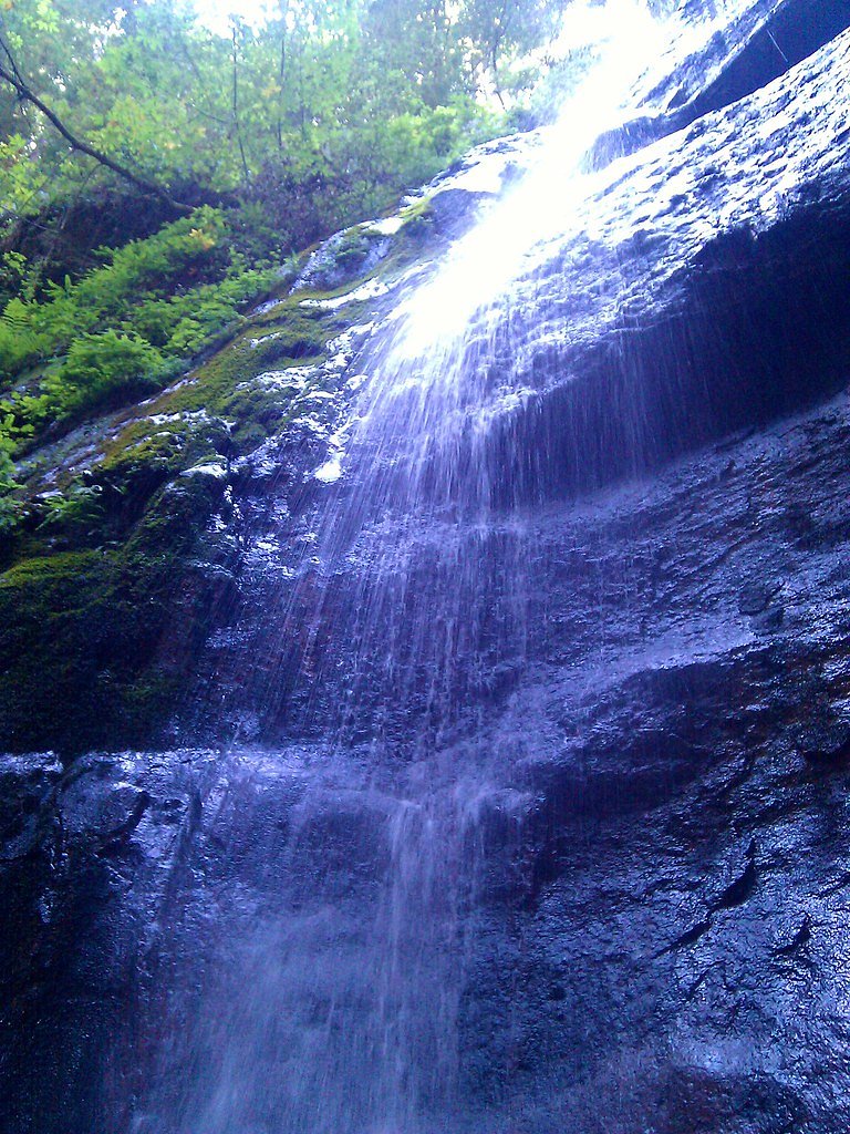
Berry Creek Falls
California • 65 ft
By Armen Suny · Last verified Mar 2026
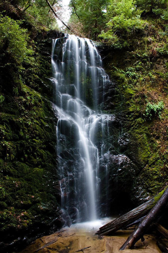
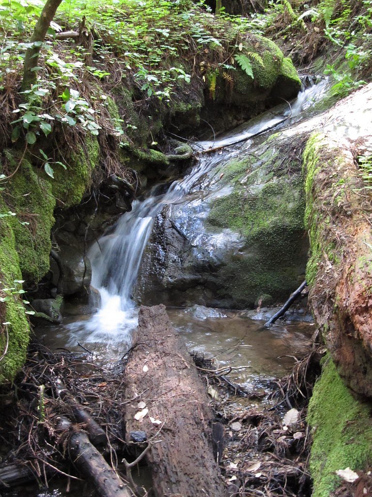

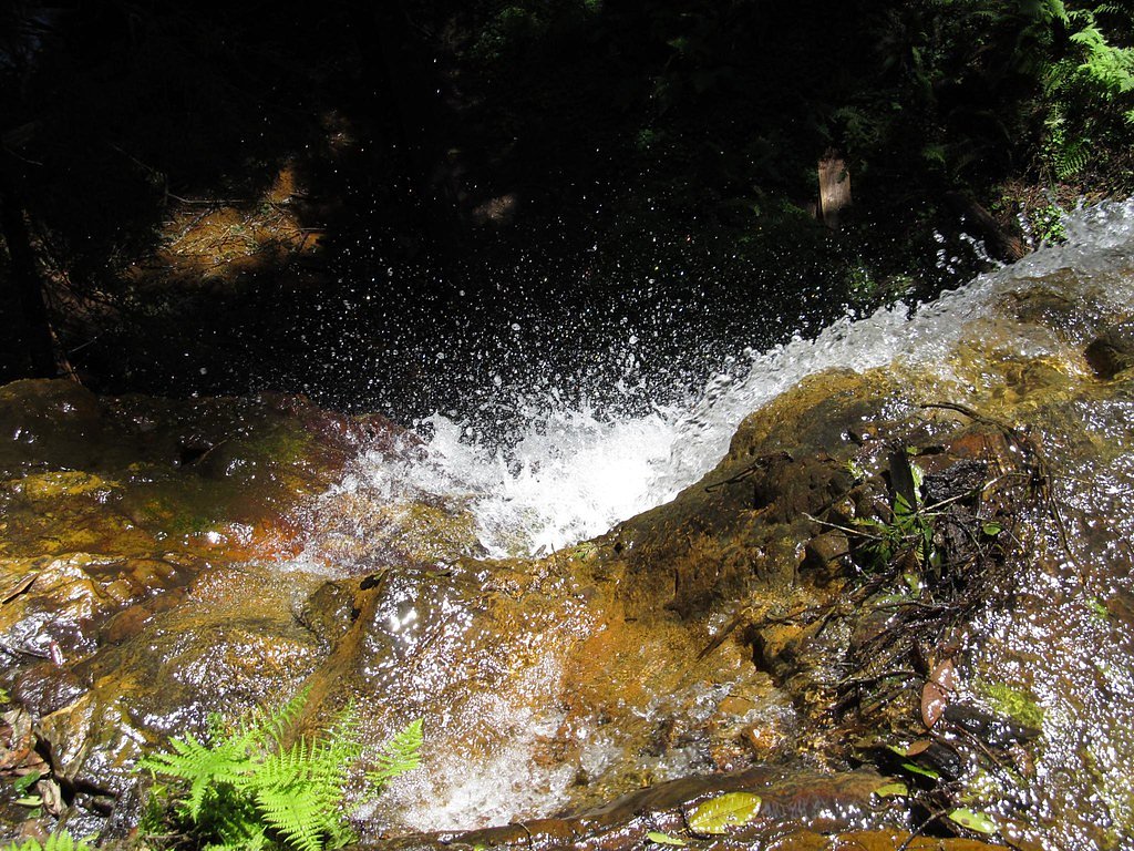

Photo Credits (5)
Difficulty
Hard
Trail Length
10.5 miles
Trail Type
Out And Back
Elevation Gain
2 ft
About Berry Creek Falls
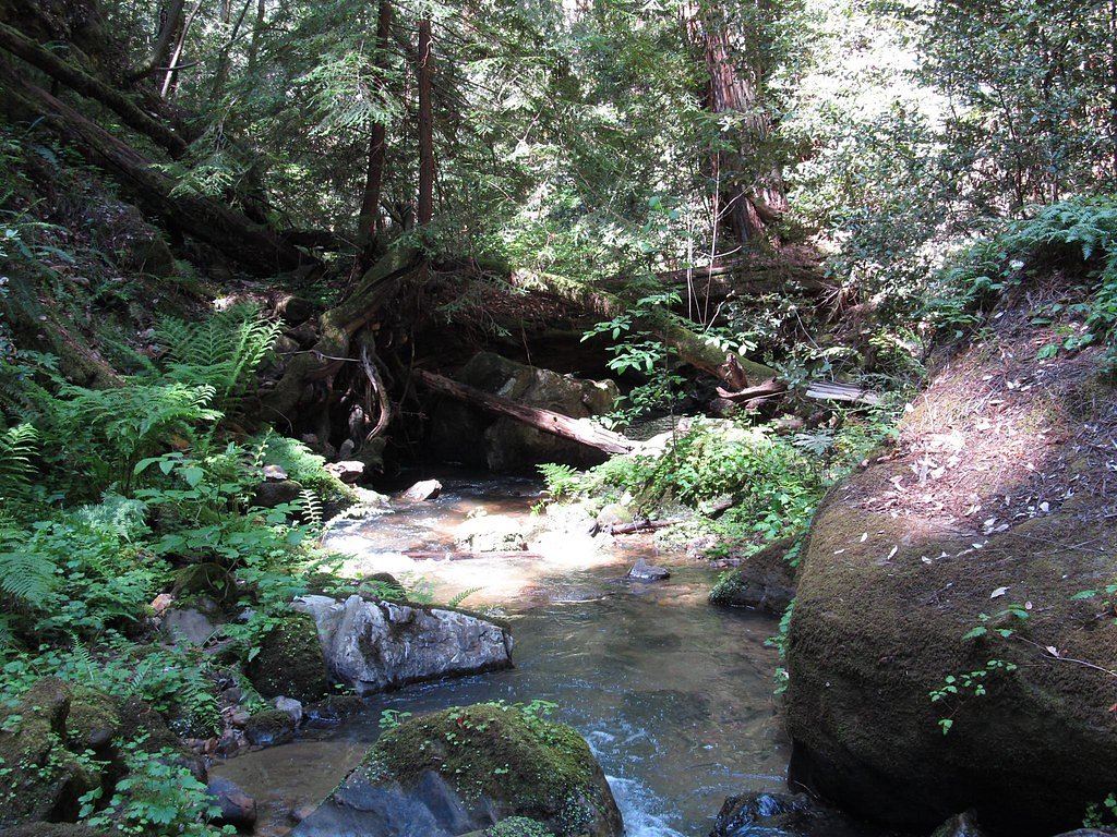
Berry Creek Falls is a stunning waterfall located in Big Basin Redwoods State Park, California. It is known for its picturesque cascade surrounded by lush redwood forests, making it a popular destination for hikers and nature enthusiasts.
The Setting
Berry Creek Falls sits at 417 feet within Big Basin Redwoods State Park, in the coastal lowlands of California. The falls drop 65 feet.
Height: 65 feet
Trail & Hike Details
The Approach
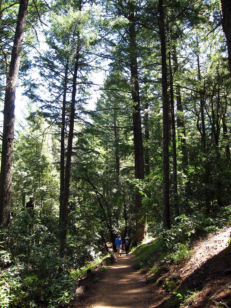
The hard 10.5-mile out-and-back trail gains 2 feet of elevation on the way to the falls.
Trail Description
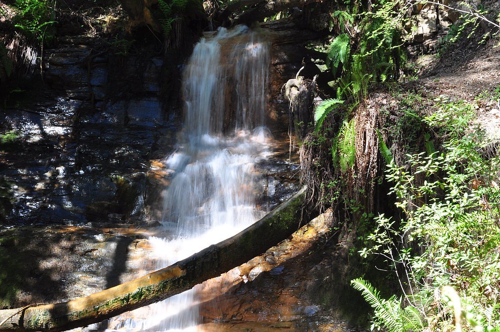
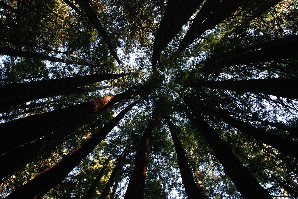
The trail to Berry Creek Falls is a challenging but rewarding hike through the heart of Big Basin's redwood forest. The route features steep inclines, switchbacks, and several creek crossings. Hikers are treated to breathtaking views of towering redwoods, ferns, and the cascading waterfall at the end.
What to Expect
The falls drop 65 feet.
Accessibility
The trail involves steep, uneven terrain with significant elevation change and is not accessible to mobility devices.
Frequently Asked Questions
🐶 Are Dogs Allowed at Berry Creek Falls?
❌ Dogs are not allowed
Are There Any Fees or Permits Required?
🤑 Fee: $10.00
Permit required
Day-use reservations are required for parking at Big Basin Redwoods State Park. Permits can be obtained online through the California State Parks reservation system.
🏊 Is There Swimming at Berry Creek Falls?
❌ Swimming is not allowed
When to Visit
Spring is the best time to visit Berry Creek Falls, as the waterfall is typically at its fullest due to seasonal rainfall.
Seasonal Access
The best time to visit is Spring, Summer, and Fall. Winter access may be limited.
Safety Information
Hikers should be prepared for a strenuous hike and carry adequate supplies. Watch for slippery sections, especially near the waterfall. Check for trail closures or hazards before your visit.
Current Water Conditions
5 ft³/s
Current discharge — how much water is flowing
About average for this time of year
Based on 14 years of record
4.01 ft
Water depth at gauge
7-Day Discharge Trend
What does this mean for your visit?
Flow is about average for this time of year.
About This Gauge
This gauge is on a nearby waterway and may not reflect exact conditions at the falls.
7-Day Flow Outlook
Based on the USGS gauge BUTANO C NR PESCADERO CA (12 km away).
Today
Moderate
5 cfs
5/10Tomorrow
Moderate
5 cfs
8/10Mon
Moderate
5 cfs
8/10Tue
Moderate
4 cfs
8/10Wed
Moderate
4 cfs
8/10Thu
Moderate
4 cfs
8/10Fri
Moderate
4 cfs
8/10Best window: Tomorrow — moderate flow, sunny (trip score 8/10).
Best time of year: this gauge typically runs highest from late January to early April, peaking in January.
How we calculate this
This is a transparent outlook, not a precise forecast. We take the waterfall's current flow strength (how it ranks against its historical normal for today, from the nearest USGS stream gauge), carry that ranking forward along the gauge's seasonal curve, and nudge it for forecast rain. Confidence is highest for the next day or two and falls further out. Always check official conditions and your own judgment before visiting — high flows can be dangerous.
Know when to go.
Get a free email alert when waterfalls near Loma Mar hit peak flow. We only send when conditions are worth the trip — no weekly newsletters, no spam.
Weather Forecast
Location & Access
Getting There
Berry Creek Falls is located within Big Basin Redwoods State Park, which is approximately 1.5 hours from San Jose, California. Visitors typically access the falls via the Skyline-to-the-Sea Trail.
Get Directions on Google MapsParking
Parking is available at the Big Basin Redwoods State Park headquarters. However, parking may require a reservation, especially during peak seasons.
Elevation
417 feet above sea level
Coordinates
37.169668° N, -122.264692° W
Land Management
Managed by SPR
Visitor Tips & Gear
Start your hike early to avoid crowds and ensure you have enough daylight to complete the trail. Wear sturdy hiking shoes, bring plenty of water, and pack snacks. Check the weather and trail conditions before heading out.
As an Amazon Associate, we earn from qualifying purchases.
This challenging 10.5 miles trail gains 2 ft in elevation — come prepared with proper hiking boots and trekking poles. Sun exposure on the trail makes good sun protection a must in summer.

Sawyer Squeeze Water Filter
The backcountry standard — filters 99.9% of bacteria and weighs just 3 oz.

Polarized Sunglasses (Knockaround)
Cuts glare off the water so you actually see the falls — and your photos turn out better too.

Columbia Watertight II Rain Jacket
Packs into its own pocket, seam-sealed, and keeps you dry from spray and surprise rain.

Earth Pak Waterproof Dry Bag
Keeps your phone and gear dry when waterfall mist soaks everything else.

Waterproof Phone Pouch (AiRunTech)
Cheap insurance — take photos right next to the falls without killing your phone.

Timberland Euro Sprint Mid Waterproof
Trusted waterproof boot with premium leather and grippy rubber sole — reliable on rocky, wet trails.
Where to Stay

Costanoa

Half Moon Bay Lodge

The Historic Brookdale Lodge, Santa Cruz Mountains

Fern River Resort
Browse vacation cabins and private rentals nearby
Unique outdoor stays — tents, yurts, and treehouses
Rent a campervan or RV for your waterfall road trip
Some links are affiliate links. We may earn a commission at no extra cost to you.
Nearby Hot Springs
Hot springs near Loma Mar, California

Mineral Springs
Mineral Springs flows at 84°F near East Foothills in the Santa Clara Valley foothills, creating a modest 25-degree temperature ...

Alameda Warm Springs
Alameda Warm Springs flows at 80°F (27°C) in Mission Peak Regional Preserve near Milpitas, a modest thermal seep just 20 degree...
Gilroy Hot Springs
Gilroy Hot Springs flows at 106 degrees Fahrenheit within Henry W. Coe State Park, a California Historical Landmark and Nationa...
Sargent Estate Warm Spring
Sargent Estate Warm Spring flows at 77°F in the hills east of Gilroy in the Diablo Range. The modest 19-degree temperature rise...

Crohare Spring
Crohare Spring emerges at 70°F from protected conservation lands near Livermore, flowing barely 9 degrees above ambient tempera...

Sulphur Hot Spring
Sulphur Hot Spring flows at 100 degrees in Monterey County near Seaside at just 36 feet elevation, essentially at-grade with th...
Looking for a soak after your hike? Explore more hot springs near Loma Mar, California on SoakingSprings.
Explore California springsAdditional Information
Nearby Attractions
Other nearby attractions include the Redwood Loop Trail, Sempervirens Falls, and the Skyline-to-the-Sea Trail.
Wildlife
The area is home to a variety of wildlife, including deer, banana slugs, and numerous bird species. Be cautious of poison oak along the trail.
Cities near Berry Creek Falls
Nearby Waterfalls
Other waterfalls named Berry Creek Falls
1 other waterfall shares this name across the U.S.
Writing about Berry Creek Falls? Embed this waterfall on your site for free.