Aziscohos Falls (historical)
By Armen Suny · Last verified May 2026
Difficulty
Moderate
Trail Length
2.4 miles
Trail Type
Out And Back
Elevation Gain
350 ft
About Aziscohos Falls (historical)
Aziscohos Falls, located in Maine, is a historical waterfall that was once a prominent feature of the region. However, due to damming and other changes in the area, the falls no longer exist in their natural state. The site may still hold historical and scenic interest for visitors.
The Setting
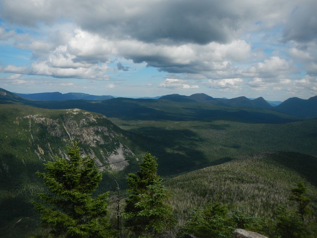
Aziscohos Falls (historical) sits at 1,457 feet along the Diamond River, in the foothills of Maine.
Trail & Hike Details
The Approach
The moderate 2.4-mile out-and-back trail gains 350 feet of elevation on the way to the falls.
Trail Description
There is no specific trail to Aziscohos Falls as the falls no longer exist in their natural state. Visitors may explore the surrounding area near the Aziscohos Dam for scenic views and historical context.
What to Expect
Visitors can expect to see the Aziscohos Dam and the Magalloway River in a scenic, remote area of Maine. The original waterfall is no longer present, but the area offers opportunities for photography, fishing, and enjoying the natural surroundings.
Accessibility
The trail is not wheelchair accessible. Uneven terrain and elevation changes require steady footing.
Frequently Asked Questions
🐶 Are Dogs Allowed at Aziscohos Falls (historical)?
❌ Dogs are not allowed
Are There Any Fees or Permits Required?
🆖 No fees required
🏊 Is There Swimming at Aziscohos Falls (historical)?
❌ Swimming is not allowed
When to Visit
Spring and summer are ideal for visiting the area due to milder weather and better road conditions. Fall offers beautiful foliage, while winter access may be limited due to snow.
Seasonal Access
The best time to visit is Spring, Summer, and Fall. Winter access may be limited.
Safety Information
Exercise caution near the dam and river, as water levels and currents can be unpredictable. The area is remote, so plan accordingly and inform someone of your travel plans.
Current Water Conditions
285 ft³/s
Current discharge — how much water is flowing
About average for this time of year
Based on 84 years of record
3.08 ft
Water depth at gauge
7-Day Discharge Trend
What does this mean for your visit?
Flow is about average for this time of year.
About This Gauge
This gauge is on a nearby waterway and may not reflect exact conditions at the falls.
7-Day Flow Outlook
Based on the USGS gauge Diamond River near Wentworth Location, NH (9 km away).
Today
Low
308 cfs
4/10Tomorrow
Moderate
327 cfs
5/10Sun
Moderate
348 cfs
4/10Mon
Low
280 cfs
6/10Tue
Low
258 cfs
4/10Wed
Moderate
251 cfs
5/10Thu
Moderate
232 cfs
5/10Best window: Mon — low flow, mostly sunny (trip score 6/10).
Best time of year: this gauge typically runs highest from late March to early June, peaking in May.
How we calculate this
This is a transparent outlook, not a precise forecast. We take the waterfall's current flow strength (how it ranks against its historical normal for today, from the nearest USGS stream gauge), carry that ranking forward along the gauge's seasonal curve, and nudge it for forecast rain. Confidence is highest for the next day or two and falls further out. Always check official conditions and your own judgment before visiting — high flows can be dangerous.
Know when to go.
Get a free email alert when waterfalls near Rangeley hit peak flow. We only send when conditions are worth the trip — no weekly newsletters, no spam.
Weather Forecast
Location & Access
Getting There
Aziscohos Falls was historically located near the Aziscohos Dam on the Magalloway River in western Maine. Visitors can access the general area via Route 16, but the falls themselves no longer exist in their original form.
Get Directions on Google MapsParking
Parking may be available near the Aziscohos Dam or along Route 16, but specific parking areas for the falls are not applicable due to their historical status.
Elevation
1,457 feet above sea level
Coordinates
44.944444° N, -70.998056° W
Visitor Tips & Gear
Bring a map or GPS device as the area is remote and cell service may be limited. Be prepared for changing weather conditions and ensure your vehicle is equipped for rural roads.
As an Amazon Associate, we earn from qualifying purchases.
With 2.4 miles and 350 ft of elevation gain, sturdy boots and trekking poles will help on this moderate trail. Sun exposure on the trail makes good sun protection a must in summer.

Columbia Watertight II Rain Jacket
Packs into its own pocket, seam-sealed, and keeps you dry from spray and surprise rain.

Earth Pak Waterproof Dry Bag
Keeps your phone and gear dry when waterfall mist soaks everything else.

Waterproof Phone Pouch (AiRunTech)
Cheap insurance — take photos right next to the falls without killing your phone.

Timberland Euro Sprint Mid Waterproof
Trusted waterproof boot with premium leather and grippy rubber sole — reliable on rocky, wet trails.

TrailBuddy Trekking Poles
Lightweight aluminum, cork grips, and flip-locks that actually hold — a best-seller for good reason.

Polarized Sunglasses (Knockaround)
Cuts glare off the water so you actually see the falls — and your photos turn out better too.
Where to Stay

Rangeley Town & Lake

Rangeley Saddleback Inn

Rangeley Lake Resort a Ramada by Wyndham

Deer Mountain Lodge & Wilderness Resort
Browse vacation cabins and private rentals nearby
Unique outdoor stays — tents, yurts, and treehouses
Rent a campervan or RV for your waterfall road trip
Some links are affiliate links. We may earn a commission at no extra cost to you.
Additional Information
Nearby Attractions
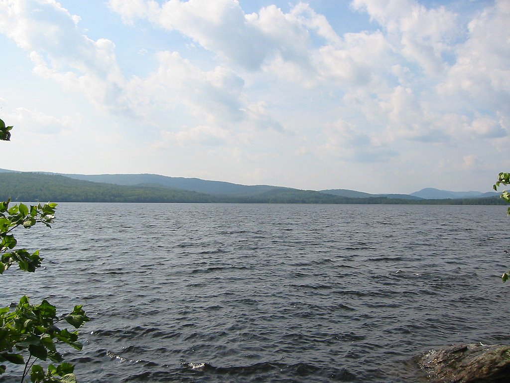
Nearby attractions include Aziscohos Lake, Rangeley Lake, and the Rangeley Lakes Scenic Byway.
Wildlife
The area is home to a variety of wildlife, including moose, deer, and birds. Visitors should observe wildlife from a safe distance.
Cities near Aziscohos Falls (historical)
Nearby Waterfalls
Writing about Aziscohos Falls (historical)? Embed this waterfall on your site for free.