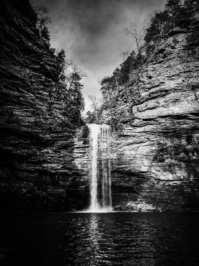
Waterfall Hikes Near Little Rock, AR
within 50 miles
Little Rock sits in the Arkansas River valley framed by rolling, forested hills and sandstone-and-shale bluffs that give way to narrow creek gorges and riparian corridors; only two mapped waterfalls lie within a 50-mile radius, so outings often combine riverfront greenways with short drives into nearby uplands. Both waterfall hikes are moderate in difficulty, following shaded mixed-hardwood trails and occasional rocky scrambles along stream channels, with seasonal cascades and exposed ledges that showcase local geology and offer accessible day trips from the city.
Map of Waterfalls Near Little Rock
Today's Conditions
Live data from USGS gauges & National Weather Service
Best Day to Hike
Monday
Sunny · 97°F
Know when to go.
Get a free email alert when waterfalls near Little Rock hit peak flow. We only send when conditions are worth the trip — no weekly newsletters, no spam.
Find waterfalls to hike near Little Rock
Have your own travel site? Embed these waterfalls for free.
🐕 Dog-Friendly Waterfall Hikes Around Little Rock (3 waterfalls)
Bring your four-legged friend along! These waterfalls welcome dogs on their trails.
All 3 Waterfalls Near Little Rock
Frequently Asked Questions About Waterfalls Near Little Rock
Are there free waterfalls near Little Rock?
There are 3 free waterfalls near Little Rock, including Bridal Veil Falls.
Are there dog friendly waterfalls in Little Rock?
There are 3 dog-friendly waterfalls near Little Rock, including Bridal Veil Falls.
Are there kid-friendly waterfalls near Little Rock?
There are 3 kid-friendly waterfalls near Little Rock, including Bridal Veil Falls.
What is the shortest waterfall hike near Little Rock?
The shortest waterfall hike near Little Rock is Bridal Veil Falls at 2.0 miles round trip.
How tall are the waterfalls near Little Rock?
The tallest waterfall near Little Rock is Cedar Falls at 95 feet.
Can I camp near the waterfalls around Little Rock?
Yes, 3 waterfalls near Little Rock have nearby campgrounds.
What is the closest waterfall to Little Rock?
The closest waterfall to Little Rock is Sausmann Falls, approximately 26.4 miles away.

Pin This Guide
Save this Little Rock waterfall guide to your Pinterest board for your next adventure.
Pin It🏙️ Other Cities Near Little Rock With Waterfalls
Nearby Hot Springs
Hot springs near Little Rock, Arkansas

Big Chalybeate Spring
Big Chalybeate Spring flows at 79 degrees Fahrenheit within Hot Springs National Park in Garland County, emerging 16.3 degrees ...

Hot Springs
Hot Springs flows at a remarkable 147 degrees Fahrenheit (63.9 degrees Celsius) in the city of Hot Springs, Arkansas, ranking a...
Looking for a soak after your hike? Explore more hot springs near Little Rock, Arkansas on SoakingSprings.
Explore Arkansas springsWhere to Stay
Browse vacation cabins and private rentals nearby
Unique outdoor stays — tents, yurts, and treehouses
Rent a campervan or RV for your waterfall road trip
Some links are affiliate links. We may earn a commission at no extra cost to you.