Photo Credits (5)
Difficulty
Easy
Trail Length
0.6 km
Trail Type
Out And Back
Elevation Gain
18 m
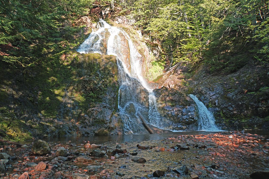
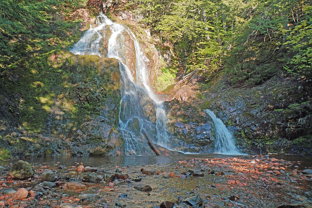
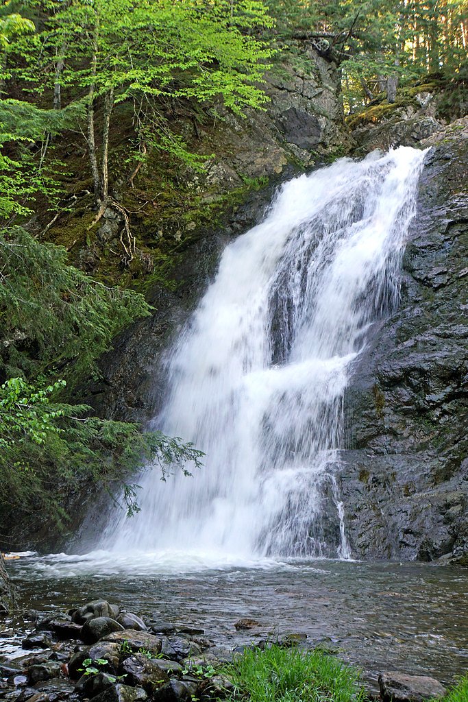
About Wentworth Falls
Wentworth Falls (Nova Scotia) is a small, forested waterfall located in the Wentworth/Wentworth Valley area of Nova Scotia (coordinates: 45.5878, -63.565). The falls are on a tributary in a mixed hardwood-conifer landscape and are typically accessed from a short unmarked trail or roadside pullout. Flow can be highly seasonal and will be strongest in spring or after heavy rain. Exact height and formal park status appear to be undocumented in major trail databases and may be limited in visitor infrastructure.
Nearby Falls Worth Visiting
Spencer Brrok Falls (15 m) lies 14.3 kilometres to the southwest.
Trail & Hike Details
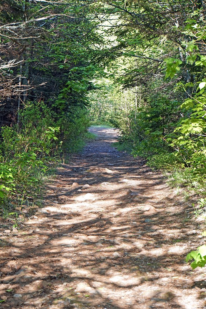
The Approach
The easy 0.6-km out-and-back trail gains 18 metres of elevation on the way to the falls.
Trail Description
The approach to the falls is likely an informal, possibly short woodland trail or footpath from a roadside pullout. Expect uneven, potentially rocky or root-covered terrain with some low, steep sections near the stream. There may be no formal boardwalks, railings, or signage. Trails in this area often become muddy after rain and can be slippery near wet rock surfaces.
What to Expect
A modest, scenic waterfall set in forested Wentworth Valley terrain. Flow varies by season, highest in spring or after rain, lower in late summer/drought conditions. The area may be quiet and lightly trafficked; assume minimal facilities (no toilets, picnic areas, or staffed visitor center). Vegetation includes mixed hardwoods and conifers; expect insects in warm months and potentially icy/icy-slick conditions in winter.
Accessibility
The trail is short and relatively flat, but the surface may be uneven. Contact the managing agency for accessibility details.
Frequently Asked Questions
🐶 Are Dogs Allowed at Wentworth Falls?
❌ Dogs are not allowed
Are There Any Fees or Permits Required?
🆖 No fees required
🏊 Is There Swimming at Wentworth Falls?
❌ Swimming is not allowed
When to Visit
Spring and late fall for the strongest water flow and mid-to-late fall for foliage colors. Summer offers warm weather but flow may be reduced; winter provides icy, scenic conditions but increased hazard from ice and limited access.
Seasonal Access
The best time to visit is Spring, Summer, Fall, and Winter. Check with the managing park or local authority for current conditions.
Safety Information
Hazards may include slippery rocks, steep or unstable banks near the stream, cold water, strong currents after heavy rain, ticks and biting insects in warm months, and icy conditions in winter. Cell service may be spotty. Use caution near the water's edge, do not climb wet rock faces, and avoid visiting alone in remote conditions. If access crosses private property, respect boundaries and posted warnings.
7-Day Flow Outlook
Based on the WSC gauge WALLACE RIVER AT WENTWORTH CENTRE (10 km away).
Best time of year: this gauge typically runs highest from mid March to mid May, peaking in April.
How we calculate this
This is a transparent outlook, not a precise forecast. We take the waterfall's current flow strength (how it ranks against its historical normal for today, from the nearest WSC stream gauge), carry that ranking forward along the gauge's seasonal curve, and nudge it for forecast rain. Confidence is highest for the next day or two and falls further out. Always check official conditions and your own judgment before visiting — high flows can be dangerous.
Know when to go.
Get a free email alert when waterfalls near Amherst hit peak flow. We only send when conditions are worth the trip — no weekly newsletters, no spam.
Weather Forecast
Location & Access
Getting There
The waterfall is located near the Wentworth Valley area of Nova Scotia (coords: 45.5878, -63.565). Major nearby communities include Amherst (~39 miles), New Glasgow (~40 miles) and Charlottetown (~50 miles). Expect to drive on provincial roads; final access is likely via a local road with a short hike or roadside approach. Use the provided coordinates in a GPS mapping app for the most direct route.
Get Directions on Google MapsParking
Parking is likely limited to a small informal pullout or roadside parking near the trail access; there may not be an official parking lot. Park clear of driveways and do not block the road. Availability may be limited during busy seasons or winter.
Elevation
125 metres above sea level
Coordinates
45.587845° N, -63.564977° W
Visitor Tips & Gear
• Wear sturdy footwear with good traction; rocks and roots can be slippery. • Bring insect repellent in spring/summer and dress in layers; weather can change quickly. • Use the coordinates for navigation; signage may be limited. • Park responsibly in designated or safe pullouts, do not block local traffic or private driveways. • Respect private property: some access routes in rural Nova Scotia cross private lands, so avoid trespassing and follow posted signs. • Check local conditions (snow, ice, high water) before visiting. Cell service may be limited in valley areas.
As an Amazon Associate, we earn from qualifying purchases.
For this easy 0.6 km trail, lightweight trail shoes and a water bottle are usually sufficient. Icy conditions are common in winter — traction cleats are a smart addition.

Columbia Watertight II Rain Jacket
Packs into its own pocket, seam-sealed, and keeps you dry from spray and surprise rain.

Polarized Sunglasses (Knockaround)
Cuts glare off the water so you actually see the falls — and your photos turn out better too.

Earth Pak Waterproof Dry Bag
Keeps your phone and gear dry when waterfall mist soaks everything else.

Waterproof Phone Pouch (AiRunTech)
Cheap insurance — take photos right next to the falls without killing your phone.

Kahtoola MICROspikes
Cult-favorite traction cleats that grip ice and wet rock — essential for winter waterfall hikes.

JOBY GorillaPod Starter Kit
Wraps around railings and rocks for long-exposure waterfall shots — no flat surface needed.
Where to Stay
Browse vacation cabins and private rentals nearby
Unique outdoor stays — tents, yurts, and treehouses
Rent a campervan or RV for your waterfall road trip
Some links are affiliate links. We may earn a commission at no extra cost to you.
Nearby Campground
Hidden Hilltop Family Campground
16.8 km away
Additional Information
Nearby Attractions
Wentworth Valley recreational areas (may include winter skiing/recreation areas such as Ski Wentworth), local trails and scenic lookouts in the Wentworth/Wentworth Valley region, small towns in Cumberland and neighboring counties. Exact nearby attractions and facilities should be confirmed with local visitor information.
Wildlife
Typical Nova Scotia wildlife may be present: white-tailed deer, small mammals, various bird species, insects (mosquitoes, black flies), and occasionally moose or black bear in rural areas. Take usual precautions (food storage, keep distance).
Cities near Wentworth Falls
Nearby Waterfalls
Writing about Wentworth Falls? Embed this waterfall on your site for free.