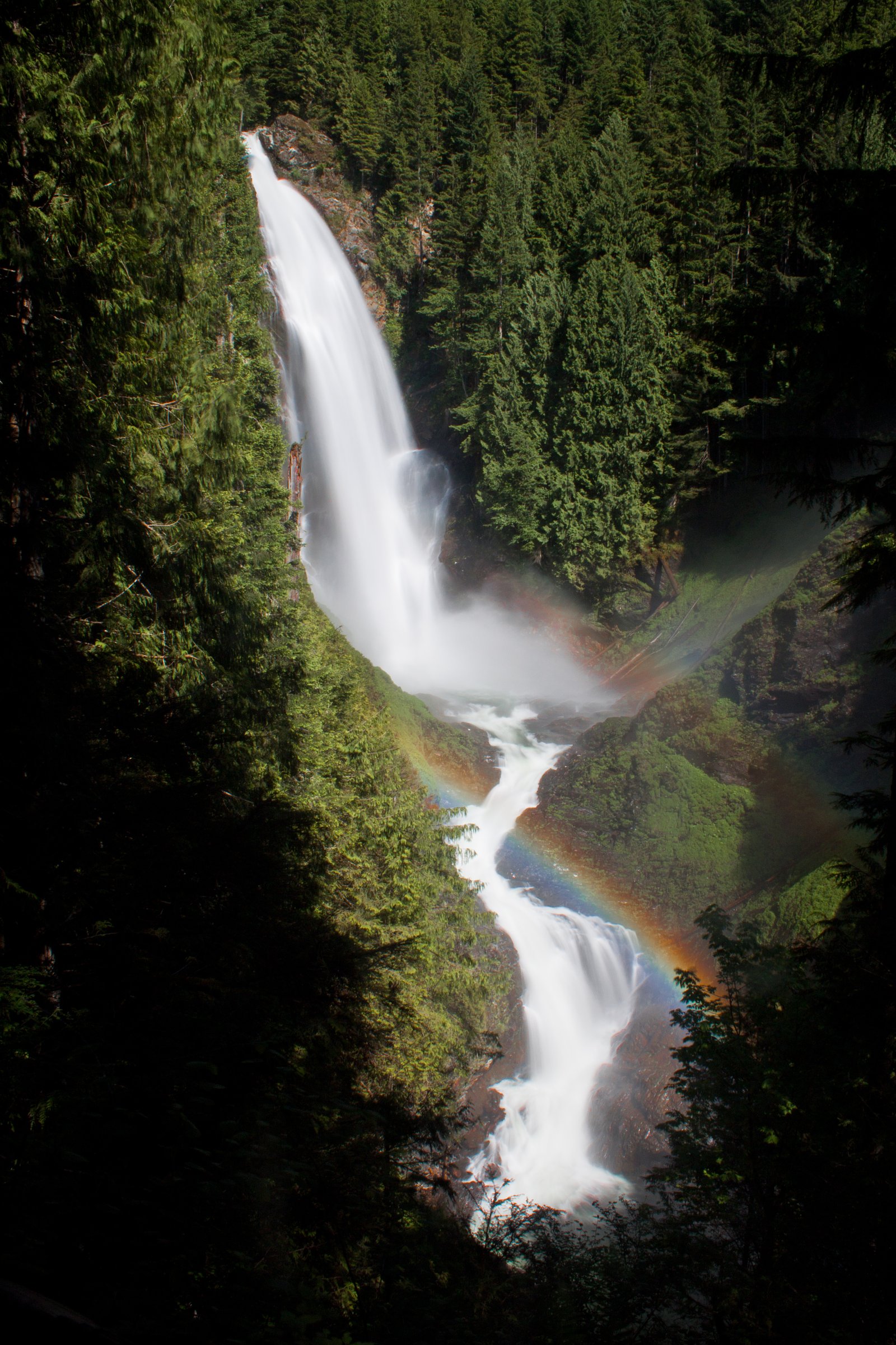
Wallace Falls
New Brunswick • 18 m
By Armen Suny · Last verified Jun 2026
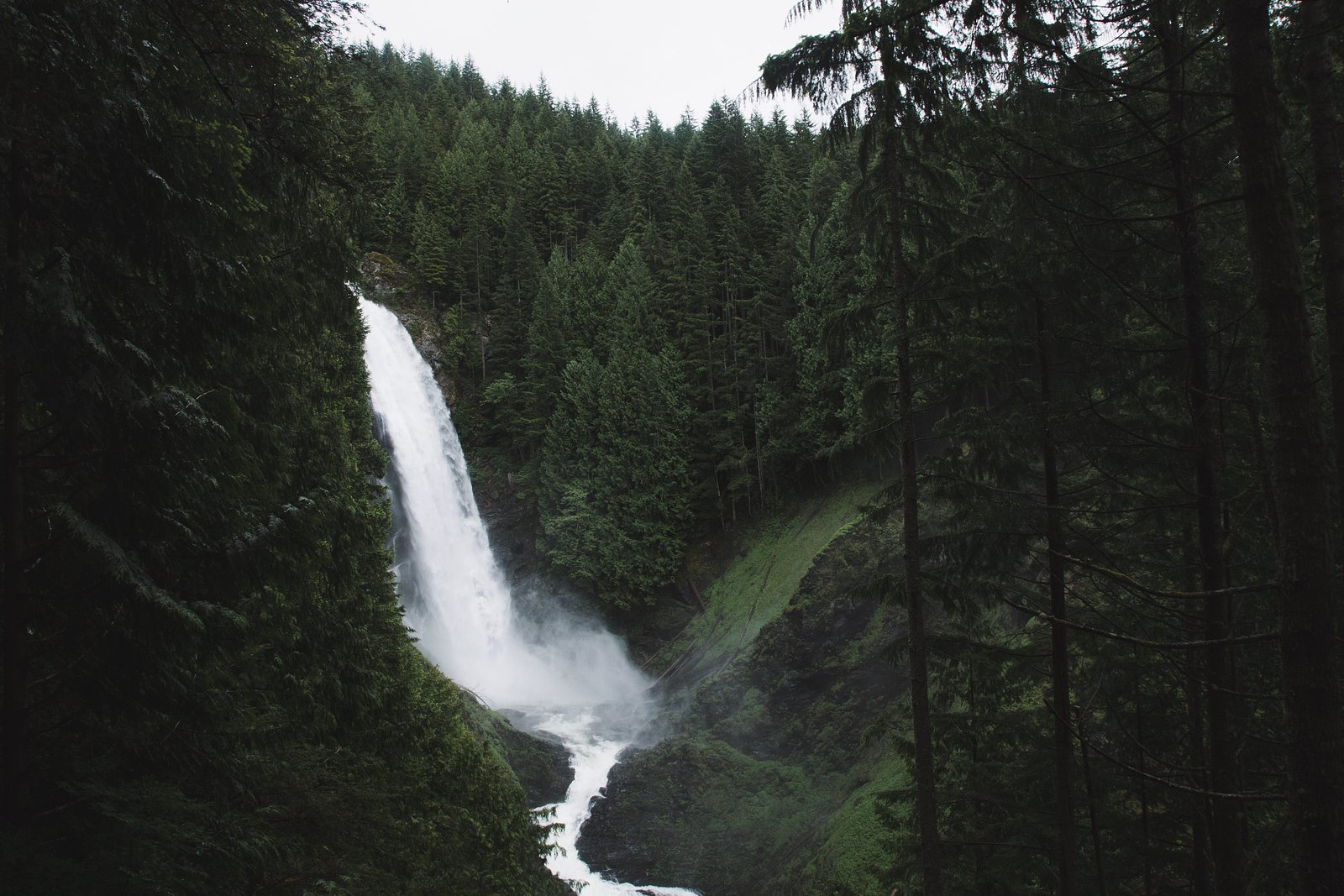
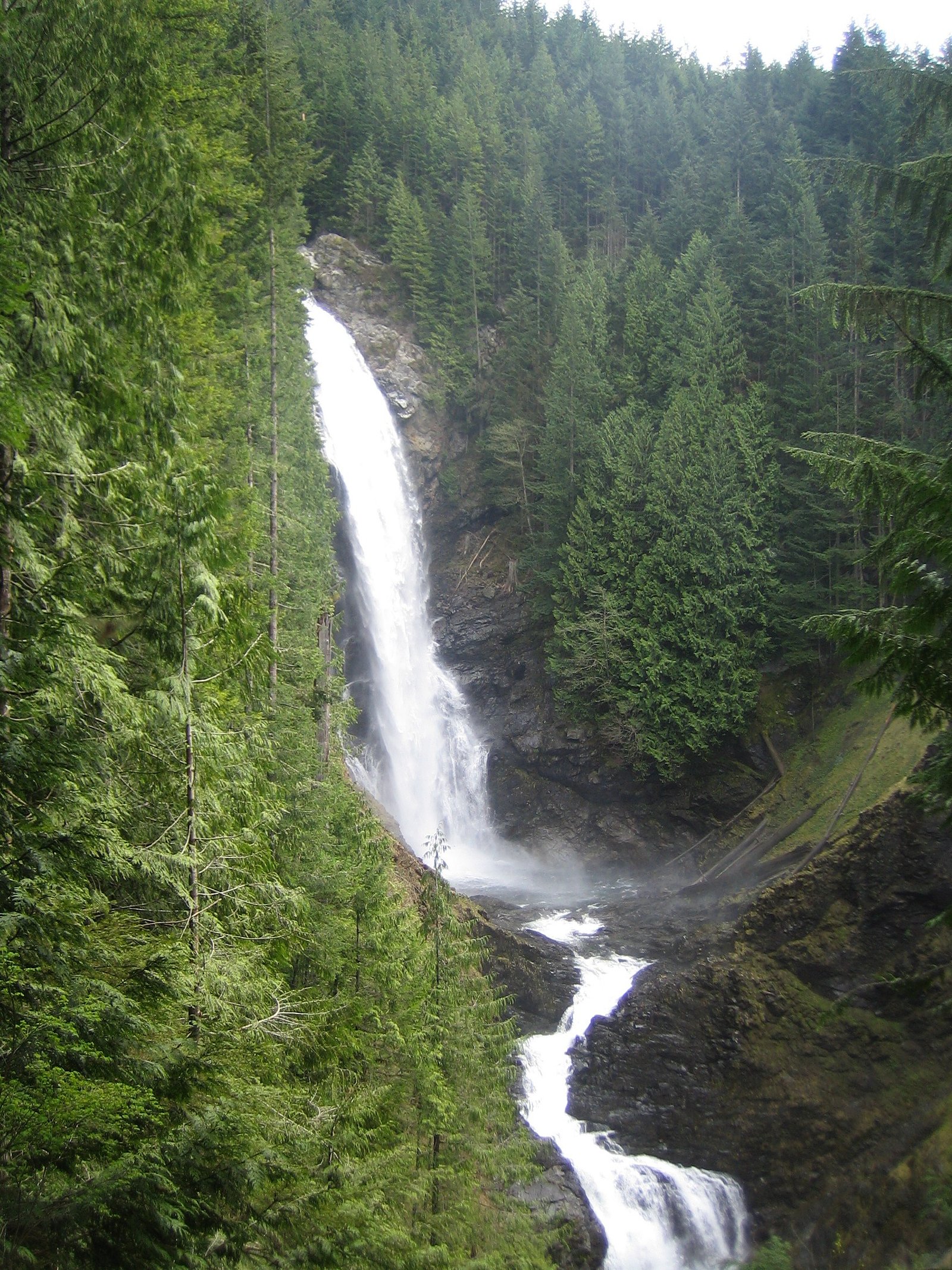
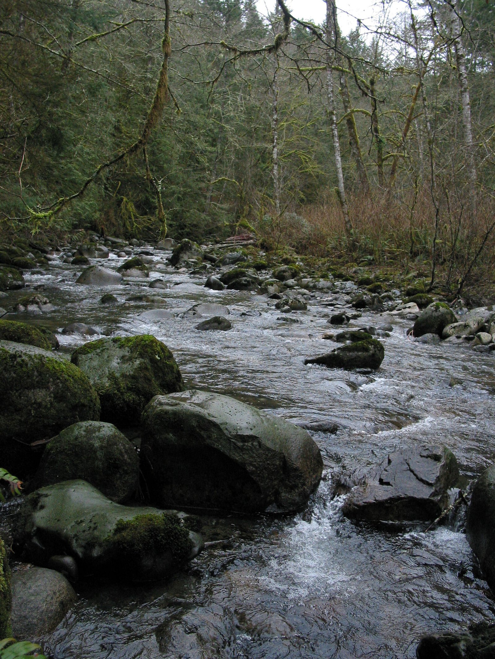
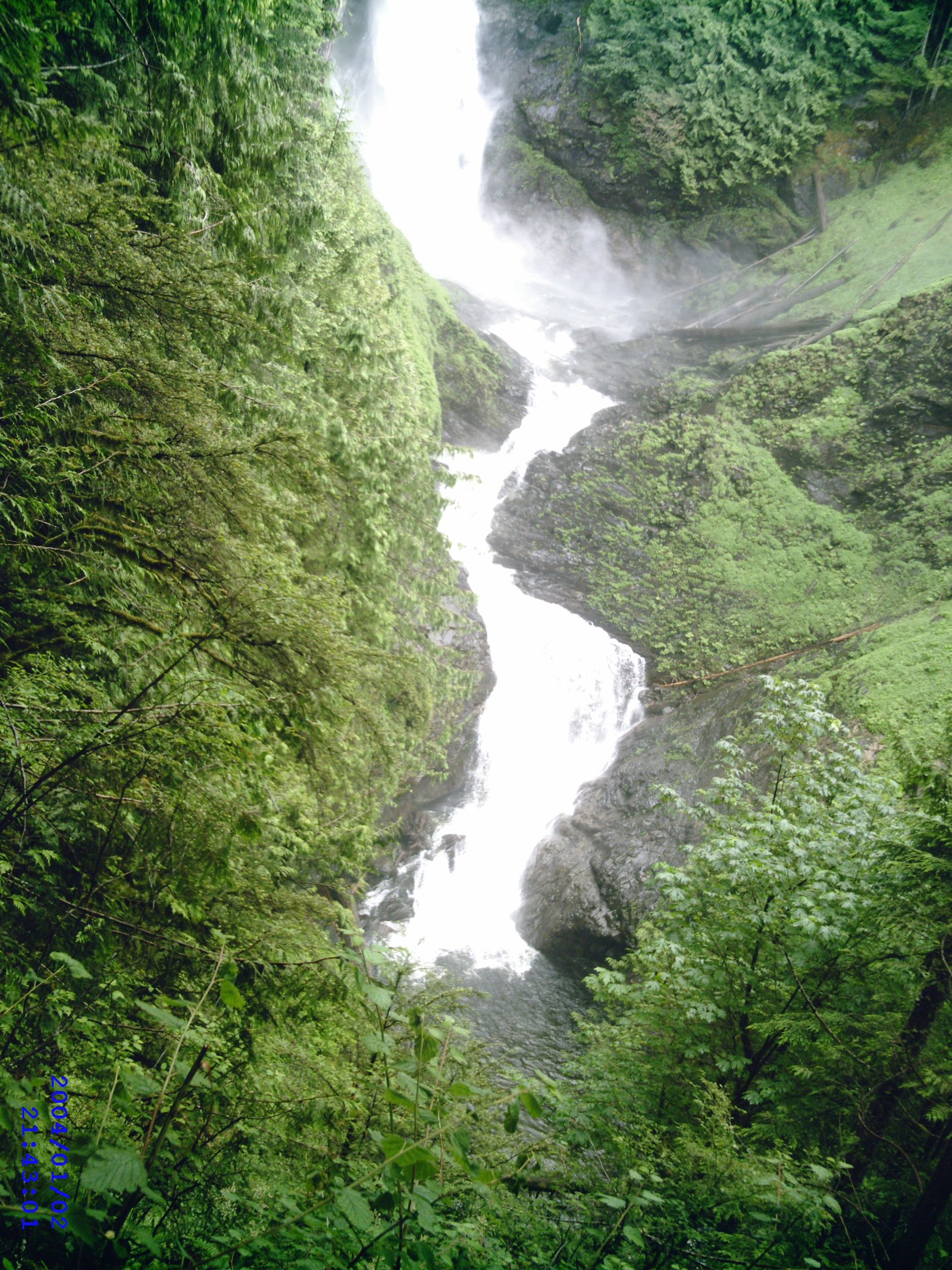
Photo Credits (5)
Difficulty
Easy
Trail Length
0.6 km
Trail Type
Out And Back
Elevation Gain
22 m
About Wallace Falls
Wallace Falls (coordinates 45.5657, -65.2327) is a small, likely multi-step cascade located in southeastern New Brunswick. The waterfall appears to be on a local stream or tributary and is relatively remote compared with major provincial attractions. Water flow is typically highest in spring after snowmelt and during rainy periods; summer and fall visits are common for lower flows and foliage viewing. Precise published height and geomorphology details are not confirmed and may vary with season.
The Setting
Wallace Falls sits at 260 metres within Fundy Ravines, in the foothills of New Brunswick. The falls drop 18 metres.
Why This Waterfall Exists
Wallace Falls flows over hard volcanic rock laid down about 539 million to 1.0 billion years ago. These resistant rocks form a durable ledge that water cannot easily wear away, creating a 59-foot drop where softer material downstream has already eroded.
Trail & Hike Details
The Approach
The easy 0.6-km out-and-back trail gains 22 metres of elevation on the way to the falls.
Trail Description
Specific, authoritative trail descriptions for Wallace Falls (NB) are not widely published. Approaches may be via short footpaths or informal trails from a roadside pullout; trails may be unmaintained and can include steep or slippery sections down to the stream bank. Expect uneven terrain, exposed roots and rocks, and limited wayfinding. If there is an established trail it is likely short (under a few miles round trip), but this is not confirmed, treat the route as unmarked and use caution.
What to Expect
The falls drop 18 metres over hard volcanic rock.
Accessibility
The trail is short and relatively flat, but the surface may be uneven. Contact the managing agency for accessibility details.
Frequently Asked Questions
🐶 Are Dogs Allowed at Wallace Falls?
❌ Dogs are not allowed
Are There Any Fees or Permits Required?
🆖 No fees required
🏊 Is There Swimming at Wallace Falls?
❌ Swimming is not allowed
When to Visit
Spring for highest flows and thundering cascades; late spring through fall for easier access and foliage/fewer wet hazards. Winter can offer iced falls and dramatic scenery but is potentially hazardous (ice, snow, limited access) and requires winter gear and experience.
Seasonal Access
The best time to visit is Spring, Summer, Fall, and Winter. Check with the managing park or local authority for current conditions.
Safety Information
• Slippery rocks and steep banks present fall hazards, stay back from edges. • Water currents can be strong and water is cold; avoid swimming or wading unless you are confident in conditions. • Seasonal flashiness: streams can rise quickly after heavy rain, avoid low-lying approaches during storms. • Winter ice can be unstable, use caution around frozen falls and consider traction devices if hiking in snow/ice. • Ticks and biting insects can be a concern, check for ticks after visiting wooded areas. • Confirm access is legal and not across private property; respect posted signs.
Current Water Conditions
0.4 m³/s
Current discharge — how much water is flowing
Much lower than usual for this time of year
Based on 61 years of record
0.25 m
Water depth at gauge
7-Day Discharge Trend
What does this mean for your visit?
Flow is well below normal for this time of year, so the waterfall may be a trickle.
About This Gauge
This gauge is on a nearby waterway and may not reflect exact conditions at the falls.
7-Day Flow Outlook
Based on the WSC gauge POINT WOLFE RIVER AT FUNDY NATIONAL PARK (17 km away).
Today
Barely Flowing
0.4 m³/s
3/10Tomorrow
Barely Flowing
0.3 m³/s
5/10Tue
Barely Flowing
0.4 m³/s
4/10Wed
Barely Flowing
0.5 m³/s
3/10Thu
Low
0.5 m³/s
4/10Fri
Barely Flowing
0.5 m³/s
4/10Sat
Barely Flowing
0.4 m³/s
3/10Best window: Tomorrow — barely flowing flow, mainly sunny (trip score 5/10).
Best time of year: this gauge typically runs highest from late March to late May, peaking in April.
How we calculate this
This is a transparent outlook, not a precise forecast. We take the waterfall's current flow strength (how it ranks against its historical normal for today, from the nearest WSC stream gauge), carry that ranking forward along the gauge's seasonal curve, and nudge it for forecast rain. Confidence is highest for the next day or two and falls further out. Always check official conditions and your own judgment before visiting — high flows can be dangerous.
Know when to go.
Get a free email alert when waterfalls near Moncton hit peak flow. We only send when conditions are worth the trip — no weekly newsletters, no spam.
Weather Forecast
Location & Access
Getting There
The falls are located roughly 44.3 miles from Moncton, 52.9 miles from Saint John, and 56.2 miles from Amherst (coordinates 45.5657, -65.2327). Access is by local secondary roads off the nearest highways; expect rural gravel or paved roads and potential short unmarked spur roads. There may be limited signage, use GPS coordinates and local maps. Some approaches may cross private land or active forestry areas, so confirm public access before parking or crossing gates.
Get Directions on Google MapsParking
Parking is likely informal and limited (pullouts or roadside parking). There may be no developed lot, restrooms, or official facilities. Park clear of gates, driveways, and ensure you are not blocking agricultural or forestry equipment access.
Elevation
260 metres above sea level
Coordinates
45.565689° N, -65.232706° W
Land Management
Managed by J.D. Irving, Limited
Visitor Tips & Gear
• Use the provided GPS coordinates and confirm access with local tourism or municipal sources if possible. • Wear sturdy, waterproof footwear with good traction; rocks and roots are slippery. • Avoid getting too close to waterfall edges and do not climb wet rocks. • Be prepared for limited or no signage and bring a map or GPS device. • Respect private property, do not cross fences or locked gates without permission. • Expect insects in warm months and dress accordingly; bring insect repellent. • Check local weather and recent visitor reports for trail/road conditions before heading out.
As an Amazon Associate, we earn from qualifying purchases.
For this easy 0.6 km trail, lightweight trail shoes and a water bottle are usually sufficient. Icy conditions are common in winter — traction cleats are a smart addition.

Columbia Watertight II Rain Jacket
Packs into its own pocket, seam-sealed, and keeps you dry from spray and surprise rain.

Polarized Sunglasses (Knockaround)
Cuts glare off the water so you actually see the falls — and your photos turn out better too.

Earth Pak Waterproof Dry Bag
Keeps your phone and gear dry when waterfall mist soaks everything else.

Waterproof Phone Pouch (AiRunTech)
Cheap insurance — take photos right next to the falls without killing your phone.

Kahtoola MICROspikes
Cult-favorite traction cleats that grip ice and wet rock — essential for winter waterfall hikes.

JOBY GorillaPod Starter Kit
Wraps around railings and rocks for long-exposure waterfall shots — no flat surface needed.
Where to Stay
Browse vacation cabins and private rentals nearby
Unique outdoor stays — tents, yurts, and treehouses
Rent a campervan or RV for your waterfall road trip
Some links are affiliate links. We may earn a commission at no extra cost to you.
Nearby Campground
Goose Creek Campsite
8.1 km away
Additional Information
Nearby Attractions
Nearby regional attractions may include coastal Fundy areas and towns in southeastern New Brunswick (Moncton area attractions, Fundy coastline destinations). Exact driving times vary; confirm specific sites and distances beforehand.
Wildlife
Expect typical maritime forest and freshwater-stream wildlife: white-tailed deer, beaver, small mammals, a variety of songbirds, and possibly moose or black bear in wider region. Exercise standard wildlife precautions (store food, give animals space).
Cities near Wallace Falls
Nearby Waterfalls
Other waterfalls named Wallace Falls
2 other waterfalls share this name across Canada.
Writing about Wallace Falls? Embed this waterfall on your site for free.