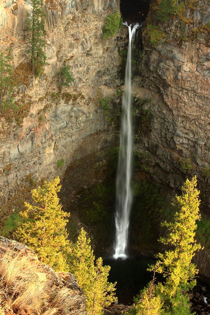
Walbran Falls
By Armen Suny · Last verified Jun 2026
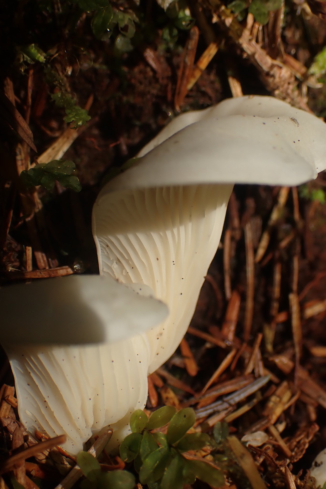
Photo Credits (3)
Difficulty
Moderate
Trail Length
5.0 km
Trail Type
Loop
About Walbran Falls
Walbran Falls is reported to be on Vancouver Island in the Walbran/Carmanah area of southern Vancouver Island (coordinates provided: 48.655, -124.5902). The waterfall lies in heavily forested, often remote terrain typical of the Carmanah–Walbran region and may be approached via logging roads and informal trails. Visitor reports vary; access is likely rough and may require a moderate to long walk or route-finding through old-growth forest and broken ground. Flow and visibility are seasonal and will be highest in spring and after heavy rains. Specifics about the exact drop and officially maintained trails are not well documented in widely available sources, so details below are conservative and include uncertainty where appropriate.
The Setting
Walbran Falls sits at 171 metres within Old Growth Management Areas (Mapped Legal), in the foothills of British Columbia.
Why This Waterfall Exists
Walbran Falls flows over Vancouver Group, a layered sedimentary rock layer deposited about 201-237 million years ago. Over time, the stream has worn through these layers at different rates, creating the step that forms the waterfall.
Trail & Hike Details
Trail Description
There is no widely published, consistently maintained trail description available from major trail resources for a clearly defined Walbran Falls route at the provided coordinates. Approaches in this part of Vancouver Island commonly involve forest roads followed by footpaths that may be rough, unmarked, and require route-finding through second-growth or old-growth forest. Trails may include muddy sections, roots, and stream crossings; some visitors report short off-trail scrambles to reach viewpoints. Because conditions and access can change with logging activity and seasonal weather, expect to navigate without formal signage and to encounter natural obstacles.
What to Expect
Expect dense coastal temperate rainforest, large conifers, ferns, and a mossy understory. The waterfall's flow may vary by season, higher in late winter and spring, lower in late summer. Footing near the falls can be wet and slippery; there may be steep banks or unprotected drops. Limited or no infrastructure (railings, viewing platforms, or maintained switchbacks) is likely. Cell service can be unreliable or absent in remote sections.
Accessibility
The trail is not wheelchair accessible. Uneven terrain and elevation changes require steady footing.
Frequently Asked Questions
🐶 Are Dogs Allowed at Walbran Falls?
❌ Dogs are not allowed
Are There Any Fees or Permits Required?
🆖 No fees required
🏊 Is There Swimming at Walbran Falls?
❌ Swimming is not allowed
When to Visit
Spring (snowmelt and seasonal rains) for the most impressive flow; early summer may offer good conditions with still-elevated flow and more stable weather. Late summer can mean lower flows and easier access on dry roads. Avoid heavy winter storms and times when logging roads may be closed or extremely muddy.
Seasonal Access
The best time to visit is Spring, Summer, and Fall. Winter access may be limited. Check with the managing park or local authority for current conditions.
Safety Information
This is a remote forest environment. Key hazards include: slippery rock and roots near the falls, steep and unguarded drop-offs, fast-moving water and cold plunge pools, poor or no cell service, and changing road conditions due to logging or weather. Check for locked gates and do not trespass on private land. Let someone know your route and expected return time. In bear country, carry bear spray and know how to use it. During or after heavy rains, avoid riverbanks and low-lying areas due to increased flow and risk of flashy conditions.
Current Water Conditions
0.0 m³/s
Current discharge — how much water is flowing
Much lower than usual for this time of year
Based on 27 years of record
1.08 m
Water depth at gauge
7-Day Discharge Trend
What does this mean for your visit?
Flow is well below normal for this time of year, so the waterfall may be a trickle.
About This Gauge
This gauge is on a nearby waterway and may not reflect exact conditions at the falls.
7-Day Flow Outlook
Based on the WSC gauge RENFREW CREEK NEAR PORT RENFREW (22 km away).
Today
Barely Flowing
0.0 m³/s
4/10Tomorrow
Barely Flowing
0.0 m³/s
4/10Tue
Barely Flowing
0.0 m³/s
4/10Wed
Barely Flowing
0.0 m³/s
4/10Thu
Barely Flowing
0.0 m³/s
4/10Fri
Barely Flowing
0.0 m³/s
4/10Sat
Barely Flowing
0.0 m³/s
3/10Best window: Today — barely flowing flow, cloudy (trip score 4/10).
Best time of year: this gauge typically runs highest from mid November to late November, peaking in January.
How we calculate this
This is a transparent outlook, not a precise forecast. We take the waterfall's current flow strength (how it ranks against its historical normal for today, from the nearest WSC stream gauge), carry that ranking forward along the gauge's seasonal curve, and nudge it for forecast rain. Confidence is highest for the next day or two and falls further out. Always check official conditions and your own judgment before visiting — high flows can be dangerous.
Know when to go.
Get a free email alert when waterfalls near Nanaimo hit peak flow. We only send when conditions are worth the trip — no weekly newsletters, no spam.
Weather Forecast
Location & Access
Getting There
The waterfall is in the southern Vancouver Island coastal zone. Typical approaches to the Walbran/Carmanah area start from Highway 14 (the West Coast Road) near Port Renfrew and use secondary/logging roads. Reachability may be limited by private forestry operations, gates, and rough road conditions; a high-clearance vehicle may be required to get to the nearest legal parking or gate. From any legal parking or trailhead, expect an unmarked or lightly used footpath and possible bushwhack to the falls. Nearest population centers referenced in the request (Neah Bay, Sekiu, Clallam Bay) are across the Strait of Juan de Fuca on the Washington state coast and help orient the location relative to the strait, but the falls are on Vancouver Island, BC.
Get Directions on Google MapsParking
Parking is likely at informal pullouts or at a gate/forest service pullout on a logging road. Expect unmaintained surfaces, limited room, and seasonal gate closures. Do not block gates or private driveways. If access requires driving on forestry roads, check for local advisories and close gates behind you.
Elevation
171 metres above sea level
Coordinates
48.655004° N, -124.590197° W
Land Management
Managed by Government of British Columbia
Visitor Tips & Gear
1) Confirm road and gate status with local BC Parks or forestry offices before traveling. 2) Use a high-clearance vehicle if driving logging roads, and never drive past closed gates. 3) Carry a recent topographic map and GPS coordinates; do not rely solely on mobile service. 4) Wear waterproof, grippy footwear and bring trekking poles for creek crossings and slippery banks. 5) Leave no trace: pack out all trash and avoid disturbing vegetation or old-growth trees. 6) If you encounter logging operations, keep distance and follow posted instructions. 7) Plan for limited daylight and bring a headlamp if you'll be out near dusk.
Where to Stay
Browse vacation cabins and private rentals nearby
Unique outdoor stays — tents, yurts, and treehouses
Rent a campervan or RV for your waterfall road trip
Some links are affiliate links. We may earn a commission at no extra cost to you.
Nearby Campground
Central Walbran Valley
0.5 km away
Nearby Hot Springs
Hot springs near Nanaimo, British Columbia

Sol Duc Hot Springs
Sol Duc Hot Springs flows at 122 degrees Fahrenheit in Olympic National Park with permanently protected Class 1 status under Na...

Olympic Hot Springs
Olympic Hot Springs flows at 118 degrees within Olympic National Park at 2,000 feet elevation, emerging 72 degrees above ambien...
Looking for a soak after your hike? Explore more hot springs near Nanaimo, British Columbia on SoakingSprings.
Explore British Columbia springsAdditional Information
Nearby Attractions
Carmanah Walbran Provincial Park (old-growth forests and giant trees), Port Renfrew (coastal access, boat charters), Avatar Grove (big tree stand near Port Renfrew). Note: distances and access depend on exact trailhead location and road closures.
Wildlife
Black bears, Roosevelt elk and deer, cougars (rare), numerous bird species (including marbled murrelet and raptors), and typical coastal-rainforest small mammals and amphibians. Practice bear-aware behavior and store food securely.
Cities near Walbran Falls
Nearby Waterfalls
Writing about Walbran Falls? Embed this waterfall on your site for free.