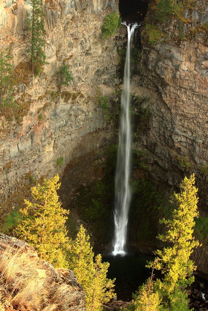
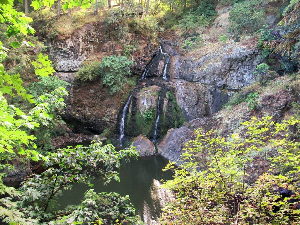
August Creek Falls
British Columbia • Carmanah Walbran Park
By Armen Suny · Last verified Jun 2026
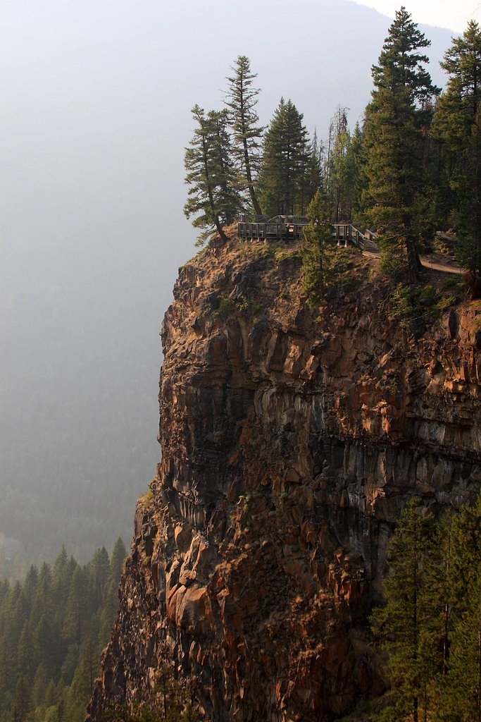
Photo Credits (3)
About August Creek Falls
August Creek Falls is a little-documented waterfall reported near coordinates 48.6927, -124.6486 in the northwestern Olympic Peninsula region. Sources and local reports are sparse and there is uncertainty about jurisdiction: the coordinates and nearby place names (Neah Bay, Sekiu, Clallam Bay) indicate this feature is likely on the Washington state side of the peninsula rather than in British Columbia. Visitor accounts suggest a relatively small, forested creek cascade that is seasonal, higher flows in spring and after heavy rain, and reduced flow in late summer. Access appears to be remote and may cross unmaintained logging roads, tribal land, or private parcels; confirm access and permissions locally before visiting.
The Setting
August Creek Falls sits at 215 metres within Carmanah Walbran Park, in the foothills of British Columbia.
Why This Waterfall Exists
August Creek Falls flows over Island Plutonic Suite, a hard intrusive rock layer deposited about 162-201 million years ago. These resistant rocks form a durable ledge that water cannot easily wear away, creating the falls where softer material downstream has already eroded.
Trail & Hike Details
Trail Description
There is no well-established, widely-published trail description available for August Creek Falls. Accounts indicate either a short unmaintained spur or a cross-country approach from a nearby forest/access road. Expect uneven, muddy, and rooty terrain through coastal temperate rainforest; the final approach to the creek and falls may involve steep or slippery sections over rocks and logs. Because documented trail length and conditions are lacking, plan for a remote, potentially route-finding hike rather than a maintained public trail.
What to Expect
A small-to-medium seasonal cascade set in dense coastal forest. Flow is typically highest in spring and after prolonged rain; late-summer flows may be greatly reduced. Features may include moss-covered logs, a narrow plunge or slide, and deep pools below the falls in wetter seasons. The area is likely remote with limited cell reception and few other visitors. Trail infrastructure (signs, bridges, railings) is unlikely.
Accessibility
Access is likely not wheelchair-accessible. Trail conditions are probably unmaintained with natural obstacles, mud, roots, and steep sections.
Frequently Asked Questions
🐶 Are Dogs Allowed at August Creek Falls?
❌ Dogs are not allowed
Are There Any Fees or Permits Required?
🆖 No fees required
🏊 Is There Swimming at August Creek Falls?
❌ Swimming is not allowed
When to Visit
Late spring through early summer typically offers the best combination of high water flow and safer trail conditions (before heavy winter storms). Late fall and winter may have higher flows but also more hazardous conditions (slippery slopes, heavy rain). Late summer can be drier with reduced flow.
Seasonal Access
The best time to visit is Spring, Summer, Fall, and Winter. Check with Carmanah Walbran Park for current conditions.
Safety Information
This site appears to be remote and undocumented. Potential hazards include: unmaintained and slippery terrain, fast-flowing water during/after heavy rain, falling trees or loose debris on logging roads, limited cell reception, and possible restricted access across tribal or private land. Always check local access rules, weather forecasts, and carry appropriate safety gear. If uncertain about land ownership or route safety, contact local ranger offices or tribal authorities for guidance.
Current Water Conditions
Based on a Water Survey of Canada gauge 26.9 km away
0.1 m³/s
Current discharge — how much water is flowing
Lower than usual for this time of year
Based on 27 years of record
1.08 m
Water depth at gauge
7-Day Discharge Trend
What does this mean for your visit?
Flow is lower than usual for this time of year.
About This Gauge
This gauge is on a regional waterway. Conditions at the falls may differ, especially after local rain.
7-Day Flow Outlook
Based on the WSC gauge RENFREW CREEK NEAR PORT RENFREW (27 km away).
Today
Low
0.1 m³/s
6/10Tomorrow
Low
0.0 m³/s
5/10Tue
Low
0.0 m³/s
5/10Wed
Moderate
0.0 m³/s
5/10Thu
Low
0.0 m³/s
5/10Fri
Low
0.0 m³/s
5/10Sat
Low
0.0 m³/s
5/10Best window: Today — low flow, mainly sunny (trip score 6/10).
Best time of year: this gauge typically runs highest from mid November to late November, peaking in January.
How we calculate this
This is a transparent outlook, not a precise forecast. We take the waterfall's current flow strength (how it ranks against its historical normal for today, from the nearest WSC stream gauge), carry that ranking forward along the gauge's seasonal curve, and nudge it for forecast rain. Confidence is highest for the next day or two and falls further out. Always check official conditions and your own judgment before visiting — high flows can be dangerous.
Know when to go.
Get a free email alert when waterfalls near Nanaimo hit peak flow. We only send when conditions are worth the trip — no weekly newsletters, no spam.
Weather Forecast
Location & Access
Getting There
General location: 48.6927, -124.6486, roughly 18–38 miles (by road) from nearby towns noted by the user (Neah Bay, Sekiu, Clallam Bay). Exact driving directions are not well documented. Expect to use a combination of paved highways and gravel/forest roads. The final approach may require walking off-road or on an unmarked spur; maps and GPS with the given coordinates are recommended. Because the area near Neah Bay is within or adjacent to Makah Tribal lands, verify whether the approach crosses tribal property and obtain permission if required.
Get Directions on Google MapsParking
No confirmed formal parking lot is documented. Parking may be limited to a roadside pullout on a logging/forest road; vehicles should be parked well clear of gates and not blocking access. If visiting tribal or private land, use designated parking areas if provided and follow posted rules.
Elevation
215 metres above sea level
Coordinates
48.692716° N, -124.648566° W
Land Management
Managed by Government of British Columbia
Visitor Tips & Gear
1) Verify land ownership and access permissions before you go, parts of the area near Neah Bay may be on tribal land. 2) Use a topographic map and GPS coordinates; established trailheads and routes are not well documented. 3) Wear waterproof footwear and expect muddy, slippery ground. 4) Be prepared for limited or no cell coverage and let someone know your plans. 5) Avoid approaching slick rock edges and refrain from climbing near the falls when wet. 6) Pack out all trash and follow Leave No Trace principles.
Where to Stay
Browse vacation cabins and private rentals nearby
Unique outdoor stays — tents, yurts, and treehouses
Rent a campervan or RV for your waterfall road trip
Some links are affiliate links. We may earn a commission at no extra cost to you.
Nearby Campground
Grunt's Grove
2.6 km away
Nearby Hot Springs
Hot springs near Nanaimo, British Columbia

Looking for a soak after your hike? Explore more hot springs near Nanaimo, British Columbia on SoakingSprings.
Explore British Columbia springsAdditional Information
Nearby Attractions
Nearby regional attractions (general to the NW Olympic Peninsula area) may include Cape Flattery, Shi Shi Beach, portions of the Makah Museum (Neah Bay), and other Pacific coastline features. Exact proximity depends on final access route.
Wildlife
Typical coastal-forest wildlife may include black-tailed deer, black bear, small mammals, and a variety of songbirds. As with much of the Olympic region, be bear-aware and store food securely. Mountain lions are present in the region but encounters are uncommon.
Cities near August Creek Falls
Nearby Waterfalls
Writing about August Creek Falls? Embed this waterfall on your site for free.