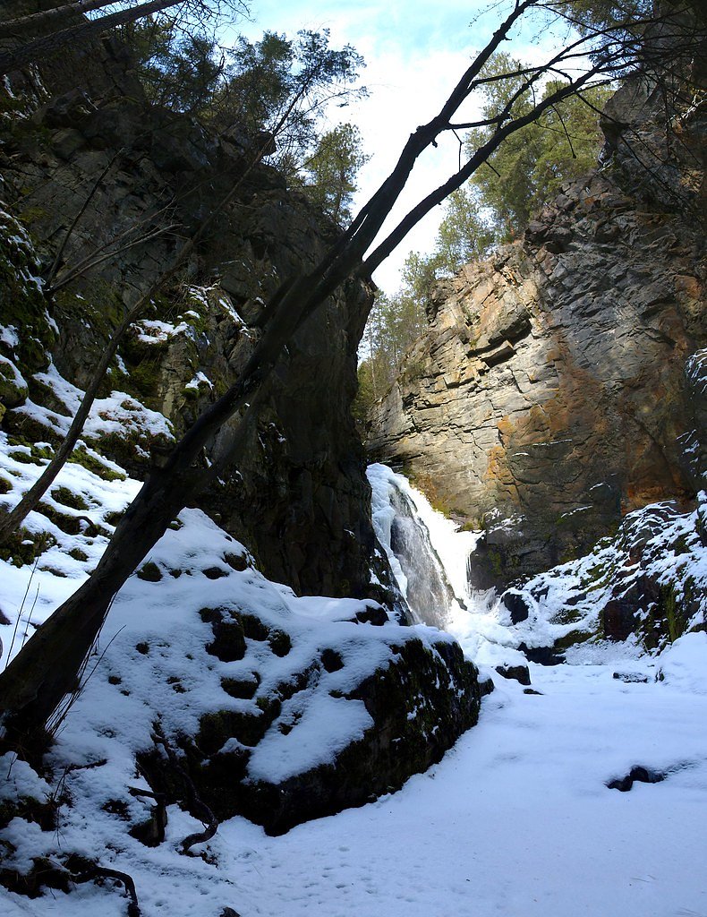
Tulip Falls
British Columbia • 13 m
By Armen Suny · Last verified Jun 2026
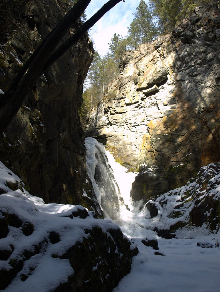
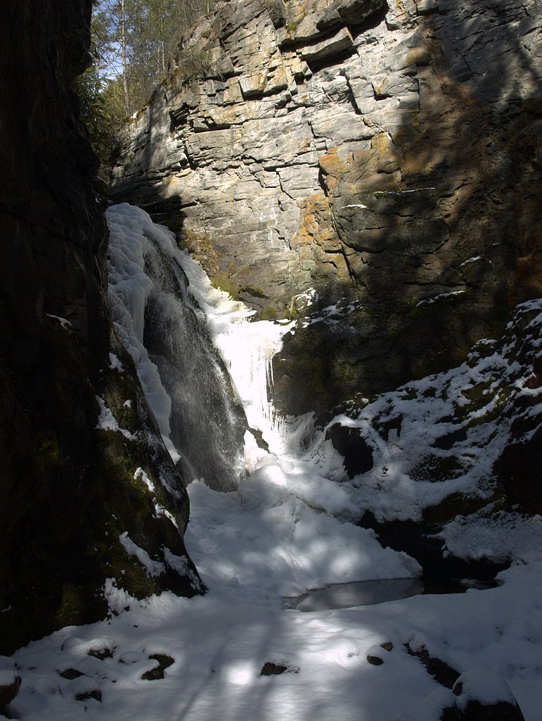
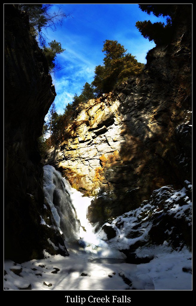
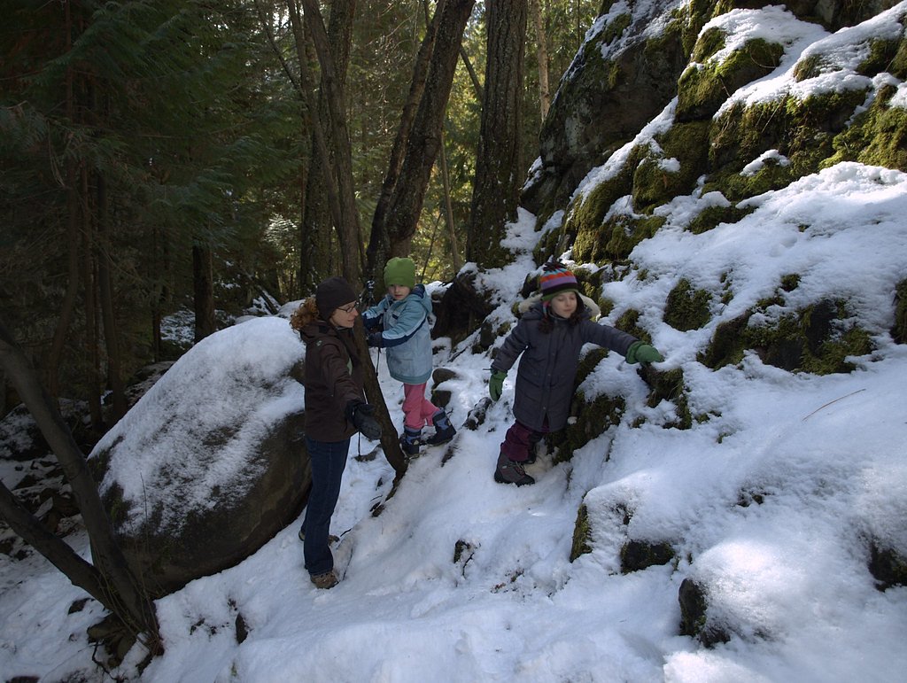
Photo Credits (5)
Difficulty
Easy
Trail Length
0.5 km
Trail Type
Out And Back
Elevation Gain
16 m
About Tulip Falls
Tulip Falls is a small, likely seasonal waterfall located in southeastern British Columbia (coordinates: 49.3656, -117.9305). It appears to be a modest cascade set in a forested, rural landscape. Flow may be strongest during spring snowmelt and after periods of heavy rain; summer flows can be reduced. Signage, formal viewpoints, and developed infrastructure at the site may be minimal or absent. Distances to nearby communities: Northport (~28.4 miles), Nelson (~33.1 miles), Orient (~36.2 miles).
The Setting
Tulip Falls sits at 521 metres within SYRINGA PARK, in the hills of British Columbia. The falls drop 13 metres.
Why This Waterfall Exists
Tulip Falls flows over hard intrusive rock, primarily granite, laid down about 23-66 million years ago. These resistant rocks form a durable ledge that water cannot easily wear away, creating a 42-foot drop where softer material downstream has already eroded.
Trail & Hike Details
The Approach
The easy 0.5-km out-and-back trail gains 16 metres of elevation on the way to the falls.
Trail Description
There may be a short, informal path from the parking area down to the stream and falls. Trails are likely unmaintained, narrow, and can be steep or slippery near the water. Expect roots, loose rock, and uneven footing. There may be no boardwalks, viewing platforms, or safety railings.
What to Expect
The falls drop 13 metres over hard intrusive rock.
Accessibility
The trail is short and relatively flat, but the surface may be uneven. Contact the managing agency for accessibility details.
Frequently Asked Questions
🐶 Are Dogs Allowed at Tulip Falls?
❌ Dogs are not allowed
Are There Any Fees or Permits Required?
🆖 No fees required
🏊 Is There Swimming at Tulip Falls?
❌ Swimming is not allowed
When to Visit
Late spring to early summer for highest flows (snowmelt). After heavy rains in other seasons can also produce strong flows. Avoid icy winter conditions unless properly equipped and experienced in winter travel.
Seasonal Access
The best time to visit is Spring, Summer, and Fall. Winter access may be limited. Check with the managing park or local authority for current conditions.
Safety Information
Primary hazards: slippery rock and steep edges near the water, variable and sometimes sudden changes in water flow, hypothermia risk from cold water, limited or no railings and lifesaving services, unmarked or rough access roads, and potentially limited cell coverage. Wildlife encounters are possible. Visitors should wear appropriate footwear, avoid risky approaches near the edge, supervise children closely, and check local conditions before visiting.
Current Water Conditions
0.4 m³/s
Current discharge — how much water is flowing
About average for this time of year
Based on 67 years of record
0.17 m
Water depth at gauge
7-Day Discharge Trend
What does this mean for your visit?
Flow is about average for this time of year.
About This Gauge
This gauge is on a nearby waterway and may not reflect exact conditions at the falls.
7-Day Flow Outlook
Based on the WSC gauge DEER CREEK AT DEER PARK (12 km away).
Today
Low
0.4 m³/s
6/10Tomorrow
Low
0.4 m³/s
5/10Tue
Low
0.4 m³/s
5/10Wed
Low
0.4 m³/s
5/10Thu
Moderate
0.4 m³/s
5/10Fri
Moderate
0.4 m³/s
5/10Sat
Moderate
0.3 m³/s
8/10Best window: Sat — moderate flow, mainly sunny (trip score 8/10).
Best time of year: this gauge typically runs highest from mid April to mid July, peaking in June.
How we calculate this
This is a transparent outlook, not a precise forecast. We take the waterfall's current flow strength (how it ranks against its historical normal for today, from the nearest WSC stream gauge), carry that ranking forward along the gauge's seasonal curve, and nudge it for forecast rain. Confidence is highest for the next day or two and falls further out. Always check official conditions and your own judgment before visiting — high flows can be dangerous.
Know when to go.
Get a free email alert when waterfalls near Nelson hit peak flow. We only send when conditions are worth the trip — no weekly newsletters, no spam.
Weather Forecast
Location & Access
Getting There
Access is from rural roads in the West Kootenay area of British Columbia. The site coordinates suggest a location reached by driving on secondary/forestry roads from the nearest towns (Northport, Nelson, Orient). Roads may be unpaved and narrow; a high-clearance vehicle may be helpful. Expect limited or no formal signage for the waterfall. Verify local road conditions before travel and consult regional maps or local visitor centres for precise access routes.
Get Directions on Google MapsParking
Parking is likely an informal pullout or small roadside turnout rather than a developed lot. Space may be limited; vehicles should not block the road. If visiting, park fully off the roadway on firm ground. There may be no toilets or facilities.
Elevation
521 metres above sea level
Coordinates
49.365624° N, -117.930472° W
Land Management
Managed by Government of British Columbia
Visitor Tips & Gear
• Wear sturdy, traction-capable footwear; approach banks and wet rocks with extreme caution. • Bring water, sun protection, and insect repellent in summer. • Tell someone your plans and expected return time; cell coverage may be limited. • Park fully off the road and do not block access for others. • Practice Leave No Trace: pack out trash and avoid disturbing vegetation or stream banks. • Avoid getting too close to the edge of the falls or climbing on slippery rocks. • Check weather and local road conditions before you go; unpaved access roads may be impassable after heavy rain or snow.
As an Amazon Associate, we earn from qualifying purchases.
For this easy 0.5 km trail, lightweight trail shoes and a water bottle are usually sufficient. Sun exposure on the trail makes good sun protection a must in summer.

Polarized Sunglasses (Knockaround)
Cuts glare off the water so you actually see the falls — and your photos turn out better too.

Columbia Watertight II Rain Jacket
Packs into its own pocket, seam-sealed, and keeps you dry from spray and surprise rain.

Earth Pak Waterproof Dry Bag
Keeps your phone and gear dry when waterfall mist soaks everything else.

Waterproof Phone Pouch (AiRunTech)
Cheap insurance — take photos right next to the falls without killing your phone.

JOBY GorillaPod Starter Kit
Wraps around railings and rocks for long-exposure waterfall shots — no flat surface needed.

Osprey Daylite Daypack
Light, organized, and just the right size for a day hike — fits water, snacks, and layers.
Where to Stay
Browse vacation cabins and private rentals nearby
Unique outdoor stays — tents, yurts, and treehouses
Rent a campervan or RV for your waterfall road trip
Some links are affiliate links. We may earn a commission at no extra cost to you.
Nearby Campground
Bighorn Campground
2.6 km away
Additional Information
Nearby Attractions
Nearby towns and destinations include Nelson (services, dining, and outdoor recreation) and the broader West Kootenay region, which offers hiking, lakes, and provincial parks. Confirm exact nearby attractions locally as this waterfall is in a rural area with limited developed amenities.
Wildlife
Typical regional wildlife may include deer, small mammals (squirrels, raccoons), numerous bird species, and occasionally black bears. Ticks and biting insects can be present in warmer months. Observe wildlife from a distance and secure food.
Cities near Tulip Falls
Nearby Waterfalls
Writing about Tulip Falls? Embed this waterfall on your site for free.