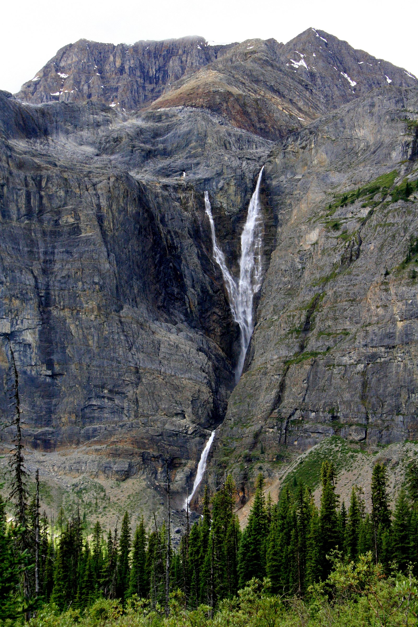
Ottertail Falls
British Columbia • Yoho National Park
By Armen Suny · Last verified Jun 2026
Difficulty
Hard
Trail Type
Out And Back
Elevation Gain
351 m
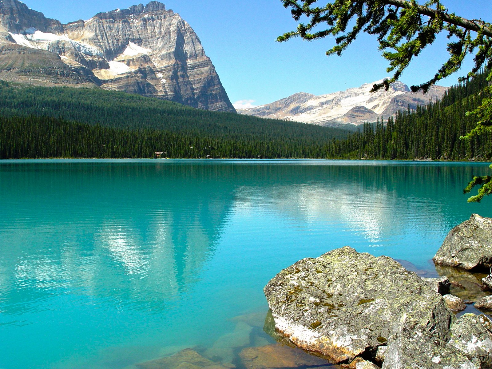
About Ottertail Falls
Ottertail Falls is a lesser-known mountain cascade near the Lake Louise / Banff region of the Canadian Rockies (coordinates: 51.2637, -116.3676). It is not widely documented in major guidebooks, and access appears to be informal, likely a creek or river cascade in a steep alpine valley. Expect a scenic, relatively remote mountain setting; seasonal flow and exact appearance may vary with snowmelt and precipitation. Visitors should treat specific route and access details as uncertain and verify locally before heading out.
The Setting
Ottertail Falls sits at 1,547 metres within Yoho National Park, in the high mountains of British Columbia.
Why This Waterfall Exists
Ottertail Falls flows over Middle Chancellor Formation, a hard metamorphic rock layer deposited about 497-509 million years ago. These resistant rocks form a durable ledge that water cannot easily wear away, creating the falls where softer material downstream has already eroded.
Nearby Falls Worth Visiting
Helmet Falls (352 m) lies 9.0 kilometres to the southeast. Also nearby: Wapta Falls (18 m, 16.7 km).
Trail & Hike Details
Trail Description
There is limited public documentation of a maintained trail to Ottertail Falls. Approaches that local visitors sometimes use for similar undocumented cascades include a short hike from a nearby road or a rough scramble down a valley side to reach the falls. Expect unmarked routefinding, potentially steep or loose terrain near the creek, and no built infrastructure (stairs, railings). Follow cairns or game trails cautiously, and avoid fragile alpine vegetation.
What to Expect
A natural mountain cascade in a remote setting. Flow may be strong during spring snowmelt and lower in late summer/early fall. Terrain near the falls is likely rocky and steep with uneven footing. There probably are no developed viewpoints, railings, or facilities. Wildlife (including bears) can be present. Cell coverage may be limited; navigation tools and a topo map or GPS are recommended.
Accessibility
The trail involves steep, uneven terrain with significant elevation change and is not accessible to mobility devices.
Frequently Asked Questions
🐶 Are Dogs Allowed at Ottertail Falls?
❌ Dogs are not allowed
Are There Any Fees or Permits Required?
🆖 No fees required
🏊 Is There Swimming at Ottertail Falls?
❌ Swimming is not allowed
When to Visit
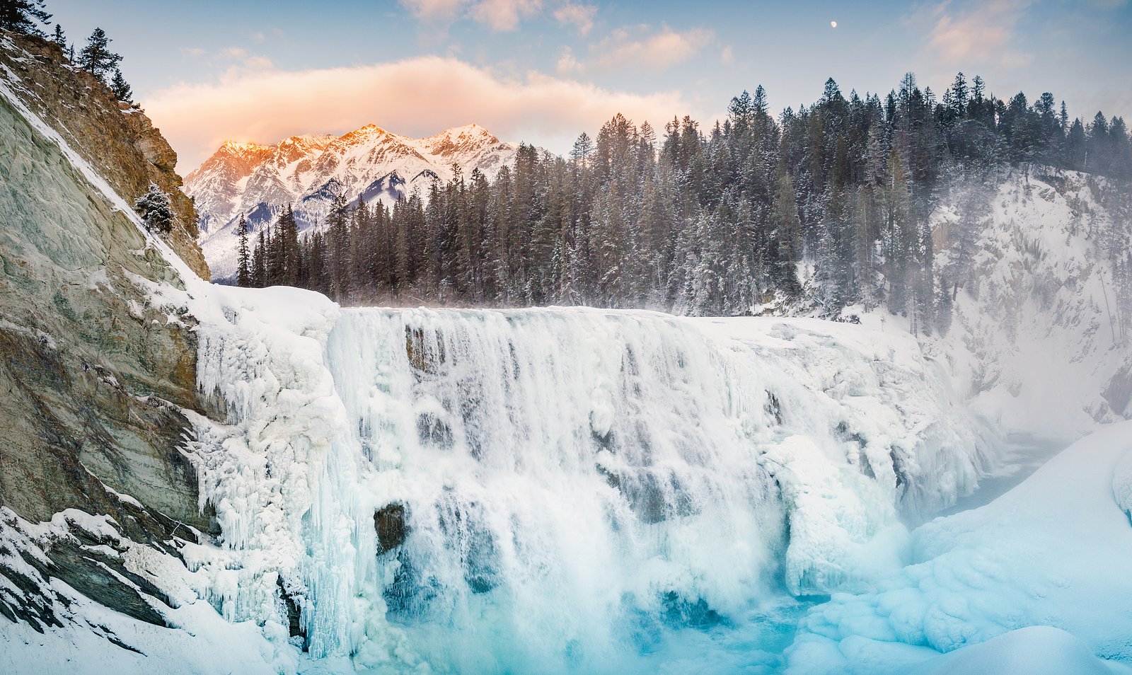
Late spring to early summer for highest flows from snowmelt and lush scenery; summer for easier access and warmer weather; fall for color and lower visitor numbers. Winter may present dramatic frozen cascades but can be hazardous and require winter mountaineering skills. Always check seasonal access and road conditions.
Seasonal Access
The best time to visit is Spring, Summer, Fall, and Winter. Check with Yoho National Park for current conditions.
Safety Information
Hazards may include steep or unstable terrain, slippery rocks near the water, cold swift water, loose rock or rockfall, rapidly changing mountain weather, limited cell coverage, and wildlife encounters (including bears). In winter, avalanche risk, icy approaches, and extreme cold increase danger. Always tell someone your plan, carry appropriate navigation tools and emergency supplies, and check local conditions before heading out.
Current Water Conditions
37.4 m³/s
Current discharge — how much water is flowing
Higher than usual for this time of year
Based on 70 years of record
1.93 m
Water depth at gauge
7-Day Discharge Trend
What does this mean for your visit?
The water is flowing higher than usual for this time of year.
About This Gauge
This gauge is on a nearby waterway and may not reflect exact conditions at the falls.
7-Day Flow Outlook
Based on the WSC gauge BOW RIVER AT LAKE LOUISE (22 km away).
Today
Strong
37 m³/s
9/10Tomorrow
Strong
37 m³/s
9/10Tue
Strong
37 m³/s
9/10Wed
Strong
37 m³/s
9/10Thu
Strong
37 m³/s
9/10Fri
Strong
39 m³/s
8/10Sat
Strong
41 m³/s
8/10Best window: Today — strong flow, cloudy (trip score 9/10).
Best time of year: this gauge typically runs highest from late May to late August, peaking in July.
How we calculate this
This is a transparent outlook, not a precise forecast. We take the waterfall's current flow strength (how it ranks against its historical normal for today, from the nearest WSC stream gauge), carry that ranking forward along the gauge's seasonal curve, and nudge it for forecast rain. Confidence is highest for the next day or two and falls further out. Always check official conditions and your own judgment before visiting — high flows can be dangerous.
Know when to go.
Get a free email alert when waterfalls near Lake Louise hit peak flow. We only send when conditions are worth the trip — no weekly newsletters, no spam.
Weather Forecast
Location & Access
Getting There
General approach is from the Lake Louise/Banff corridor. The waterfall coordinates place it in a rugged mountain area about 16.1 miles from Lake Louise and about 38.6 miles from Banff (as the crow flies). There does not appear to be an established, signed trailhead in widely available online sources; access may require driving to a roadside pullout or logging/access road near the coordinates and hiking cross-country or along an unmarked spur. Verify route and seasonal road status with local park/forest authorities before travel.
Get Directions on Google MapsParking
Parking is likely informal (roadside pulloff or small gravel turnout). There is probably no developed parking lot, restroom, or other facilities. Do not block gates or private access; where in doubt, park only in designated areas or official pullouts.
Elevation
1,547 metres above sea level
Coordinates
51.263732° N, -116.367644° W
Land Management
Managed by Parks Canada Agency
Visitor Tips & Gear
• Check with Parks Canada or the nearest provincial/park office for any local restrictions, road closures, or advisories before you go. • If route is unmarked, carry a map, GPS, and compass and be comfortable with backcountry navigation. • Wear sturdy footwear and expect wet, slippery rock near the falls. • Bring bear spray and know how to use it; make noise when moving through brush. • Leave no trace, pack out everything and stay on durable surfaces where possible. • Avoid getting too close to cliff edges or riverbanks: undercut banks and strong currents are hazardous. • If visiting in winter, be prepared for avalanche and icy conditions; traction devices and avalanche training/equipment may be required.
Where to Stay
Browse vacation cabins and private rentals nearby
Unique outdoor stays — tents, yurts, and treehouses
Rent a campervan or RV for your waterfall road trip
Some links are affiliate links. We may earn a commission at no extra cost to you.
Nearby Campground
McArthur Creek
2 km away
Additional Information
Nearby Attractions
Lake Louise (~16 miles by straight-line distance) and the town of Banff (~38.6 miles by straight-line distance). The general area contains many alpine lakes, viewpoints, and established hikes, check local visitor centers for popular nearby trails and attractions.
Wildlife
This region may host black bears and grizzly bears, elk, deer, mountain goats, marmots, and various bird species. Practice wildlife safety and store food appropriately.
Cities near Ottertail Falls
Nearby Waterfalls
Writing about Ottertail Falls? Embed this waterfall on your site for free.