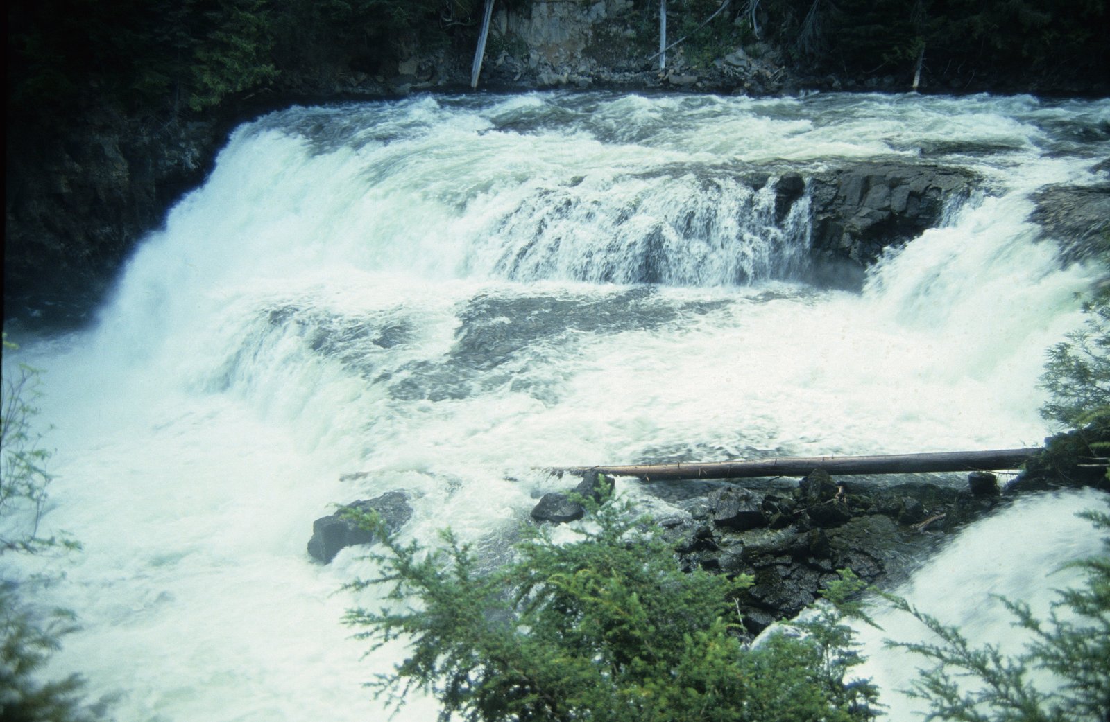
McDougall Falls
By Armen Suny · Last verified Jun 2026
Photo Credits (3)
About McDougall Falls
McDougall Falls is a forested cascade located in a relatively remote part of northern Ontario (coordinates: 50.1741, -91.5641). The falls sit in a rugged boreal landscape characterized by mixed forest, rock outcrops and small streams. Flow and appearance can vary substantially by season and recent precipitation; spring runoff typically produces the strongest flows while late summer and fall often show lower water levels. Specific published measurements of the drop are not widely available.
Why This Waterfall Exists
McDougall Falls flows over hard intrusive rock, primarily granodiorite and granite, laid down over 2.5-3.2 billion years ago. These resistant rocks form a durable ledge that water cannot easily wear away, creating the falls where softer material downstream has already eroded.
Trail & Hike Details
Trail Description
Detailed, authoritative trail descriptions for McDougall Falls are limited. Approaches are typically unpaved and may follow short, unmaintained paths from a roadside pullout. Trails through boreal forest and over rock can be rooty, muddy or uneven. Route-finding skills may be required where formal trails are not signed.
What to Expect
Expect a remote, natural setting with limited infrastructure. The waterfall may be a multi-step cascade or single drop depending on the specific stream reach. Terrain near the falls can be rocky and wet. Cell service is likely intermittent or absent. Seasonal conditions influence accessibility: spring runoff increases flow and can make river crossings or approaches wetter; winter will bring ice and snow, making the area hazardous without winter gear.
Accessibility
The site is likely not wheelchair accessible. Trails (if present) are expected to be natural, uneven and may include roots, rocks and wet sections. Accessibility for people with mobility impairments is likely limited.
Frequently Asked Questions
🐶 Are Dogs Allowed at McDougall Falls?
❌ Dogs are not allowed
Are There Any Fees or Permits Required?
🆖 No fees required
🏊 Is There Swimming at McDougall Falls?
❌ Swimming is not allowed
When to Visit
Late spring to early fall is generally best for access and viewing (spring for highest flows, summer and early fall for easier access). Winter visits are possible but require winter travel skills and awareness of ice hazards; many access roads may be impassable in winter.
Seasonal Access
The best time to visit is Spring, Summer, Fall, and Winter. Check with the managing park or local authority for current conditions.
Safety Information
Hazards include slippery and unstable rock near the falls, steep or uneven terrain, cold water and strong currents, changing water levels after rain or snowmelt, limited or no cell service, and potentially challenging road conditions (mud, washouts). Remote location increases risk: travel with others when possible, leave trip plans with someone, and carry emergency communication/Navigation gear. In winter, expect ice, deep snow and severe cold, specialized equipment and experience are required. Always check recent local reports and weather before visiting.
Current Water Conditions
34.0 m³/s
Current discharge — how much water is flowing
Lower than usual for this time of year
Based on 63 years of record
29.00 m
Water depth at gauge
7-Day Discharge Trend
What does this mean for your visit?
Flow is lower than usual for this time of year.
About This Gauge
7-Day Flow Outlook
Based on the WSC gauge STURGEON RIVER AT MCDOUGALL MILLS (2 km away).
Today
Moderate
37 m³/s
5/10Tomorrow
Low
35 m³/s
5/10Wed
Low
33 m³/s
5/10Thu
Moderate
36 m³/s
5/10Fri
Moderate
37 m³/s
5/10Sat
Moderate
36 m³/s
5/10Sun
Low
32 m³/s
5/10Best window: Today — moderate flow, heavy rain (trip score 5/10).
Best time of year: this gauge typically runs highest from early May to late July, peaking in May.
How we calculate this
This is a transparent outlook, not a precise forecast. We take the waterfall's current flow strength (how it ranks against its historical normal for today, from the nearest WSC stream gauge), carry that ranking forward along the gauge's seasonal curve, and nudge it for forecast rain. Confidence is highest for the next day or two and falls further out. Always check official conditions and your own judgment before visiting — high flows can be dangerous.
Weather Forecast
Location & Access
Getting There
The falls are in a remote area of northern Ontario at 50.1741, -91.5641. Access likely requires driving on secondary or logging/gravel roads and a short walk from a roadside pullout; exact approach routes and road conditions vary seasonally. Expect limited signage. Visitors should obtain recent local information (local visitor centres, Forest Service, or recent trip reports) and confirm road conditions before traveling.
Get Directions on Google MapsParking
Minimal to no formal parking infrastructure is expected. There may be an informal pullout or small cleared area near a trailhead or logging road. Parking may be on gravel or soft ground; a high-clearance vehicle may be advisable.
Elevation
356 metres above sea level
Coordinates
50.174129° N, -91.564084° W
Visitor Tips & Gear
• Check recent trip reports or contact local authorities for road and trail conditions before you go. • Use a high-clearance vehicle if traveling on logging/gravel roads; avoid low-clearance vehicles in wet conditions. • Wear sturdy footwear with good traction; expect muddy or slippery rocky sections. • Bring navigation (GPS with downloaded maps) and a physical map; do not rely solely on mobile reception. • Practice Leave No Trace: pack out all trash and avoid damaging vegetation or disturbing stream banks.
Where to Stay
Browse vacation cabins and private rentals nearby
Unique outdoor stays — tents, yurts, and treehouses
Rent a campervan or RV for your waterfall road trip
Some links are affiliate links. We may earn a commission at no extra cost to you.
Additional Information
Nearby Attractions
There is limited published information about nearby named attractions at the immediate coordinates. The falls lie within the broader Lake Superior/northern Ontario boreal region, where visitors can find lakes, forested backcountry and other small waterfalls and rapids, identify specific nearby attractions using regional maps or local visitor information.
Wildlife
Typical wildlife in this region may include moose, white-tailed deer, black bear, wolves, foxes, beaver, and a variety of birds (including waterfowl and raptors). Be bear-aware and store food securely.
Nearby Waterfalls
Other waterfalls named McDougall Falls
1 other waterfall shares this name across Canada.
Writing about McDougall Falls? Embed this waterfall on your site for free.