Photo Credits (5)
Difficulty
Easy
Trail Length
4.2 km
Trail Type
Out And Back
Elevation Gain
149 m
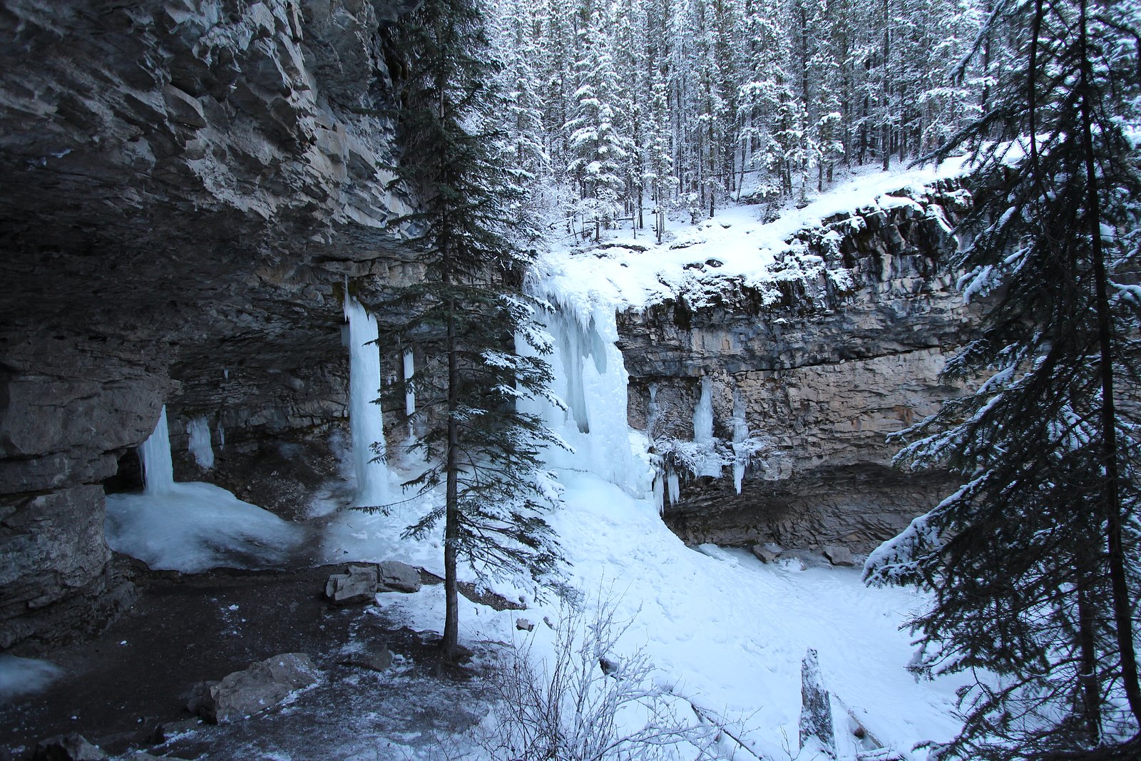
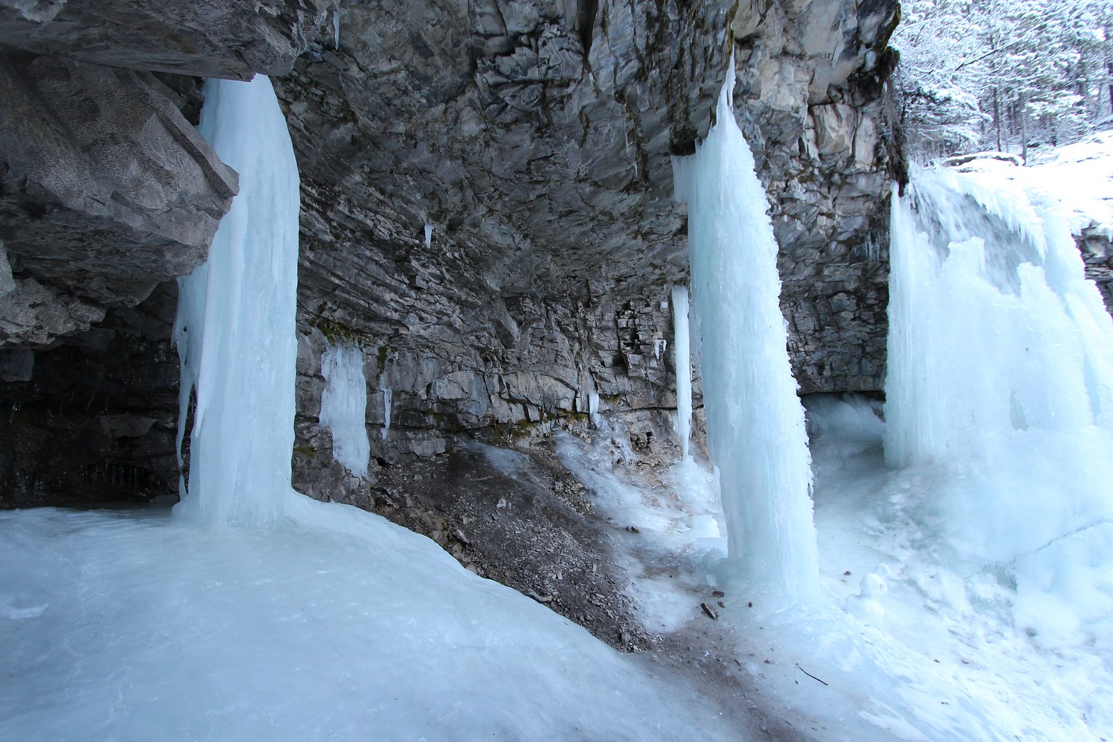
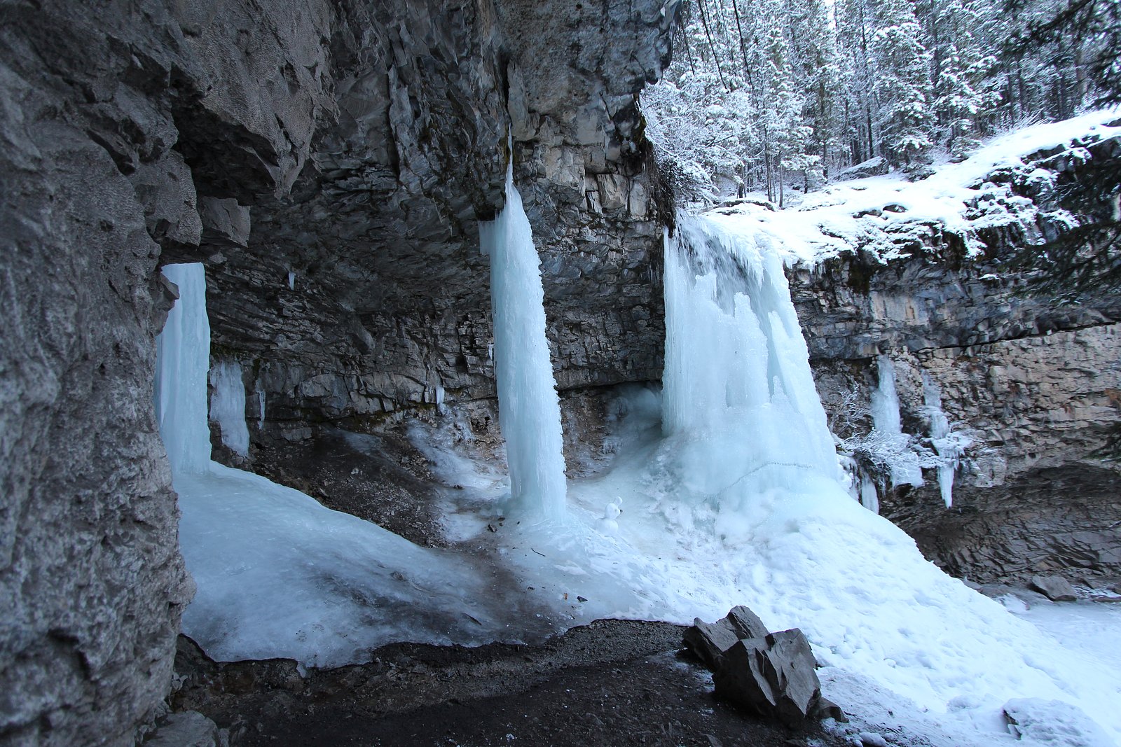
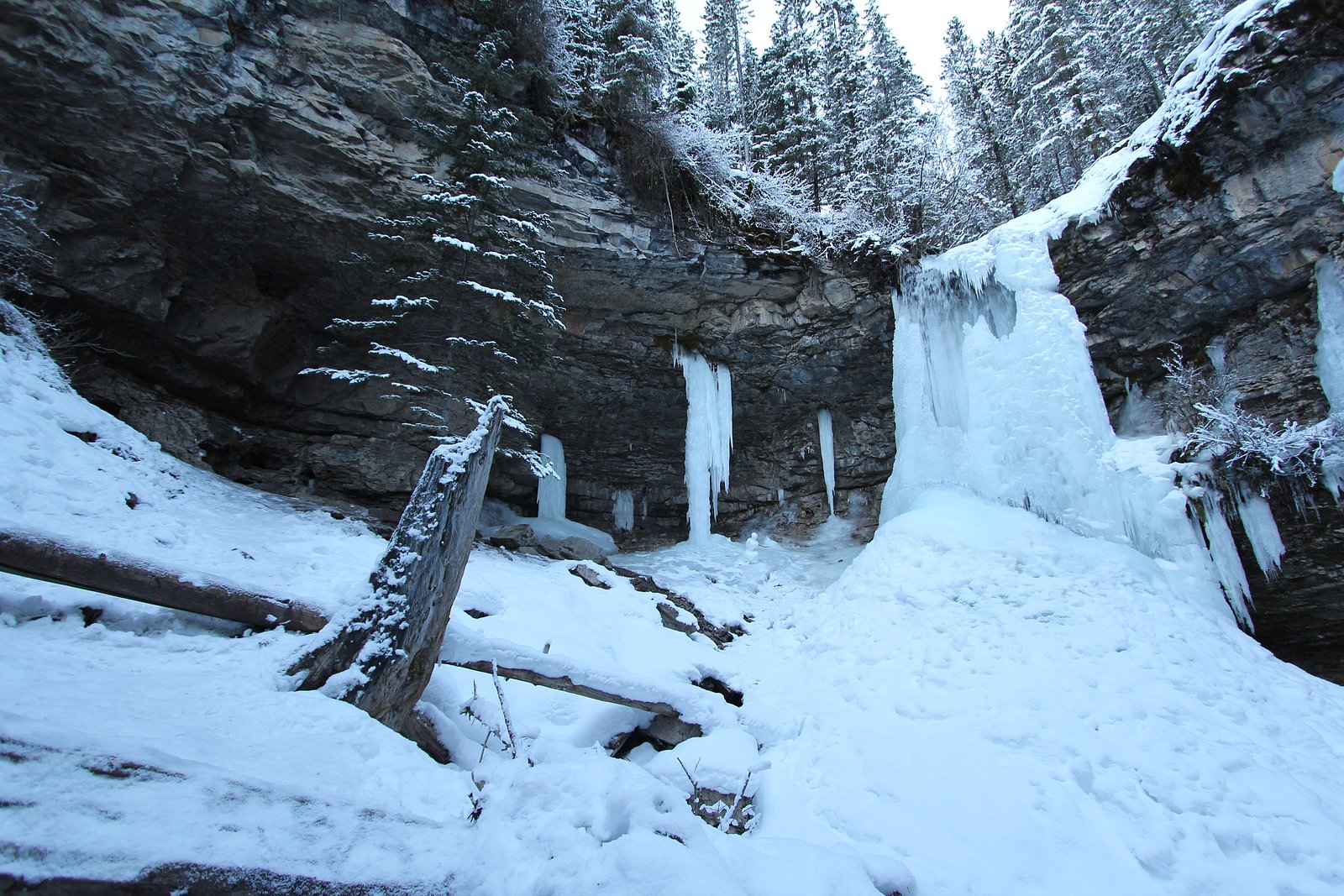
About Marmot Falls
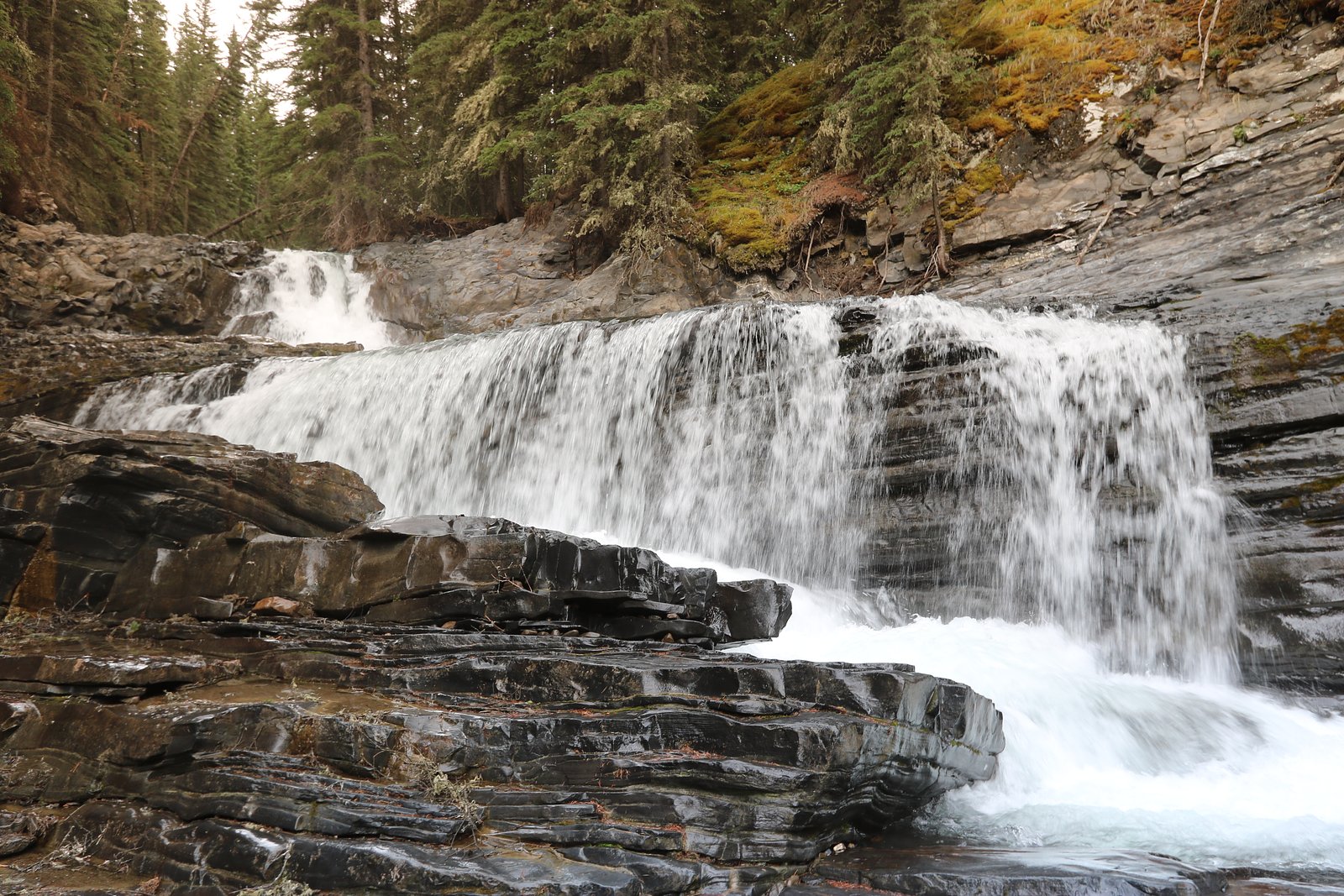
Marmot Falls is a small to medium cascade-style waterfall in Alberta, Canada, located at approximately 50.948, -115.1483. It lies in the general mountain region west of Calgary and east of Banff (user-provided distances: ~28.4 miles from Banff, ~51.7 miles from Calgary, ~67.5 miles from Lake Louise). The falls are typical of foothill/subalpine streams in this part of Alberta and are most dramatic in spring and after heavy rains. Exact published measurements and formal trailhead information are limited; visitors should verify current access and conditions with local park or forest authorities before traveling.
Why This Waterfall Exists
Marmot Falls flows over hard intrusive rock laid down about 359-419 million years ago. These resistant rocks form a durable ledge that water cannot easily wear away, creating the falls where softer material downstream has already eroded.
Nearby Falls Worth Visiting
O'Shaughnessy Falls (7 m) lies 7.7 kilometres to the northeast.
Trail & Hike Details
The Approach
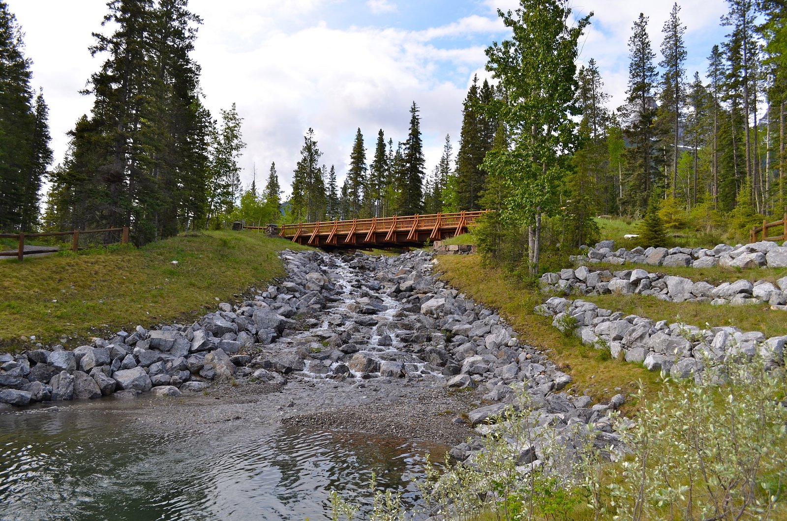
The easy 4.2-km out-and-back trail gains 149 metres of elevation on the way to the falls.
Trail Description
Detailed, authoritative trail descriptions are not consistently documented for this specific feature. From typical regional patterns: expect a single out-and-back spur trail from a parking/pullout that descends/ascends through subalpine forest and meadow to a viewpoint near the watercourse. The tread may be narrow, rocky, and possibly steep in sections; some viewpoints may require short scramble over rock to get closer. Trails in this region can become muddy, icy, or obscured after storms or heavy snowmelt. If you need exact mileage, elevation gain, or step-by-step directions, consult Parks Canada (if inside a national park), Alberta Parks, or recent AllTrails/other trail report entries before you go.
What to Expect
A scenic mountain stream cascade with variable flow depending on season (highest in spring snowmelt and after heavy rain). Expect mixed terrain: forested approach, rock and root sections, and potentially slippery rock near the fall. Views may be limited to one or a few vantage points rather than a broad amphitheater. Wildlife in the area can include marmots, ground squirrels, deer/elk, and possibly bears. Cell service may be intermittent.
Accessibility
The trail is not wheelchair accessible. Uneven terrain and elevation changes require steady footing.
Frequently Asked Questions
🐶 Are Dogs Allowed at Marmot Falls?
❌ Dogs are not allowed
Are There Any Fees or Permits Required?
🆖 No fees required
🏊 Is There Swimming at Marmot Falls?
❌ Swimming is not allowed
When to Visit
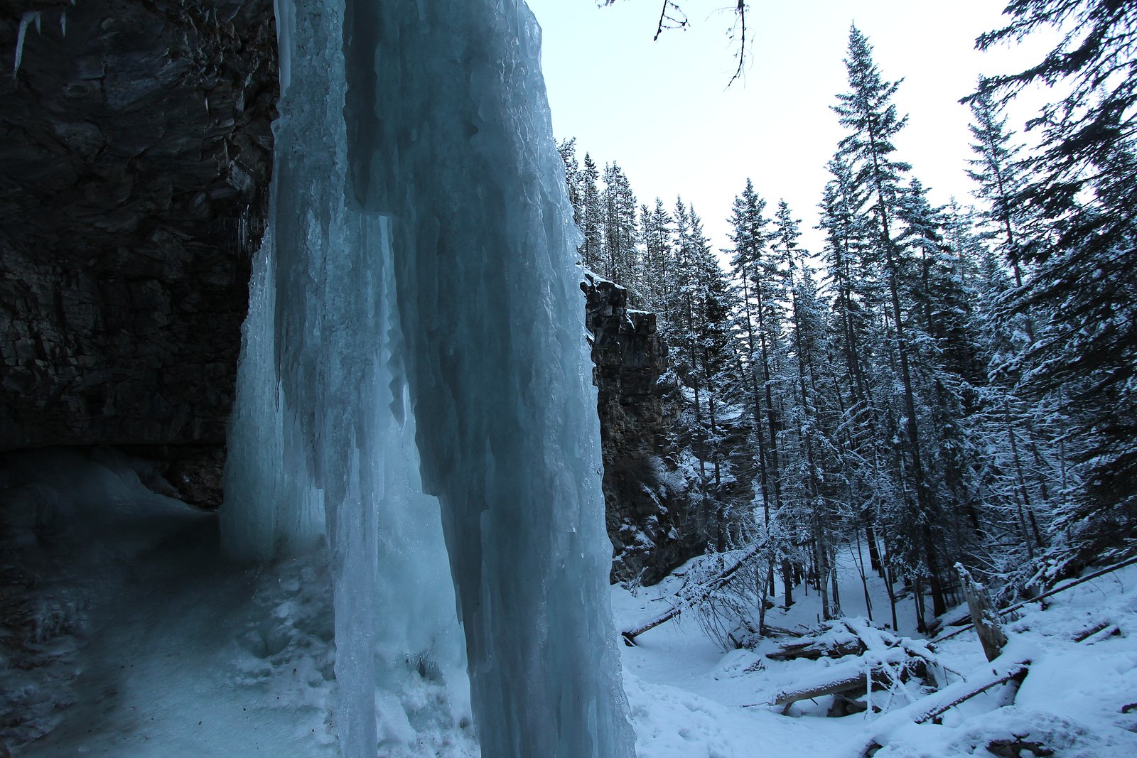
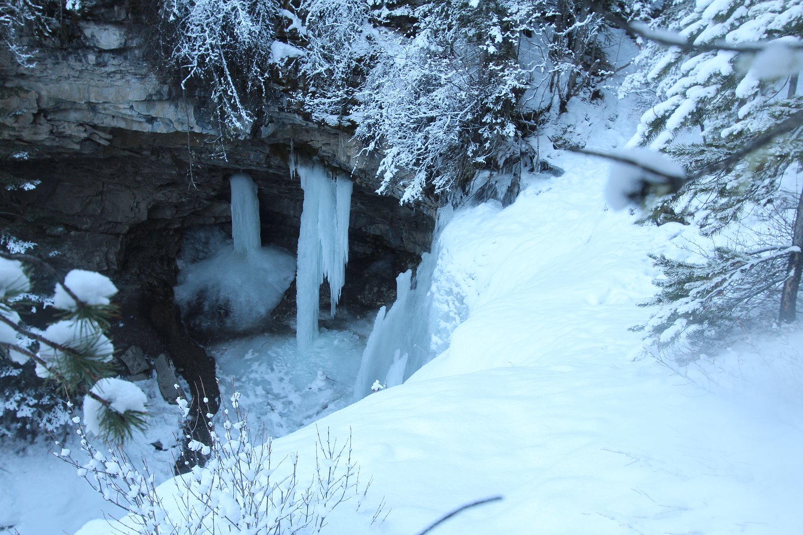
Late spring and early summer for highest flows and lush scenery. Early morning or weekday visits reduce crowds. Fall offers color and lower insect activity. Winter provides ice-fall and frozen-waterfall photography opportunities but requires winter gear and caution.
Seasonal Access
The best time to visit is Spring, Summer, Fall, and Winter. Check with the managing park or local authority for current conditions.
Safety Information
Primary hazards: slippery wet rock near the fall, steep or unstable edges, cold water, sudden surges in flow after rain or rapid snowmelt, potential for loose rock on approach, and wildlife encounters (including bears). Winter conditions add avalanche risk in some areas and icy surfaces. Cell service may be unreliable; carry navigation and emergency supplies. Check current conditions and closures before visiting and never approach the lip or edge of a fall.
Current Water Conditions
0.2 m³/s
Current discharge — how much water is flowing
About average for this time of year
Based on 48 years of record
0.37 m
Water depth at gauge
7-Day Discharge Trend
What does this mean for your visit?
Flow is about average for this time of year.
About This Gauge
This gauge is on a nearby waterway and may not reflect exact conditions at the falls.
7-Day Flow Outlook
Based on the WSC gauge JUMPINGPOUND CREEK NEAR COX HILL (16 km away).
Today
Moderate
0.2 m³/s
6/10Tomorrow
Moderate
0.2 m³/s
6/10Tue
Moderate
0.2 m³/s
5/10Wed
Moderate
0.2 m³/s
6/10Thu
Moderate
0.2 m³/s
6/10Fri
Moderate
0.2 m³/s
6/10Sat
Moderate
0.2 m³/s
6/10Best window: Today — moderate flow, cloudy (trip score 6/10).
Best time of year: this gauge typically runs highest from mid May to late June, peaking in May.
How we calculate this
This is a transparent outlook, not a precise forecast. We take the waterfall's current flow strength (how it ranks against its historical normal for today, from the nearest WSC stream gauge), carry that ranking forward along the gauge's seasonal curve, and nudge it for forecast rain. Confidence is highest for the next day or two and falls further out. Always check official conditions and your own judgment before visiting — high flows can be dangerous.
Know when to go.
Get a free email alert when waterfalls near Banff hit peak flow. We only send when conditions are worth the trip — no weekly newsletters, no spam.
Weather Forecast
Location & Access
Getting There
Use the provided coordinates (50.948, -115.1483) to locate the falls. The site is in a mountain/foothill area within driving distance of Banff, Calgary and Lake Louise. Access typically requires driving to a nearby trailhead or pullout on a local road or forest service access route followed by a short hike. Exact road names and turnoffs may vary; confirm route and conditions with provincial park information or recent trip reports before you go.
Get Directions on Google MapsParking
Parking is likely limited to a small pullout or unpaved trailhead lot. Expect minimal facilities (no guaranteed toilets or staffed parking attendants). High-use periods may require parking further away and walking. Check recent reports for exact parking location and capacity.
Elevation
1,517 metres above sea level
Coordinates
50.948016° N, -115.148289° W
Visitor Tips & Gear
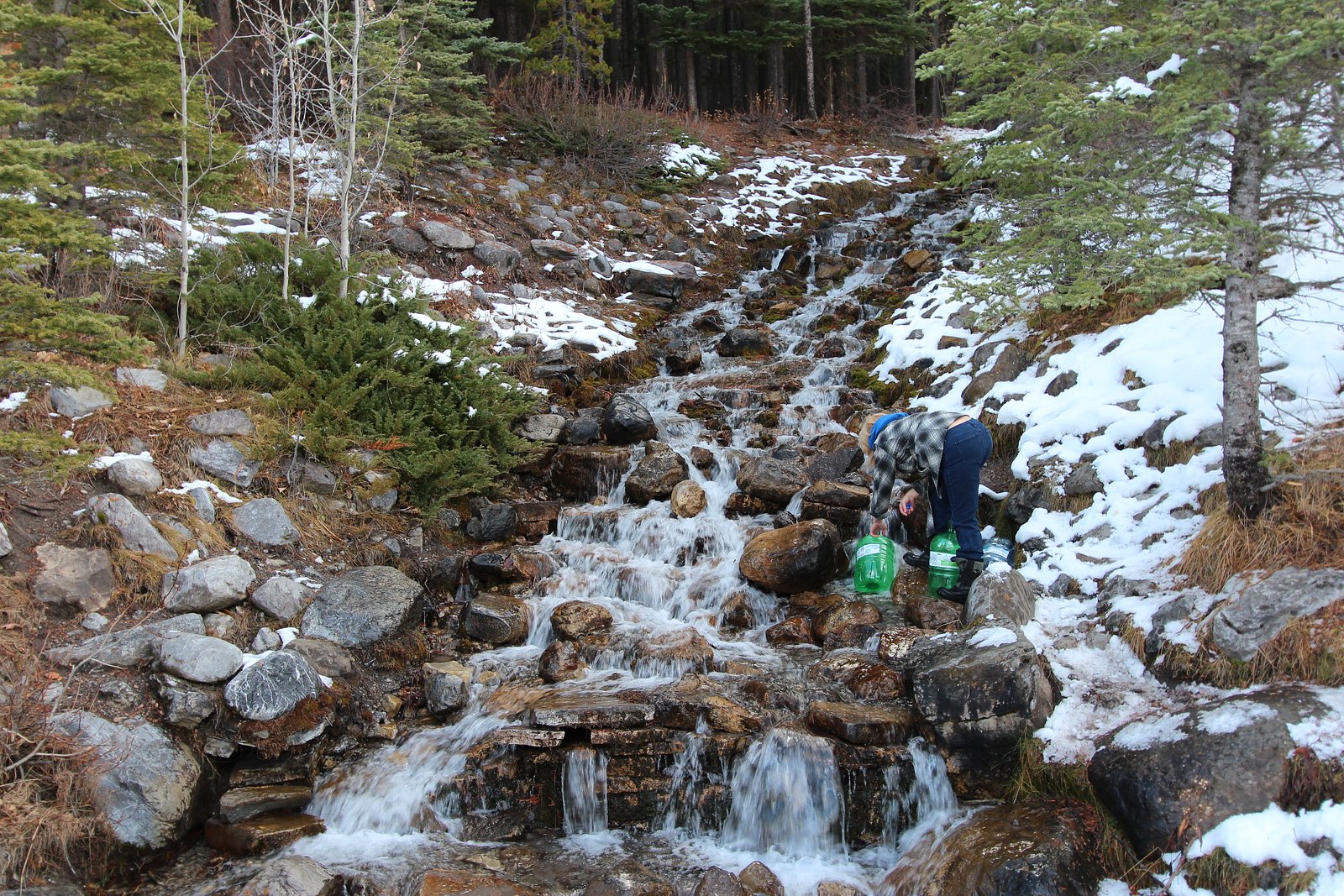
• Check recent trip reports or park/forest service pages for up-to-date access and trail condition information. • Wear sturdy, grippy footwear; expect wet and slippery rock near the falls. • Bring bear spray in bear country and know how to use it. Keep dogs on leash if dogs are allowed. • Leave no trace: pack out trash and avoid disturbing vegetation or wildlife. • Avoid getting too close to the edge or climbing on wet rocks, falls and currents can be stronger than they appear. • If visiting in winter, expect ice and consider traction devices (microspikes) and winter clothing.
As an Amazon Associate, we earn from qualifying purchases.
This easy 4.2 km hike is straightforward — comfortable trail shoes and plenty of water should do. Icy conditions are common in winter — traction cleats are a smart addition.

Columbia Watertight II Rain Jacket
Packs into its own pocket, seam-sealed, and keeps you dry from spray and surprise rain.

Polarized Sunglasses (Knockaround)
Cuts glare off the water so you actually see the falls — and your photos turn out better too.

Earth Pak Waterproof Dry Bag
Keeps your phone and gear dry when waterfall mist soaks everything else.

Waterproof Phone Pouch (AiRunTech)
Cheap insurance — take photos right next to the falls without killing your phone.

Kahtoola MICROspikes
Cult-favorite traction cleats that grip ice and wet rock — essential for winter waterfall hikes.

JOBY GorillaPod Starter Kit
Wraps around railings and rocks for long-exposure waterfall shots — no flat surface needed.
Where to Stay
Browse vacation cabins and private rentals nearby
Unique outdoor stays — tents, yurts, and treehouses
Rent a campervan or RV for your waterfall road trip
Some links are affiliate links. We may earn a commission at no extra cost to you.
Nearby Campground
Mount Kidd RV Park
6.6 km away
Additional Information
Nearby Attractions
Banff National Park (general area), Kananaskis Country and provincial backcountry areas, Lake Louise (regional landmark). Other nearby attractions may include other mountain lakes, viewpoints, and trail networks in the Bow Valley/Kananaskis region, confirm specifics based on exact access route.
Wildlife
Marmots, ground squirrels, deer/elk, coyotes, black bears and occasionally grizzly bears in higher mountain regions. Birdlife includes a variety of songbirds and raptors. Practice wildlife safety and keep a safe distance.
Cities near Marmot Falls
Nearby Waterfalls
Writing about Marmot Falls? Embed this waterfall on your site for free.