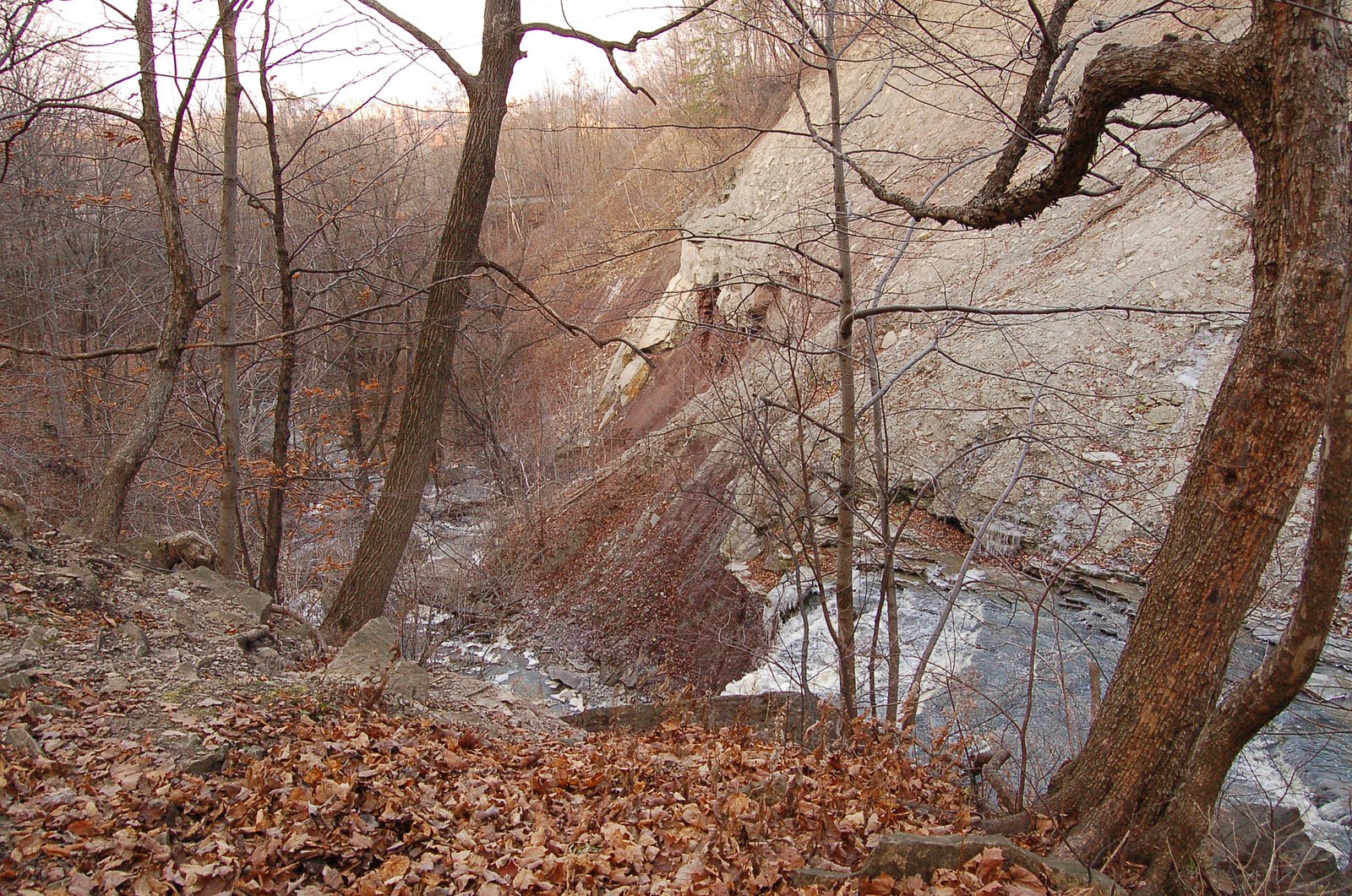
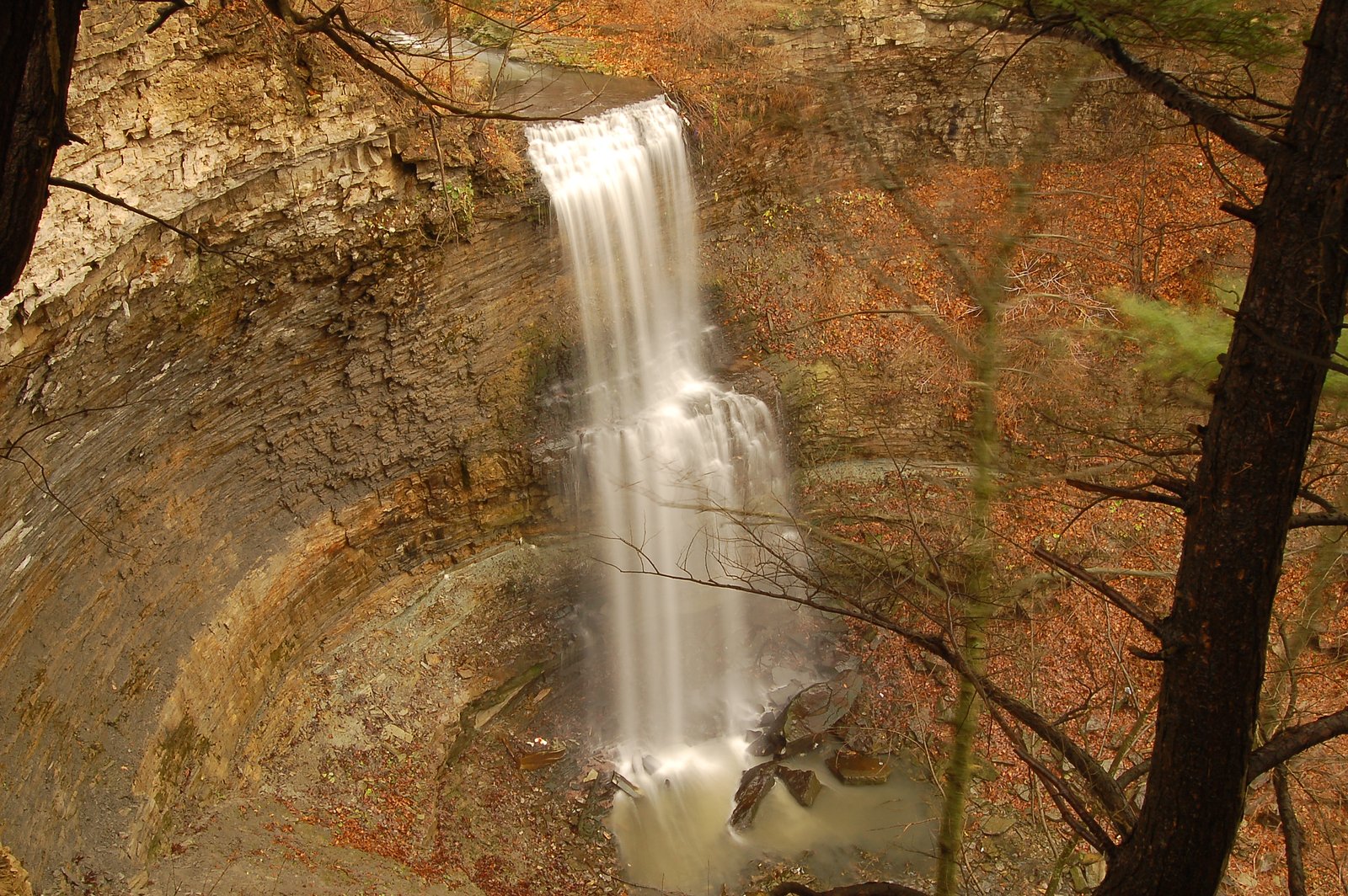
Lower Punchbowl Falls
Ontario • Devil's Punch Bowl Conservation Area • 7 m
By Armen Suny · Last verified Jun 2026
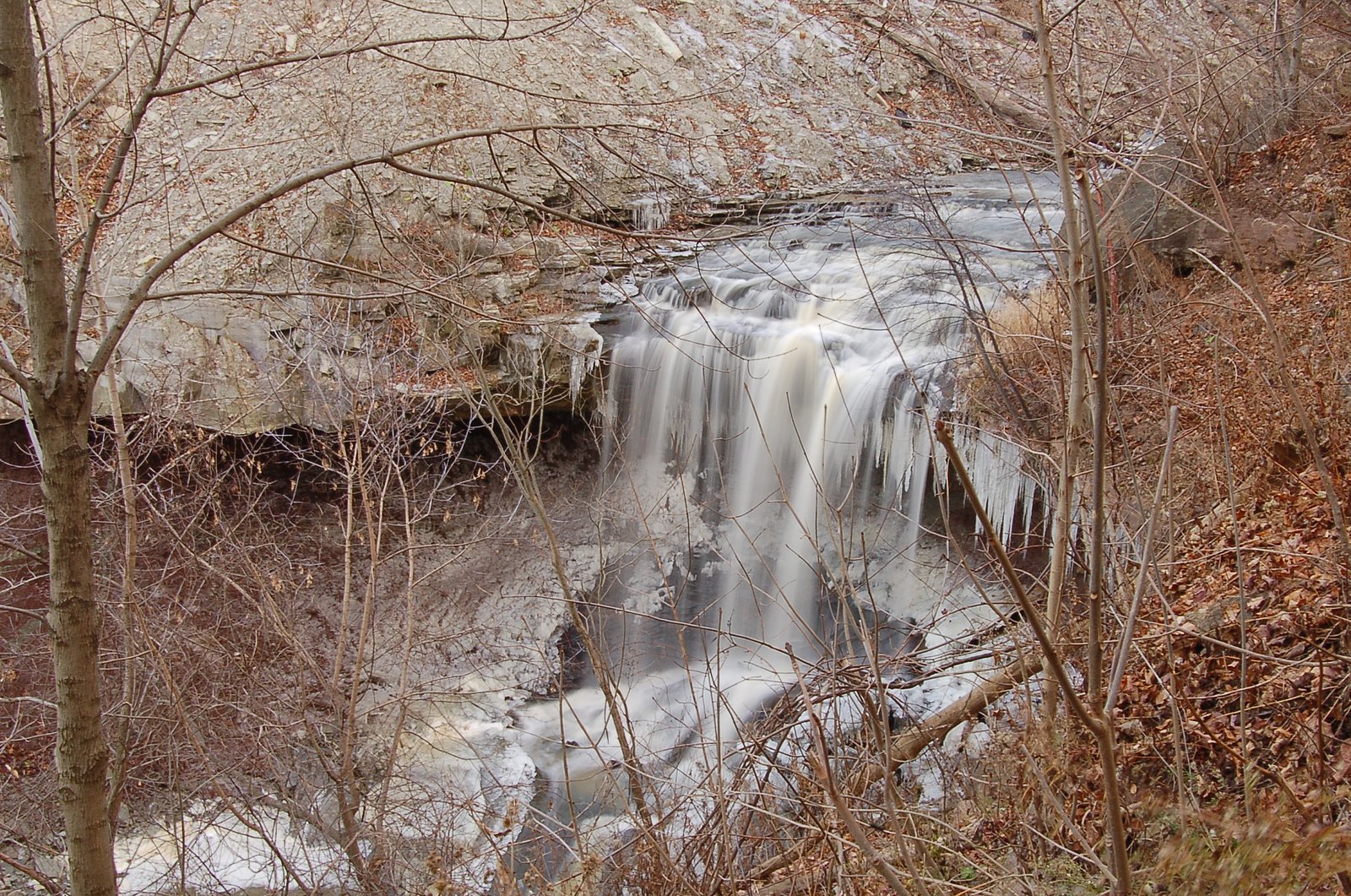
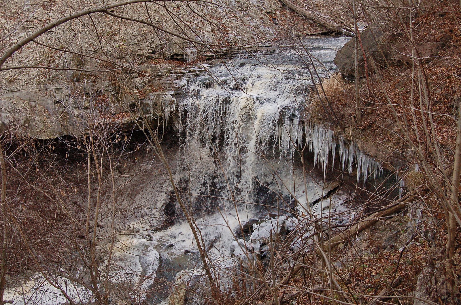
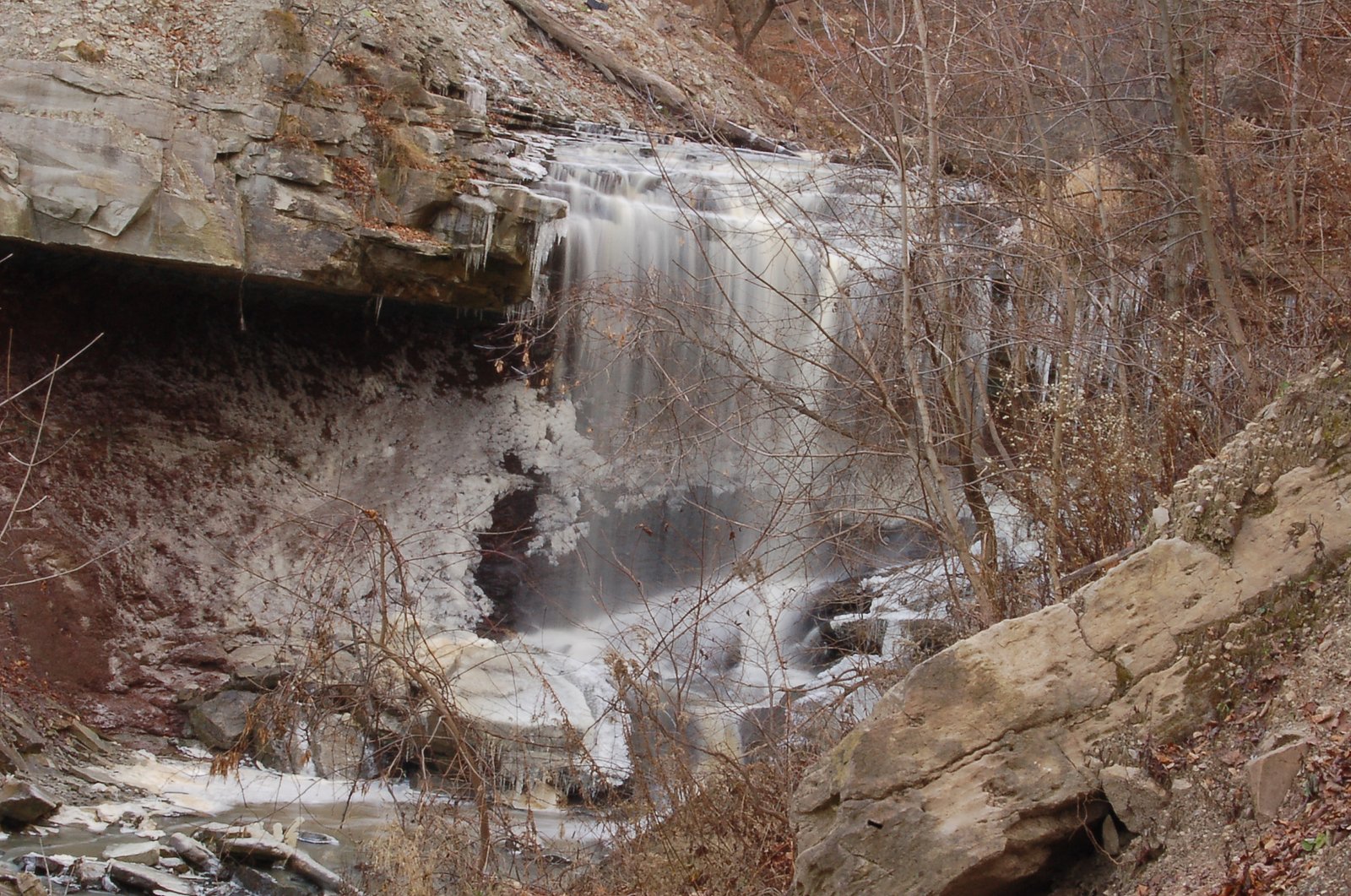
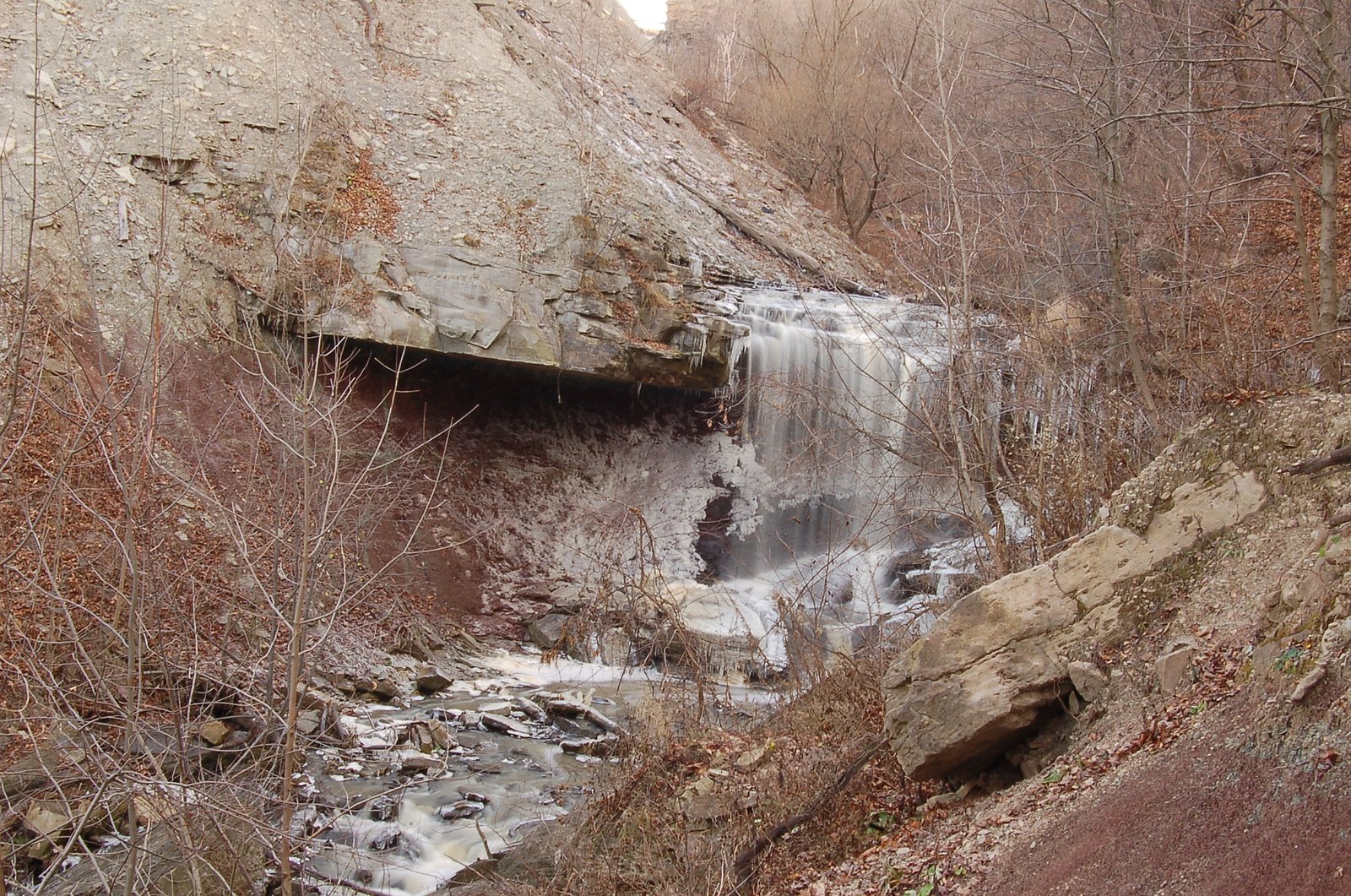
Photo Credits (5)
Difficulty
Moderate
Trail Length
0.8 km
Trail Type
Out And Back
Elevation Gain
67 m
About Lower Punchbowl Falls
Lower Punchbowl Falls (coords 43.2114, -79.7576) is a waterfall located on the Niagara Escarpment region near Hamilton, Ontario. Public information about this specific named feature is limited; the name suggests a punchbowl-style fall feeding a rounded plunge pool. Exact ownership and formal trail access are not clearly documented here, so visitors should confirm access before visiting. Conditions and access may change seasonally and may be informal (unmarked footpaths).
The Setting
Lower Punchbowl Falls sits at 165 metres within Devil's Punch Bowl Conservation Area, in the foothills of Ontario. The falls drop 7 metres.
Height: 23 feet
Nearby Falls Worth Visiting
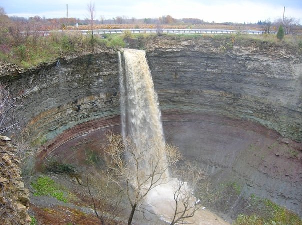
Devil's Punchbowl Falls (37 m) lies 0.2 kilometres to the southeast. Also nearby: Billy Green Falls (17 m, 0.8 km) and Centennial Falls (10 m, 1.0 km).
Trail & Hike Details
The Approach
The moderate 0.8-km out-and-back trail gains 67 metres of elevation on the way to the falls.
Trail Description
Public descriptions of a maintained trail to Lower Punchbowl Falls are sparse. Approaches may be via short, informal footpaths from a nearby road or conservation property and could include steep, rocky or muddy sections along the escarpment. Expect uneven footing, possibly no signage, and limited or no handrails. If the fall lies within a conservation area, there may be a short maintained trail; otherwise access may be cross-country.
What to Expect
The falls drop a gentle 7 metres.
Accessibility
The trail is not wheelchair accessible. Uneven terrain and elevation changes require steady footing.
Frequently Asked Questions
🐶 Are Dogs Allowed at Lower Punchbowl Falls?
❌ Dogs are not allowed
Are There Any Fees or Permits Required?
🆖 No fees required
🏊 Is There Swimming at Lower Punchbowl Falls?
❌ Swimming is not allowed
When to Visit
Spring (snowmelt and rain) typically offers the highest flows and dramatic water volume. Early fall provides good foliage color and still-robust flows. Summer can be pleasant but water levels may be lower; winter can offer ice formations but is slippery and may be unsafe without proper gear.
Seasonal Access
The best time to visit is Spring, Summer, Fall, and Winter. Check with Devil's Punch Bowl Conservation Area for current conditions.
Safety Information
Potential hazards: slippery rocks and wet surfaces, steep and unstable ledges, fast or cold water, falling rock, limited or no cell coverage, and seasonal ice. Always stay back from cliff edges, supervise children closely, avoid alcohol, and do not enter the water unless you are certain it is safe. Check local conservation authority or landowner rules and conditions before visiting. If conditions are poor (heavy rain, flooding, ice), do not attempt to approach the fall.
Current Water Conditions
0.2 m³/s
Current discharge — how much water is flowing
About average for this time of year
Based on 40 years of record
11.27 m
Water depth at gauge
7-Day Discharge Trend
What does this mean for your visit?
Flow is about average for this time of year.
About This Gauge
7-Day Flow Outlook
Based on the WSC gauge REDHILL CREEK AT HAMILTON (4 km away).
Today
Moderate
0.2 m³/s
8/10Tomorrow
Moderate
0.2 m³/s
6/10Tue
Moderate
0.2 m³/s
6/10Wed
Moderate
0.2 m³/s
6/10Thu
Moderate
0.2 m³/s
8/10Fri
Moderate
0.2 m³/s
6/10Sat
Moderate
0.2 m³/s
6/10Best window: Today — moderate flow, mainly sunny (trip score 8/10).
Best time of year: this gauge typically runs highest from mid February to early May, peaking in April.
How we calculate this
This is a transparent outlook, not a precise forecast. We take the waterfall's current flow strength (how it ranks against its historical normal for today, from the nearest WSC stream gauge), carry that ranking forward along the gauge's seasonal curve, and nudge it for forecast rain. Confidence is highest for the next day or two and falls further out. Always check official conditions and your own judgment before visiting — high flows can be dangerous.
Know when to go.
Get a free email alert when waterfalls near Hamilton hit peak flow. We only send when conditions are worth the trip — no weekly newsletters, no spam.
Weather Forecast
Location & Access
Getting There
The waterfall is located near Hamilton (approx. 6.4 miles), Youngstown (approx. 32.0 miles), and Niagara University (approx. 34.2 miles) at coordinates 43.2114, -79.7576. Use a reliable mapping app/GPS to navigate to the coordinates. Exact turnoffs, parking points, and trailheads are not well documented here, expect to use local roads and possibly informal access routes from nearby conservation lands or road shoulders.
Get Directions on Google MapsParking
Parking information is not well documented. There may be limited roadside parking or small informal pullouts. If the site is on conservation authority land it may have designated parking; otherwise parking could be limited or on-street. Do not block driveways or gates; obey signage.
Elevation
165 metres above sea level
Coordinates
43.211384° N, -79.757639° W
Land Management
Managed by Hamilton Conservation Authority
Visitor Tips & Gear
1) Confirm access and land ownership before visiting; some falls are on private land or within managed conservation areas with rules. 2) Wear sturdy, grippy footwear and expect slippery rocks and muddy trails. 3) Keep a safe distance from cliff edges; escarpment ledges can be unstable. 4) Bring a map or use coordinates; phone service may be spotty. 5) Respect posted signs and fencing, don’t cross barriers. 6) Leave no trace: pack out trash and avoid disturbing vegetation or wildlife.
As an Amazon Associate, we earn from qualifying purchases.
With 0.8 km and 67 m of elevation gain, sturdy boots and trekking poles will help on this moderate trail. Icy conditions are common in winter — traction cleats are a smart addition.

Columbia Watertight II Rain Jacket
Packs into its own pocket, seam-sealed, and keeps you dry from spray and surprise rain.

Polarized Sunglasses (Knockaround)
Cuts glare off the water so you actually see the falls — and your photos turn out better too.

Earth Pak Waterproof Dry Bag
Keeps your phone and gear dry when waterfall mist soaks everything else.

Waterproof Phone Pouch (AiRunTech)
Cheap insurance — take photos right next to the falls without killing your phone.

Timberland Euro Sprint Mid Waterproof
Trusted waterproof boot with premium leather and grippy rubber sole — reliable on rocky, wet trails.

TrailBuddy Trekking Poles
Lightweight aluminum, cork grips, and flip-locks that actually hold — a best-seller for good reason.
Where to Stay
Browse vacation cabins and private rentals nearby
Unique outdoor stays — tents, yurts, and treehouses
Rent a campervan or RV for your waterfall road trip
Some links are affiliate links. We may earn a commission at no extra cost to you.
Nearby Campground
Lost Forest Park & Camping Resort
21.7 km away
Additional Information
Nearby Attractions
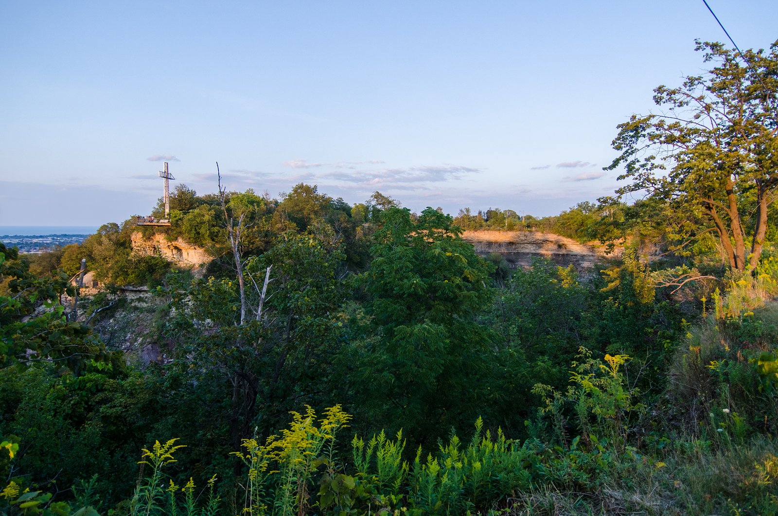
Nearby attractions in the Hamilton/Niagara Escarpment area include: Devil's Punch Bowl Conservation Area, Webster's Falls, Tews Falls, Albion Falls, Spencer Gorge / Webster's Falls Conservation Area, and the broader Niagara Falls region. Confirm distances and access before planning a multi-site visit.
Wildlife
Typical Niagara Escarpment wildlife: songbirds, raptors, small mammals (squirrels, raccoons), amphibians near streams, and occasional deer. Ticks and poison ivy can be present, take appropriate precautions.
Cities near Lower Punchbowl Falls
Nearby Waterfalls

Writing about Lower Punchbowl Falls? Embed this waterfall on your site for free.