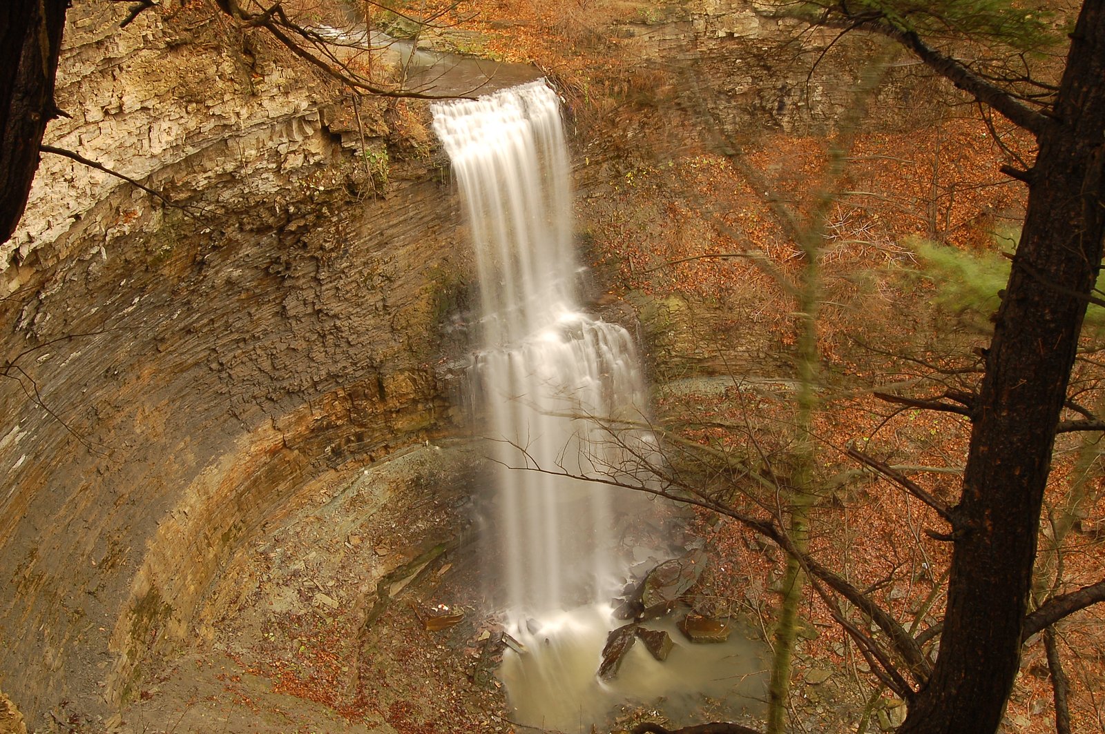
Glover's Falls
Ontario • 8 m
By Armen Suny · Last verified Jun 2026
Photo Credits (5)
About Glover's Falls
Glover’s Falls is one of the many small but scenic cascades tucked into the Niagara Escarpment around Hamilton, a city famous for having more than 100 waterfalls and the long, winding Bruce Trail that threads the escarpment. The Escarpment’s hard caprock and sedimentary layers create the perfect conditions for falls and cascades from Tobermory all the way down to Niagara Falls, and Glover’s Falls offers a compact, rewarding stop for hikers exploring the area. Approaches to Glover’s Falls tend to be informal and low-key rather than heavily developed; there’s no widely published managing agency or maintained trail name for this specific site. Treat the spot like a neighborhood gem: plan for a short visit, keep to existing footpaths, and respect private-property boundaries and sensitive cliff edges to help preserve the site for others.
The Setting
Glover's Falls sits at 178 metres in the foothills of Ontario. The falls drop 8 metres.
Height: 26 feet
Nearby Falls Worth Visiting
Billy Green Falls (17 m) lies 0.6 kilometres to the east. Also nearby: Taro Falls (12 m, 1.1 km) and Centennial Falls (10 m, 0.5 km).
Trail & Hike Details
Trail Description
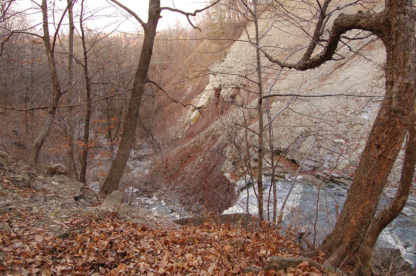
Specific trail details for Glover's Falls are not well documented in widely available trail databases. Approaches to similar small waterfalls in the Hamilton/Niagara area are commonly short but can be steep, rocky, and uneven. Expect an informal path or foottrack rather than a heavily maintained trail. Trail conditions may include exposed roots, loose rock, and muddy sections after rain. Follow signage, respect private property boundaries, and avoid shortcutting vegetation or destabilizing edges.
What to Expect
The falls drop 8 metres.
Accessibility
Accessibility is likely limited. Expect uneven, possibly steep and rocky terrain; this site is probably not wheelchair accessible. Specific accessibility features (designated viewpoints, paved paths) are not documented.
Frequently Asked Questions
🐶 Are Dogs Allowed at Glover's Falls?
❌ Dogs are not allowed
Are There Any Fees or Permits Required?
🆖 No fees required
🏊 Is There Swimming at Glover's Falls?
❌ Swimming is not allowed
When to Visit
Late winter to spring (snowmelt and seasonal rains) for highest flows; early summer for pleasant weather; fall for foliage color. Winter can produce icy/photogenic conditions but is more hazardous; exercise caution.
Seasonal Access
The best time to visit is Spring, Summer, and Fall. Winter access may be limited. Check with the managing park or local authority for current conditions.
Safety Information
Hazards may include slippery rocks, steep drop-offs, fast currents after rain, unstable banks, and seasonal ice. There may be little or no signage or barriers. Cell service can be spotty. Use caution near water, supervise children closely, avoid cliff edges, and do not attempt technical climbs without proper gear and experience. If unsure about conditions, consider visiting with someone experienced or choosing a better-documented nearby trail.
Current Water Conditions
0.2 m³/s
Current discharge — how much water is flowing
About average for this time of year
Based on 40 years of record
11.27 m
Water depth at gauge
7-Day Discharge Trend
What does this mean for your visit?
Flow is about average for this time of year.
About This Gauge
7-Day Flow Outlook
Based on the WSC gauge REDHILL CREEK AT HAMILTON (4 km away).
Today
Moderate
0.2 m³/s
8/10Tomorrow
Moderate
0.2 m³/s
6/10Tue
Moderate
0.2 m³/s
6/10Wed
Moderate
0.2 m³/s
6/10Thu
Moderate
0.2 m³/s
8/10Fri
Moderate
0.2 m³/s
6/10Sat
Moderate
0.2 m³/s
6/10Best window: Today — moderate flow, mainly sunny (trip score 8/10).
Best time of year: this gauge typically runs highest from mid February to early May, peaking in April.
How we calculate this
This is a transparent outlook, not a precise forecast. We take the waterfall's current flow strength (how it ranks against its historical normal for today, from the nearest WSC stream gauge), carry that ranking forward along the gauge's seasonal curve, and nudge it for forecast rain. Confidence is highest for the next day or two and falls further out. Always check official conditions and your own judgment before visiting — high flows can be dangerous.
Know when to go.
Get a free email alert when waterfalls near Hamilton hit peak flow. We only send when conditions are worth the trip — no weekly newsletters, no spam.
Weather Forecast
Location & Access
Getting There
The waterfall is located near Hamilton (about 5.8 miles), Youngstown (about 32.8 miles), and Niagara University (about 34.8 miles) at approximately 43.2091, -79.7742. Access is likely via local roads; visitors should use a reliable mapping app and verify access points before travel. Some approaches may require driving on narrow rural roads.
Get Directions on Google MapsParking
Parking information is not definitively documented. There may be limited roadside parking or a small informal lot; in some cases parking may be on-street or on private property nearby. Park legally and avoid blocking driveways or gates.
Elevation
178 metres above sea level
Coordinates
43.209113° N, -79.774207° W
Visitor Tips & Gear
• Check recent trip reports or local resources (park, municipal, or trail sites) before you go, as access details can change. • Wear sturdy, grippy footwear, rocks and shoreline are often slippery. • Stay back from the lip and avoid walking on wet ledges; many small falls have hidden undercut or unstable edges. • Respect private property, if access requires crossing private land, seek permission. • Leave no trace: pack out trash and avoid disturbing vegetation or wildlife. • If visiting in winter, be prepared for ice and very slippery conditions and consider avoiding the area unless experienced with winter hiking.
Where to Stay
Browse vacation cabins and private rentals nearby
Unique outdoor stays — tents, yurts, and treehouses
Rent a campervan or RV for your waterfall road trip
Some links are affiliate links. We may earn a commission at no extra cost to you.
Nearby Campground
Lost Forest Park & Camping Resort
21.2 km away
Additional Information
Nearby Attractions
The broader Hamilton/Niagara area is known for numerous waterfalls and conservation areas. Nearby points of interest may include other regional falls and conservation parks around Hamilton and the Niagara Peninsula; Niagara Falls is approximately 35 miles away. Confirm specific nearby attractions using local tourism resources.
Wildlife
Typical southern Ontario wildlife may be present: songbirds, waterfowl, small mammals (raccoons, squirrels), deer; be aware of ticks in warmer months.
Cities near Glover's Falls
Nearby Waterfalls


Writing about Glover's Falls? Embed this waterfall on your site for free.