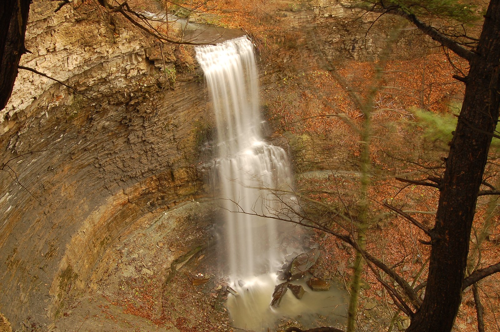
Devil's Punchbowl Falls
Ontario • Devil's Punch Bowl Conservation Area • 37 m
By Armen Suny · Last verified Jun 2026

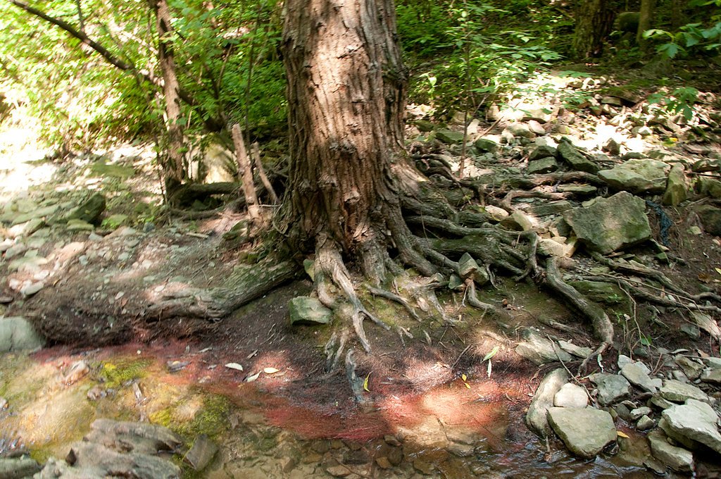
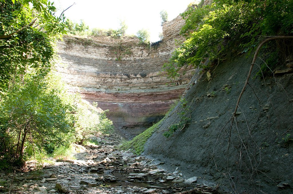
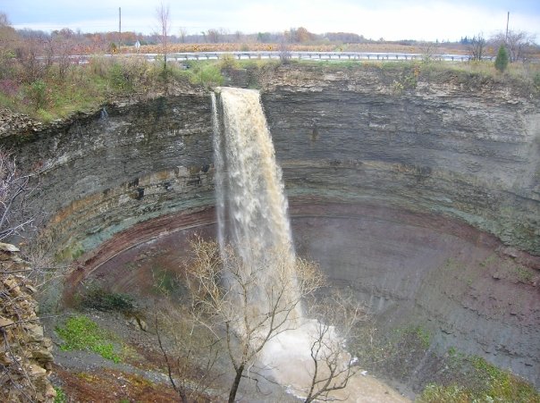
Photo Credits (5)
Difficulty
Easy
Trail Length
0.3 km
Trail Type
Out And Back
Elevation Gain
8 m
About Devil's Punchbowl Falls
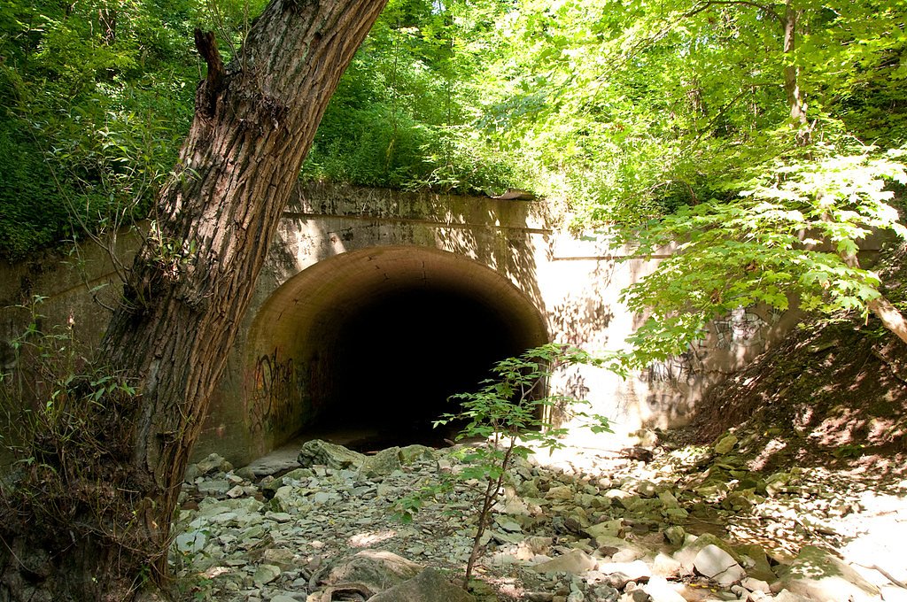
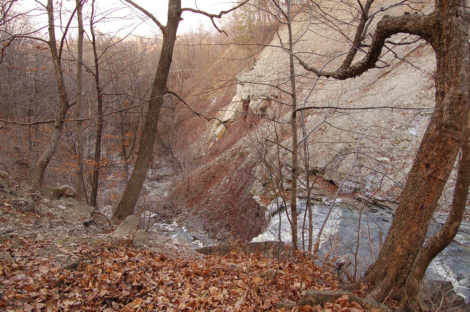
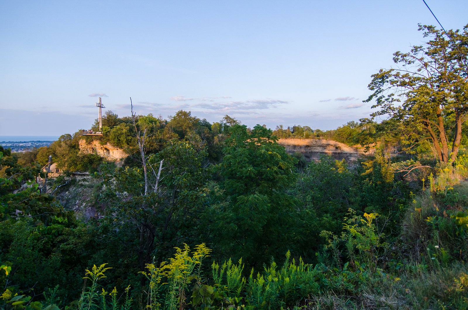
Devil's Punch Bowl is a 37-metre ribbon waterfall on the Niagara Escarpment, in the Stoney Creek community of Hamilton, Ontario, Canada. It is in the Devil's Punchbowl Conservation Area maintained by the Hamilton Conservation Authority, and features an escarpment access trail with connections to a section of the Bruce Trail. Stoney Creek's Dofasco 2000 Trail is nearby. The Punch Bowl is also known as Horseshoe Falls for the distinctive shape of the cliff-face, which somewhat resembles its much larger cousin in Niagara Falls.
The Setting
Devil's Punchbowl Falls sits at 165 metres within Devil's Punch Bowl Conservation Area, in the foothills of Ontario. At 37 metres, it is among the taller waterfalls in Ontario.
Height: 121 feet
Nearby Falls Worth Visiting
Billy Green Falls (17 m) lies 1.0 kilometres to the west. Also nearby: Centennial Falls (10 m, 1.0 km) and Glover's Falls (8 m, 1.4 km).
Trail & Hike Details
The Approach
The easy 0.3-km out-and-back trail gains 8 metres of elevation on the way to the falls.
Trail Description
The primary route to Devil's Punchbowl Falls is a short out-and-back trail from the parking area to the main overlook(s). Expect paved or well-packed sections near the parking/viewing area with stairs or steep steps leading down toward lower viewpoints in the gorge. Trails can be slippery when wet and may include short stretches of exposed rock, roots, and loose footing. The route is suitable for most visitors in reasonable physical condition, but stairs and uneven surfaces make full accessibility limited.
What to Expect
The falls cascade 37 metres.
Accessibility
The trail is short and relatively flat, but the surface may be uneven. Contact the managing agency for accessibility details.
Frequently Asked Questions
🐶 Are Dogs Allowed at Devil's Punchbowl Falls?
❌ Dogs are not allowed
Are There Any Fees or Permits Required?
🆖 No fees required
🏊 Is There Swimming at Devil's Punchbowl Falls?
❌ Swimming is not allowed
When to Visit
Spring for high flows and dramatic water; fall for foliage colors; early mornings on weekends for smaller crowds. Winter offers unique icy scenery but increased hazards (ice, closed areas).
Seasonal Access
The best time to visit is Spring, Summer, Fall, and Winter. Check with Devil's Punch Bowl Conservation Area for current conditions.
Safety Information
Hazards include steep drop-offs, slippery rock and stairs, cold and fast-moving water, unstable edges, variable trail conditions (mud, ice), and limited cell service in the gorge. Stay on marked trails and behind guardrails, keep children and pets under control, wear appropriate footwear, and exercise extra caution in wet or icy conditions. In winter, assume extra risk from ice and consider avoiding lower viewpoints if icy.
Current Water Conditions
0.2 m³/s
Current discharge — how much water is flowing
About average for this time of year
Based on 40 years of record
11.27 m
Water depth at gauge
7-Day Discharge Trend
What does this mean for your visit?
Flow is about average for this time of year.
About This Gauge
7-Day Flow Outlook
Based on the WSC gauge REDHILL CREEK AT HAMILTON (4 km away).
Today
Moderate
0.2 m³/s
8/10Tomorrow
Moderate
0.2 m³/s
6/10Tue
Moderate
0.2 m³/s
6/10Wed
Moderate
0.2 m³/s
6/10Thu
Moderate
0.2 m³/s
8/10Fri
Moderate
0.2 m³/s
6/10Sat
Moderate
0.2 m³/s
6/10Best window: Today — moderate flow, mainly sunny (trip score 8/10).
Best time of year: this gauge typically runs highest from mid February to early May, peaking in April.
How we calculate this
This is a transparent outlook, not a precise forecast. We take the waterfall's current flow strength (how it ranks against its historical normal for today, from the nearest WSC stream gauge), carry that ranking forward along the gauge's seasonal curve, and nudge it for forecast rain. Confidence is highest for the next day or two and falls further out. Always check official conditions and your own judgment before visiting — high flows can be dangerous.
Know when to go.
Get a free email alert when waterfalls near Hamilton hit peak flow. We only send when conditions are worth the trip — no weekly newsletters, no spam.
Weather Forecast
Location & Access
Getting There
Coordinates: 43.2104, -79.7559. The site is located on the Niagara escarpment near St. Catharines/Hamilton. From Hamilton (approx. 6.5 miles) follow local roads toward the Devil's Punchbowl Conservation Area / mountain access roads; from Niagara-region communities follow signs to the conservation area or use the provided coordinates in a mapping app. Nearest cities: Hamilton (~6.5 miles), Youngstown (~32.0 miles), Niagara University (~34.1 miles).
Get Directions on Google MapsParking
There is a small parking area associated with the conservation area. Parking spaces may fill on weekends and holidays. Expect an informal lot with limited spaces; check posted signs for any fees, permits, or seasonal closures.
Elevation
165 metres above sea level
Coordinates
43.210360° N, -79.755893° W
Land Management
Managed by Hamilton Conservation Authority
Visitor Tips & Gear
1) Wear sturdy shoes with good traction, routes include stairs and slick rock. 2) Supervise children near edges and viewing platforms. 3) Avoid leaving the trail or climbing onto the rocks near the waterfall, steep drop-offs and unstable rock are hazards. 4) Check weather and recent visitor reports for trail conditions (mud, ice, or flooding). 5) Parking can be limited on busy days; arrive early. 6) In winter, use traction devices and be prepared for icy steps. 7) Respect posted signage and any seasonal restrictions.
As an Amazon Associate, we earn from qualifying purchases.
For this easy 0.3 km trail, lightweight trail shoes and a water bottle are usually sufficient. Icy conditions are common in winter — traction cleats are a smart addition.

Columbia Watertight II Rain Jacket
Packs into its own pocket, seam-sealed, and keeps you dry from spray and surprise rain.

Polarized Sunglasses (Knockaround)
Cuts glare off the water so you actually see the falls — and your photos turn out better too.

Earth Pak Waterproof Dry Bag
Keeps your phone and gear dry when waterfall mist soaks everything else.

Waterproof Phone Pouch (AiRunTech)
Cheap insurance — take photos right next to the falls without killing your phone.

Kahtoola MICROspikes
Cult-favorite traction cleats that grip ice and wet rock — essential for winter waterfall hikes.

JOBY GorillaPod Starter Kit
Wraps around railings and rocks for long-exposure waterfall shots — no flat surface needed.
Where to Stay
Browse vacation cabins and private rentals nearby
Unique outdoor stays — tents, yurts, and treehouses
Rent a campervan or RV for your waterfall road trip
Some links are affiliate links. We may earn a commission at no extra cost to you.
Nearby Campground
Lost Forest Park & Camping Resort
21.8 km away
Additional Information
Nearby Attractions
Other Niagara/Hamilton-area attractions include Niagara Falls (regional major attraction), local conservation areas and falls around Hamilton and the Niagara escarpment (e.g., Spencer Gorge/Webster's Falls, Tew's Falls), and trails on the Bruce Trail. Exact distances vary; consult a local map for a route plan.
Wildlife
Typical regional wildlife includes songbirds, small mammals (squirrels, raccoons), and occasional deer. Take standard precautions against ticks and mosquitoes in warmer months. Do not feed wildlife.
Cities near Devil's Punchbowl Falls
Nearby Waterfalls

Writing about Devil's Punchbowl Falls? Embed this waterfall on your site for free.