
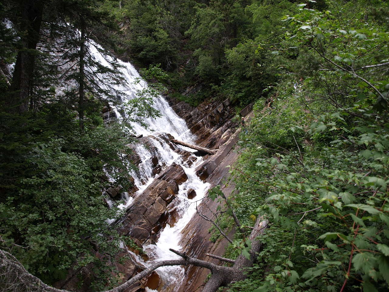
Lower Bertha Falls
Alberta • Waterton Lakes National Park
By Armen Suny · Last verified Jun 2026
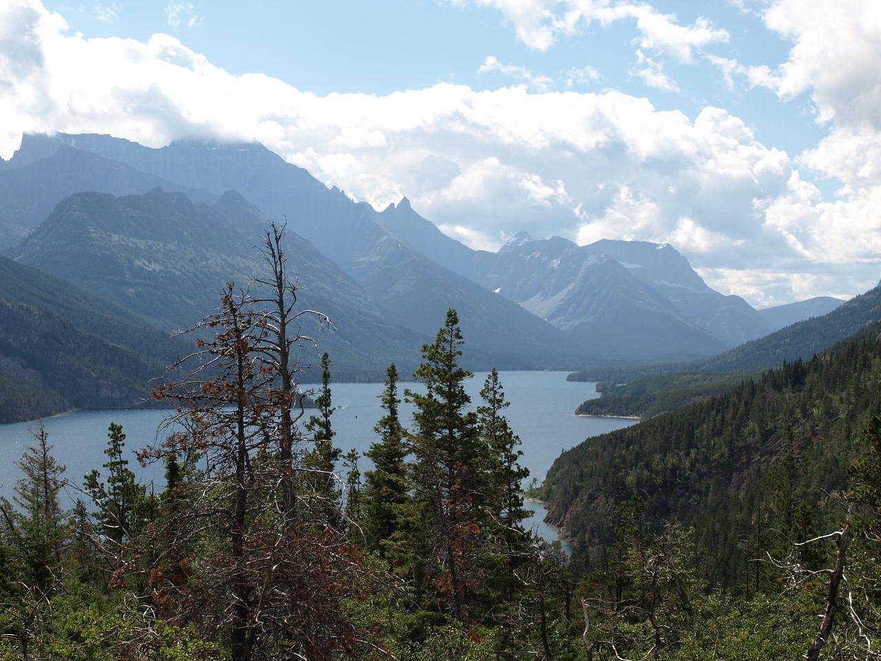
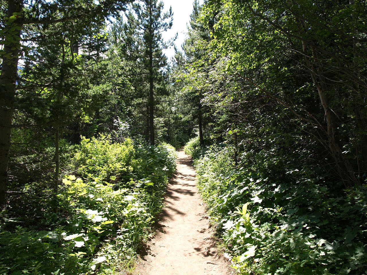
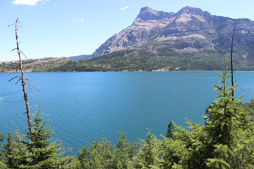
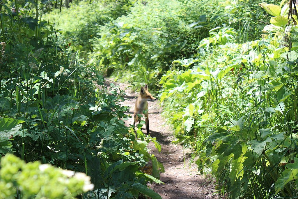
Photo Credits (5)
Difficulty
Moderate
Trail Length
5.8 km
Trail Type
Out And Back
Elevation Gain
209 m
About Lower Bertha Falls
Lower Bertha Falls is a cascade-style waterfall in the Waterton Lakes / Waterton-Glacier International Peace Park region of southwestern Alberta, close to the Canada–US border. It is commonly visited as part of short hikes in the Bertha/Cameron Lake/Red Rock area. Visitor reports indicate a scenic, forested setting with rocky banks and variable flow depending on seasonal snowmelt and rainfall. Exact height measurements and official published stats for the falls are not widely published.
The Setting
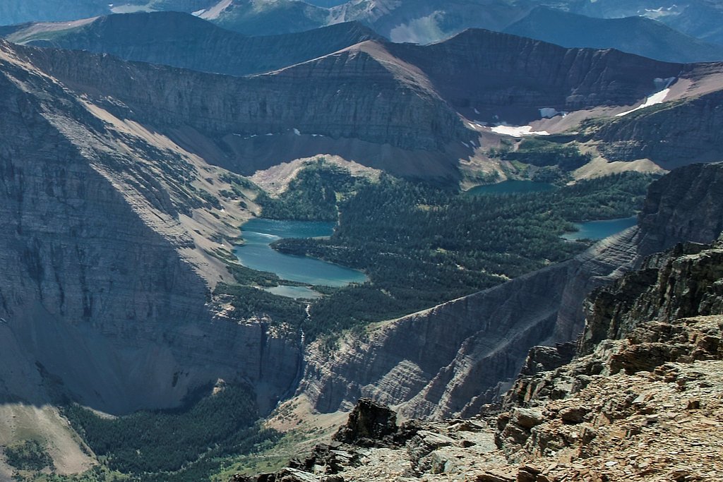
Lower Bertha Falls sits at 1,497 metres within Waterton Lakes National Park, in the mountains of Alberta.
Why This Waterfall Exists
Lower Bertha Falls flows over Purcell Supergroup, a layered carbonate rock layer deposited over 1.0-1.6 billion years ago. Over time, the stream has worn through these layers at different rates, creating the step that forms the waterfall.
Nearby Falls Worth Visiting
Lineham Falls (125 m) lies 10.5 kilometres to the west. Also nearby: Upper Bertha Falls (75 m, 0.8 km) and Cameron Falls (23 m, 1.9 km).
Trail & Hike Details
The Approach
The moderate 5.8-km out-and-back trail gains 209 metres of elevation on the way to the falls.
Trail Description
The route to Lower Bertha Falls is typically a forested out-and-back trail that may include uneven footing, roots and rocks, short steep sections, and creek crossings depending on the exact approach. Trails in this area can be narrow and may not be fully maintained; some visitors report short scrambles or rough steps near the falls. Signage can be limited, so bring a map or use an official park map/GPS. Depending on which approach you use (Cameron Lake/Red Rock/bertha lake side trails) the distance and terrain will vary.
What to Expect
Expect a short-to-moderate hike through montane forest with wildflowers in season and viewpoints of the cascade. The waterfall flow is typically highest in late spring/early summer during snowmelt and after heavy rains. Rocks around the falls are wet and slippery, there may be limited room to safely view the falls, and there are no guaranteed formal viewing platforms. Cell service may be limited. Wildlife in the area includes deer, elk and black bears; follow park wildlife safety guidance.
Accessibility
The trail is not wheelchair accessible. Uneven terrain and elevation changes require steady footing.
Frequently Asked Questions
🐶 Are Dogs Allowed at Lower Bertha Falls?
❌ Dogs are not allowed
Are There Any Fees or Permits Required?
🆖 No fees required
🏊 Is There Swimming at Lower Bertha Falls?
❌ Swimming is not allowed
When to Visit
Late spring through early fall is generally best for both access and water flow; late spring/early summer usually yields the strongest flows due to snowmelt. Winter visits are possible but trails may be snow-covered, icy and require winter gear and avalanche/route awareness.
Seasonal Access
The best time to visit is Spring, Summer, Fall, and Winter. Check with Waterton Lakes National Park for current conditions.
Safety Information
Hazards include slippery wet rocks near the falls, steep or uneven terrain, variable water flow, sudden rises in stream volume after rain, limited cell coverage, and wildlife encounters (bears). Always check local park advisories and trail conditions before setting out, carry appropriate gear (including bear spray in bear country), and do not approach the edge of cliffs or fast water. Be prepared for rapidly changing mountain weather.
Current Water Conditions
20.7 m³/s
Current discharge — how much water is flowing
About average for this time of year
Based on 101 years of record
0.65 m
Water depth at gauge
7-Day Discharge Trend
What does this mean for your visit?
Flow is about average for this time of year.
About This Gauge
This gauge is on a nearby waterway and may not reflect exact conditions at the falls.
7-Day Flow Outlook
Based on the WSC gauge WATERTON RIVER NEAR WATERTON PARK (11 km away).
Today
Moderate
21 m³/s
8/10Tomorrow
Moderate
21 m³/s
6/10Tue
Moderate
20 m³/s
6/10Wed
Moderate
19 m³/s
6/10Thu
Moderate
18 m³/s
6/10Fri
Moderate
17 m³/s
6/10Sat
Moderate
17 m³/s
8/10Best window: Today — moderate flow, sunny (trip score 8/10).
Best time of year: this gauge typically runs highest from late April to late July, peaking in June.
How we calculate this
This is a transparent outlook, not a precise forecast. We take the waterfall's current flow strength (how it ranks against its historical normal for today, from the nearest WSC stream gauge), carry that ranking forward along the gauge's seasonal curve, and nudge it for forecast rain. Confidence is highest for the next day or two and falls further out. Always check official conditions and your own judgment before visiting — high flows can be dangerous.
Weather Forecast
Location & Access
Getting There
The falls are located in the Waterton Lakes area of southwestern Alberta (coordinates: 49.0352, -113.9266), within the Waterton-Glacier international region. Typical access is from roads and trailheads in Waterton Lakes National Park, approach is usually from the Waterton townsite / Cameron Lake / Red Rock Canyon area. Due to the international park boundary nearby, plan your route from the Canadian side. Access routes and trailheads may be unmarked in places; follow official Parks Canada maps and signage.
Get Directions on Google MapsParking
Parking at nearby trailheads is typically limited and can fill early in peak season. A Parks Canada day-use pass or valid national park pass may be required. Expect basic gravel lots or roadside pullouts; parking, where available, may not be paved.
Elevation
1,497 metres above sea level
Coordinates
49.035187° N, -113.926582° W
Land Management
Managed by Parks Canada Agency
Visitor Tips & Gear
• Carry a current Parks Canada map and park pass. • Wear sturdy footwear with good traction, rocks near the falls are slippery. • Start early in summer to secure parking. • Stay on designated trails and avoid scrambling on wet rocks near the drop. • Bring bear spray and know how to use it if recreating in bear country. • Check current conditions and trail closures with Parks Canada before you go.
As an Amazon Associate, we earn from qualifying purchases.
With 5.8 km and 209 m of elevation gain, sturdy boots and trekking poles will help on this moderate trail. Icy conditions are common in winter — traction cleats are a smart addition.

Columbia Watertight II Rain Jacket
Packs into its own pocket, seam-sealed, and keeps you dry from spray and surprise rain.

Polarized Sunglasses (Knockaround)
Cuts glare off the water so you actually see the falls — and your photos turn out better too.

Earth Pak Waterproof Dry Bag
Keeps your phone and gear dry when waterfall mist soaks everything else.

Waterproof Phone Pouch (AiRunTech)
Cheap insurance — take photos right next to the falls without killing your phone.

Timberland Euro Sprint Mid Waterproof
Trusted waterproof boot with premium leather and grippy rubber sole — reliable on rocky, wet trails.

TrailBuddy Trekking Poles
Lightweight aluminum, cork grips, and flip-locks that actually hold — a best-seller for good reason.
Where to Stay
Browse vacation cabins and private rentals nearby
Unique outdoor stays — tents, yurts, and treehouses
Rent a campervan or RV for your waterfall road trip
Some links are affiliate links. We may earn a commission at no extra cost to you.
Nearby Campground
Bertha Lake Camp
0.9 km away
Additional Information
Nearby Attractions
Waterton Townsite, Cameron Lake, Red Rock Canyon, Bertha Lake and trail network, Crypt Lake (access from Waterton/Glacier region), scenic drives and viewpoints in Waterton Lakes National Park.
Wildlife
Typical wildlife includes mule deer/elk, black bears, marmots, various bird species and smaller mammals. Follow Parks Canada wildlife safety guidelines (keep distance, store food securely, carry bear spray where appropriate).
Nearby Waterfalls
Writing about Lower Bertha Falls? Embed this waterfall on your site for free.