Lady Falls
British Columbia • Strathcona Park • 27 m
By Armen Suny · Last verified Jun 2026
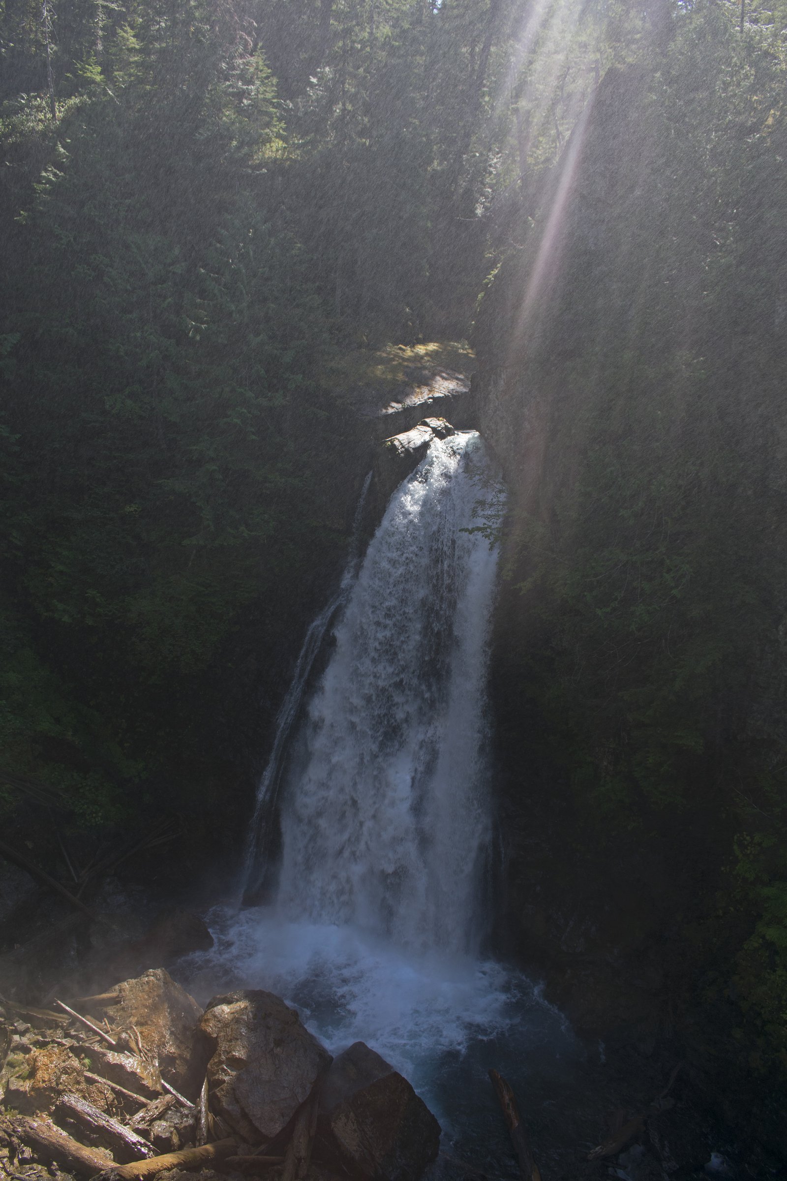
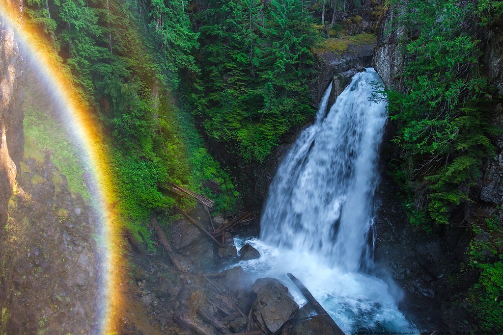
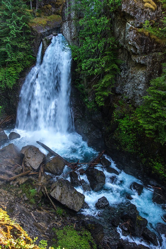
Photo Credits (5)
Difficulty
Easy
Trail Length
1.0 km
Trail Type
Out And Back
Elevation Gain
33 m
About Lady Falls
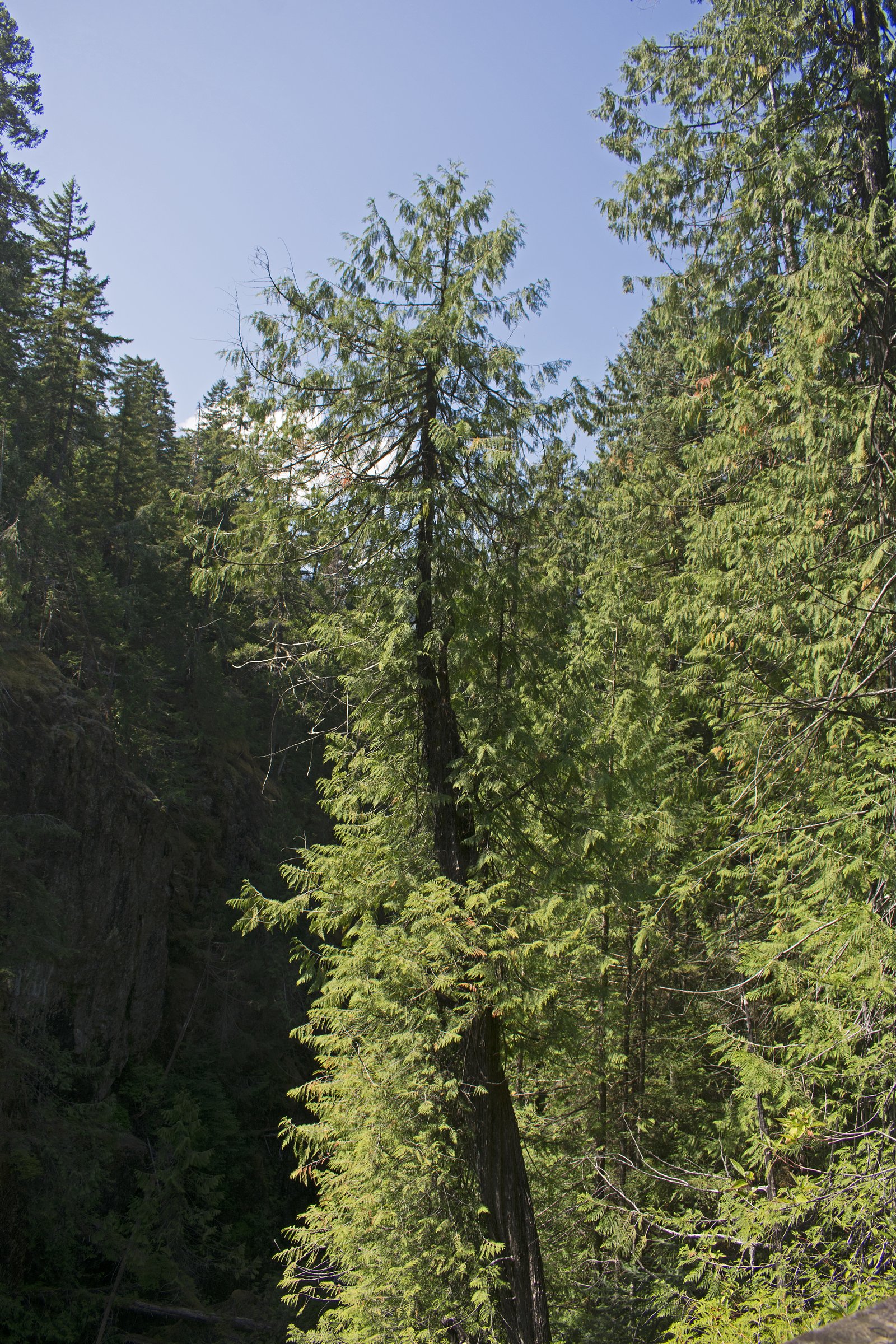
Lady Falls is a forested waterfall on northern Vancouver Island, British Columbia (approximate coordinates 49.8523, -125.7826). The falls sit in a remote, heavily timbered landscape typical of the west side of the island and are likely reached via a combination of paved highways and secondary/forest logging roads followed by a short walk. Exact stream name, official trailhead, and developed facilities are not well documented in widely available sources; descriptions below are therefore conservative and emphasize safety and access uncertainty.
The Setting
Lady Falls sits at 321 metres within Strathcona Park, in the foothills of British Columbia. The falls drop 27 metres.
Why This Waterfall Exists
Lady Falls flows over hard volcanic rock laid down about 201-252 million years ago. These resistant rocks form a durable ledge that water cannot easily wear away, creating a 90-foot drop where softer material downstream has already eroded.
Nearby Falls Worth Visiting
Mia Falls (220 m) lies 4.7 kilometres to the north. Also nearby: Lupin Falls (37 m, 14.6 km).
Trail & Hike Details
The Approach
The easy 1.0-km out-and-back trail gains 33 metres of elevation on the way to the falls.
Trail Description
Publicly available trail descriptions for Lady Falls at these coordinates are limited. Where visited, access is commonly described as a short walk from a nearby road or pullout through dense coastal forest, with an unmarked or lightly-used path to viewpoints. Expect uneven, rooty, and potentially muddy footing; there may be short steep sections near the falls and limited developed viewpoints or railings. Because route details vary by visit report, treat the approach as informal and prepare for route-finding.
What to Expect
The falls cascade 27 metres over hard volcanic rock.
Accessibility
The trail is short and relatively flat, but the surface may be uneven. Contact the managing agency for accessibility details.
Frequently Asked Questions
🐶 Are Dogs Allowed at Lady Falls?
❌ Dogs are not allowed
Are There Any Fees or Permits Required?
🆖 No fees required
🏊 Is There Swimming at Lady Falls?
❌ Swimming is not allowed
When to Visit
Late spring (snowmelt and higher flows) and early fall (after summer dry season) typically offer the best combination of water flow and safer, drier road conditions. Summer may offer easier road access but reduced flows; winter access may be difficult or hazardous due to weather and logging activity.
Seasonal Access
The best time to visit is Spring, Summer, and Fall. Winter access may be limited. Check with Strathcona Park for current conditions.
Safety Information
This waterfall is in a remote forested area. Hazards can include: unstable or slippery rocks near the waterfall, steep drop-offs without railings, rough or gated logging roads, active logging traffic, variable weather (cold, wet), poor cell reception, and wildlife encounters (black bears). Visitors should use caution near water, avoid climbing on wet rocks, check road and weather conditions before travel, and not enter the water unless conditions, depth, and currents are explicitly known to be safe.
Current Water Conditions
4.0 m³/s
Current discharge — how much water is flowing
About average for this time of year
Based on 33 years of record
4.52 m
Water depth at gauge
7-Day Discharge Trend
What does this mean for your visit?
Flow is about average for this time of year.
About This Gauge
7-Day Flow Outlook
Based on the WSC gauge ELK RIVER ABOVE CAMPBELL LAKE (2 km away).
Today
Moderate
4.0 m³/s
8/10Tomorrow
Moderate
3.9 m³/s
8/10Tue
Moderate
3.7 m³/s
6/10Wed
Moderate
4.3 m³/s
5/10Thu
Moderate
4.2 m³/s
5/10Fri
Moderate
4.2 m³/s
5/10Sat
Moderate
4.1 m³/s
5/10Best window: Today — moderate flow, sunny (trip score 8/10).
Best time of year: this gauge typically runs highest from early May to late June, peaking in June.
How we calculate this
This is a transparent outlook, not a precise forecast. We take the waterfall's current flow strength (how it ranks against its historical normal for today, from the nearest WSC stream gauge), carry that ranking forward along the gauge's seasonal curve, and nudge it for forecast rain. Confidence is highest for the next day or two and falls further out. Always check official conditions and your own judgment before visiting — high flows can be dangerous.
Know when to go.
Get a free email alert when waterfalls near Campbell River hit peak flow. We only send when conditions are worth the trip — no weekly newsletters, no spam.
Weather Forecast
Location & Access
Getting There
From Campbell River, Courtenay or Tofino travel on Vancouver Island highways toward the west coast and then use local secondary and forest/logging roads to approach the coordinates (49.8523, -125.7826). Expect some unpaved or gated roads; a high-clearance vehicle or 4x4 may be required depending on road conditions. Cell reception can be unreliable; download an offline map and/or carry GPS coordinates. Exact public trailhead signage and formal directions are not consistently described in major trail databases.
Get Directions on Google MapsParking
There may be informal roadside parking or a small pullout near a trail or road access; there is likely no developed parking lot or services. Avoid blocking gates or private driveways and follow posted signage. If accessing via active logging roads, park only where explicitly allowed and be mindful of logging traffic.
Elevation
321 metres above sea level
Coordinates
49.852272° N, -125.782623° W
Land Management
Managed by Government of British Columbia
Visitor Tips & Gear
1) Prepare for remote access: bring a map/GPS and download offline maps. 2) Use a high-clearance vehicle if driving secondary or logging roads; check local road reports and logging activity. 3) Wear sturdy, waterproof footwear and be ready for slippery rocks near the falls. 4) Carry insect repellent in summer. 5) Respect private property and any posted closures or gates. 6) Leave no trace and pack out all trash. 7) Tell someone your plans and expected return time.
As an Amazon Associate, we earn from qualifying purchases.
For this easy 1.0 km trail, lightweight trail shoes and a water bottle are usually sufficient. Sun exposure on the trail makes good sun protection a must in summer.

Polarized Sunglasses (Knockaround)
Cuts glare off the water so you actually see the falls — and your photos turn out better too.

Columbia Watertight II Rain Jacket
Packs into its own pocket, seam-sealed, and keeps you dry from spray and surprise rain.

Earth Pak Waterproof Dry Bag
Keeps your phone and gear dry when waterfall mist soaks everything else.

Waterproof Phone Pouch (AiRunTech)
Cheap insurance — take photos right next to the falls without killing your phone.

JOBY GorillaPod Starter Kit
Wraps around railings and rocks for long-exposure waterfall shots — no flat surface needed.

Osprey Daylite Daypack
Light, organized, and just the right size for a day hike — fits water, snacks, and layers.
Where to Stay
Browse vacation cabins and private rentals nearby
Unique outdoor stays — tents, yurts, and treehouses
Rent a campervan or RV for your waterfall road trip
Some links are affiliate links. We may earn a commission at no extra cost to you.
Nearby Campground
Butterwort Flats Campsite
9.3 km away
Additional Information
Nearby Attractions
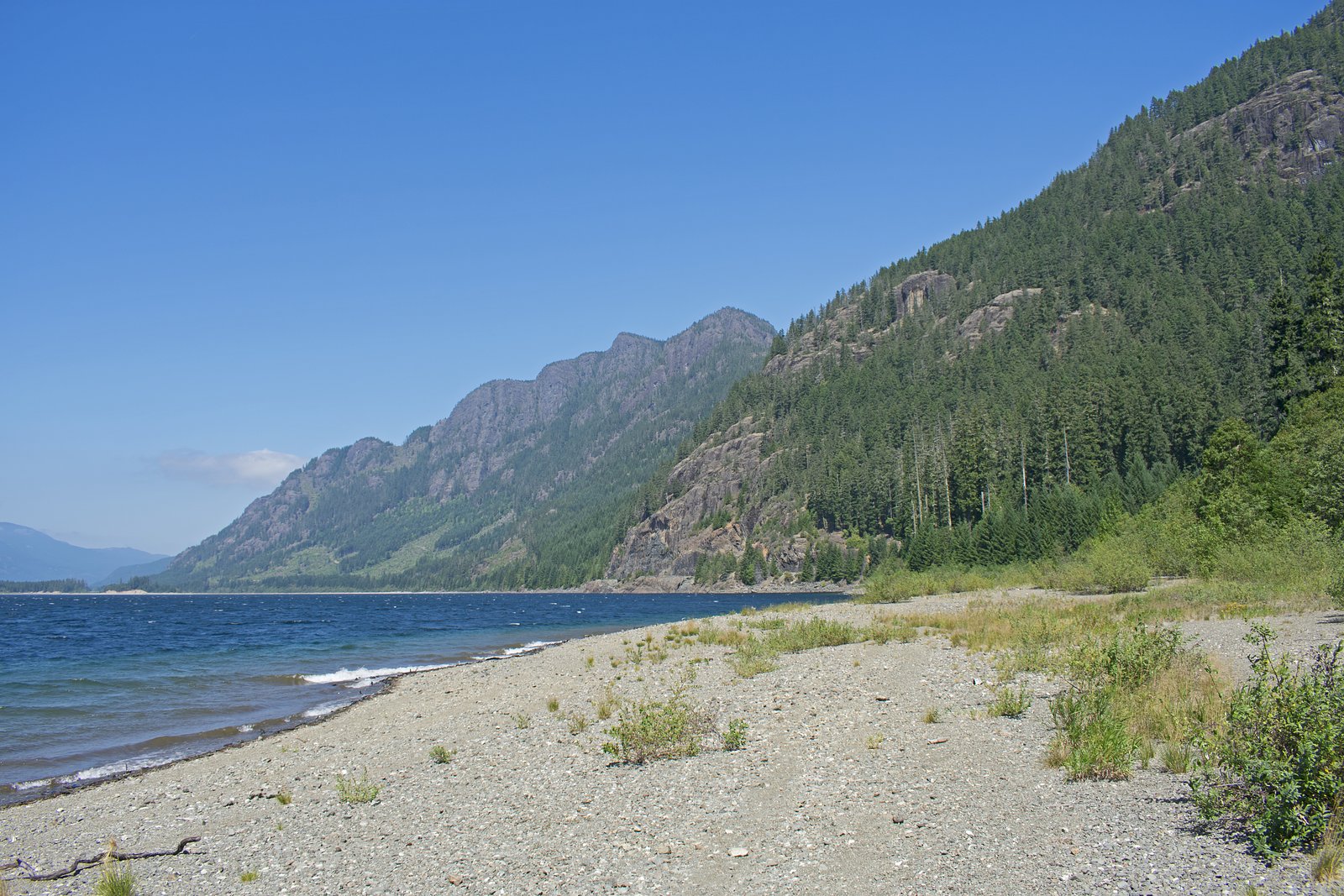
Nearest towns by road: Campbell River (~30.6 miles), Tofino (~40.1 miles), Courtenay (~41.4 miles). Other nearby points of interest on Vancouver Island may include the beaches and coastal scenery of the west coast, provincial parks and inland lakes; specific nearby attractions depend on your approach route.
Wildlife
Typical Vancouver Island wildlife may be present: black bears, cougars (rare but possible), deer, small mammals, and many bird species (including eagles and shorebirds near coastal areas). Streams on the island can support salmon runs in some watersheds, though this falls' specific salmon presence is not confirmed. Be bear-aware: make noise, store food securely, and carry bear spray where appropriate.
Cities near Lady Falls
Nearby Waterfalls
Writing about Lady Falls? Embed this waterfall on your site for free.