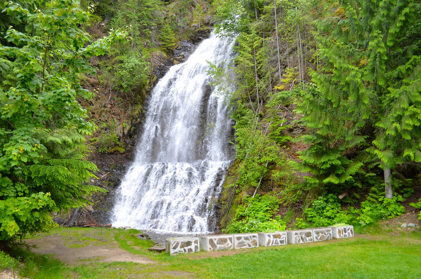
Ione Falls
British Columbia • 29 m
By Armen Suny · Last verified Jun 2026
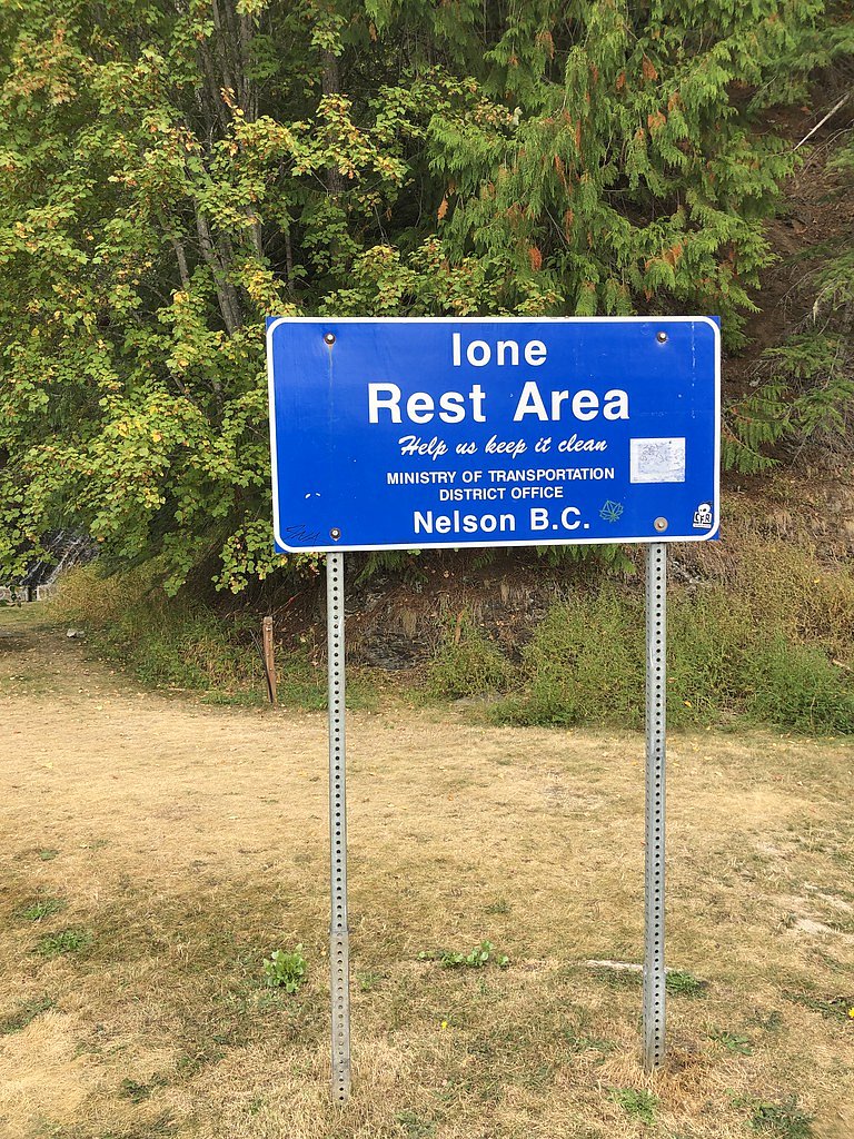
Photo Credits (2)
Difficulty
Drive Up
Trail Length
0.2 km
Trail Type
Out And Back
About Ione Falls
Ione Falls is a lesser-known cascade located on a tributary in southeastern British Columbia, approximately 41.3 miles (by road) from Revelstoke. The falls sit near coordinates 50.4058, -117.8928. There is limited formal documentation of the site and it appears to be a relatively small to medium waterfall with seasonally variable flow, typically higher in spring runoff and lower in late summer. Access is informal and may require travel on forestry or logging roads and a short off-trail scramble; visitors should be prepared for minimal signage and no developed facilities. Details below are conservative where source information is limited.
The Setting
Ione Falls sits at 559 metres within Wildlife Habitat Areas, in the hills of British Columbia. The falls drop 29 metres.
Why This Waterfall Exists
Ione Falls flows over Slocan Group, a layered carbonate rock layer deposited about 201-237 million years ago. These soft rocks erode readily, allowing the stream to carve a 95-foot drop into the landscape.
Trail & Hike Details
The Approach
No hiking required. Ione Falls is accessible by vehicle with a roadside viewing area.
Trail Description
There is no widely documented maintained trail to Ione Falls. Access appears to involve driving to a nearby forestry road or pullout and then a short off-trail approach or scramble through forest/second-growth. Terrain may include uneven ground, loose rock, and wet/slippery sections. Because route details are not well-established in public trail guides, plan for navigation with GPS, map, compass, and good routefinding skills.
What to Expect
The falls cascade 29 metres over layered carbonate rock.
Accessibility
This waterfall is viewable from a vehicle-accessible area. No hiking is required.
Frequently Asked Questions
🐶 Are Dogs Allowed at Ione Falls?
❌ Dogs are not allowed
Are There Any Fees or Permits Required?
🆖 No fees required
🏊 Is There Swimming at Ione Falls?
❌ Swimming is not allowed
When to Visit
Late spring (snowmelt) is typically best for maximum flow. Early to mid-summer often provides easier access on dry roads. Fall can offer pleasant weather and colour but lower flows. Winter access is likely difficult and hazardous due to snow and ice unless you are equipped and experienced in winter travel.
Seasonal Access
The best time to visit is Spring, Summer, and Fall. Winter access may be limited. Check with the managing park or local authority for current conditions.
Safety Information
Hazards may include unmaintained roads, limited or no signage, slippery rocks and wet stream banks, steep drops near the falls, fast-flowing water during spring runoff, loose rock, sudden weather changes, and limited cell coverage. Travel with a partner when possible, tell someone your route and expected return time, and carry appropriate safety gear (navigation, first aid, warm layers). Avoid getting too close to edges; do not climb wet rock faces. If uncertain about access or conditions, consult local forestry offices, BC parks, or recent trip reports before attempting the visit.
Current Water Conditions
11.5 m³/s
Current discharge — how much water is flowing
Lower than usual for this time of year
Based on 63 years of record
0.67 m
Water depth at gauge
7-Day Discharge Trend
What does this mean for your visit?
Flow is lower than usual for this time of year.
About This Gauge
This gauge is on a nearby waterway and may not reflect exact conditions at the falls.
7-Day Flow Outlook
Based on the WSC gauge KUSKANAX CREEK NEAR NAKUSP (18 km away).
Today
Low
11 m³/s
6/10Tomorrow
Low
12 m³/s
5/10Tue
Low
11 m³/s
5/10Wed
Low
9.8 m³/s
5/10Thu
Moderate
11 m³/s
5/10Fri
Moderate
11 m³/s
5/10Sat
Moderate
9.4 m³/s
6/10Best window: Today — low flow, sunny (trip score 6/10).
Best time of year: this gauge typically runs highest from late April to late July, peaking in June.
How we calculate this
This is a transparent outlook, not a precise forecast. We take the waterfall's current flow strength (how it ranks against its historical normal for today, from the nearest WSC stream gauge), carry that ranking forward along the gauge's seasonal curve, and nudge it for forecast rain. Confidence is highest for the next day or two and falls further out. Always check official conditions and your own judgment before visiting — high flows can be dangerous.
Know when to go.
Get a free email alert when waterfalls near Revelstoke hit peak flow. We only send when conditions are worth the trip — no weekly newsletters, no spam.
Weather Forecast
Location & Access
Getting There
Coordinates: 50.4058, -117.8928. From Revelstoke (approx. 41.3 miles), follow the most direct provincial highway south/southeast toward the area indicated by the coordinates and then use local forestry/logging roads as needed. The last access may be on unpaved roads; high-clearance or 4x4 vehicles may be advisable. Expect limited or no signage; use GPS coordinates and a topo map. Confirm current road conditions and land access before travel.
Get Directions on Google MapsParking
No formal parking lot is known. Parking is likely informal (roadside pullout or small clearing). Do not block gates or forestry equipment. If the area is on or adjacent to private tenure, parking and access may be restricted, verify before parking.
Elevation
559 metres above sea level
Coordinates
50.405794° N, -117.892834° W
Land Management
Managed by Government of British Columbia
Visitor Tips & Gear
1) Use the provided coordinates and verify route on a topo map before travel. 2) Check recent trip reports or local forestry notices for road closures or conditions. 3) Wear sturdy, waterproof footwear with good traction for slippery rocks and stream banks. 4) Do not attempt to park or cross private land without permission, confirm land tenure. 5) Carry bear spray in grizzly/bear country and know how to use it. 6) Bring a physical map and compass; GPS can be unreliable in dense forest or steep valleys. 7) Leave no trace, pack out all waste.
Where to Stay
Browse vacation cabins and private rentals nearby
Unique outdoor stays — tents, yurts, and treehouses
Rent a campervan or RV for your waterfall road trip
Some links are affiliate links. We may earn a commission at no extra cost to you.
Nearby Campground
Harris Lake Recreation Site
16.5 km away
Additional Information
Nearby Attractions
Revelstoke (town amenities, shops, and services) is the nearest larger centre. Nearby provincial and national attractions in the broader region include Mount Revelstoke National Park and Glacier National Park (BC), alpine viewpoints, and other waterfalls and hiking routes, but distances vary; plan accordingly.
Wildlife
Typical interior-British-Columbia wildlife: black bear and possibly grizzly bear, mule/deer/elk, moose in some areas, cougars, small mammals, and abundant birdlife. Ticks and biting insects can be seasonal concerns.
Cities near Ione Falls
Nearby Waterfalls
Writing about Ione Falls? Embed this waterfall on your site for free.