About Superslide
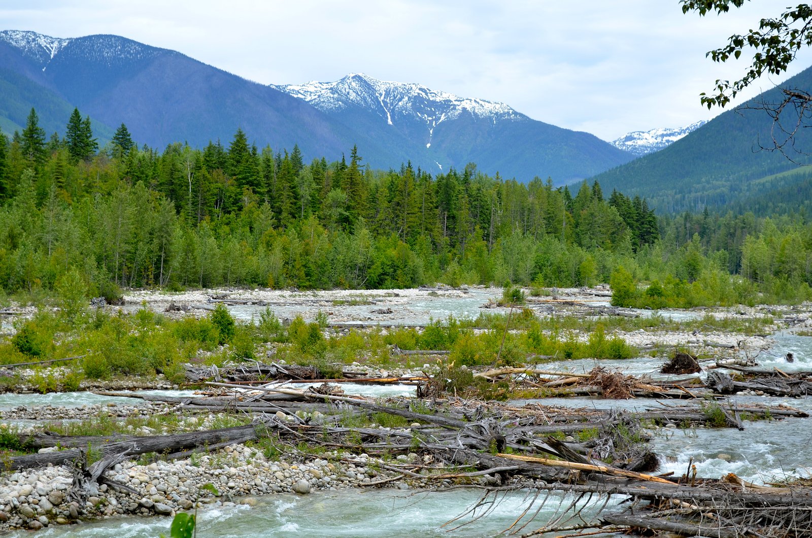
Superslide is a natural slide/waterfall feature located in interior British Columbia, approximately 40.7 miles from Revelstoke (coordinates: 50.4392, -117.868). Detailed, authoritative trail descriptions are limited; this entry summarizes typical conditions and precautions based on general backcountry waterfall access in the Revelstoke region. Exact approach, trailhead location, and route can vary and should be confirmed with local sources before travel.
Why This Waterfall Exists
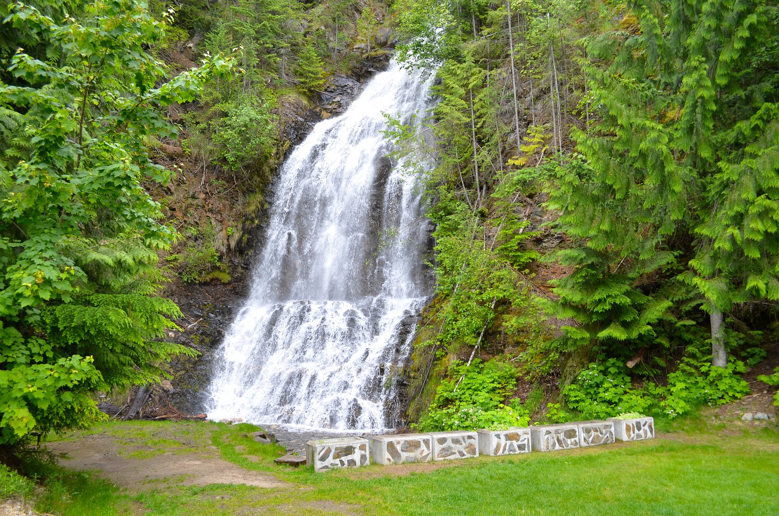
Superslide flows over hard intrusive rock laid down about 162-175 million years ago. These resistant rocks form a durable ledge that water cannot easily wear away, creating the falls where softer material downstream has already eroded.
Nearby Falls Worth Visiting
Ione Falls (29 m) lies 4.2 kilometres to the southwest. Also nearby: St. Leon Falls (8 m, 0.8 km).
Trail & Hike Details
Trail Description
Specific, reliable trail descriptions for Superslide are scarce. Approaches to features like Superslide in the Revelstoke region commonly involve unmarked or lightly marked trails and variable terrain. Hikers should be prepared for uneven, possibly wet or slippery paths, and potential route-finding. If visiting in winter or shoulder seasons expect deep snow and avalanche risk in exposed terrain.
What to Expect
Expect a relatively remote natural feature with limited facilities. There may be a short scramble to reach the best viewing areas. Water flows will be highest in spring and early summer from snowmelt and after heavy rains; late summer and fall flows may be reduced. The immediate area may have steep banks, slick bedrock, and fast-flowing water near the slide.
Accessibility
This site is likely not accessible to wheelchairs or people with limited mobility due to natural terrain, unpaved roads, and possible scrambling. No formal accessibility information is available.
Frequently Asked Questions
🐶 Are Dogs Allowed at Superslide?
❌ Dogs are not allowed
Are There Any Fees or Permits Required?
🆖 No fees required
🏊 Is There Swimming at Superslide?
❌ Swimming is not allowed
When to Visit
Late spring through early fall is typically best for access and viewing (higher flows in spring, reliable access by summer). Winter visits are possible but may require winter travel skills and avalanche awareness.
Seasonal Access
The best time to visit is Spring, Summer, Fall, and Winter. Check with the managing park or local authority for current conditions.
Safety Information
Hazards may include slippery bedrock, steep banks, fast water, cold water temperatures, loose rock, limited or no cell coverage, and changing mountain weather. In winter or shoulder seasons expect deep snow and avalanche risk in exposed terrain. Always confirm current conditions, route, and hazards with local authorities before visiting and err on the side of caution.
Current Water Conditions
11.5 m³/s
Current discharge — how much water is flowing
Lower than usual for this time of year
Based on 63 years of record
0.67 m
Water depth at gauge
7-Day Discharge Trend
What does this mean for your visit?
Flow is lower than usual for this time of year.
About This Gauge
This gauge is on a nearby waterway and may not reflect exact conditions at the falls.
7-Day Flow Outlook
Based on the WSC gauge KUSKANAX CREEK NEAR NAKUSP (20 km away).
Today
Low
11 m³/s
6/10Tomorrow
Low
12 m³/s
5/10Tue
Low
11 m³/s
5/10Wed
Low
9.8 m³/s
5/10Thu
Moderate
11 m³/s
5/10Fri
Moderate
11 m³/s
5/10Sat
Moderate
9.4 m³/s
6/10Best window: Today — low flow, sunny (trip score 6/10).
Best time of year: this gauge typically runs highest from late April to late July, peaking in June.
How we calculate this
This is a transparent outlook, not a precise forecast. We take the waterfall's current flow strength (how it ranks against its historical normal for today, from the nearest WSC stream gauge), carry that ranking forward along the gauge's seasonal curve, and nudge it for forecast rain. Confidence is highest for the next day or two and falls further out. Always check official conditions and your own judgment before visiting — high flows can be dangerous.
Know when to go.
Get a free email alert when waterfalls near Revelstoke hit peak flow. We only send when conditions are worth the trip — no weekly newsletters, no spam.
Weather Forecast
Location & Access
Getting There
Approximate coordinates provided. Access is likely by secondary or forest service roads off the main highways in the Revelstoke area followed by a short to moderate hike. Road and trail conditions in this region can change quickly (seasonal closures, washouts, logging activity). Confirm current driving directions and road status with local visitor centres or land managers before travel.
Get Directions on Google MapsParking
Parking information is not well documented; expect limited or informal parking at a nearby trailhead or road pullout. Larger vehicles may have difficulty on unrestored logging roads. Verify parking availability locally.
Elevation
618 metres above sea level
Coordinates
50.439247° N, -117.867958° W
Visitor Tips & Gear
• Confirm current access and road conditions with local visitor centres (Revelstoke) or the relevant forest district before traveling. • Wear sturdy footwear with good traction; expect wet, slippery rock. • Keep a safe distance from the top and base of waterfalls and slides, slick surfaces and undercut banks are hazardous. • Avoid approaching during high flows or after heavy rain. • Pack out all trash and follow Leave No Trace principles. • Be prepared for limited or no cell service; carry a map, compass, or GPS and tell someone your plans.
Where to Stay
Browse vacation cabins and private rentals nearby
Unique outdoor stays — tents, yurts, and treehouses
Rent a campervan or RV for your waterfall road trip
Some links are affiliate links. We may earn a commission at no extra cost to you.
Nearby Campground
Harris Lake Recreation Site
12.8 km away
Additional Information
Nearby Attractions
The Revelstoke area offers hiking, lakes, and mountain recreation. Glacier National Park (BC) and local recreation sites are in the broader region; confirm exact proximity and access before planning a combined trip.
Wildlife
Regional wildlife may include black bears, cougars, moose, deer, and small mammals. Take standard wildlife precautions: store food securely, make noise on trails, and carry bear spray where appropriate.
Cities near Superslide
Nearby Waterfalls
Writing about Superslide? Embed this waterfall on your site for free.