Defrauder Falls
British Columbia • Pinecone Burke Park
By Armen Suny · Last verified Jun 2026
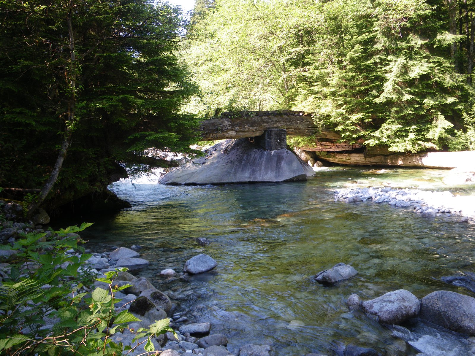
About Defrauder Falls
Defrauder Falls is reported at coordinates 49.448, -122.5523 in British Columbia. There is little authoritative published information available; the feature appears to be a small cascade or falls on a lesser-known creek or tributary. Access is likely informal (forest or logging roads and unmaintained footpaths) rather than a developed park trail. Flow is likely seasonal and highest in spring or after heavy rain. Details about exact height and official name usage appear to be uncertain and may vary by local sources.
The Setting
Defrauder Falls sits at 103 metres within Pinecone Burke Park, in the coastal lowlands of British Columbia.
Why This Waterfall Exists
Defrauder Falls flows over hard intrusive rock laid down about 66-101 million years ago. These resistant rocks form a durable ledge that water cannot easily wear away, creating the falls where softer material downstream has already eroded.
Trail & Hike Details
Trail Description
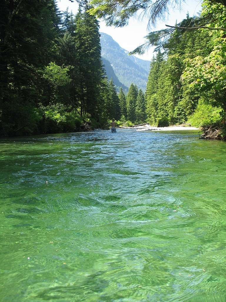
There does not appear to be a maintained, signed trail to Defrauder Falls in widely available guides. Expect an unmarked route, possible short scramble through brush and over roots/rocks, and route-finding across uneven terrain. The approach may include walking along or crossing a creek, and the last section to the falls could be steep and slippery. Hikers should be prepared for limited or no trail infrastructure (no railings, boardwalks, or official viewpoints).
What to Expect
A small, likely seasonal cascade set in a wooded, mossy environment. Water flow may vary widely by season, higher in spring and after rains, lower in late summer. Views may be limited; there may be a single informal viewpoint that requires scrambling. Surrounding area may be logged or show evidence of forestry activity. Expect limited signage, no facilities (no toilets or trash service), and possibly limited cell reception.
Accessibility
Not wheelchair accessible. Access likely involves uneven, unmaintained terrain and potential scrambling; not suitable for visitors with limited mobility.
Frequently Asked Questions
🐶 Are Dogs Allowed at Defrauder Falls?
❌ Dogs are not allowed
Are There Any Fees or Permits Required?
🆖 No fees required
🏊 Is There Swimming at Defrauder Falls?
❌ Swimming is not allowed
When to Visit
Late spring (snowmelt and higher rains) typically offers the best flows. Early summer can be good if access roads are dry. Fall may offer lower flows but good color. Winter visits can be hazardous due to ice, high flows, and poor road conditions, only attempt with experience and proper gear.
Seasonal Access
The best time to visit is Spring, Summer, and Fall. Winter access may be limited. Check with Pinecone Burke Park for current conditions.
Safety Information
• Route may be unmarked; use navigation and tell someone your plan. • Slippery rock, wet roots, and steep banks make falls and injuries possible, use caution near edges. • Creek levels can rise quickly during/after heavy rain, avoid approaching the base during high flows. • Access may cross private property or active logging areas, respect signage and maintain distance from equipment. • Cell reception may be unreliable; carry a paper map or offline navigation and a basic first-aid kit. • Wildlife encounters are possible, know how to respond safely (e.g., for bears). • If unsure about legal access, contact local land managers or municipal offices before visiting.
Current Water Conditions
0.1 m³/s
Current discharge — how much water is flowing
Much lower than usual for this time of year
Based on 16 years of record
3.12 m
Water depth at gauge
7-Day Discharge Trend
What does this mean for your visit?
Flow is well below normal for this time of year, so the waterfall may be a trickle.
About This Gauge
This gauge is on a nearby waterway and may not reflect exact conditions at the falls.
7-Day Flow Outlook
Based on the WSC gauge OR CREEK NEAR COQUITLAM (16 km away).
Today
Barely Flowing
0.1 m³/s
4/10Tomorrow
Barely Flowing
0.1 m³/s
4/10Tue
Barely Flowing
0.1 m³/s
4/10Wed
Barely Flowing
0.1 m³/s
4/10Thu
Barely Flowing
0.1 m³/s
3/10Fri
Barely Flowing
0.1 m³/s
4/10Sat
Barely Flowing
0.1 m³/s
3/10Best window: Today — barely flowing flow, fog (trip score 4/10).
Best time of year: this gauge typically runs highest from mid April to late May, peaking in November.
How we calculate this
This is a transparent outlook, not a precise forecast. We take the waterfall's current flow strength (how it ranks against its historical normal for today, from the nearest WSC stream gauge), carry that ranking forward along the gauge's seasonal curve, and nudge it for forecast rain. Confidence is highest for the next day or two and falls further out. Always check official conditions and your own judgment before visiting — high flows can be dangerous.
Know when to go.
Get a free email alert when waterfalls near Abbotsford hit peak flow. We only send when conditions are worth the trip — no weekly newsletters, no spam.
Weather Forecast
Location & Access
Getting There
The falls are located near the provided coordinates (49.448, -122.5523). They lie roughly ~28–30 miles from nearby towns noted (Lynden, Custer, Abbotsford) depending on route. Expect the final approach to be via rural, forestry, or unpaved roads and possibly a short unmarked path or bushwhack; the site may be on or adjacent to private or active-logging land. Confirm land access and current road conditions with local land managers or forest service maps before visiting.
Get Directions on Google MapsParking
Parking is likely limited to roadside pullouts on gravel or logging-road shoulders. There may be no formal parking lot or signage. Do not block gates or driveways; obey posted private property signs.
Elevation
103 metres above sea level
Coordinates
49.448009° N, -122.552295° W
Land Management
Managed by Government of British Columbia
Visitor Tips & Gear
• Confirm landownership and road status before visiting; some approaches may cross private or leased logging lands. • Use a detailed map/GPS and the exact coordinates (49.448, -122.5523). • Wear sturdy, waterproof footwear with good traction; expect slippery rocks and muddy sections. • Bring insect repellent and dress in layers, weather and creek spray can make temperatures cooler. • Leave no trace: pack out all trash and avoid disturbing vegetation or streambanks. • If the access involves active logging roads, exercise caution and avoid entering areas where equipment is operating.
Where to Stay
Browse vacation cabins and private rentals nearby
Unique outdoor stays — tents, yurts, and treehouses
Rent a campervan or RV for your waterfall road trip
Some links are affiliate links. We may earn a commission at no extra cost to you.
Nearby Campground
Defrauder Falls Marine Day Use Area
0.1 km away
Nearby Hot Springs
Hot springs near Abbotsford, British Columbia
Dorr Fumarole Field
Dorr Fumarole Field reaches 194 degrees at 8,168 feet elevation on Mount Baker's active volcanic slopes, producing superheated ...

Sherman Crater Fumaroles
Sherman Crater Fumaroles register 266 degrees Fahrenheit at 9,463 feet elevation within the active volcanic crater atop Mount B...
Baker Hot Spring
Baker Hot Spring emerges at 108 degrees Fahrenheit on US Forest Service land in Mt. Baker National Forest, flowing 59.5 degrees...
Looking for a soak after your hike? Explore more hot springs near Abbotsford, British Columbia on SoakingSprings.
Explore British Columbia springsAdditional Information
Nearby Attractions
General region attractions may include outdoor recreation areas and communities near Abbotsford and adjacent Washington State towns. Specific nearby developed attractions for this waterfall are not documented; consider regional parks and trails in Abbotsford and Whatcom County for additional options.
Wildlife
Regionally common wildlife may include black bear, deer, small mammals, and a variety of birds. Expect insects (mosquitoes, black flies) in warmer months. Be aware of large-animal safety practices and store food securely.
Cities near Defrauder Falls
Nearby Waterfalls
Writing about Defrauder Falls? Embed this waterfall on your site for free.