DeBeck Falls
British Columbia • Pinecone Burke Park
By Armen Suny · Last verified Jun 2026
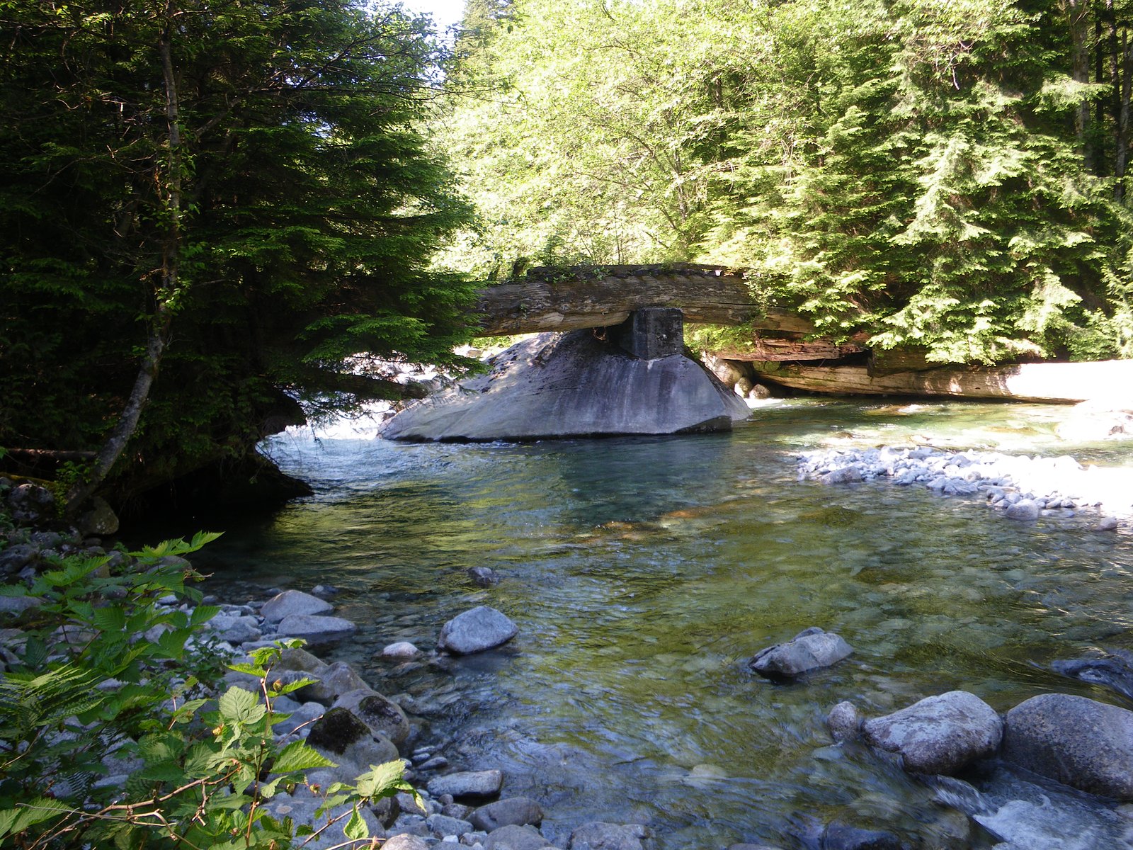
About DeBeck Falls
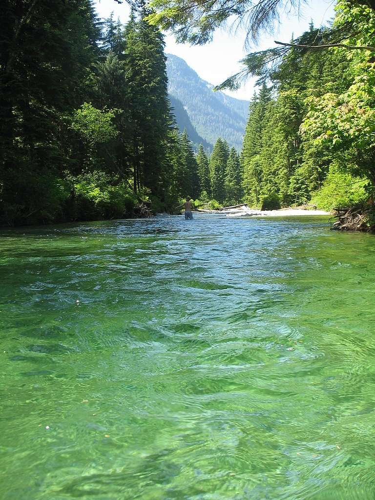
DeBeck Falls is a small, forested cascade located in southern British Columbia near the Canada–US border (coordinates 49.5024, -122.6101). The fall sits in a rural, wooded setting and is most easily reached via local roads and informal access points rather than a developed park. Visitor reports and mapping place it roughly equidistant from the small communities listed (Custer ~29.9 mi, Blaine ~30.9 mi, Ferndale ~32.6 mi). Specifics about the drop, official trailhead, and management authority are limited; details below are conservative and note uncertainty where appropriate.
The Setting
DeBeck Falls sits at 181 metres within Pinecone Burke Park, in the foothills of British Columbia.
Why This Waterfall Exists
DeBeck Falls flows over hard intrusive rock laid down about 66-101 million years ago. These resistant rocks form a durable ledge that water cannot easily wear away, creating the falls where softer material downstream has already eroded.
Trail & Hike Details
Trail Description
There does not appear to be a well-maintained, signed trail to DeBeck Falls. Approach likely involves a short walk from a roadside pullout or informal parking area, possibly over uneven, muddy, or brushy ground. Trails (if present) may be narrow, steep in places, and unmarked. Expect natural forest footing, exposed roots, and slippery sections near the water.
What to Expect
A modest cascade set in second-growth or mixed forest typical of the Lower Mainland/Sumas area. Flow will vary seasonally, higher in spring and after rain, lower in late summer. There are likely no built viewing platforms, railings, restrooms, or lifeguards. You may encounter muddy approaches, fallen trees, and wet, slippery rock near the creek. Because access may cross or run alongside private property, signage or fences could be present.
Accessibility
Likely not accessible for wheelchairs or those with limited mobility. Terrain is probably uneven, narrow, and natural (no boardwalks or ramps).
Frequently Asked Questions
🐶 Are Dogs Allowed at DeBeck Falls?
❌ Dogs are not allowed
Are There Any Fees or Permits Required?
🆖 No fees required
🏊 Is There Swimming at DeBeck Falls?
❌ Swimming is not allowed
When to Visit
Late spring for highest flow and lush surroundings; early summer for good access and moderate flows. Fall can offer pleasant colors but flow may be reduced. Avoid heavy rainstorms when flashier flows and slippery conditions increase hazards.
Seasonal Access
The best time to visit is Spring, Summer, and Fall. Winter access may be limited. Check with Pinecone Burke Park for current conditions.
Safety Information
Hazards may include slippery rocks and banks, fast or cold water, unstable or muddy approaches, hidden drop-offs near the stream, and possible private property or logging activity. Because this site is close to the international border, be mindful of the boundary and do not cross into the U.S. without proper documentation. Check for posted signs and respect closures. Bring a means of navigation and tell someone your plan. If bears are known in the area, carry bear-aware gear and know how to react to encounters.
Current Water Conditions
1.2 m³/s
Current discharge — how much water is flowing
Much lower than usual for this time of year
Based on 44 years of record
1.67 m
Water depth at gauge
7-Day Discharge Trend
What does this mean for your visit?
Flow is well below normal for this time of year, so the waterfall may be a trickle.
About This Gauge
This gauge is on a nearby waterway and may not reflect exact conditions at the falls.
7-Day Flow Outlook
Based on the WSC gauge COQUITLAM RIVER ABOVE COQUITLAM LAKE (13 km away).
Today
Barely Flowing
1.2 m³/s
4/10Tomorrow
Barely Flowing
1.1 m³/s
4/10Tue
Barely Flowing
1.1 m³/s
4/10Wed
Barely Flowing
1.0 m³/s
4/10Thu
Barely Flowing
1.0 m³/s
4/10Fri
Barely Flowing
0.9 m³/s
4/10Sat
Barely Flowing
1.1 m³/s
3/10Best window: Today — barely flowing flow, cloudy (trip score 4/10).
Best time of year: this gauge typically runs highest from mid April to early July, peaking in May.
How we calculate this
This is a transparent outlook, not a precise forecast. We take the waterfall's current flow strength (how it ranks against its historical normal for today, from the nearest WSC stream gauge), carry that ranking forward along the gauge's seasonal curve, and nudge it for forecast rain. Confidence is highest for the next day or two and falls further out. Always check official conditions and your own judgment before visiting — high flows can be dangerous.
Know when to go.
Get a free email alert when waterfalls near Vancouver hit peak flow. We only send when conditions are worth the trip — no weekly newsletters, no spam.
Weather Forecast
Location & Access
Getting There
The falls are at approx. 49.5024, -122.6101. Access is typically via local/forestry roads and informal spurs off paved county roads in the Sumas/Abbotsford area; there is no widely advertised, maintained trailhead. Use a GPS with the coordinates and prepare for short off-road walking. Because access routes are informal, check recent trip reports or local land/park authorities before going.
Get Directions on Google MapsParking
Parking is likely limited to roadside or small pullouts; there is probably no formal parking lot or facilities. Obey signage, avoid blocking private driveways, and do not park where it would impede agricultural or logging operations. Expect minimal to no amenities.
Elevation
181 metres above sea level
Coordinates
49.502428° N, -122.610066° W
Land Management
Managed by Government of British Columbia
Visitor Tips & Gear
• Confirm access before you go, some routes may cross private land or active logging areas. • Use GPS coordinates (49.5024, -122.6101) and a recent map; cell coverage may be spotty in rural areas. • Wear sturdy, waterproof footwear with good traction; expect slippery rocks near the water. • Park legally and out of the way of farm equipment or private driveways. • Watch for seasonal high water and avoid entering the creek during high flow. • Leave no trace: pack out all trash and avoid damaging riparian vegetation. • Check local authorities if you’re unsure about access, seasonal closures, or land ownership.
Where to Stay
Browse vacation cabins and private rentals nearby
Unique outdoor stays — tents, yurts, and treehouses
Rent a campervan or RV for your waterfall road trip
Some links are affiliate links. We may earn a commission at no extra cost to you.
Nearby Campground
Vicker's Creek North
2.5 km away
Nearby Hot Springs
Hot springs near Vancouver, British Columbia
Looking for a soak after your hike? Explore more hot springs near Vancouver, British Columbia on SoakingSprings.
Explore British Columbia springsAdditional Information
Nearby Attractions
Nearby communities and points of reference include Custer, Blaine (WA), Ferndale (WA), and the Sumas/Abbotsford area. Regional outdoor attractions in the broader area include Sumas Mountain trails and Lower Mainland parks, but these are separate and may require different access routes.
Wildlife
Expect typical regional wildlife: songbirds, small mammals (squirrels, raccoons), deer, and possibly black bears or coyotes. Ticks and biting insects can be present in warmer months. Keep a respectful distance from wildlife and secure food.
Cities near DeBeck Falls
Nearby Waterfalls
Writing about DeBeck Falls? Embed this waterfall on your site for free.