
Photo Credits (5)
Difficulty
Easy
Trail Length
0.8 km
Trail Type
Out And Back
Elevation Gain
22 m
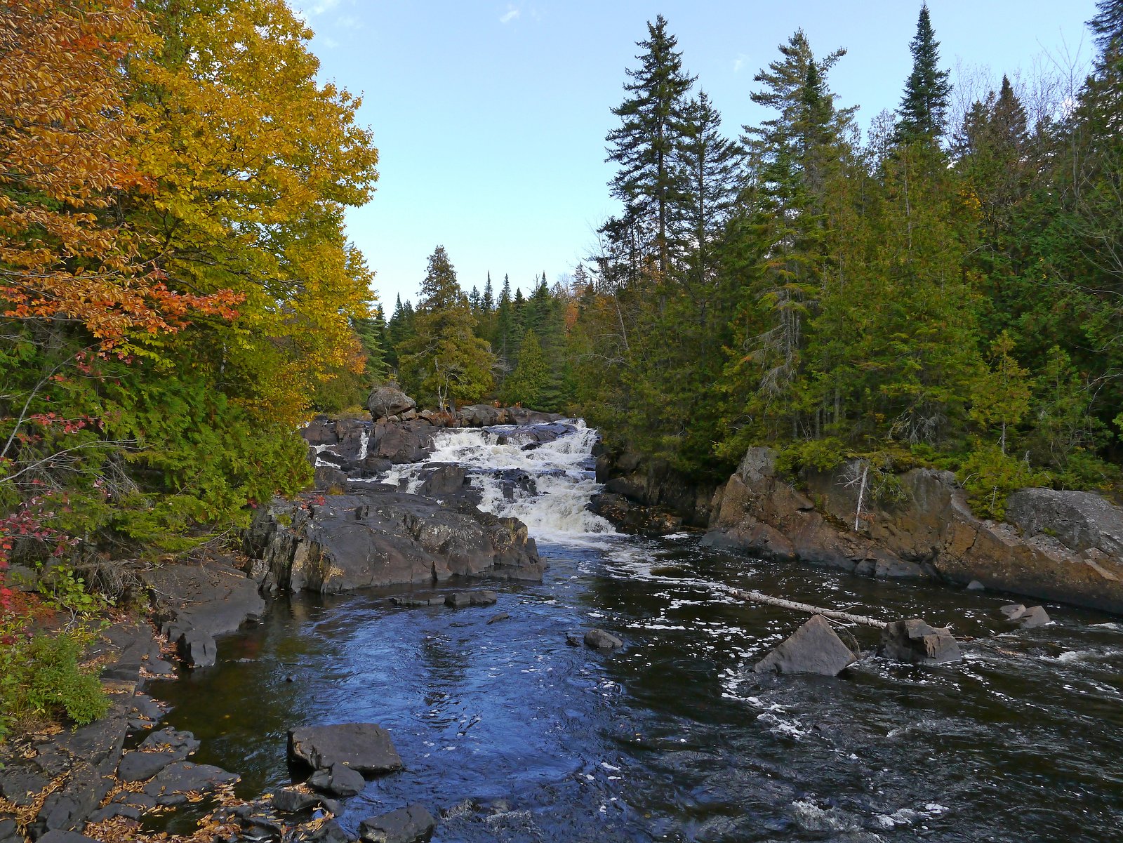
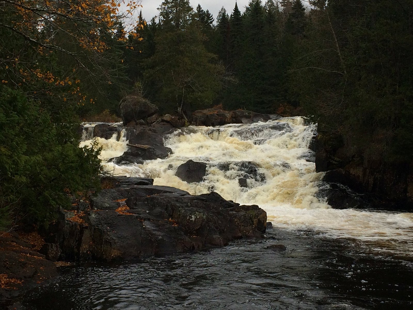
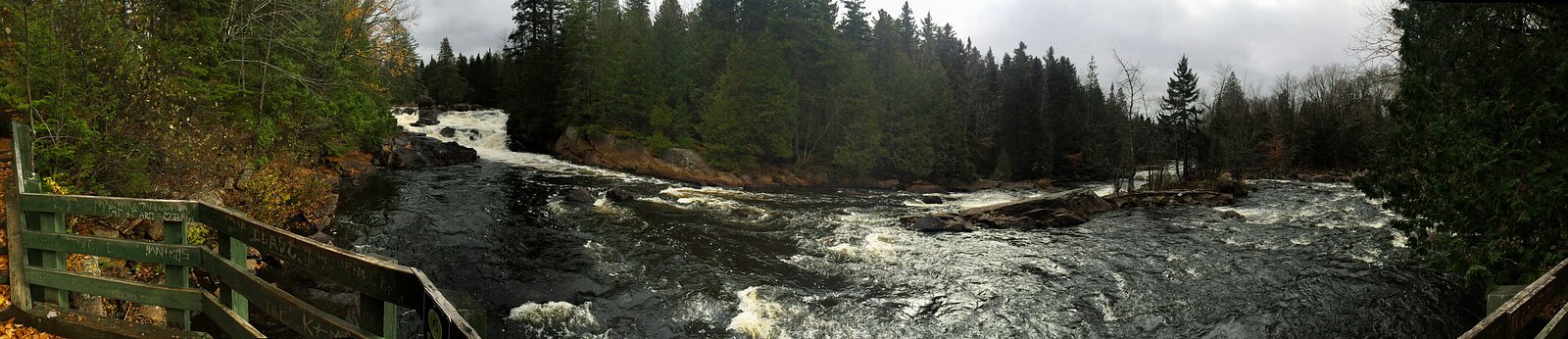
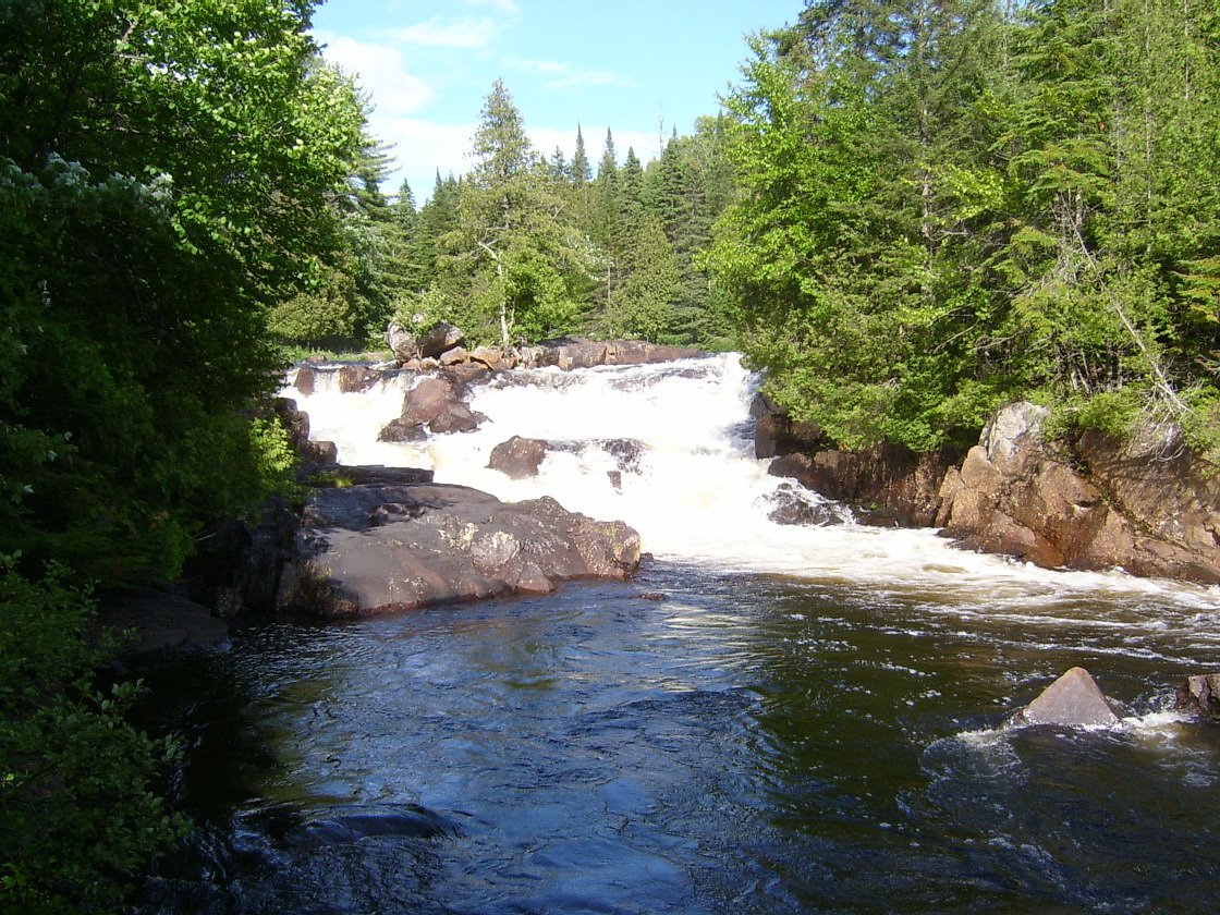
About Chutes Croches
Chutes Croches is a forested, riverine waterfall feature in the Laurentian region of Quebec near the coordinates 46.3695, -74.516. The site sits in a largely natural, wooded landscape with rapids and rocky ledges typical of small to medium-sized Quebec chutes. Flow and appearance vary widely with season, high and dramatic in spring runoff, steady in summer, and photogenic with fall color. Winter may produce ice formations but also creates icy, hazardous conditions.
The Setting
Chutes Croches sits at 371 metres within Mont-Tremblant National Park, in the foothills of Quebec.
Why This Waterfall Exists
Chutes Croches flows over hard crystalline rock, primarily gneiss, laid down over 1.0-1.6 billion years ago. These resistant rocks form a durable ledge that water cannot easily wear away, creating the falls where softer material downstream has already eroded.
Nearby Falls Worth Visiting
Chute du Diable (15 m) lies 2.1 kilometres to the north.
Trail & Hike Details
The Approach
The easy 0.8-km out-and-back trail gains 22 metres of elevation on the way to the falls.
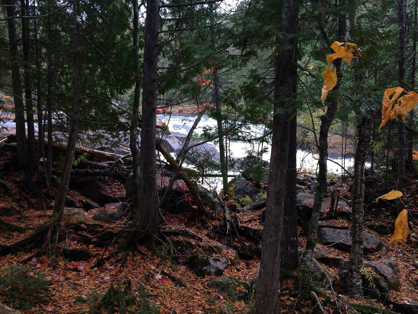
Trail Description
Trail information for Chutes Croches is not well documented in widely available trail databases. Many visitors report a short walk from a roadside parking area or pull‑off to a viewpoint, but specifics (exact distance, marked trail) vary. Expect an informal path through mixed forest, potentially rocky or muddy in places, with minimal infrastructure (few or no railings or interpretive signs). Use caution on wet or icy rock near the water's edge.
What to Expect
Wooded surroundings with rocky stream channel and cascades. Spring brings the highest flows; summer can be lower but still attractive; fall offers color. The site may have limited visitor facilities (no toilets, benches, or maintained viewpoints). Wildlife of the Laurentian forests (songbirds, small mammals, deer, and possibly black bear) may be present. Conditions can change quickly after heavy rain or thaw.
Accessibility
The trail is short and relatively flat, but the surface may be uneven. Contact the managing agency for accessibility details.
Frequently Asked Questions
🐶 Are Dogs Allowed at Chutes Croches?
❌ Dogs are not allowed
Are There Any Fees or Permits Required?
🆖 No fees required
🏊 Is There Swimming at Chutes Croches?
❌ Swimming is not allowed
When to Visit
Late spring for peak water flow and dramatic rapids; early fall for color and lower crowds. Summer provides easier access and warmer weather. Winter can be scenic with ice formations but is more hazardous and may limit access.
Seasonal Access
The best time to visit is Spring, Summer, and Fall. Winter access may be limited. Check with Mont-Tremblant National Park for current conditions.
Safety Information
Hazards can include slippery rocks near the falls, unstable or steep banks, strong currents, cold water, rapidly changing water levels after rain or during spring melt, and limited cell service. In winter, ice can be brittle and treacherous. Bring appropriate footwear, avoid getting too close to fast water, supervise children closely, and check weather/road conditions before travel.
7-Day Flow Outlook
Based on the WSC gauge SAINT-LOUIS (RUISSEAU) A 0,3 KM DE LA RIVIERE DU DIABLE (1 km away).
Best time of year: this gauge typically runs highest from early April to early June, peaking in May.
How we calculate this
This is a transparent outlook, not a precise forecast. We take the waterfall's current flow strength (how it ranks against its historical normal for today, from the nearest WSC stream gauge), carry that ranking forward along the gauge's seasonal curve, and nudge it for forecast rain. Confidence is highest for the next day or two and falls further out. Always check official conditions and your own judgment before visiting — high flows can be dangerous.
Know when to go.
Get a free email alert when waterfalls near Mont-Laurier hit peak flow. We only send when conditions are worth the trip — no weekly newsletters, no spam.
Weather Forecast
Location & Access
Getting There
Coordinates: 46.3695, -74.516. Use the coordinates in a GPS unit or mapping app for the most direct route. The falls are in a rural area of Quebec; the nearest larger communities mentioned in local references are Mont‑Laurier (~50 miles) and Saint‑Jérôme (~51 miles). Expect to travel on provincial and local secondary roads; some last stretches may be gravel or narrow forest roads. Cell service may be intermittent, download directions or maps in advance.
Get Directions on Google MapsParking
Parking is likely limited to a small roadside pull‑off or an informal lot. There may not be a formal, signed parking area. Park well off the travel lane and avoid blocking gates or private driveways. If you are unsure, check local signage or municipal resources before visiting.
Elevation
371 metres above sea level
Coordinates
46.369525° N, -74.516043° W
Land Management
Managed by Ministère de l'Environnement, de la Lutte contre les changements climatiques, de la Faune et des Parcs, Direction des parcs
Visitor Tips & Gear
• Use the coordinates and a recent map/GPS, signage may be minimal. • Wear sturdy, non slip footwear; trails and rocks near the water can be slippery. • Bring insect repellent in summer and be prepared for mosquitoes and black flies. • Pack out all trash; carry a small first aid kit and sufficient water. • Respect private property and posted closures; do not park where you block access. • If visiting in winter, be prepared for snow, ice, and limited access; use caution around frozen falls.
As an Amazon Associate, we earn from qualifying purchases.
For this easy 0.8 km trail, lightweight trail shoes and a water bottle are usually sufficient. Sun exposure on the trail makes good sun protection a must in summer.

Polarized Sunglasses (Knockaround)
Cuts glare off the water so you actually see the falls — and your photos turn out better too.

Columbia Watertight II Rain Jacket
Packs into its own pocket, seam-sealed, and keeps you dry from spray and surprise rain.

Earth Pak Waterproof Dry Bag
Keeps your phone and gear dry when waterfall mist soaks everything else.

Waterproof Phone Pouch (AiRunTech)
Cheap insurance — take photos right next to the falls without killing your phone.

JOBY GorillaPod Starter Kit
Wraps around railings and rocks for long-exposure waterfall shots — no flat surface needed.

Osprey Daylite Daypack
Light, organized, and just the right size for a day hike — fits water, snacks, and layers.
Where to Stay
Browse vacation cabins and private rentals nearby
Unique outdoor stays — tents, yurts, and treehouses
Rent a campervan or RV for your waterfall road trip
Some links are affiliate links. We may earn a commission at no extra cost to you.
Nearby Campground
L Étroit
2.1 km away
Additional Information
Nearby Attractions
Nearest larger communities include Mont‑Laurier and Saint‑Jérôme. The surrounding region contains typical Laurentian outdoor opportunities (forest roads, lakes, rivers), consult regional tourism resources for specific parks or reserves nearby.
Wildlife
Typical Laurentian forest wildlife: white‑tailed deer, small mammals, beavers, a variety of birds, and occasional black bear. Observe wildlife from a distance and do not feed animals.
Cities near Chutes Croches
Nearby Waterfalls
Writing about Chutes Croches? Embed this waterfall on your site for free.