Photo Credits (3)
Difficulty
Easy
Trail Length
1.4 km
Trail Type
Out And Back
Elevation Gain
46 m
About Chute du Diable
Chute du Diable is a named waterfall in Quebec located at approximately latitude 46.3886, longitude -74.5102. It sits in a forested, relatively remote portion of southern Quebec, with the nearest larger towns being Mont-Laurier (about 49.8 miles) and Saint-Jérôme (about 52.0 miles). Specific published trail and infrastructure details for this exact site are limited or inconsistent across sources; the following description uses general, conservative information typical for rural Quebec waterfalls and notes uncertainty where appropriate.
The Setting
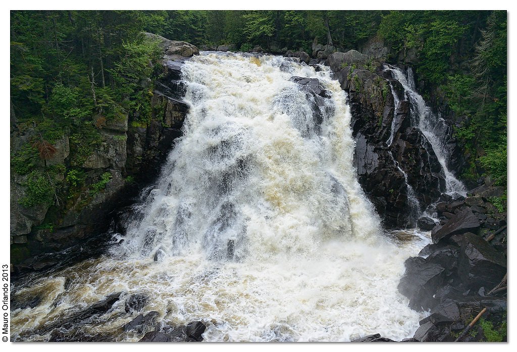
Chute du Diable sits at 430 metres within Mont-Tremblant National Park, in the foothills of Quebec. The falls drop 15 metres.
Why This Waterfall Exists
Chute du Diable flows over hard crystalline rock, primarily gneiss, laid down over 1.0-1.6 billion years ago. These resistant rocks form a durable ledge that water cannot easily wear away, creating a 49-foot drop where softer material downstream has already eroded.
Trail & Hike Details
The Approach
The easy 1.4-km out-and-back trail gains 46 metres of elevation on the way to the falls.
Trail Description
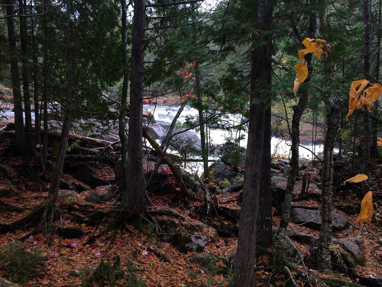
Reliable, detailed trail descriptions for this specific Chute du Diable location are scarce. The approach is likely a short to moderate forest trail from an informal parking area; trails in this region may be rocky, rooty, and uneven. Expect natural surfaces without boardwalks or railings. If there is an established viewpoint it may be a short walk from parking; if not, reaching the base or best viewpoints could require scrambling over rocks near the stream. Trail length, elevation gain and official wayfinding information are not confirmed and should be checked on a current trail resource before visiting.
What to Expect
The falls drop 15 metres over hard crystalline rock.
Accessibility
The trail is short and relatively flat, but the surface may be uneven. Contact the managing agency for accessibility details.
Frequently Asked Questions
🐶 Are Dogs Allowed at Chute du Diable?
❌ Dogs are not allowed
Are There Any Fees or Permits Required?
🆖 No fees required
🏊 Is There Swimming at Chute du Diable?
❌ Swimming is not allowed
When to Visit
Late spring (snowmelt) typically offers the fullest flows and dramatic views. Early summer and fall are good for stable trail conditions and scenic foliage colors (fall). Winter can produce striking ice formations but increases hazards from ice and cold; only attempt winter visits if properly equipped and experienced.
Seasonal Access
The best time to visit is Spring, Summer, Fall, and Winter. Check with Mont-Tremblant National Park for current conditions.
Safety Information
Hazards to be aware of: slippery wet rocks and steep ledges near the falls; strong currents and undertows in pools; rapidly changing water levels after rain or during spring melt; unstable or loose rock when scrambling; seasonal road closures or muddy/washed-out access roads. In winter expect ice, hidden crevasses, and extreme cold. There may be limited or no cell service. Always wear appropriate footwear, stay a safe distance from edges, and avoid approaching the base of the falls after heavy rain or during high flow. If uncertain about conditions, consult local park authorities or recent visitor reports before attempting the visit.
7-Day Flow Outlook
Based on the WSC gauge SAINT-LOUIS (RUISSEAU) A 0,3 KM DE LA RIVIERE DU DIABLE (2 km away).
Best time of year: this gauge typically runs highest from early April to early June, peaking in May.
How we calculate this
This is a transparent outlook, not a precise forecast. We take the waterfall's current flow strength (how it ranks against its historical normal for today, from the nearest WSC stream gauge), carry that ranking forward along the gauge's seasonal curve, and nudge it for forecast rain. Confidence is highest for the next day or two and falls further out. Always check official conditions and your own judgment before visiting — high flows can be dangerous.
Know when to go.
Get a free email alert when waterfalls near Mont-Laurier hit peak flow. We only send when conditions are worth the trip — no weekly newsletters, no spam.
Weather Forecast
Location & Access
Getting There
Access to the site is likely via local gravel or secondary roads off provincial routes. The closest reference towns are Mont-Laurier (~49.8 miles) and Saint-Jérôme (~52.0 miles). Exact driving directions and the final access road condition are not confirmed here, visitors should consult a current local map, municipal information, or recent visitor reports (e.g., AllTrails or local hiking forums) before traveling. In spring and after heavy rain the last access roads may be muddy or seasonally gated.
Get Directions on Google MapsParking
Parking details are not confirmed. Expect limited or informal parking (pullouts or small gravel lots) rather than a developed visitor parking lot. Park only where permitted and avoid blocking gates or driveways.
Elevation
430 metres above sea level
Coordinates
46.388623° N, -74.510244° W
Land Management
Managed by Ministère de l'Environnement, de la Lutte contre les changements climatiques, de la Faune et des Parcs, Direction des parcs
Visitor Tips & Gear
• Check local maps and recent trip reports (AllTrails, local hiking groups) for up-to-date access and trail conditions. • Leave no trace: pack out all trash and avoid disturbing vegetation or riverbanks. • Wear sturdy, waterproof footwear with good traction; expect wet, slippery rocks near the falls. • If approaching the water, stay back from unstable ledges and do not climb wet cliffs. • Cell service may be spotty; tell someone your plans and expected return time. • Bring insect repellent in spring/summer and traction devices in winter. • Respect private property; some access routes may cross private land, verify permission if required.
As an Amazon Associate, we earn from qualifying purchases.
For this easy 1.4 km trail, lightweight trail shoes and a water bottle are usually sufficient. Icy conditions are common in winter — traction cleats are a smart addition.

Columbia Watertight II Rain Jacket
Packs into its own pocket, seam-sealed, and keeps you dry from spray and surprise rain.

Polarized Sunglasses (Knockaround)
Cuts glare off the water so you actually see the falls — and your photos turn out better too.

Earth Pak Waterproof Dry Bag
Keeps your phone and gear dry when waterfall mist soaks everything else.

Waterproof Phone Pouch (AiRunTech)
Cheap insurance — take photos right next to the falls without killing your phone.

Kahtoola MICROspikes
Cult-favorite traction cleats that grip ice and wet rock — essential for winter waterfall hikes.

JOBY GorillaPod Starter Kit
Wraps around railings and rocks for long-exposure waterfall shots — no flat surface needed.
Where to Stay
Browse vacation cabins and private rentals nearby
Unique outdoor stays — tents, yurts, and treehouses
Rent a campervan or RV for your waterfall road trip
Some links are affiliate links. We may earn a commission at no extra cost to you.
Nearby Campground
L Étroit
4.3 km away
Additional Information
Nearby Attractions
Nearest larger communities: Mont-Laurier (~49.8 miles) and Saint-Jérôme (~52.0 miles). The broader region contains lakes, rivers and provincial/municipal parks typical of the Laurentian/Outaouais area; confirm specific nearby parks and attractions with regional tourism resources.
Wildlife
Typical regional wildlife may include white-tailed deer, beaver, otter, moose (in more remote areas), small mammals, and a variety of birds. Black flies and mosquitoes are common in spring and summer. Always store food securely and maintain distance from wildlife.
Cities near Chute du Diable
Nearby Waterfalls
Writing about Chute du Diable? Embed this waterfall on your site for free.