Difficulty
Moderate
Trail Length
7.6 km
Trail Type
Out And Back
About Chute aux Mûres
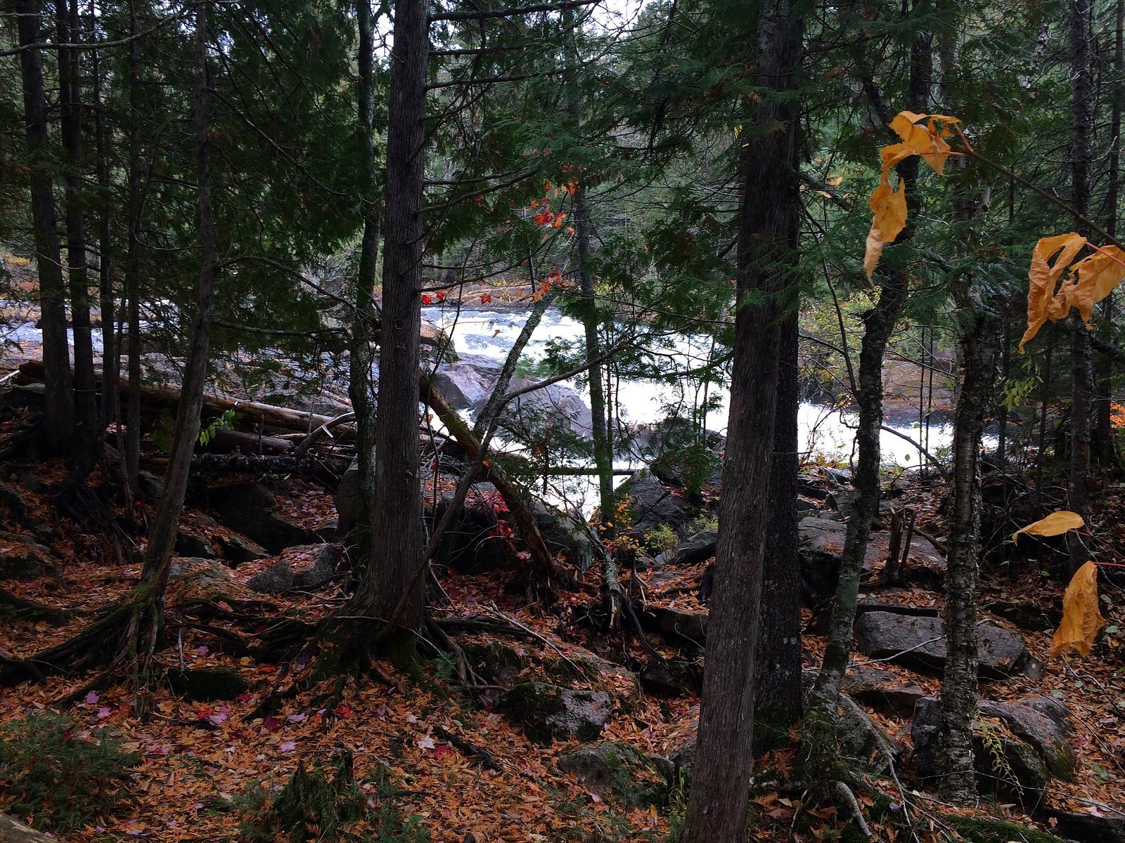
Chute aux Mûres is a small scenic waterfall in the Laurentides region of Quebec. It sits in a forested, riverine setting near Mont‑Laurier and is visited locally for its cascades and natural surroundings. Exact published details on infrastructure and official management are limited; the site is best described as a natural roadside/short‑hike waterfall that may be accessed by local roads and trails.
The Setting
Chute aux Mûres sits at 374 metres within Mont-Tremblant National Park, in the foothills of Quebec.
Why This Waterfall Exists
Chute aux Mûres flows over hard intrusive rock laid down over 1.0-1.2 billion years ago. These resistant rocks form a durable ledge that water cannot easily wear away, creating the falls where softer material downstream has already eroded.
Nearby Falls Worth Visiting
Chute du Diable (15 m) lies 10.5 kilometres to the east.
Trail & Hike Details
Trail Description
Publicly available, authoritative trail descriptions for Chute aux Mûres are limited. Reports suggest the waterfall is reached by a short walk from a nearby road or small parking area, possibly over uneven, rocky, and rooty terrain. Trails (if present) may be unmarked and can include wet or slippery rock surfaces close to the water. Treat the route as unmaintained unless confirmed otherwise.
What to Expect
Expect a natural, wooded setting with a rocky stream channel and a series of cascades or a single chute. Water levels will vary by season, high in spring runoff, lower in late summer and fall. Facilities are likely minimal or non‑existent (no restrooms, picnic tables, or guardrails). Cell service may be intermittent in rural Laurentides locations. Insects (blackflies, mosquitoes) can be numerous in late spring and summer.
Accessibility
The trail is not wheelchair accessible. Uneven terrain and elevation changes require steady footing.
Frequently Asked Questions
🐶 Are Dogs Allowed at Chute aux Mûres?
❌ Dogs are not allowed
Are There Any Fees or Permits Required?
🆖 No fees required
🏊 Is There Swimming at Chute aux Mûres?
❌ Swimming is not allowed
When to Visit
Spring (late melt/early runoff) for highest flows and dramatic water; fall for foliage color. Summer is pleasant for access but flows may be reduced. Winter offers icy scenery but may be hazardous without proper equipment.
Seasonal Access
The best time to visit is Spring, Summer, Fall, and Winter. Check with Mont-Tremblant National Park for current conditions.
Safety Information
Take standard waterfall safety precautions: avoid getting too close to the edge, watch for slippery rocks and sudden dropoffs, be cautious of fast currents and cold water, and do not climb wet rock faces. Conditions can change quickly with rain or spring melt. Cell service may be limited, tell someone your plans and expected return time. Insect and tick precautions are recommended in warmer months. If unsure of conditions, contact local authorities or park services for up‑to‑date advisories.
7-Day Flow Outlook
Based on the WSC gauge SAINT-LOUIS (RUISSEAU) A 0,3 KM DE LA RIVIERE DU DIABLE (11 km away).
Best time of year: this gauge typically runs highest from early April to early June, peaking in May.
How we calculate this
This is a transparent outlook, not a precise forecast. We take the waterfall's current flow strength (how it ranks against its historical normal for today, from the nearest WSC stream gauge), carry that ranking forward along the gauge's seasonal curve, and nudge it for forecast rain. Confidence is highest for the next day or two and falls further out. Always check official conditions and your own judgment before visiting — high flows can be dangerous.
Know when to go.
Get a free email alert when waterfalls near Mont-Laurier hit peak flow. We only send when conditions are worth the trip — no weekly newsletters, no spam.
Weather Forecast
Location & Access
Getting There
Coordinates: 46.3749, -74.6448. The waterfall lies in the general Laurentides/Mont‑Laurier area of Quebec. From Mont‑Laurier (approx. 44.7 miles away) or Saint‑Jérôme (approx. 57.0 miles away) drive on regional roads toward the local river valleys; final access is typically via secondary roads or a short forest/river access road. Exact turnoff and trailhead information should be confirmed with local maps or regional tourism/municipal sources before travel.
Get Directions on Google MapsParking
Likely a small roadside pullout or informal parking near the access point. There may be limited or no formal parking infrastructure; park only where permitted and avoid blocking roads. Verify local signage and restrictions.
Elevation
374 metres above sea level
Coordinates
46.374863° N, -74.644790° W
Land Management
Managed by Ministère de l'Environnement, de la Lutte contre les changements climatiques, de la Faune et des Parcs, Direction des parcs
Visitor Tips & Gear
• Confirm exact location and access with a local tourism office or municipal website before traveling. • Wear sturdy shoes with good traction; expect slippery rocks near the water. • Stay back from the edge, wet rock and fast currents create drowning risks. • Bring insect repellent in spring and summer. • Respect private property, do not trespass on adjacent land. • Leave no trace: pack out trash and minimize disturbance. • If visiting in winter, be prepared for ice, cold temperatures, and shorter daylight hours.
Where to Stay
Browse vacation cabins and private rentals nearby
Unique outdoor stays — tents, yurts, and treehouses
Rent a campervan or RV for your waterfall road trip
Some links are affiliate links. We may earn a commission at no extra cost to you.
Nearby Campground
Camping du Lac-Caché
2.8 km away
Additional Information
Nearby Attractions
Regional attractions in the broader Laurentides area include provincial parks, lakes, and forested recreation areas; Mont‑Laurier serves as a local service hub. Confirm specific nearby parks or trails with regional tourism resources.
Wildlife
Typical Laurentides wildlife may be present: white‑tailed deer, beaver, small mammals, a variety of songbirds, and potentially moose or black bear. Use normal wildlife precautions (store food, maintain distance).
Cities near Chute aux Mûres
Nearby Waterfalls
Writing about Chute aux Mûres? Embed this waterfall on your site for free.