Photo Credits (2)
About Chute du Sept
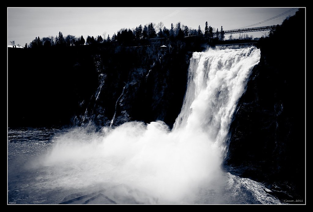
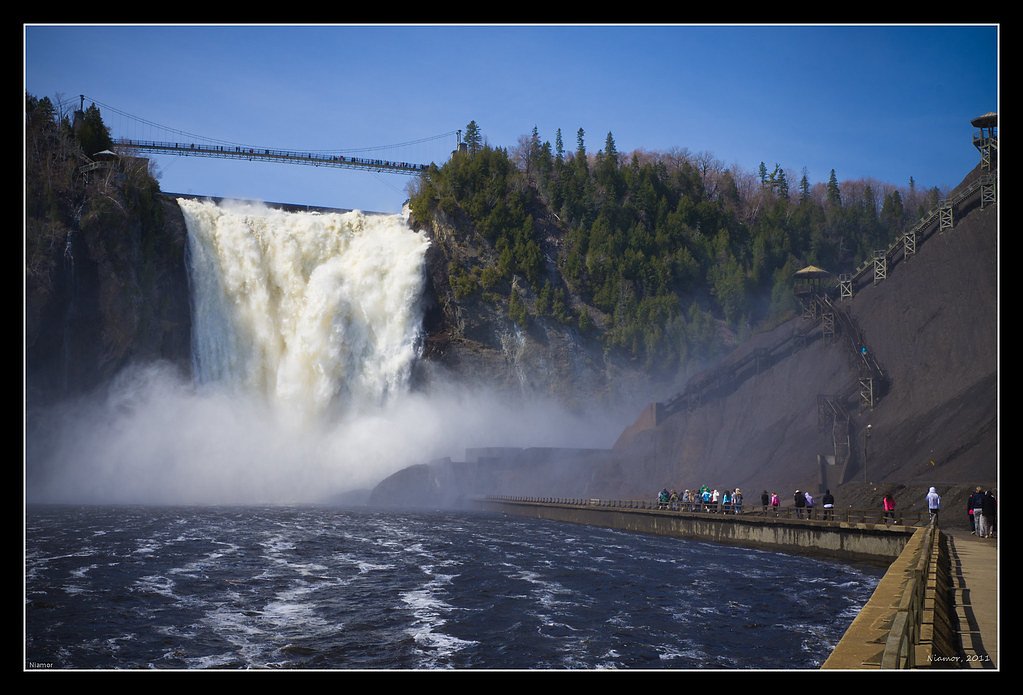
Chute du Sept is a waterfall feature in the Shawinigan region of Quebec (coordinates 46.8482, -72.4001). The falls are set in a forested, rocky landscape and are most notable for seasonal variation in flow (high in spring melt, lower in late summer). On-site infrastructure may be minimal at some viewpoints; visitors should expect natural trails, rocky approaches, and variable signage. Specifics about developed viewing platforms or official park amenities are uncertain and may vary by exact property ownership.
Why This Waterfall Exists
Chute du Sept flows over hard crystalline rock laid down over 1.0-1.6 billion years ago. These resistant rocks form a durable ledge that water cannot easily wear away, creating the falls where softer material downstream has already eroded.
Trail & Hike Details
Trail Description
Trail conditions appear to be natural singletrack or footpaths through mixed forest and rocky terrain. Trails to the falls may include roots, rock steps, and some short steep sections; they may be muddy in wet seasons and icy in winter. Signage and official maintained infrastructure (boardwalks, railings) may be limited or absent depending on the exact access point.
What to Expect
Expect a natural, potentially rugged setting with variable water flow. In spring the waterfall is likely at its fullest. Summer and fall visits offer easier hiking but possibly lower flows. Winter visits can offer ice formations but will include icy, slippery approaches and cold conditions. Limited facilities (restrooms, trash service) are likely; cell service may be spotty in some sections.
Accessibility
Access is likely not wheelchair accessible. Trails are natural and may include roots, rocks, and uneven surfaces. If accessibility information is critical, contact local municipal or park authorities for confirmation.
Frequently Asked Questions
🐶 Are Dogs Allowed at Chute du Sept?
❌ Dogs are not allowed
Are There Any Fees or Permits Required?
🆖 No fees required
🏊 Is There Swimming at Chute du Sept?
❌ Swimming is not allowed
When to Visit
Late spring (after snowmelt) for highest flow and vibrant water features; early fall for foliage color with generally good access. Winter offers ice vistas but requires experience with icy terrain and appropriate gear.
Seasonal Access
The best time to visit is Spring, Summer, Fall, and Winter. Check with the managing park or local authority for current conditions.
Safety Information
Hazards can include slippery wet rocks, steep drop-offs, fast-moving water, cold water temperatures, and variable trail conditions. Winter conditions can create ice and hidden hazards. Cell service may be limited. Always tell someone your plans, carry appropriate gear, and avoid approaching edges or climbing on unstable rock. When in doubt, err on the side of caution and stay on established trails.
7-Day Flow Outlook
Based on the WSC gauge BATISCAN (RIVIERE) A 3,4 KM EN AVAL DE LA RIVIERE DES ENVIES (29 km away).
Best time of year: this gauge typically runs highest from early April to mid June, peaking in April.
How we calculate this
This is a transparent outlook, not a precise forecast. We take the waterfall's current flow strength (how it ranks against its historical normal for today, from the nearest WSC stream gauge), carry that ranking forward along the gauge's seasonal curve, and nudge it for forecast rain. Confidence is highest for the next day or two and falls further out. Always check official conditions and your own judgment before visiting — high flows can be dangerous.
Know when to go.
Get a free email alert when waterfalls near Shawinigan-Sud hit peak flow. We only send when conditions are worth the trip — no weekly newsletters, no spam.
Weather Forecast
Location & Access
Getting There
The falls are located near Shawinigan-Sud and Trois-Rivières in central Quebec (approximate distances: Shawinigan-Sud ~30.5 miles, Trois-Rivières ~30.7 miles). Access is typically via local secondary roads off the regional highway network; a short hike on foot is commonly required from roadside parking. Use the provided coordinates (46.8482, -72.4001) in a mapping app to pinpoint the trailhead or roadside pullout. Road and trail conditions can change seasonally.
Get Directions on Google MapsParking
Parking is likely limited to a small pullout or informal lot near the trailhead. Parking may be unpaved and may not have formal facilities. During busy periods, roadside parking may fill; park safely and obey local signage.
Elevation
117 metres above sea level
Coordinates
46.848151° N, -72.400090° W
Visitor Tips & Gear
• Wear sturdy, grippy footwear; trails and rocks can be slippery. • Give yourself extra time in spring and after heavy rain, trails can be muddy and water levels high. • Stay behind any safety barriers and respect private property signs. • Bring insect repellent in warm months and layers in cold months. • If parking roadside, park fully off the roadway and avoid blocking driveways or gates. • Check local sources or municipal/park websites for any access advisories before you go.
Where to Stay
Browse vacation cabins and private rentals nearby
Unique outdoor stays — tents, yurts, and treehouses
Rent a campervan or RV for your waterfall road trip
Some links are affiliate links. We may earn a commission at no extra cost to you.
Nearby Campground
Camping Lac-aux-Sables
2.4 km away
Additional Information
Nearby Attractions
Nearby communities include Shawinigan and Trois-Rivières. La Mauricie National Park and other regional river and forest recreation areas are within reasonable driving distance and offer additional trails and viewpoints.
Wildlife
Typical regional wildlife may include deer, small mammals, and a variety of birds. In forested areas of central Quebec you may encounter insects (black flies, mosquitoes) in warm months. Larger mammals such as moose may be present in broader regional habitats; exercise usual caution and do not approach wildlife.
Cities near Chute du Sept
Nearby Waterfalls
Writing about Chute du Sept? Embed this waterfall on your site for free.