Difficulty
Easy
Trail Length
0.3 km
Trail Type
Out And Back
Elevation Gain
15 m
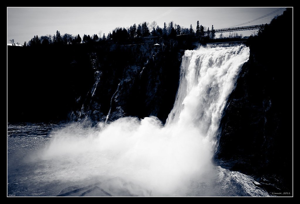
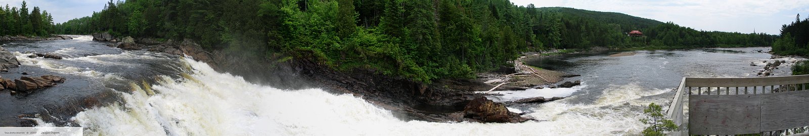
About Chute du 8
Chute du 8 is a small, local waterfall in the Shawinigan / Trois-Rivières region of Quebec (coordinates: 46.8465, -72.3375). It is a natural scenic drop on a local stream and is visited primarily by local hikers and sightseers. Specific published information about the falls is limited; descriptions below are based on typical local access and visitor reports and may be approximate.
Why This Waterfall Exists
Chute du 8 flows over hard crystalline rock laid down over 1.0-1.6 billion years ago. These resistant rocks form a durable ledge that water cannot easily wear away, creating the falls where softer material downstream has already eroded.
Trail & Hike Details
The Approach
The easy 0.3-km out-and-back trail gains 15 metres of elevation on the way to the falls.
Trail Description
The approach to Chute du 8 is typically a short walk from a nearby roadside parking or pullout. The path is usually a narrow footpath that may be natural/dirt, with some roots and rocks. The trail is short and generally easy, with modest elevation change down to the stream level. Trail marking and facilities (handrails, boardwalks) may be minimal or absent.
What to Expect
Expect a modest-sized waterfall with rock ledges and a small plunge or cascade depending on water levels. Spring (snowmelt) often produces higher flows; late summer may be lower. The immediate area is wooded and may be damp and muddy. There may be viewpoints from above the falls; getting down to the water edge could require scrambling on uneven, slippery rock.
Accessibility
The trail is short and relatively flat, but the surface may be uneven. Contact the managing agency for accessibility details.
Frequently Asked Questions
🐶 Are Dogs Allowed at Chute du 8?
❌ Dogs are not allowed
Are There Any Fees or Permits Required?
🆖 No fees required
🏊 Is There Swimming at Chute du 8?
❌ Swimming is not allowed
When to Visit
Spring for peak flow (snowmelt) and fall for foliage color. Summer provides easy access and warmer conditions. Winter visits are possible but expect icy conditions and limited access.
Seasonal Access
The best time to visit is Spring, Summer, Fall, and Winter. Check with the managing park or local authority for current conditions.
Safety Information
Hazards include slippery rocks, steep or unstable edges near the waterfall, fast or cold water, and variable trail conditions (mud, roots). In winter, icefall and thin ice are dangerous. Avoid getting too close to the edge, supervise children closely, and do not climb on wet rocks. If visiting after heavy rain or during spring flood, water levels and currents may be hazardous, avoid entering the water.
7-Day Flow Outlook
Based on the WSC gauge BATISCAN (RIVIERE) A 3,4 KM EN AVAL DE LA RIVIERE DES ENVIES (30 km away).
Best time of year: this gauge typically runs highest from early April to mid June, peaking in April.
How we calculate this
This is a transparent outlook, not a precise forecast. We take the waterfall's current flow strength (how it ranks against its historical normal for today, from the nearest WSC stream gauge), carry that ranking forward along the gauge's seasonal curve, and nudge it for forecast rain. Confidence is highest for the next day or two and falls further out. Always check official conditions and your own judgment before visiting — high flows can be dangerous.
Know when to go.
Get a free email alert when waterfalls near Shawinigan-Sud hit peak flow. We only send when conditions are worth the trip — no weekly newsletters, no spam.
Weather Forecast
Location & Access
Getting There
Located roughly 33 miles from both Shawinigan-Sud and Trois-Rivières (approximate distances provided). Use the coordinates 46.8465, -72.3375 in a GPS or mapping app. Access is from local secondary roads; expect narrow paved or gravel approaches. Exact turn-offs and signed pullouts may be limited, so follow mapping directions and local signage.
Get Directions on Google MapsParking
Parking is likely limited to a small roadside pullout or informal parking area near the trailhead. There may be no formal paved lot or facilities; park well off the road and do not block access. Availability may be limited on busy days.
Elevation
128 metres above sea level
Coordinates
46.846547° N, -72.337461° W
Visitor Tips & Gear
1) Wear sturdy, non-slip footwear, rocks near the falls can be very slippery. 2) Bring insect repellent in warm months. 3) Park well clear of the road and avoid blocking driveways or gates. 4) Cell reception may be spotty; carry a map or download offline directions. 5) Respect private property, if the route passes near residences, stay on public access and posted trails. 6) If visiting in winter, use traction devices and be cautious of ice.
As an Amazon Associate, we earn from qualifying purchases.
For this easy 0.3 km trail, lightweight trail shoes and a water bottle are usually sufficient. Icy conditions are common in winter — traction cleats are a smart addition.

Columbia Watertight II Rain Jacket
Packs into its own pocket, seam-sealed, and keeps you dry from spray and surprise rain.

Earth Pak Waterproof Dry Bag
Keeps your phone and gear dry when waterfall mist soaks everything else.

Waterproof Phone Pouch (AiRunTech)
Cheap insurance — take photos right next to the falls without killing your phone.

Kahtoola MICROspikes
Cult-favorite traction cleats that grip ice and wet rock — essential for winter waterfall hikes.

Polarized Sunglasses (Knockaround)
Cuts glare off the water so you actually see the falls — and your photos turn out better too.

Osprey Daylite Daypack
Light, organized, and just the right size for a day hike — fits water, snacks, and layers.
Where to Stay
Browse vacation cabins and private rentals nearby
Unique outdoor stays — tents, yurts, and treehouses
Rent a campervan or RV for your waterfall road trip
Some links are affiliate links. We may earn a commission at no extra cost to you.
Nearby Campground
Domaine Naturiste Le Cyprès
0.9 km away
Additional Information
Nearby Attractions
Shawinigan area attractions such as La Cité de l'Énergie (industrial history and observation tower) and other regional rivers, viewpoints, and parks. Parc national de la Mauricie is within regional driving distance; Trois-Rivières historic district is also nearby.
Wildlife
Typical southern Quebec wildlife may be present: songbirds, waterfowl, beaver, white-tailed deer and small mammals. Black bears are present in the broader region but sightings near small roadside falls are uncommon. Take normal wildlife precautions (store food securely, keep distance).
Cities near Chute du 8
Nearby Waterfalls
Writing about Chute du 8? Embed this waterfall on your site for free.