
Canterbury Falls
Ontario • Dundas Valley Conservation Area • 9 m
By Armen Suny · Last verified Jun 2026
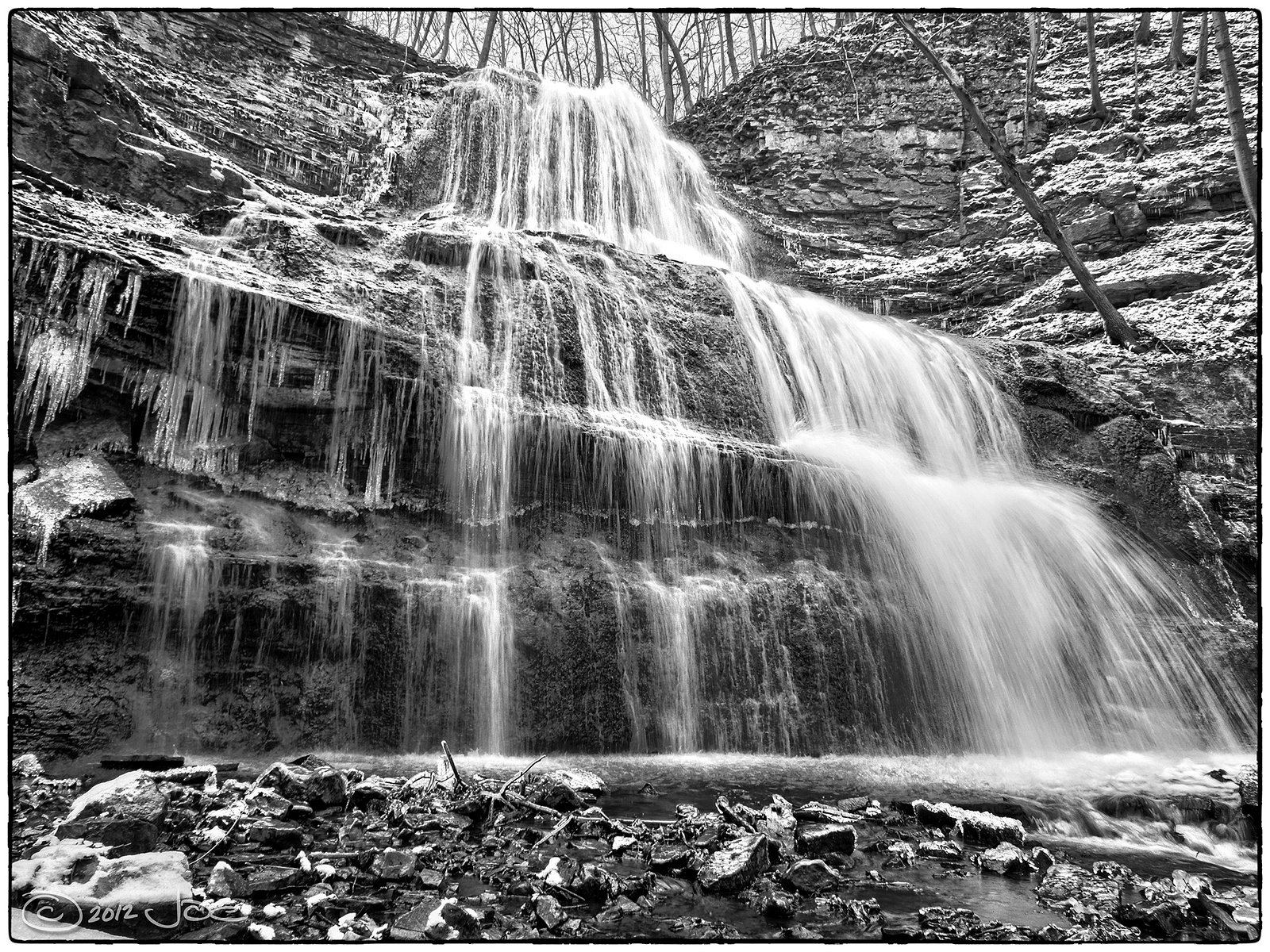
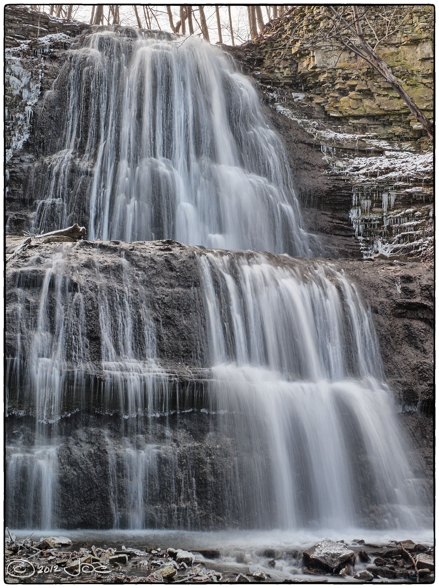
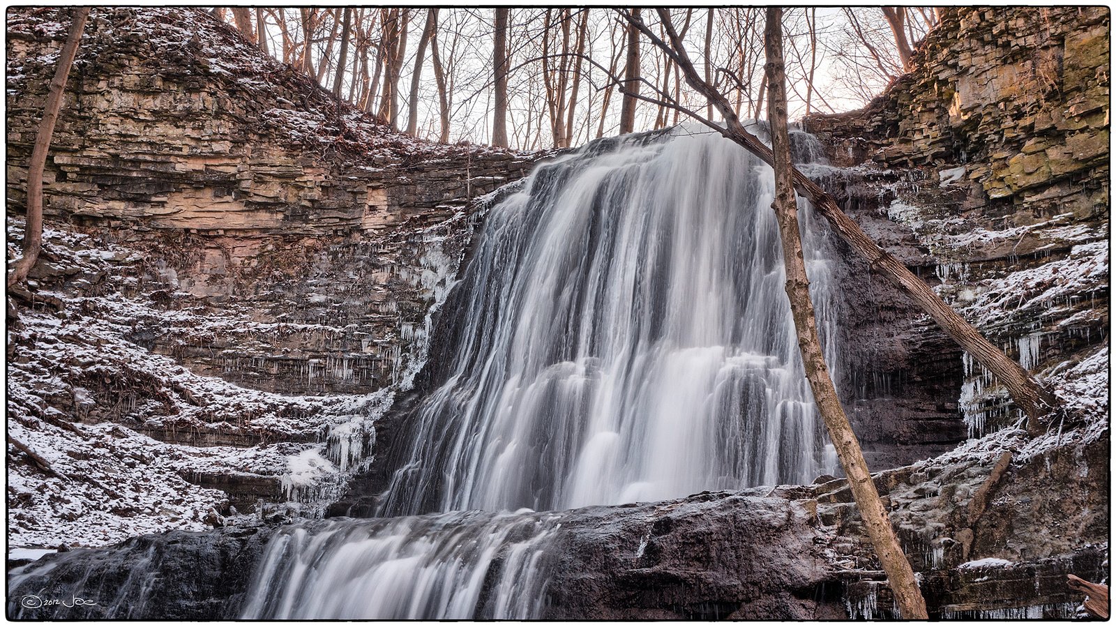
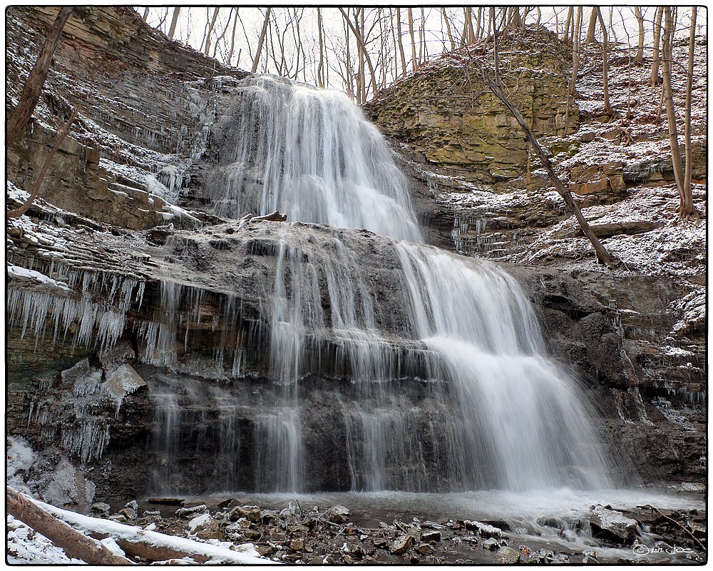
Photo Credits (5)
Difficulty
Easy
Trail Length
1.9 km
Trail Type
Out And Back
About Canterbury Falls
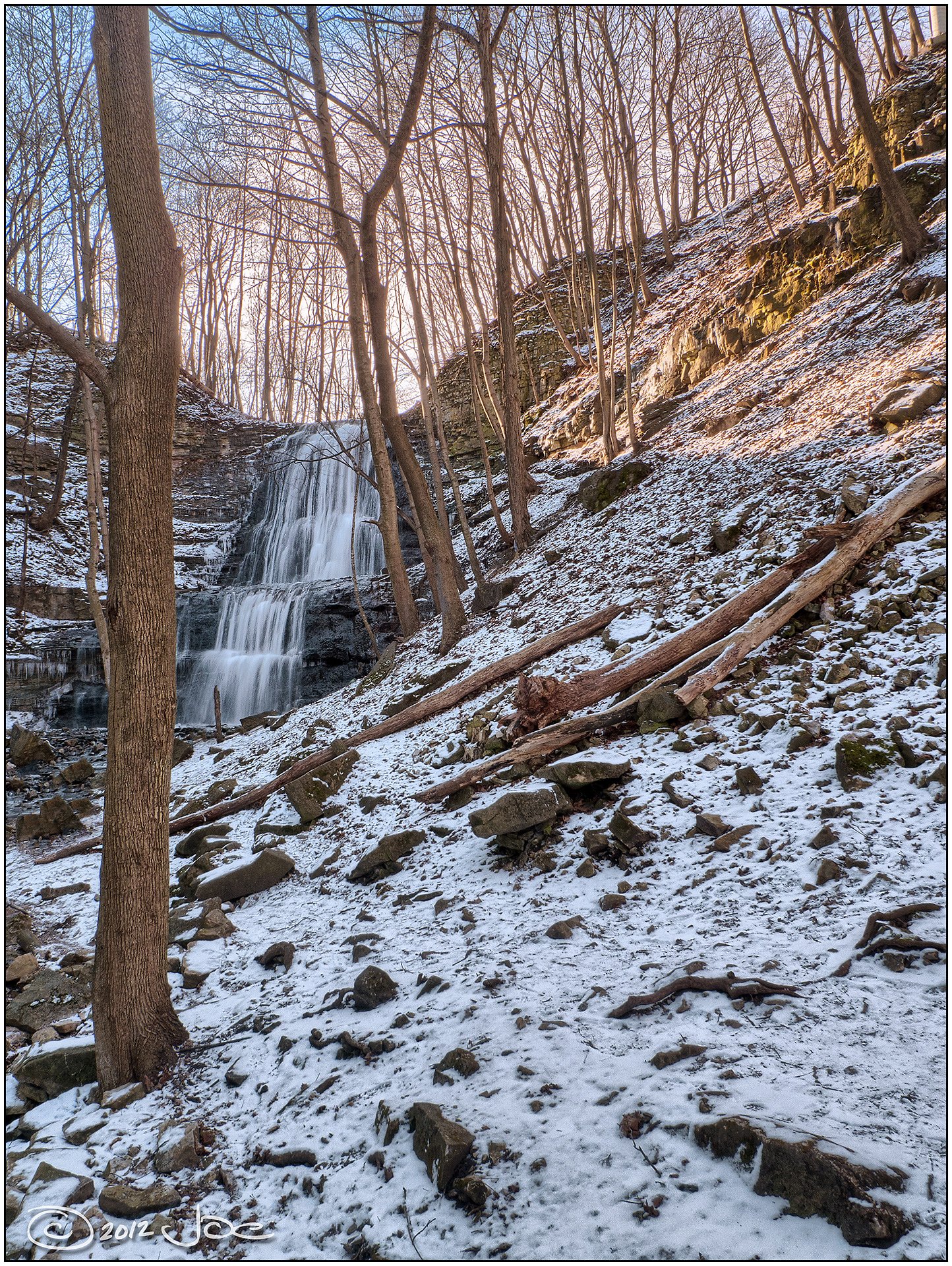
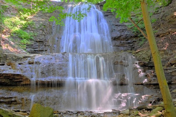
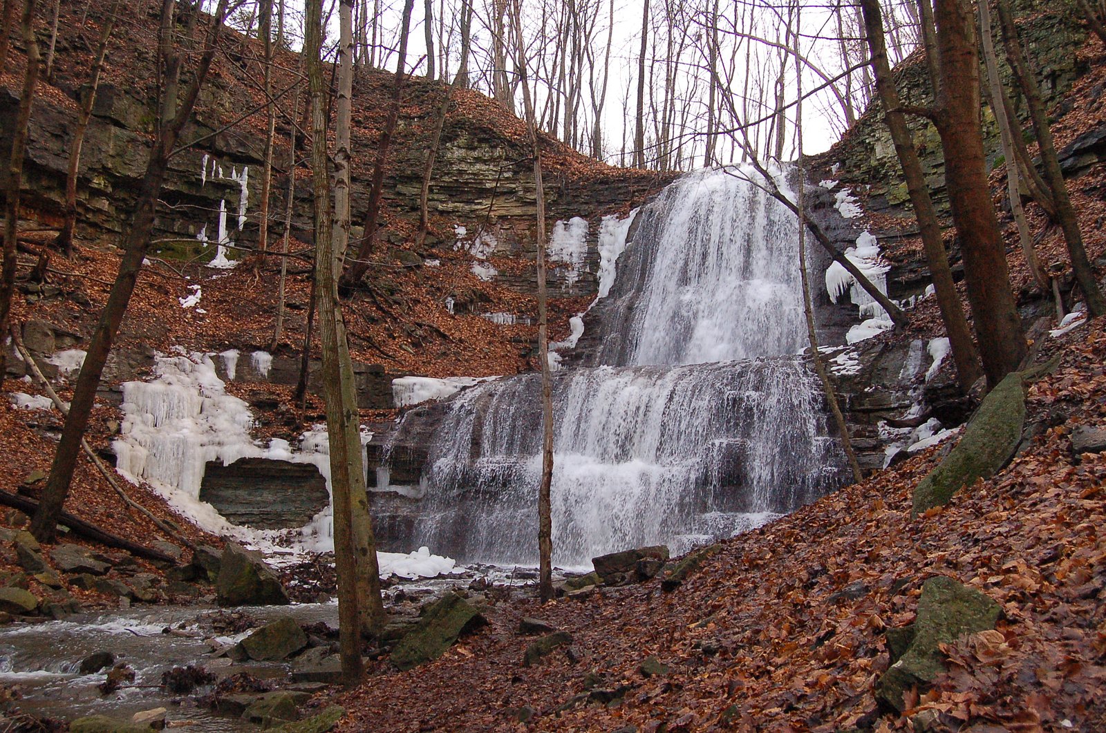
Canterbury Falls sits within the Dundas Valley Conservation Area and is managed by the Hamilton Conservation Authority, tucked into the Niagara Escarpment just outside Hamilton, Ontario. The escarpment’s layered geology produces many of the region’s scenic drops, Hamilton is famous for more than 100 waterfalls, and the Bruce Trail follows the escarpment, making Canterbury Falls an easy and rewarding stop for people exploring the city’s cascades. The most commonly used approach is a short, easy out-and-back of roughly 1.2 miles that works well for families and casual hikers. The route leads to a natural, wooded setting and creekside viewpoints; because the site is within a conservation area, follow posted Hamilton Conservation Authority signs and stay on designated routes to protect sensitive terrain and habitat.
The Setting
Canterbury Falls sits at 193 metres within Dundas Valley Conservation Area, in the foothills of Ontario. The falls drop 9 metres.
Height: 30 feet
Nearby Falls Worth Visiting
Sherman Falls (17 m) lies 0.6 kilometres to the east. Also nearby: Old Dundas Road Falls (7 m, 1.0 km) and Lower Mill Falls (6 m, 0.6 km).
Trail & Hike Details
Trail Description
Publicly available trail descriptions for Canterbury Falls are limited. The approach may be a short, informal footpath from a roadside or small parking area and could include rocky, uneven terrain and short scrambles near the creek. Expect minimal trail infrastructure (likely no boardwalks or formal viewing platforms). Trails in this region can be muddy after rain and icy in winter. If a nearby conservation area maintains a formal trail, follow their published route.
What to Expect
The falls drop 9 metres.
Accessibility
The trail is not wheelchair accessible. Uneven terrain and elevation changes require steady footing.
Frequently Asked Questions
🐶 Are Dogs Allowed at Canterbury Falls?
❌ Dogs are not allowed
Are There Any Fees or Permits Required?
🆖 No fees required
🏊 Is There Swimming at Canterbury Falls?
❌ Swimming is not allowed
When to Visit
Spring (late March–May) for highest water flow and early leaf-out; fall for foliage color and cooler conditions. Summer offers warm weather but lower flows in dry spells. Winter can produce ice formations but increases slip and fall risk, only attempt with proper gear and experience.
Seasonal Access
The best time to visit is Spring, Summer, Fall, and Winter. Check with Dundas Valley Conservation Area for current conditions.
Safety Information
Hazards may include slippery rocks, unstable or eroding stream banks, steep drop-offs, cold water temperatures, strong currents after rain, and thin ice in winter. Do not climb or stand on wet rock near edges. Stay back from cliff edges and follow Leave No Trace principles. Tell someone your plan and expected return time; cell service may be unreliable in ravines.
Current Water Conditions
0.0 m³/s
Current discharge — how much water is flowing
Lower than usual for this time of year
Based on 33 years of record
0.11 m
Water depth at gauge
7-Day Discharge Trend
What does this mean for your visit?
Flow is lower than usual for this time of year.
About This Gauge
7-Day Flow Outlook
Based on the WSC gauge ANCASTER CREEK AT ANCASTER (1 km away).
Today
Low
0.0 m³/s
5/10Tomorrow
Low
0.0 m³/s
5/10Tue
Moderate
0.0 m³/s
4/10Wed
Moderate
0.0 m³/s
6/10Thu
Low
0.0 m³/s
5/10Fri
Moderate
0.0 m³/s
5/10Sat
Moderate
0.0 m³/s
5/10Best window: Wed — moderate flow, cloudy (trip score 6/10).
Best time of year: this gauge typically runs highest from early March to late May, peaking in April.
How we calculate this
This is a transparent outlook, not a precise forecast. We take the waterfall's current flow strength (how it ranks against its historical normal for today, from the nearest WSC stream gauge), carry that ranking forward along the gauge's seasonal curve, and nudge it for forecast rain. Confidence is highest for the next day or two and falls further out. Always check official conditions and your own judgment before visiting — high flows can be dangerous.
Know when to go.
Get a free email alert when waterfalls near Hamilton hit peak flow. We only send when conditions are worth the trip — no weekly newsletters, no spam.
Weather Forecast
Location & Access
Getting There
Use GPS to navigate to 43.237, -79.9807. The falls sit within driving distance of Hamilton (~6.1 miles), Kitchener (~31.1 miles) and Orangeville (~38.1 miles). Exact vehicle access and the final approach route may be on small local roads; check a mapping app and local conservation authority maps before you go. If the site is on or adjacent to conservation land, follow posted signs and stay on permitted trails.
Get Directions on Google MapsParking
Parking information is not clearly documented. There may be limited roadside parking or a small unmarked pull-off. Do not block driveways or impede traffic. If a designated lot exists, use that and obey any posted rules. If you cannot find official parking, consider visiting during off-peak times or contact the local conservation authority for guidance.
Elevation
193 metres above sea level
Coordinates
43.236953° N, -79.980702° W
Land Management
Managed by Hamilton Conservation Authority
Visitor Tips & Gear
1) Check recent trip reports, AllTrails, or the local conservation authority for up-to-date access and parking notes before visiting. 2) Wear sturdy, grippy footwear, rocks and trail sections can be slippery. 3) If visiting in winter, bring traction devices and expect ice; approach frozen falls with extreme caution. 4) Respect private property, do not cut fences or cross fields. 5) Pack out what you bring and avoid disturbing vegetation or stream banks. 6) Bring a map/GPS and note the coordinates in case you need to re-locate the access point.
Where to Stay
Browse vacation cabins and private rentals nearby
Unique outdoor stays — tents, yurts, and treehouses
Rent a campervan or RV for your waterfall road trip
Some links are affiliate links. We may earn a commission at no extra cost to you.
Nearby Campground
circle square ranch
15.2 km away
Additional Information
Nearby Attractions
The Hamilton region is known for many waterfalls and conservation areas (for example: Webster's Falls, Tew's Falls, Albion Falls, and the Spencer Gorge area). If you are exploring waterfalls in the area, consult the Hamilton Conservation Authority and regional waterfall guides for verified routes and amenities.
Wildlife
Typical southern Ontario woodland species: white-tailed deer, raccoons, squirrels, a variety of songbirds, and waterfowl. Ticks capable of carrying Lyme disease are present, perform tick checks after visits. Poison ivy can also occur near trails and shorelines.
Cities near Canterbury Falls
Nearby Waterfalls
Writing about Canterbury Falls? Embed this waterfall on your site for free.