Photo Credits (2)
Difficulty
Hard
About Bakatase Falls
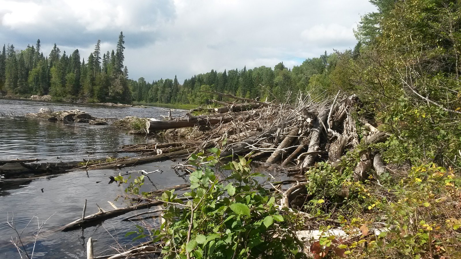
Bakatase Falls is a remote waterfall site in northeastern Ontario, Canada, located roughly 16.9 miles from Kapuskasing and 63.6 miles from Hearst (coordinates: 49.2677, -82.6617). It sits in boreal forest country and appears to be a small to medium cascade or drop on a local stream or river tributary. There is limited published information about developed access or facilities; approaches are likely along forestry or logging roads with some bushwhacking required. Seasonal flows are likely highest in spring (snowmelt) and lower in late summer. Details about exact height, formal trailheads, and maintained infrastructure are not well documented and are reported here with caution.
Why This Waterfall Exists
Bakatase Falls flows over hard intrusive rock, primarily granodiorite and tonalite, laid down over 2.5-3.2 billion years ago. These resistant rocks form a durable ledge that water cannot easily wear away, creating the falls where softer material downstream has already eroded.
Trail & Hike Details
Trail Description
There is no widely documented, maintained trail to Bakatase Falls in commonly referenced park or trail databases. Approaches reported by local visitors and regional maps are typically along unmarked paths, old logging roads, or off-trail through boreal forest and uneven terrain. Expect variable footing: roots, rocks, wet/mossy ground, and possibly muskeg or swampy sections. Navigation with a map, compass, and GPS is recommended. Because information is sparse, route details and distances are not confirmed and may require route-finding and bushcraft skills.
What to Expect
A secluded waterfall in boreal forest setting with typical northern Ontario flora (spruce, fir, poplar) and wetland pockets nearby. Spring runoff will produce the most impressive flows; summer may reduce flow but improve trail conditions. The site may have a rocky gorge or exposed bedrock near the falls, slippery surfaces, and limited developed viewpoints. Expect insect activity (black flies, mosquitoes) in spring and early summer. Cell signal may be intermittent or absent.
Accessibility
The trail involves steep, uneven terrain with significant elevation change and is not accessible to mobility devices.
Frequently Asked Questions
🐶 Are Dogs Allowed at Bakatase Falls?
❌ Dogs are not allowed
Are There Any Fees or Permits Required?
🆖 No fees required
🏊 Is There Swimming at Bakatase Falls?
❌ Swimming is not allowed
When to Visit
Spring (snowmelt) for highest flow and dramatic appearance; late summer and early fall for easier access and lower water (but watch for insects in summer). Winter access may be possible for experienced winter hikers or snowmobilers, but expect ice, deep snow, and very cold conditions, treat winter travel as technical and plan accordingly.
Seasonal Access
The best time to visit is Spring, Summer, Fall, and Winter. Check with the managing park or local authority for current conditions.
Safety Information
Hazards include slippery wet rocks, steep or unstable banks, cold and fast-moving water, sudden changes in flow (after heavy rain or spring melt), poor cell coverage, challenging navigation, biting insects, and wildlife encounters. Forestry roads can be rough and seasonally impassable; check gate closures and local forestry activity. If uncertain about route or conditions, consider hiring a local guide or contacting regional authorities for advice. Always err on the side of caution and prepare for self-rescue and overnight scenarios.
Current Water Conditions
31.3 m³/s
Current discharge — how much water is flowing
About average for this time of year
Based on 93 years of record
4.64 m
Water depth at gauge
7-Day Discharge Trend
What does this mean for your visit?
Flow is about average for this time of year.
About This Gauge
This gauge is on a nearby waterway and may not reflect exact conditions at the falls.
7-Day Flow Outlook
Based on the WSC gauge KAPUSKASING RIVER AT KAPUSKASING (23 km away).
Today
Moderate
31 m³/s
6/10Tomorrow
Moderate
33 m³/s
5/10Tue
Moderate
34 m³/s
5/10Wed
Moderate
32 m³/s
5/10Thu
Moderate
33 m³/s
4/10Fri
Moderate
29 m³/s
8/10Sat
Moderate
28 m³/s
5/10Best window: Fri — moderate flow, sunny (trip score 8/10).
Best time of year: this gauge typically runs highest from mid April to mid July, peaking in May.
How we calculate this
This is a transparent outlook, not a precise forecast. We take the waterfall's current flow strength (how it ranks against its historical normal for today, from the nearest WSC stream gauge), carry that ranking forward along the gauge's seasonal curve, and nudge it for forecast rain. Confidence is highest for the next day or two and falls further out. Always check official conditions and your own judgment before visiting — high flows can be dangerous.
Know when to go.
Get a free email alert when waterfalls near Kapuskasing hit peak flow. We only send when conditions are worth the trip — no weekly newsletters, no spam.
Weather Forecast
Location & Access
Getting There
General access is by driving on regional highways (Kapuskasing area) then onto secondary/forestry roads. The falls are in a remote, forested area and may require unpaved road travel and a hike/bushwhack to reach the immediate site. Use a GPS with the provided coordinates (49.2677, -82.6617) and verify current road conditions before travel. Expect limited or no signage.
Get Directions on Google MapsParking
There is likely no formal parking lot. Visitors may park at a safe pullout on a forestry road or at a trailhead if one exists. Roadside and logging-road parking may be rough; a high-clearance vehicle may be helpful. Confirm local rules and avoid blocking gates or private driveways.
Elevation
229 metres above sea level
Coordinates
49.267742° N, -82.661669° W
Visitor Tips & Gear
1) Tell someone your plans and expected return time, cell coverage may be poor. 2) Use GPS coordinates and offline maps; carry a compass and topo map. 3) Wear sturdy waterproof boots and bring insect repellent. 4) Expect unmarked, potentially wet and muddy routes; gaiters are useful. 5) Avoid slippery rocks near the water; do not attempt dangerous scrambles without experience. 6) Check local forestry road conditions and seasonal closures before driving forestry roads. 7) Carry bear spray and know how to use it; practice standard bear-safety measures.
Where to Stay
Browse vacation cabins and private rentals nearby
Unique outdoor stays — tents, yurts, and treehouses
Rent a campervan or RV for your waterfall road trip
Some links are affiliate links. We may earn a commission at no extra cost to you.
Additional Information
Nearby Attractions
Nearest towns with services are Kapuskasing (approximately 16.9 miles) and Hearst (approximately 63.6 miles). The broader region offers boreal forest landscapes, fishing lakes, rivers, and outdoor recreation typical of northeastern Ontario. Specific maintained parks or easily accessible tourist falls are limited in very remote areas, check local tourism offices for mapped attractions.
Wildlife
Typical northern Ontario wildlife may include black bears, moose, white-tailed deer, beaver, fox, wolves, and various bird species. Insect activity (black flies, mosquitoes) can be intense in spring and early summer. Practice wildlife awareness and food-storage precautions.
Cities near Bakatase Falls
Nearby Waterfalls
Writing about Bakatase Falls? Embed this waterfall on your site for free.