Allstones Falls
Alberta • 5 m
By Armen Suny · Last verified Jun 2026
Difficulty
Moderate
Trail Length
2.4 km
Trail Type
Out And Back
Elevation Gain
74 m
About Allstones Falls
Allstones Falls appears to be a little-documented waterfall in west-central Alberta (coordinates: 52.2899, -116.3903). There is very limited public information or official signage available. Based on the coordinates it is likely located in a remote, forested portion of the eastern slopes/foothills of the Canadian Rockies and may be a small cascade or tiered fall on a tributary stream. Information below is conservative and many specifics (height, maintained trail) are not confirmed.
The Setting
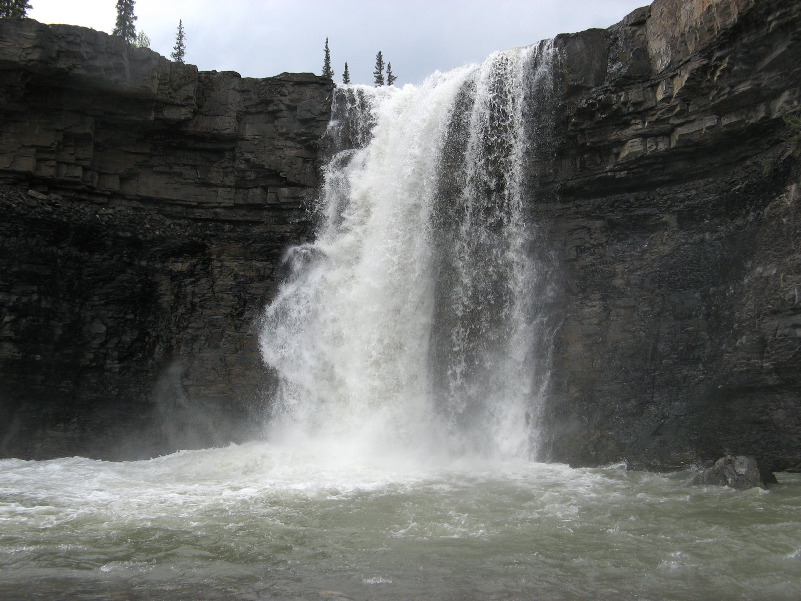
Allstones Falls sits at 1,419 metres in the mountains of Alberta. The falls drop 5 metres.
Why This Waterfall Exists
Allstones Falls flows over Luscar Group, a layered sedimentary rock layer deposited about 101-145 million years ago. These soft rocks erode readily, allowing the stream to carve a 16-foot drop into the landscape.
Trail & Hike Details
The Approach
The moderate 2.4-km out-and-back trail gains 74 metres of elevation on the way to the falls.
Trail Description
There is no reliably documented, maintained trail to Allstones Falls in mainstream trail guides. Expect an approach that may involve following a creek bed, bushwhacking through forest, uneven and rocky terrain, and potentially steep or slippery sections near the stream. If you attempt access, plan for route-finding over unmarked terrain and use topographic maps or GPS based on the provided coordinates.
What to Expect
The falls drop a gentle 5 metres over layered sedimentary rock.
Accessibility
The trail is not wheelchair accessible. Uneven terrain and elevation changes require steady footing.
Frequently Asked Questions
🐶 Are Dogs Allowed at Allstones Falls?
❌ Dogs are not allowed
Are There Any Fees or Permits Required?
🆖 No fees required
🏊 Is There Swimming at Allstones Falls?
❌ Swimming is not allowed
When to Visit
Late spring to early summer for highest water flow (snowmelt). Summer offers easier road/trail access and more stable weather. Early fall can offer good colors but lower flows. Winter access may be difficult or dangerous due to snow and ice unless you are equipped for winter backcountry travel.
Seasonal Access
The best time to visit is Spring, Summer, and Fall. Winter access may be limited. Check with the managing park or local authority for current conditions.
Safety Information
Hazards may include slippery rocks, steep or unstable banks, sudden water level changes (especially after rain or during snowmelt), limited or no cell coverage, challenging or unmaintained access roads, and wildlife encounters. Do not attempt cliff-edge photography or scrambling near the lip. If conditions are icy or snowy, travel requires appropriate winter gear and skills. Emergency response may be delayed, carry a personal locator beacon (PLB) or satellite communicator if venturing into remote areas.
Current Water Conditions
Based on a Water Survey of Canada gauge 26.6 km away
3.0 m³/s
Current discharge — how much water is flowing
About average for this time of year
Based on 50 years of record
0.93 m
Water depth at gauge
7-Day Discharge Trend
What does this mean for your visit?
Flow is about average for this time of year.
About This Gauge
This gauge is on a regional waterway. Conditions at the falls may differ, especially after local rain.
7-Day Flow Outlook
Based on the WSC gauge NORTH RAM RIVER AT FORESTRY ROAD (27 km away).
Today
Moderate
3.3 m³/s
5/10Tomorrow
Moderate
3.3 m³/s
5/10Tue
Moderate
3.1 m³/s
5/10Wed
Moderate
3.0 m³/s
5/10Thu
Moderate
3.0 m³/s
5/10Fri
Moderate
2.9 m³/s
5/10Sat
Moderate
2.5 m³/s
8/10Best window: Sat — moderate flow, sunny (trip score 8/10).
Best time of year: this gauge typically runs highest from early June to mid July, peaking in June.
How we calculate this
This is a transparent outlook, not a precise forecast. We take the waterfall's current flow strength (how it ranks against its historical normal for today, from the nearest WSC stream gauge), carry that ranking forward along the gauge's seasonal curve, and nudge it for forecast rain. Confidence is highest for the next day or two and falls further out. Always check official conditions and your own judgment before visiting — high flows can be dangerous.
Weather Forecast
Location & Access
Getting There
There is no widely published, maintained trailhead for Allstones Falls. Access will likely require driving on secondary or forestry roads off the nearest paved highway and either hiking cross-country or following an unmarked track. A high-clearance vehicle and good map/GPS are likely needed. Expect limited or no cell service in the area. Always confirm access with local land management (provincial forestry/municipal offices) before travelling.
Get Directions on Google MapsParking
No official parking lot is known. Parking is likely limited to roadside pullouts or informal clearings on logging/forestry roads. Park well off the roadway and avoid blocking gates or access routes.
Elevation
1,419 metres above sea level
Coordinates
52.289903° N, -116.390277° W
Visitor Tips & Gear
1) Treat this as a backcountry visit: tell someone your plan and expected return time. 2) Use detailed topographic maps and GPS; wayfinding may be necessary. 3) Wear sturdy waterproof boots and bring trekking poles for stability. 4) Expect wet, slippery rocks near the falls, avoid climbing on unstable ledges. 5) Carry bear spray and know how to use it (region may have bears). 6) Pack out all waste. 7) If you find private land or posted gates, respect closures and access restrictions.
As an Amazon Associate, we earn from qualifying purchases.
With 2.4 km and 74 m of elevation gain, sturdy boots and trekking poles will help on this moderate trail. Sun exposure on the trail makes good sun protection a must in summer.

Columbia Watertight II Rain Jacket
Packs into its own pocket, seam-sealed, and keeps you dry from spray and surprise rain.

Earth Pak Waterproof Dry Bag
Keeps your phone and gear dry when waterfall mist soaks everything else.

Waterproof Phone Pouch (AiRunTech)
Cheap insurance — take photos right next to the falls without killing your phone.

Timberland Euro Sprint Mid Waterproof
Trusted waterproof boot with premium leather and grippy rubber sole — reliable on rocky, wet trails.

TrailBuddy Trekking Poles
Lightweight aluminum, cork grips, and flip-locks that actually hold — a best-seller for good reason.

Polarized Sunglasses (Knockaround)
Cuts glare off the water so you actually see the falls — and your photos turn out better too.
Where to Stay
Browse vacation cabins and private rentals nearby
Unique outdoor stays — tents, yurts, and treehouses
Rent a campervan or RV for your waterfall road trip
Some links are affiliate links. We may earn a commission at no extra cost to you.
Nearby Campground
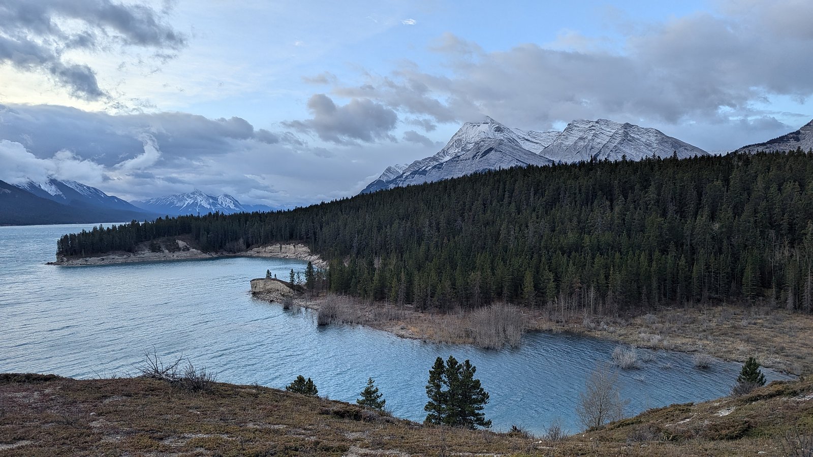
Abraham Cove Campsite
1.1 km away
Additional Information
Nearby Attractions
The location is in the general David Thompson/Columbia region of Alberta's foothills and Rocky Mountain front. Regional attractions in the broader area may include scenic sections of the David Thompson Highway, mountain viewpoints, and other rivers and lakes. Exact nearby named attractions relative to these coordinates are not well documented for this specific feature.
Wildlife
Typical foothills and montane wildlife may be present: black bears (and possibly grizzly in parts of the region), moose, deer, elk, coyotes, cougars, and smaller mammals and birds. Take standard wildlife precautions, store food properly and maintain distance.
Nearby Waterfalls
Writing about Allstones Falls? Embed this waterfall on your site for free.