

Photo Credits (5)
Difficulty
Moderate
Trail Length
2.4 miles
Trail Type
Out And Back
Elevation Gain
350 ft
About Young Falls
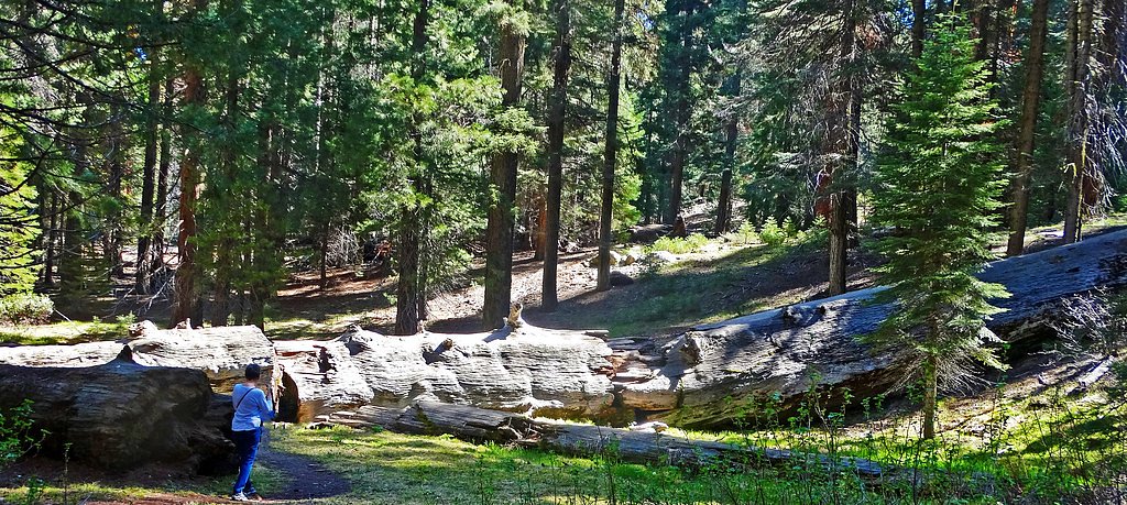
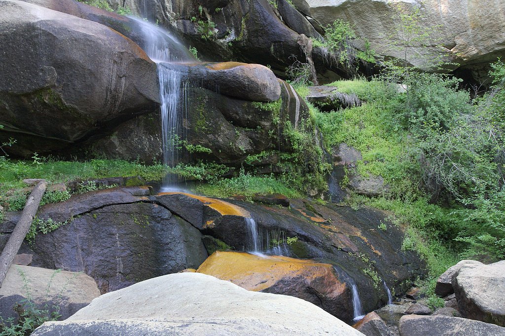
Young Falls is a picturesque California waterfall that feels tucked away from the bustle — especially dramatic in spring and early summer when snowmelt swells the flow and the cascade is at its most photogenic. The setting is peaceful and scenic, offering a rewarding destination for photographers and hikers looking for a quieter outing. The falls are accessed via a roughly 2.4-mile out-and-back hike with about 350 feet of elevation gain and is generally rated moderate. Trail details are not extensively documented, so expect a backcountry feel as you approach the cascade; the effort is well rewarded by close-up views and the soothing sound of falling water.
Trail & Hike Details
The Approach
The moderate 2.4-mile out-and-back trail gains 350 feet of elevation on the way to the falls.
Trail Description
Length: 2.4 miles (out-and-back). Elevation gain: 350 feet. Difficulty: Moderate. Official USFS trail name/number and surface/grade/class are not listed for this route. Trail information is limited and the approach may include unmarked or rugged sections, so navigation can be informal in places. Hikers should be prepared for natural tread and short steeper segments along the way.
What to Expect
Visitors can expect a tranquil natural setting with a waterfall that may vary in flow depending on the season. The surrounding area is likely to feature lush vegetation, especially in spring.
Accessibility
The trail is not wheelchair accessible. Uneven terrain and elevation changes require steady footing.
Frequently Asked Questions
🐶 Are Dogs Allowed at Young Falls?
❌ Dogs are not allowed
Are There Any Fees or Permits Required?
🆖 No fees required
🏊 Is There Swimming at Young Falls?
❌ Swimming is not allowed
When to Visit
Spring and early summer are typically the best times to visit, as the waterfall is most active during these seasons.
Seasonal Access
The best time to visit is Spring, Summer, and Fall. Winter access may be limited.
Safety Information
Visitors should be cautious of slippery rocks near the waterfall and uneven terrain. Always check weather conditions before visiting.
Know when to go.
Get a free email alert when waterfalls near McArthur hit peak flow. We only send when conditions are worth the trip — no weekly newsletters, no spam.
Weather Forecast
Location & Access
Getting There
Specific directions to Young Falls are not widely documented. Visitors are advised to consult local maps or contact nearby park services for guidance.
Get Directions on Google MapsParking
Parking availability near Young Falls is unclear. Visitors should prepare for limited parking options and consider arriving early during peak seasons.
Elevation
3,287 feet above sea level
Coordinates
41.042664° N, -121.317200° W
Visitor Tips & Gear
Bring a detailed map or GPS device as trail markings may be limited. Wear sturdy footwear and be prepared for uneven terrain.
As an Amazon Associate, we earn from qualifying purchases.
With 2.4 miles and 350 ft of elevation gain, sturdy boots and trekking poles will help on this moderate trail. Sun exposure on the trail makes good sun protection a must in summer.

Polarized Sunglasses (Knockaround)
Cuts glare off the water so you actually see the falls — and your photos turn out better too.

Columbia Watertight II Rain Jacket
Packs into its own pocket, seam-sealed, and keeps you dry from spray and surprise rain.

Earth Pak Waterproof Dry Bag
Keeps your phone and gear dry when waterfall mist soaks everything else.

Waterproof Phone Pouch (AiRunTech)
Cheap insurance — take photos right next to the falls without killing your phone.

Timberland Euro Sprint Mid Waterproof
Trusted waterproof boot with premium leather and grippy rubber sole — reliable on rocky, wet trails.

TrailBuddy Trekking Poles
Lightweight aluminum, cork grips, and flip-locks that actually hold — a best-seller for good reason.
Where to Stay

Millz Manor

Green Gables Motel & Suites

Himont Motel

Shasta Pines Motel & Suites
Browse vacation cabins and private rentals nearby
Unique outdoor stays — tents, yurts, and treehouses
Rent a campervan or RV for your waterfall road trip
Some links are affiliate links. We may earn a commission at no extra cost to you.
Nearby Campground
Pit River Campground
10.5 miles away · 0 sites
The Pit River Recreation area is adjacent to the Pit River, has a small campground with eight campsites with tables, metal firerings, and barbeque pits. Amenities include: two single wheelchair accessible restrooms, a kayak launch ramp, and an accessible fishing pier. Camping:$8.00/night
Book on Recreation.govNearby Hot Springs
Hot springs near McArthur, California
Hot Springs
Hot Springs emerge from the canyon walls of the Pit River in Shasta County at 3,310 feet elevation, their thermal nature docume...
Little Hot Spring
Little Hot Spring discharges at 169°F in the volcanic terrain south of Lassen, where superheated water rises 117 degrees above ...
Bassett Hot Springs
Bassett Hot Springs delivers superheated water at 174 degrees Fahrenheit from volcanic terrain near Burney, ranking among north...
Kellog Hot Springs
Kellog Hot Springs discharges at 172°F in the high desert of Modoc County, 121°F hotter than the frigid local average of 51°F. ...
Hunt Hot Spring
Hunt Hot Spring produces 136-degree water from the forested slopes near McCloud in Siskiyou County at just 1,712 feet elevation...
Big Bend, California
Big Bend sits along a dramatic curve of the Pit River in Shasta County at 1,720 feet elevation, occupying territory historicall...
Looking for a soak after your hike? Explore more hot springs near McArthur, California on SoakingSprings.
Explore California springsAdditional Information
Nearby Attractions
Nearby attractions are not well-documented, but visitors may find other natural landmarks or hiking trails in the surrounding area.
Wildlife
The area around Young Falls may feature local wildlife such as birds, deer, and small mammals. Visitors should be cautious of potential encounters with snakes or other wildlife.
Cities near Young Falls
Nearby Waterfalls
Writing about Young Falls? Embed this waterfall on your site for free.