Pit River Falls
By Armen Suny · Last verified Mar 2026
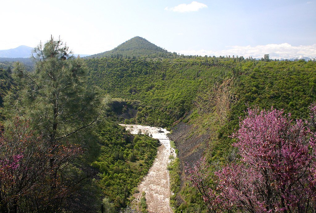
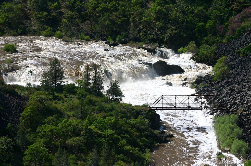
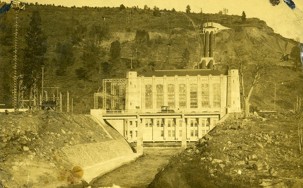
Photo Credits (5)
Difficulty
Moderate
Trail Length
2.4 miles
Trail Type
Out And Back
Elevation Gain
350 ft
About Pit River Falls
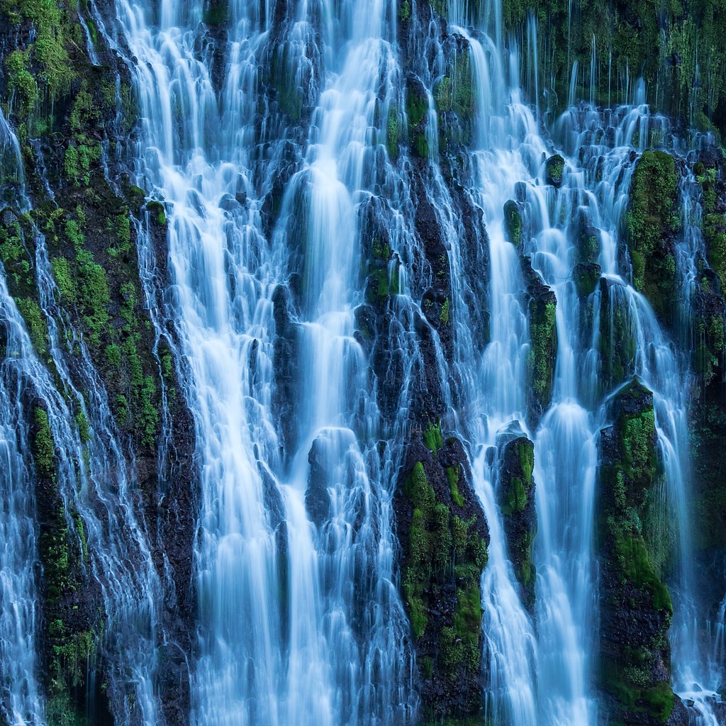
Pit River Falls tumbles along the Pit River in northern California, offering multi-tiered cascades set against rugged, largely undeveloped surroundings. The waterfall sits on public land managed by the Bureau of Land Management’s Applegate Field Office (designation: PUB), which helps keep the area feeling remote and peaceful—a draw for photographers and hikers looking for solitude. Access is straightforward but rustic: the most common approach is an out-and-back route that covers 2.4 miles with about 350 feet of elevation gain, so plan on a moderate hike. If you want to make a night of it, Pit River Campground is roughly 3.07 km away, making car-camping a convenient option before or after your visit.
The Setting
Pit River Falls sits at 3,035 feet within Applegate Field Office, in the mountains of California.
Trail & Hike Details
The Approach
The moderate 2.4-mile out-and-back trail gains 350 feet of elevation on the way to the falls.
Trail Description
The trail to Pit River Falls is an out-and-back route of approximately 2.4 miles with 350 feet of elevation gain and is rated moderate. Expect uneven footing and some steep descents on the approach to the falls; sections can be rugged and may not be well-marked, so sturdy footwear and basic navigation awareness are recommended. The surface is natural tread through mixed terrain rather than a developed paved path, and the route rewards hikers with close-up views of the cascades and surrounding BLM-managed land.
What to Expect
Visitors can expect a peaceful and remote experience with the sound of cascading water and scenic views of the Pit River. The area is surrounded by natural beauty, including rocky outcrops and lush vegetation. The falls themselves are multi-tiered and impressive, especially during the spring when water flow is at its peak.
Accessibility
The trail is not wheelchair accessible. Uneven terrain and elevation changes require steady footing.
Frequently Asked Questions
🐶 Are Dogs Allowed at Pit River Falls?
❌ Dogs are not allowed
Are There Any Fees or Permits Required?
🆖 No fees required
🏊 Is There Swimming at Pit River Falls?
❌ Swimming is not allowed
When to Visit
Spring is the best time to visit, as the water flow is typically strongest after the winter snowmelt. Summer and fall are also good options, but water levels may be lower.
Seasonal Access
The best time to visit is Spring, Summer, and Fall. Winter access may be limited.
Safety Information
The trail can be steep and slippery in places, so proper footwear is essential. Visitors should exercise caution near the falls and avoid climbing on wet rocks. Be prepared for remote conditions and carry a first aid kit.
Current Water Conditions
889 ft³/s
Current discharge — how much water is flowing
Much lower than usual for this time of year
Based on 50 years of record
5.00 ft
Water depth at gauge
7-Day Discharge Trend
What does this mean for your visit?
Flow is well below normal for this time of year, so the waterfall may be a trickle.
About This Gauge
7-Day Flow Outlook
Based on the USGS gauge PIT R BL PIT NO 1 PH NR FALL RIVER MILLS CA (3 km away).
Today
Low
960 cfs
4/10Tomorrow
Barely Flowing
917 cfs
5/10Tue
Barely Flowing
860 cfs
5/10Wed
Barely Flowing
875 cfs
5/10Thu
Barely Flowing
860 cfs
5/10Fri
Barely Flowing
853 cfs
5/10Sat
Barely Flowing
846 cfs
5/10Best window: Tomorrow — barely flowing flow, sunny (trip score 5/10).
Best time of year: this gauge typically runs highest from mid February to early May, peaking in March.
How we calculate this
This is a transparent outlook, not a precise forecast. We take the waterfall's current flow strength (how it ranks against its historical normal for today, from the nearest USGS stream gauge), carry that ranking forward along the gauge's seasonal curve, and nudge it for forecast rain. Confidence is highest for the next day or two and falls further out. Always check official conditions and your own judgment before visiting — high flows can be dangerous.
Know when to go.
Get a free email alert when waterfalls near Fall River Mills hit peak flow. We only send when conditions are worth the trip — no weekly newsletters, no spam.
Weather Forecast
Location & Access
Getting There
Pit River Falls is located near Fall River Mills in Shasta County, California. Access typically involves driving on rural roads, and the falls are situated in a remote area. Directions may vary depending on the starting point, so using a GPS or detailed map is recommended.
Get Directions on Google MapsParking
Parking availability is limited and may require roadside parking near the trailhead or access point. Visitors should ensure they park in designated areas to avoid blocking roads or private property.
Elevation
3,035 feet above sea level
Coordinates
40.985996° N, -121.471926° W
Land Management
Managed by BLM
Visitor Tips & Gear
Wear sturdy hiking shoes and bring plenty of water. Cell service may be limited in the area, so download maps or directions in advance. Be cautious of slippery rocks near the falls and avoid visiting during heavy rain or inclement weather.
As an Amazon Associate, we earn from qualifying purchases.
With 2.4 miles and 350 ft of elevation gain, sturdy boots and trekking poles will help on this moderate trail. Sun exposure on the trail makes good sun protection a must in summer.

Polarized Sunglasses (Knockaround)
Cuts glare off the water so you actually see the falls — and your photos turn out better too.

Columbia Watertight II Rain Jacket
Packs into its own pocket, seam-sealed, and keeps you dry from spray and surprise rain.

Earth Pak Waterproof Dry Bag
Keeps your phone and gear dry when waterfall mist soaks everything else.

Waterproof Phone Pouch (AiRunTech)
Cheap insurance — take photos right next to the falls without killing your phone.

Timberland Euro Sprint Mid Waterproof
Trusted waterproof boot with premium leather and grippy rubber sole — reliable on rocky, wet trails.

TrailBuddy Trekking Poles
Lightweight aluminum, cork grips, and flip-locks that actually hold — a best-seller for good reason.
Where to Stay

Himont Motel

Millz Manor

Green Gables Motel & Suites

Shasta Pines Motel & Suites
Browse vacation cabins and private rentals nearby
Unique outdoor stays — tents, yurts, and treehouses
Rent a campervan or RV for your waterfall road trip
Some links are affiliate links. We may earn a commission at no extra cost to you.
Nearby Campground
Pit River Campground
1.9 miles away · 0 sites
The Pit River Recreation area is adjacent to the Pit River, has a small campground with eight campsites with tables, metal firerings, and barbeque pits. Amenities include: two single wheelchair accessible restrooms, a kayak launch ramp, and an accessible fishing pier. Camping:$8.00/night
Book on Recreation.govNearby Hot Springs
Hot springs near Fall River Mills, California
Hot Springs
Hot Springs emerge from the canyon walls of the Pit River in Shasta County at 3,310 feet elevation, their thermal nature docume...
Little Hot Spring
Little Hot Spring discharges at 169°F in the volcanic terrain south of Lassen, where superheated water rises 117 degrees above ...
Big Bend, California
Big Bend sits along a dramatic curve of the Pit River in Shasta County at 1,720 feet elevation, occupying territory historicall...
Big Bend Hot Springs
Big Bend Hot Springs surges at a scalding 180 degrees Fahrenheit from volcanic terrain at just 1,644 feet elevation, creating o...
Hunt Hot Spring
Hunt Hot Spring produces 136-degree water from the forested slopes near McCloud in Siskiyou County at just 1,712 feet elevation...
Bassett Hot Springs
Bassett Hot Springs delivers superheated water at 174 degrees Fahrenheit from volcanic terrain near Burney, ranking among north...
Looking for a soak after your hike? Explore more hot springs near Fall River Mills, California on SoakingSprings.
Explore California springsAdditional Information
Nearby Attractions
Nearby attractions include McArthur-Burney Falls Memorial State Park and the Fall River Valley, which offers fishing and other outdoor activities.
Wildlife
The area is home to a variety of wildlife, including birds, deer, and small mammals. Visitors should be aware of the potential presence of snakes and other natural hazards.
Cities near Pit River Falls
Nearby Waterfalls

Writing about Pit River Falls? Embed this waterfall on your site for free.