Photo Credits (5)
Difficulty
Moderate
Trail Length
2.4 miles
Trail Type
Out And Back
Elevation Gain
350 ft
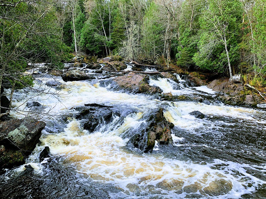
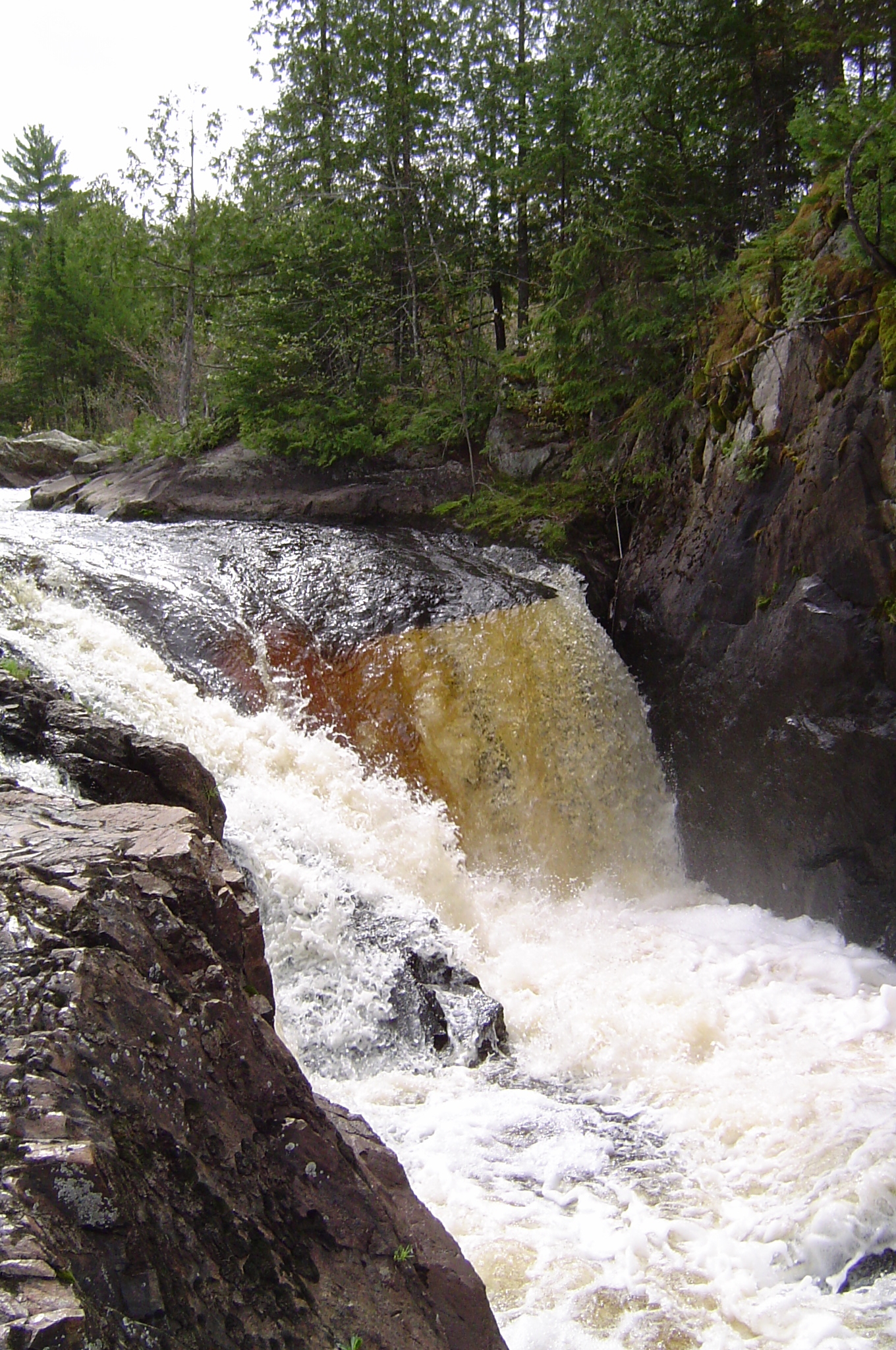
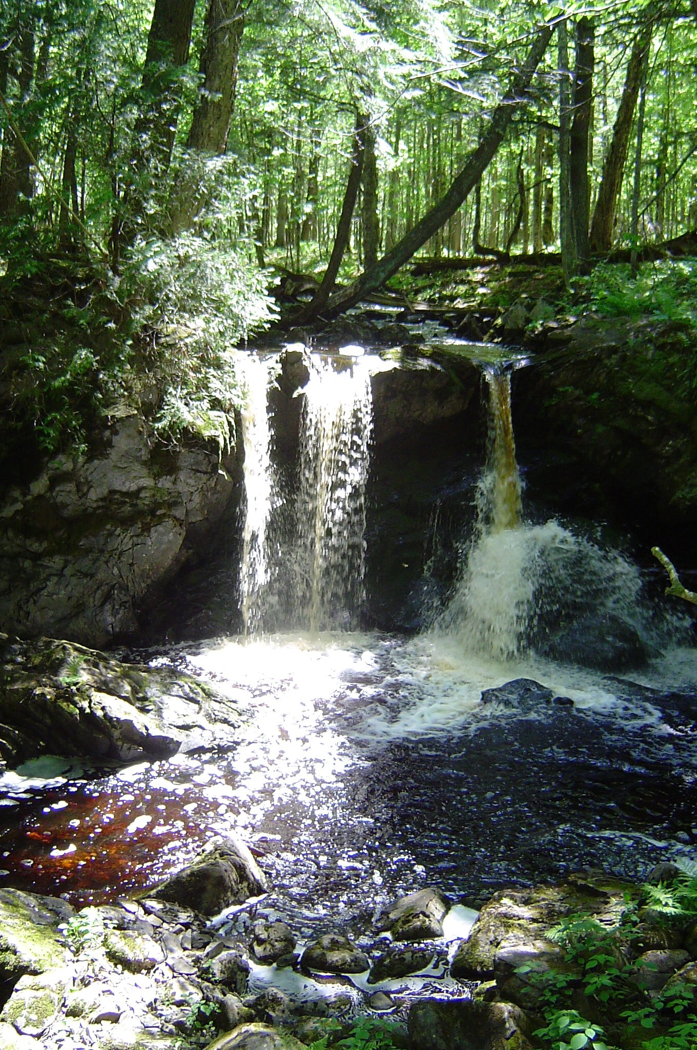
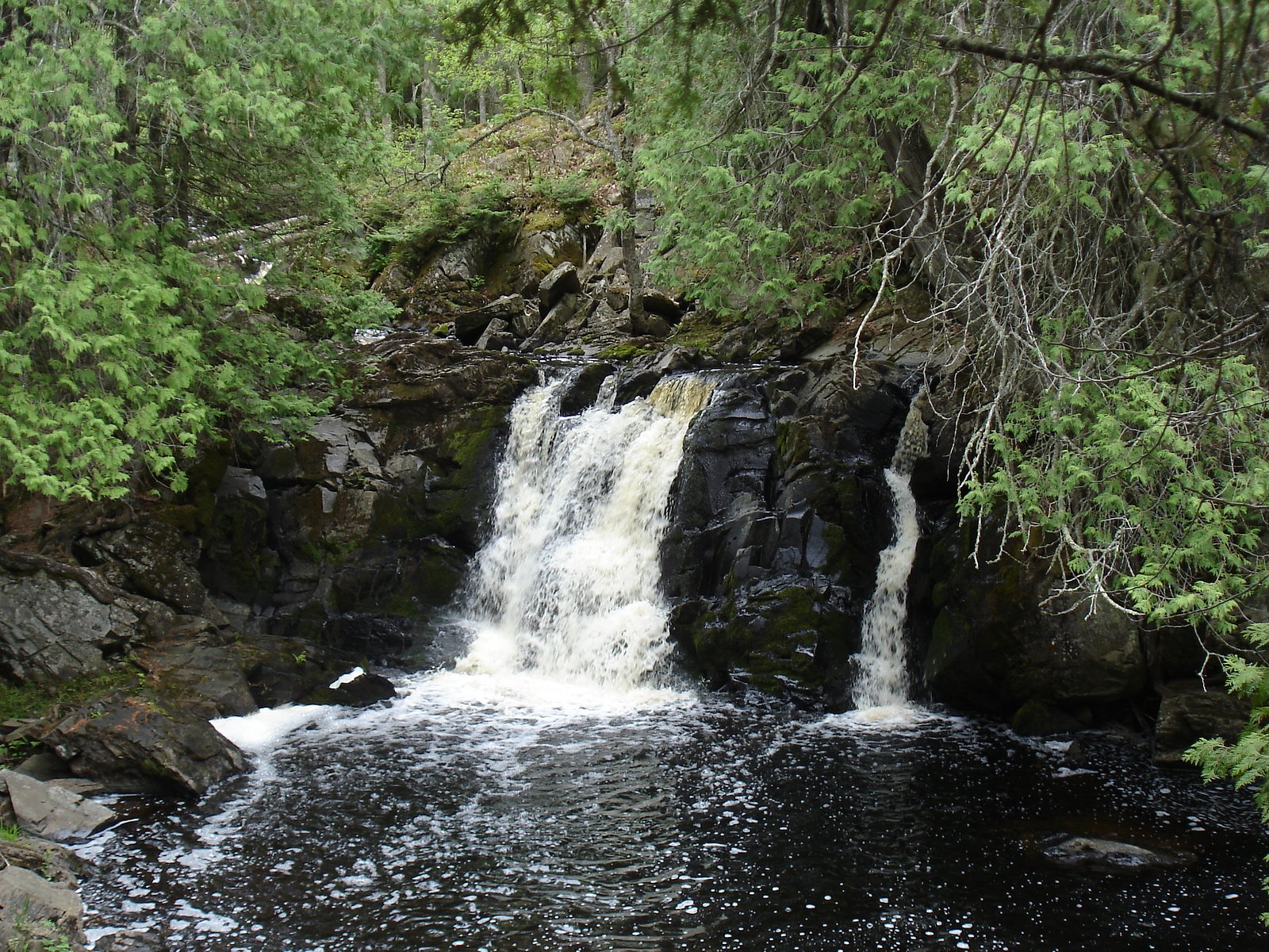
About Yondota Falls
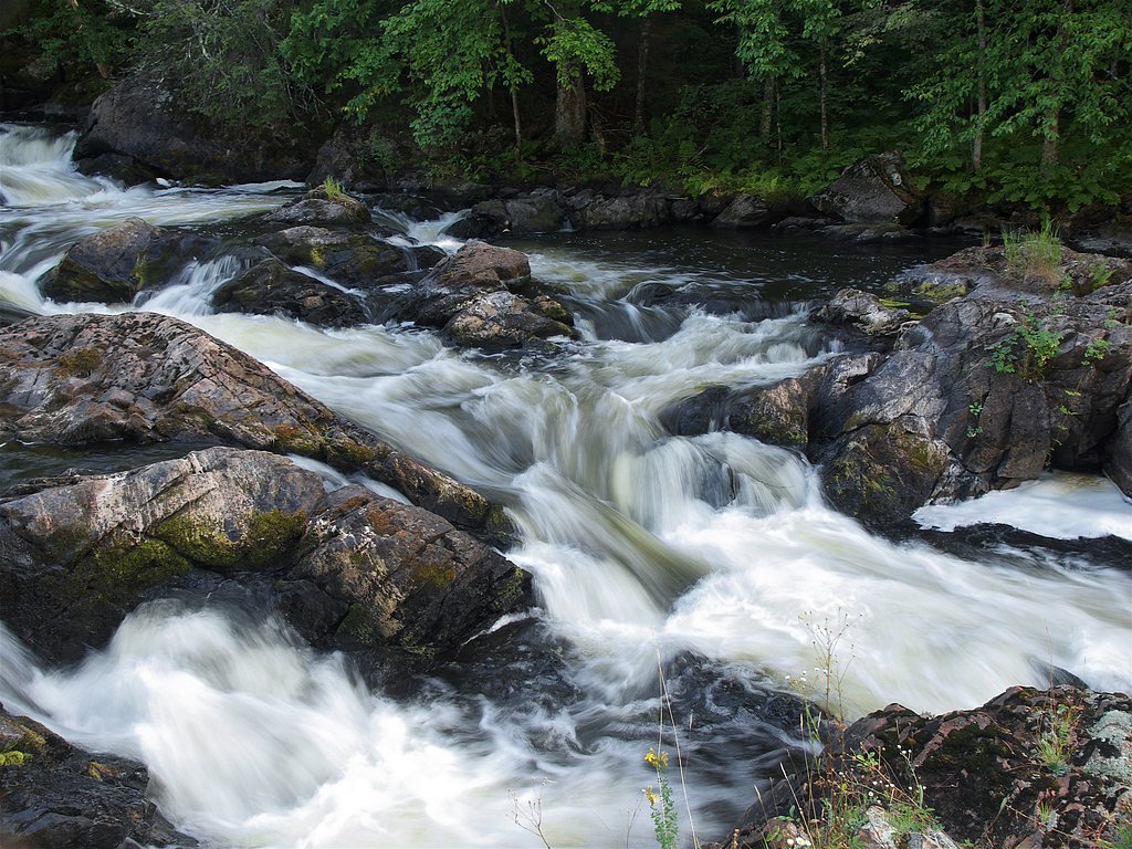
Yondota Falls is a picturesque waterfall located in the Ottawa National Forest in Michigan's Upper Peninsula. It is part of the Presque Isle River system and is known for its serene surroundings and cascading waters over rocky terrain.
The Setting
Yondota Falls sits at 1,483 feet within Ottawa National Forest, fed by the West Branch Ontonagon River, in the foothills of Michigan.
Trail & Hike Details
The Approach
The moderate hike follows Yondota Falls (#60065), a 2.4-mile out-and-back trail over natural surface. Expect 350 feet of elevation gain with grades of 8-10%. The trail is moderately developed (Class 2).
USFS Trail
YONDOTA FALLS #60065
Trail Class
Moderately Developed
Surface
Avg Grade
USFS Segment
0.33 miTrail Description
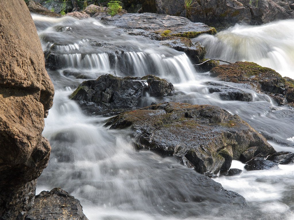
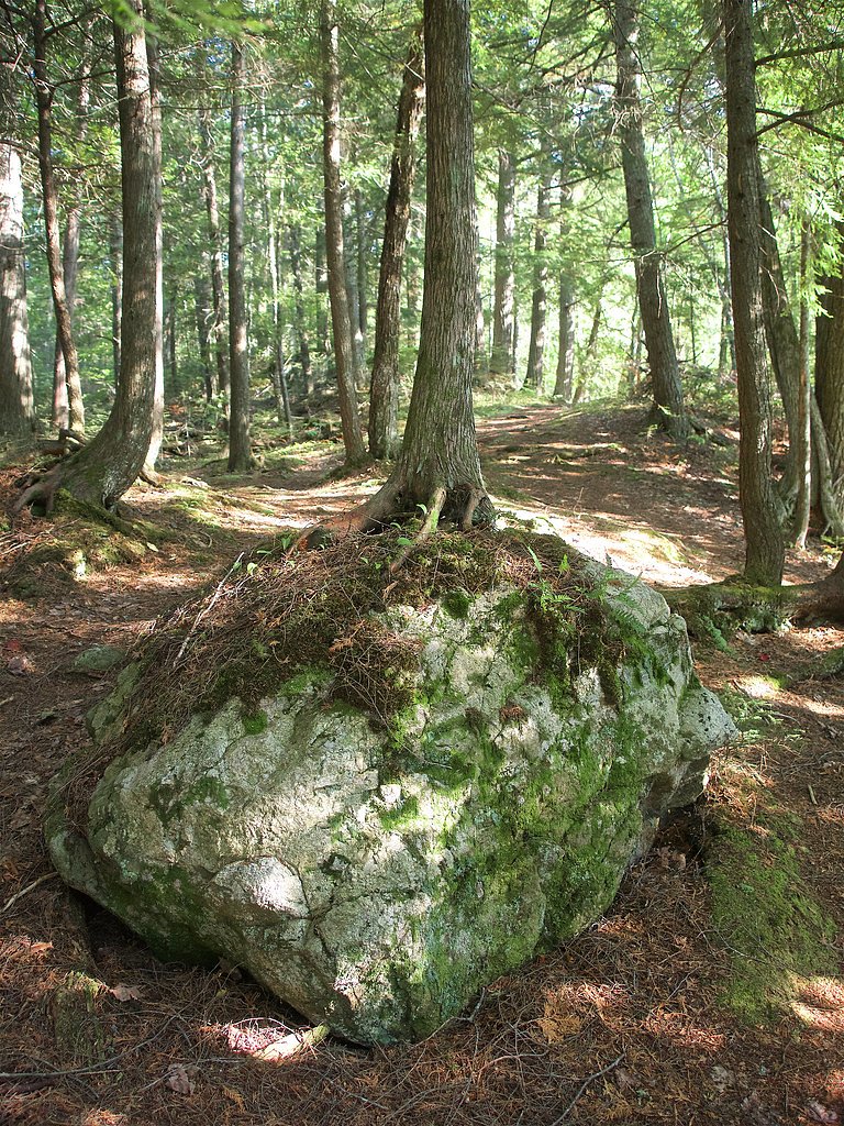
The trail to Yondota Falls is a short and easy walk through a forested area. The path is relatively flat and well-maintained, making it suitable for most visitors. The trail leads directly to the falls, where visitors can enjoy scenic views and the sound of rushing water.
What to Expect
Dogs are welcome.
Accessibility
The trail is not wheelchair accessible. Uneven terrain and elevation changes require steady footing.
Frequently Asked Questions
🐶 Are Dogs Allowed at Yondota Falls?
✅ Dogs are allowed
Are There Any Fees or Permits Required?
🆖 No fees required
🏊 Is There Swimming at Yondota Falls?
❌ Swimming is not allowed
When to Visit
Spring is the best time to visit Yondota Falls due to higher water flow, but summer and fall also offer beautiful scenery. Winter visits may be possible but could require additional preparation for snow and ice.
Seasonal Access
The best time to visit is Spring, Summer, and Fall. Winter access may be limited. Check with Ottawa National Forest for seasonal road closures.
Safety Information
Exercise caution near the falls as the rocks can be slippery. Be aware of changing weather conditions and avoid visiting during heavy rain or storms.
Current Water Conditions
75 ft³/s
Current discharge — how much water is flowing
About average for this time of year
Based on 83 years of record
1.90 ft
Water depth at gauge
7-Day Discharge Trend
What does this mean for your visit?
Flow is about average for this time of year.
About This Gauge
This gauge is on a nearby waterway and may not reflect exact conditions at the falls.
7-Day Flow Outlook
Based on the USGS gauge WEST BRANCH ONTONAGON RIVER NEAR BERGLAND, MI (21 km away).
Today
Roaring
75 cfs
9/10Tomorrow
Roaring
79 cfs
6/10Mon
Roaring
84 cfs
6/10Tue
Roaring
80 cfs
6/10Wed
Roaring
80 cfs
6/10Thu
Roaring
81 cfs
6/10Fri
Roaring
76 cfs
6/10Best window: Today — roaring flow, sunny (trip score 9/10).
Best time of year: this gauge typically runs highest from late March to early May, peaking in April.
How we calculate this
This is a transparent outlook, not a precise forecast. We take the waterfall's current flow strength (how it ranks against its historical normal for today, from the nearest USGS stream gauge), carry that ranking forward along the gauge's seasonal curve, and nudge it for forecast rain. Confidence is highest for the next day or two and falls further out. Always check official conditions and your own judgment before visiting — high flows can be dangerous.
Know when to go.
Get a free email alert when waterfalls near Marenisco hit peak flow. We only send when conditions are worth the trip — no weekly newsletters, no spam.
Weather Forecast
Location & Access
Getting There
Yondota Falls is located near Marenisco, Michigan, in the Ottawa National Forest. It can be accessed via a short drive from US-2, followed by a gravel road leading to the trailhead.
Get Directions on Google MapsParking
There is a small parking area near the trailhead, but it may be limited in size.
Elevation
1,483 feet above sea level
Coordinates
46.430200° N, -89.684081° W
Land Management
Managed by USFS
Visitor Tips & Gear
Wear sturdy shoes as the trail may be muddy or slippery, especially after rain. Bring insect repellent during the summer months to protect against mosquitoes. Consider visiting in the spring when water flow is typically at its peak.
As an Amazon Associate, we earn from qualifying purchases.
With 2.4 miles and 350 ft of elevation gain, sturdy boots and trekking poles will help on this moderate trail. Sun exposure on the trail makes good sun protection a must in summer.

Polarized Sunglasses (Knockaround)
Cuts glare off the water so you actually see the falls — and your photos turn out better too.

Columbia Watertight II Rain Jacket
Packs into its own pocket, seam-sealed, and keeps you dry from spray and surprise rain.

Earth Pak Waterproof Dry Bag
Keeps your phone and gear dry when waterfall mist soaks everything else.

Waterproof Phone Pouch (AiRunTech)
Cheap insurance — take photos right next to the falls without killing your phone.

Timberland Euro Sprint Mid Waterproof
Trusted waterproof boot with premium leather and grippy rubber sole — reliable on rocky, wet trails.

TrailBuddy Trekking Poles
Lightweight aluminum, cork grips, and flip-locks that actually hold — a best-seller for good reason.
Where to Stay

Quality Inn Ironwood

Boulder Bear Motor Lodge

Great Northern Hotel

North Ironwood Acres - Black River Lodge
Browse vacation cabins and private rentals nearby
Unique outdoor stays — tents, yurts, and treehouses
Rent a campervan or RV for your waterfall road trip
Some links are affiliate links. We may earn a commission at no extra cost to you.
Nearby Campground
Bessemer Ranger District
3 miles away · 0 sites
Bessemer Ranger District has a variety of traditional lands, fisheries, and timber programs with new challenges in wildlife partnerships, in recreation (Region 9's only Harbor) and with management of our Wild and Scenic Rivers, and Scenic Byway. The district has an excellent reputation for being team participants at both the district and Forest levels.There is something for everyone with 32 waterfalls; 1200 miles of rivers and streams; over 1,100 lakes; and 30 miles of Lake Superior shoreline jus
Book on Recreation.govAdditional Information
Nearby Attractions
Other nearby waterfalls in the Ottawa National Forest include Agate Falls and Bond Falls. The Porcupine Mountains Wilderness State Park is also within driving distance.
Wildlife
The area is home to a variety of wildlife, including deer, birds, and small mammals. Visitors should be cautious of ticks and other insects.
Cities near Yondota Falls
Nearby Waterfalls

Writing about Yondota Falls? Embed this waterfall on your site for free.