Wildwood Falls
By Armen Suny · Last verified Sep 2026
3D terrain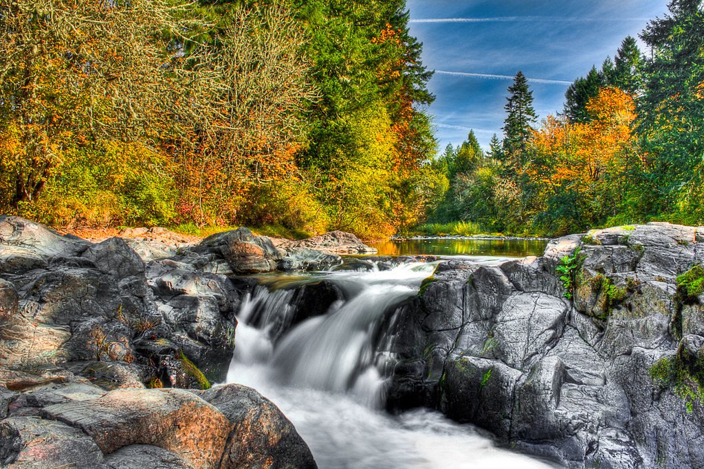
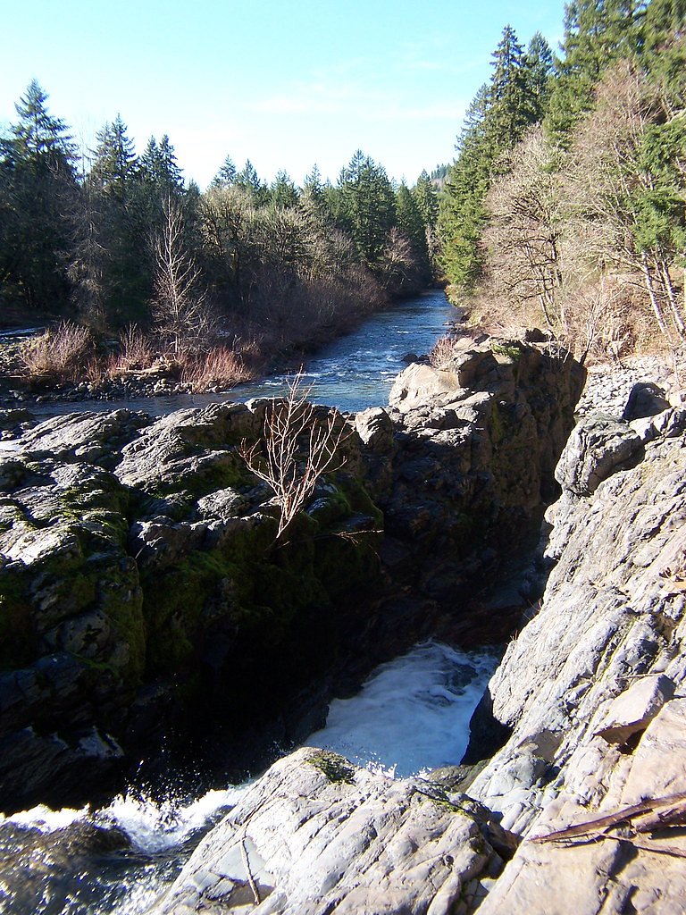
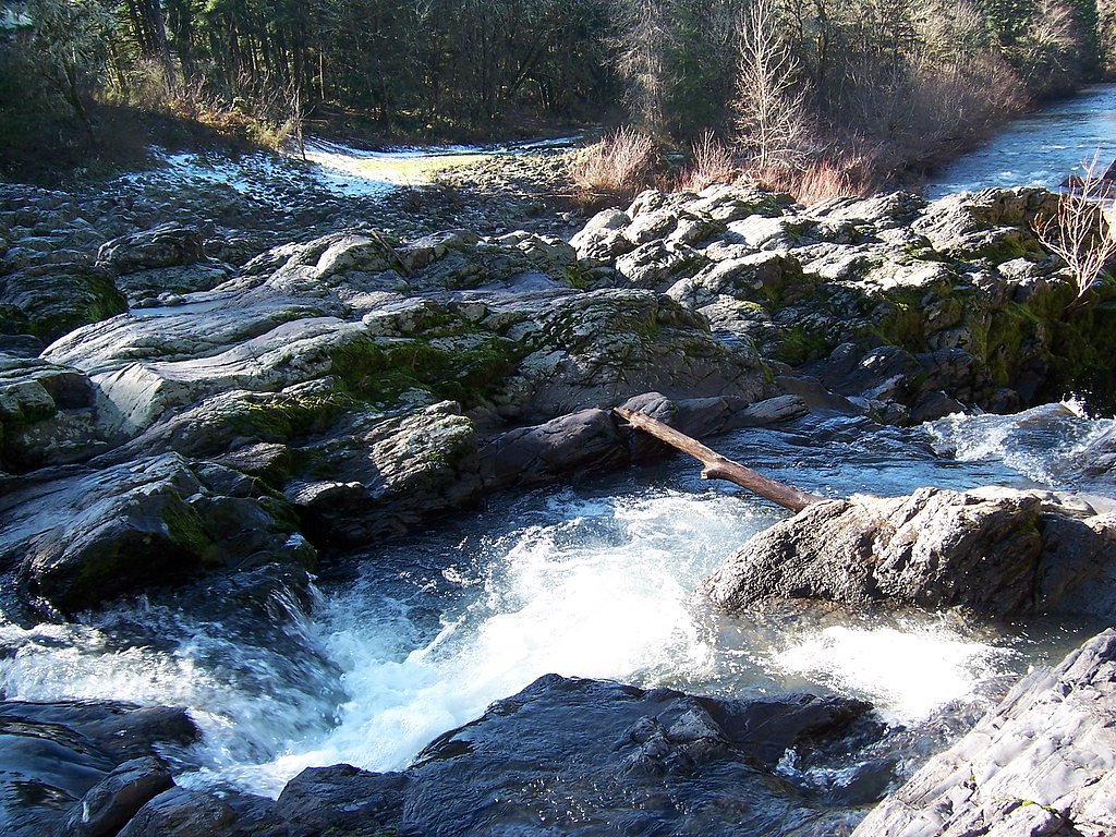
Photo Credits (5)
Difficulty
Easy
Trail Length
0.1 miles
Trail Type
Out And Back
About Wildwood Falls
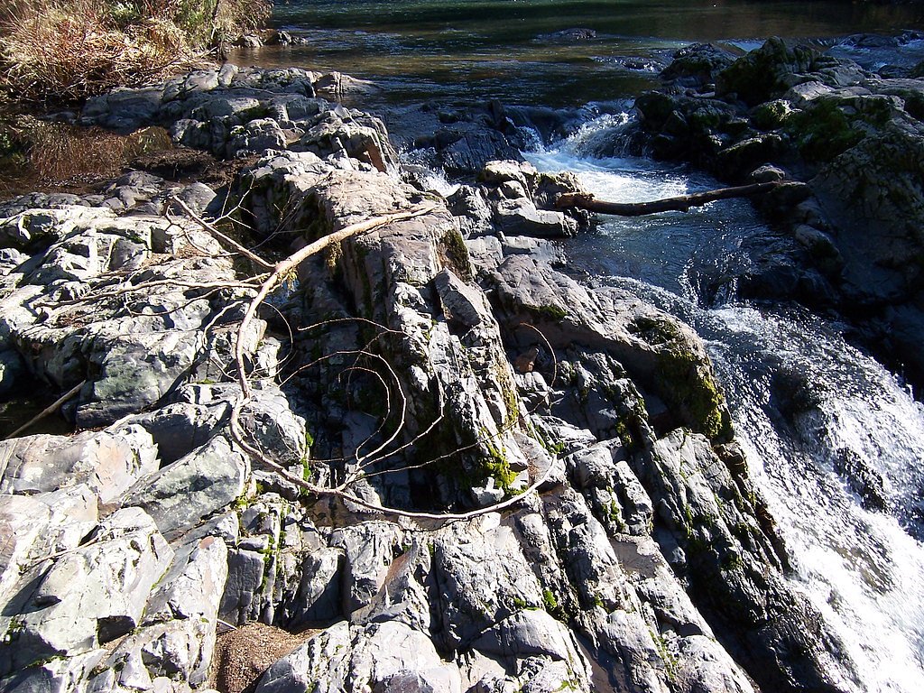
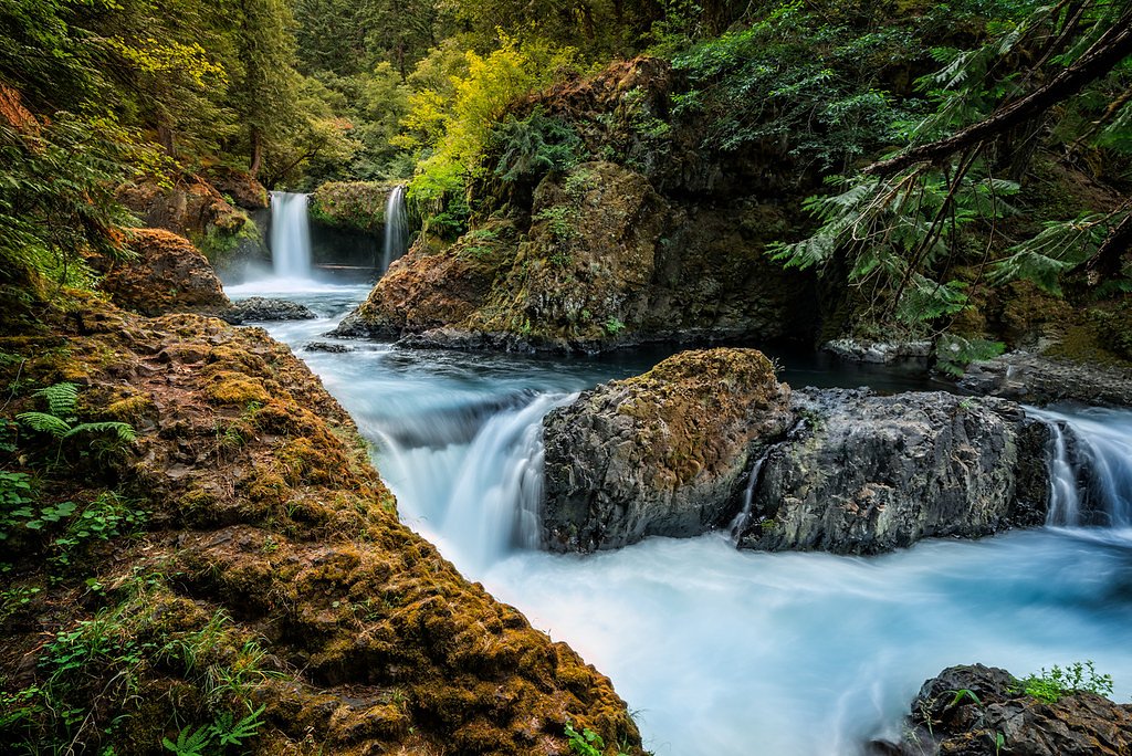
Wildwood Falls (also called Row River Falls and shown on Google Earth as Lassels D Stewart County Park) tumbles through a scenic slot in Lane County, Oregon, within the county-managed Wildwood Falls Park. The cascade drops into a deep pool framed by rocky outcrops and forest, making it a favorite half-day outing for locals and visitors. Note that a day or annual pass is required (see Lanecounty.org), and you shouldn’t expect reliable cell service at the site. Access is straightforward from the Wildwood Falls Park parking area, and the setting is well suited to photographers and casual hikers looking for a rewarding waterfall destination. If you’re planning to camp nearby, RUJADA DAY USE PICNIC AREA lies about 6.19 km away and is the closest option for an overnight or extended visit.
The Setting
Wildwood Falls sits at 1,004 feet within Wildwood Falls Park, fed by the Row River, in the foothills of Oregon.
Nearby Falls Worth Visiting
Lower Trestle Creek Falls (60 ft) lies 8.8 miles to the east. Also nearby: Upper Trestle Creek Falls (60 ft, 9.0 mi).
Trail & Hike Details
Trail Description
The trail to Wildwood Falls is a 2.4-mile out-and-back route with approximately 350 feet of elevation gain and is rated moderate in difficulty. The route starts at the Wildwood Falls Park parking area and leads hikers through forested terrain to viewpoints of the cascade; allow time for short stops and photographs. Remember a day or annual pass is required at this county-managed site, and cell service is unreliable in the area.
What to Expect
Swimming is permitted. Dogs are welcome.
Accessibility
The trail is short and relatively flat, but the surface may be uneven. Contact the managing agency for accessibility details.
Frequently Asked Questions
🐶 Are Dogs Allowed at Wildwood Falls?
✅ Dogs are allowed
Are There Any Fees or Permits Required?
🆖 No fees required
🏊 Is There Swimming at Wildwood Falls?
✅ Swimming is allowed
When to Visit
The best time to visit is during spring and early summer when water flow is at its peak, but the falls are also enjoyable in the fall when the surrounding foliage changes color.
Seasonal Access
The best time to visit is Spring, Summer, and Fall. Winter access may be limited.
Safety Information
Rocks near the falls can be slippery, and the water may have strong currents. Always supervise children and avoid climbing on wet rocks. Be aware of potential flash flooding during heavy rains.
Current Water Conditions
39 ft³/s
Current discharge — how much water is flowing
About average for this time of year
Based on 90 years of record
2.10 ft
Water depth at gauge
60°F
ColdBracing — limit time in water
7-Day Discharge Trend
What does this mean for your visit?
Flow is about average for this time of year. Water temperature is a bracing 60 degrees F, limit your time in the water.
About This Gauge
7-Day Flow Outlook
Based on the USGS gauge ROW RIVER ABOVE PITCHER CREEK, NEAR DORENA, OR (6 km away).
Today
Strong
41 cfs
10/10Tomorrow
Strong
41 cfs
10/10Tue
Strong
42 cfs
10/10Wed
Strong
44 cfs
10/10Thu
Strong
45 cfs
10/10Fri
Strong
42 cfs
10/10Sat
Strong
45 cfs
10/10Best window: Today — strong flow, sunny (trip score 10/10).
Best time of year: this gauge typically runs highest from early March to late April, peaking in February.
How we calculate this
This is a transparent outlook, not a precise forecast. We take the waterfall's current flow strength (how it ranks against its historical normal for today, from the nearest USGS stream gauge), carry that ranking forward along the gauge's seasonal curve, and nudge it for forecast rain. Confidence is highest for the next day or two and falls further out. Always check official conditions and your own judgment before visiting — high flows can be dangerous.
Know when to go.
Get a free email alert when waterfalls near Dexter hit peak flow. We only send when conditions are worth the trip — no weekly newsletters, no spam.
Weather Forecast
The Terrain Around Wildwood Falls
High-resolution lidar hasn't been flown here yet, so this is the aerial view of the ground around the falls. Open the 3D view to tilt and spin the landscape.
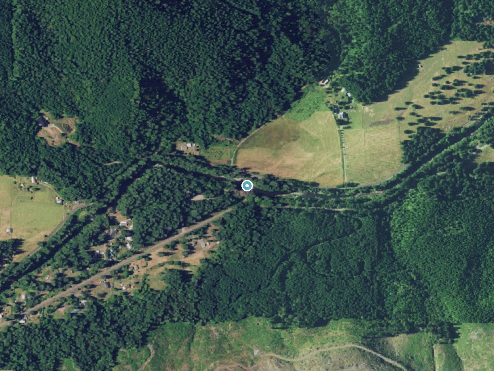
The dot marks the waterfall. The frame is about a mile across.
Aerial imagery: USGS The National Map. Public domain.
Location & Access
Getting There
Wildwood Falls is located approximately 25 miles southeast of Cottage Grove, Oregon, along the Row River. From Cottage Grove, take Row River Road east, then turn onto Shoreview Drive to reach the falls.
Get Directions on Google MapsParking
There is a small parking area near the falls, but it may fill up quickly during peak times.
Elevation
1,004 feet above sea level
Coordinates
43.699845° N, -122.818954° W
Land Management
Managed by CNTY
Visitor Tips & Gear
Arrive early during summer weekends to secure parking. Be cautious around the rocks near the falls, as they can be slippery. Bring water and sunscreen if visiting during warmer months.
Where to Stay
Cascade Motel

Comfort Inn & Suites Creswell
Oakridge Inn & Suites
Westfir Lodge & Mountain Market
Browse vacation cabins and private rentals nearby
Unique outdoor stays — tents, yurts, and treehouses
Rent a campervan or RV for your waterfall road trip
Some links are affiliate links. We may earn a commission at no extra cost to you.
Nearby Campground
RUJADA DAY USE PICNIC AREA
3.8 miles away · 2 sites
Overview Rujada Day Use Picnic Area is set along the banks of Layng Creek, with a large, open grassy area amidst a scattering of Douglas fir. Rujada is a perfect setting for family reunions, parties or group getaways.Recreation In addition to being a prime location for hiking and biking in summer and early fall. The large grassy field is perfect for group activities or sports, and a playground and horseshoe pit are also provided on-site. Hikers will enjoy a moderately challenging hike on Swordfer
Book on Recreation.govNearby Hot Springs
Hot springs near Springfield, Oregon
Kitson Hot Springs
Kitson Hot Springs flows at 109°F within Willamette National Forest at 1,664 feet elevation, positioned just 17 meters from For...

Mccredie Springs
McCredie Springs flows at 163°F along Salt Creek in the Willamette National Forest, creating one of western Oregon's most popul...
Wall Creek Warm Springs
Wall Creek Warm Springs flows at 106°F deep within Willamette National Forest at 2,362 feet elevation on the western Cascades s...

Umpqua Hot Springs
Umpqua Hot Springs flows at 117°F from multiple geothermal sources along the North Umpqua River in Lane County, forming cascadi...

Cougar Reservoir Hot Springs
Cougar Reservoir Hot Springs, widely known as Terwilliger Hot Springs, flows at 111 degrees Fahrenheit with roadside access req...
Foley Springs
Foley Springs emerges at 178°F in the Cascade Range of Lane County, making it one of Oregon's hottest thermal features with rec...
Looking for a soak after your hike? Explore more hot springs near Springfield, Oregon on SoakingSprings.
Explore Oregon springsAdditional Information
Nearby Attractions
Dorena Lake, Cottage Grove Covered Bridges, Brice Creek Trail
Wildlife
The area is home to various bird species, deer, and other small wildlife.
Cities near Wildwood Falls
Nearby Waterfalls

Writing about Wildwood Falls? Embed this waterfall on your site for free.