Smith Falls
By Armen Suny · Last verified Mar 2026
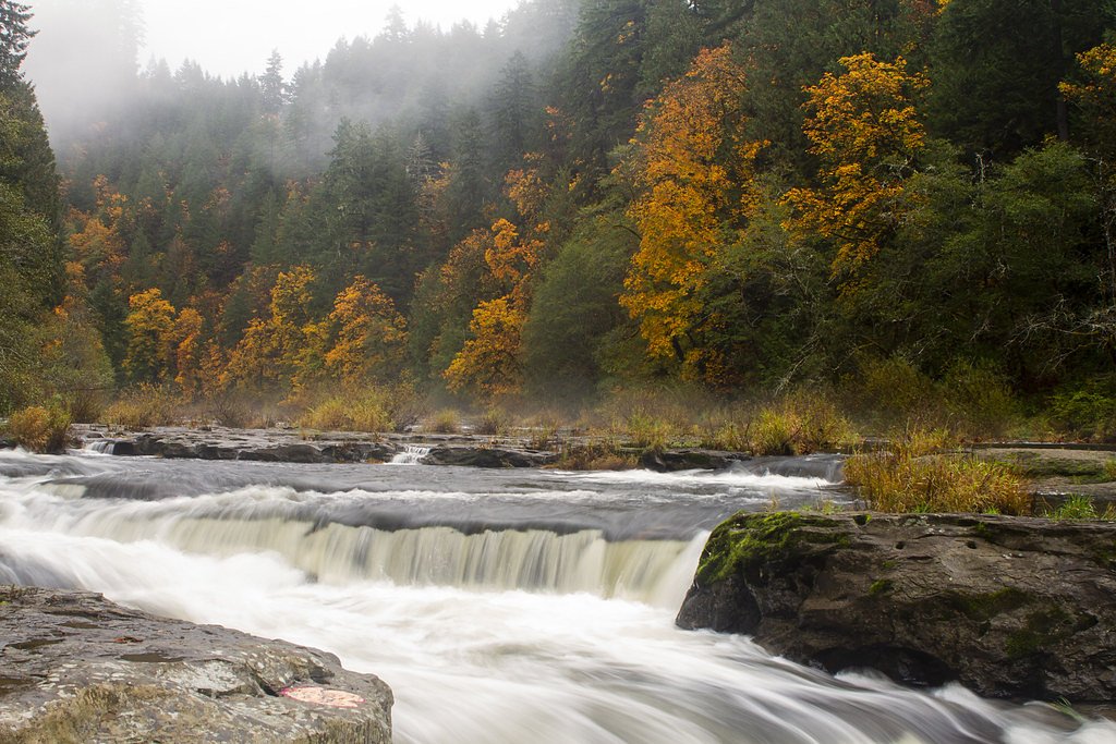
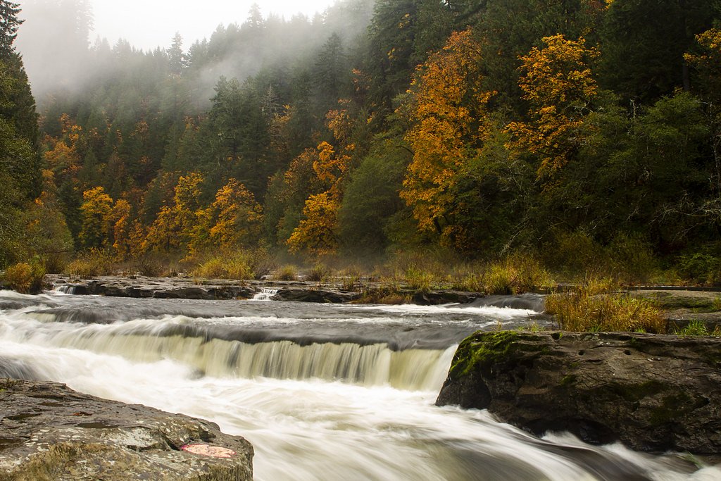
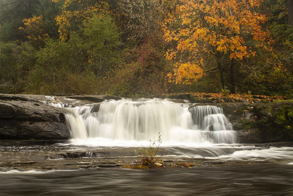
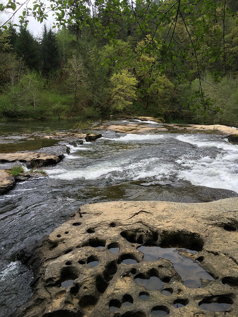
Photo Credits (5)
Difficulty
Moderate
Trail Length
2.4 miles
Trail Type
Out And Back
Elevation Gain
350 ft
About Smith Falls
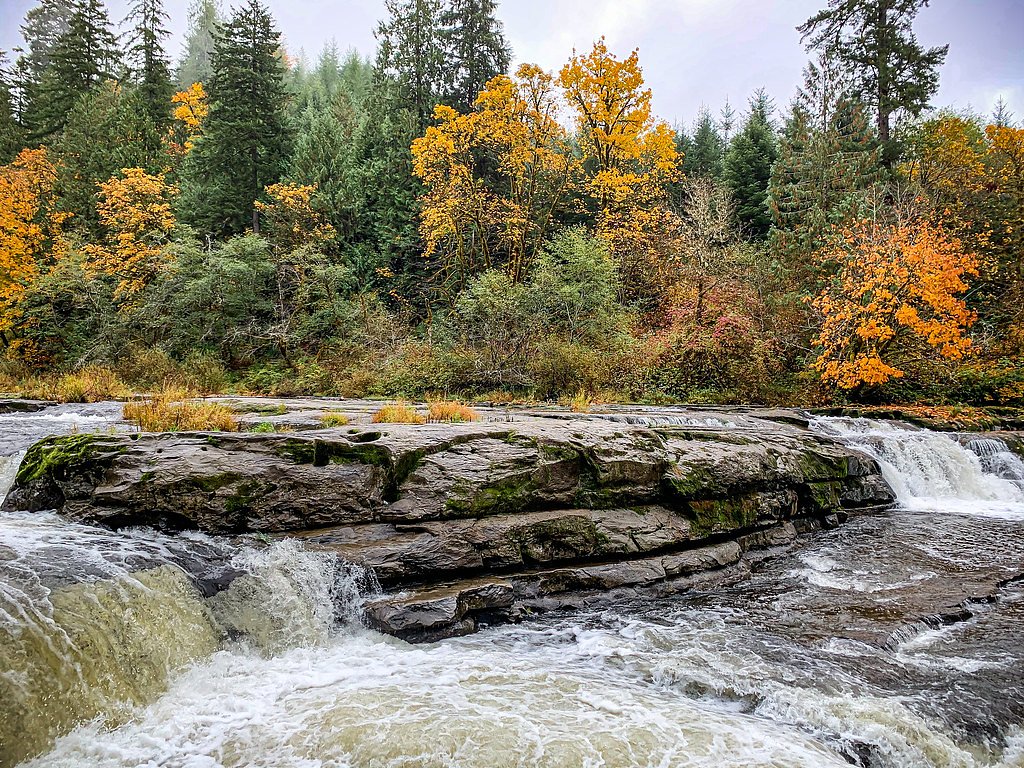
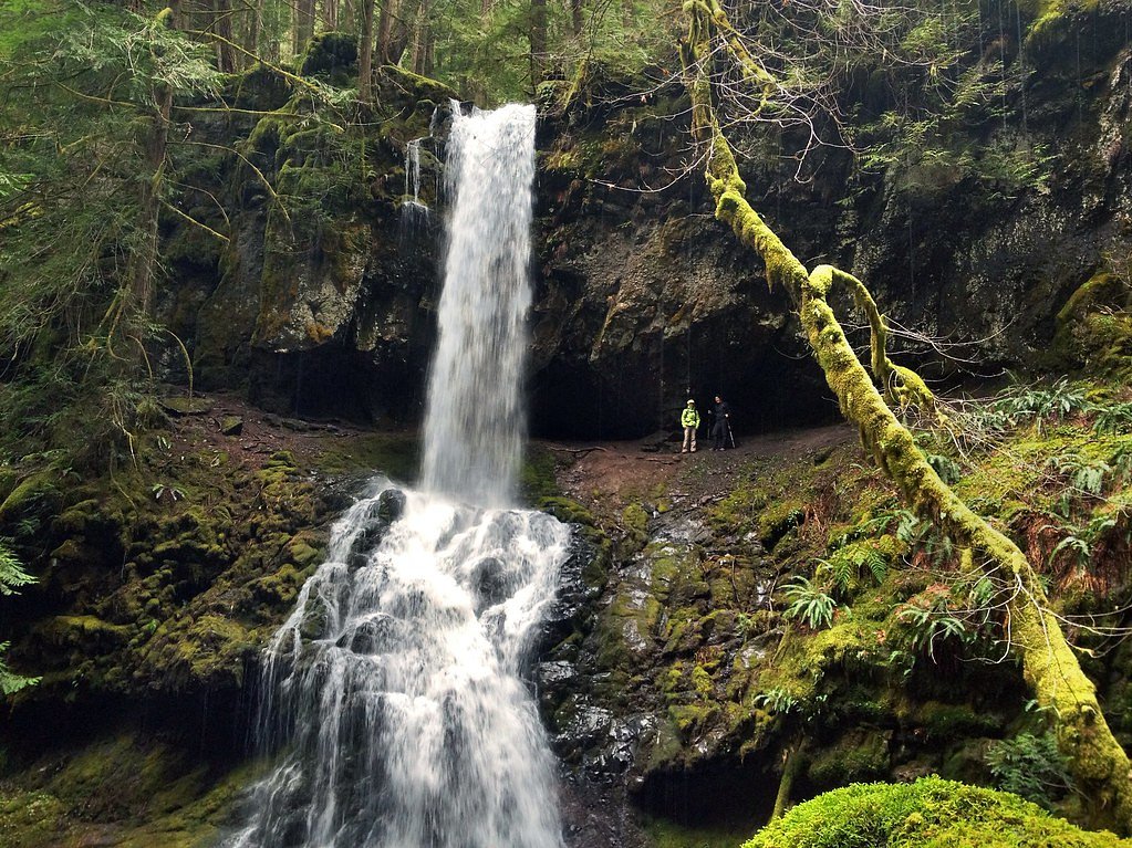
Smith Falls is a tucked-away waterfall in Oregon’s Umpqua National Forest, managed by the U.S. Forest Service. The falls reward a short but satisfying hike with a quiet cascade framed by dense, green forest—an inviting escape from busier spots and a great choice for hikers who appreciate a peaceful, natural setting. Access to the area is managed by the USFS, and the route includes a named Forest Service segment (4WD SULTANA WAY, Trail #1405A). The hike to Smith Falls is a moderate out-and-back of about 2.4 miles round-trip with roughly 350 feet of elevation gain, so you’ll climb through native forest tread and reach the viewpoint without a long drive from the trailhead. The USFS-maintained Sultana Way section is a short (0.24-mile) native-surface connector with a typical grade of 12–20% and is listed as Class 3 on USFS maps, so expect some steep pitches and natural footing. The nearest developed day-use/picnic area (Rujada Day Use Picnic Area) is roughly 13 km away, so plan accordingly for supplies and parking.
The Setting
Smith Falls sits at 2,651 feet within Umpqua National Forest, fed by the Mf Willamette River Abv Salt Crk,, in the hills of Oregon.
Nearby Falls Worth Visiting
Upper Trestle Creek Falls (60 ft) lies 2.5 miles to the north. Also nearby: Lower Trestle Creek Falls (60 ft, 2.3 mi).
Trail & Hike Details
The Approach
The moderate hike follows 4 Wd Sultana Way (#1405A), a 2.4-mile out-and-back trail over natural surface. Expect 350 feet of elevation gain with grades of 12-20%. The trail is developed (Class 3).
USFS Trail
4WD SULTANA WAY #1405A
Trail Class
Developed
Surface
Avg Grade
USFS Segment
0.24 miTrail Description
Length: 2.4 miles (out-and-back). Elevation gain: ~350 ft. Difficulty: Moderate. Trail type: Out-and-back. Surface: mostly native material; expect natural dirt tread, roots, and some rocks. USFS access: 4WD SULTANA WAY (Trail #1405A) — GIS length 0.24 miles, Class: 3, Typical grade: 12–20%. Trail notes: short but moderately steep sections on natural surface; suitable footwear recommended and be prepared for uneven tread and brief steeper pitches on the Class 3 segment.
What to Expect
Expect a tranquil natural setting with a beautiful waterfall surrounded by forested areas. The trail may be less maintained due to its lesser-known status.
Accessibility
The trail is not wheelchair accessible. Uneven terrain and elevation changes require steady footing.
Frequently Asked Questions
🐶 Are Dogs Allowed at Smith Falls?
❌ Dogs are not allowed
Are There Any Fees or Permits Required?
🆖 No fees required
🏊 Is There Swimming at Smith Falls?
❌ Swimming is not allowed
When to Visit
Spring and early summer are typically the best times to visit, as the waterfall may have higher flow due to seasonal rainfall.
Seasonal Access
The best time to visit is Spring, Summer, and Fall. Winter access may be limited. Check with Umpqua National Forest for seasonal road closures.
Safety Information
Trail conditions may be uneven or slippery, especially after rain. Visitors should exercise caution and avoid visiting during inclement weather.
Current Water Conditions
551 ft³/s
Current discharge — how much water is flowing
Much lower than usual for this time of year
2.88 ft
Water depth at gauge
53°F
ColdBracing — limit time in water
7-Day Discharge Trend
What does this mean for your visit?
Flow is well below normal for this time of year, so the waterfall may be a trickle. Water temperature is a bracing 53 degrees F, limit your time in the water.
About This Gauge
This gauge is on a nearby waterway and may not reflect exact conditions at the falls.
7-Day Flow Outlook
Based on the USGS gauge MF WILLAMETTE RIVER ABV SALT CRK, NEAR OAKRIDGE,OR (20 km away).
Today
Barely Flowing
595 cfs
3/10Tomorrow
Barely Flowing
561 cfs
4/10Tue
Barely Flowing
522 cfs
5/10Wed
Barely Flowing
498 cfs
5/10Thu
Barely Flowing
532 cfs
3/10Fri
Barely Flowing
512 cfs
5/10Sat
Barely Flowing
476 cfs
5/10Best window: Tue — barely flowing flow, mostly sunny (trip score 5/10).
Best time of year: this gauge typically runs highest from mid November to late December, peaking in January.
How we calculate this
This is a transparent outlook, not a precise forecast. We take the waterfall's current flow strength (how it ranks against its historical normal for today, from the nearest USGS stream gauge), carry that ranking forward along the gauge's seasonal curve, and nudge it for forecast rain. Confidence is highest for the next day or two and falls further out. Always check official conditions and your own judgment before visiting — high flows can be dangerous.
Know when to go.
Get a free email alert when waterfalls near Westfir hit peak flow. We only send when conditions are worth the trip — no weekly newsletters, no spam.
Weather Forecast
Location & Access
Getting There
Smith Falls is located in Oregon, but specific directions and access details are not widely documented. Visitors are encouraged to consult local maps or guides for precise information.
Get Directions on Google MapsParking
Parking availability is unclear, but visitors should prepare for limited or primitive parking options near the trailhead.
Elevation
2,651 feet above sea level
Coordinates
43.616225° N, -122.640810° W
Land Management
Managed by USFS
Visitor Tips & Gear
Bring a map or GPS device as the trail may not be well-marked. Wear sturdy footwear and be prepared for uneven terrain.
As an Amazon Associate, we earn from qualifying purchases.
With 2.4 miles and 350 ft of elevation gain, sturdy boots and trekking poles will help on this moderate trail. Sun exposure on the trail makes good sun protection a must in summer.

Polarized Sunglasses (Knockaround)
Cuts glare off the water so you actually see the falls — and your photos turn out better too.

Columbia Watertight II Rain Jacket
Packs into its own pocket, seam-sealed, and keeps you dry from spray and surprise rain.

Earth Pak Waterproof Dry Bag
Keeps your phone and gear dry when waterfall mist soaks everything else.

Waterproof Phone Pouch (AiRunTech)
Cheap insurance — take photos right next to the falls without killing your phone.

Timberland Euro Sprint Mid Waterproof
Trusted waterproof boot with premium leather and grippy rubber sole — reliable on rocky, wet trails.

TrailBuddy Trekking Poles
Lightweight aluminum, cork grips, and flip-locks that actually hold — a best-seller for good reason.
Where to Stay

Cascade Motel

Oakridge Inn & Suites

Shelter Cove Resort & Marina

Comfort Inn & Suites Creswell
Browse vacation cabins and private rentals nearby
Unique outdoor stays — tents, yurts, and treehouses
Rent a campervan or RV for your waterfall road trip
Some links are affiliate links. We may earn a commission at no extra cost to you.
Nearby Campground
RUJADA DAY USE PICNIC AREA
8.1 miles away · 2 sites
Overview Rujada Day Use Picnic Area is set along the banks of Layng Creek, with a large, open grassy area amidst a scattering of Douglas fir. Rujada is a perfect setting for family reunions, parties or group getaways.Recreation In addition to being a prime location for hiking and biking in summer and early fall. The large grassy field is perfect for group activities or sports, and a playground and horseshoe pit are also provided on-site. Hikers will enjoy a moderately challenging hike on Swordfer
Book on Recreation.govNearby Hot Springs
Hot springs near Westfir, Oregon
Kitson Hot Springs
Kitson Hot Springs flows at 109°F within Willamette National Forest at 1,664 feet elevation, positioned just 17 meters from For...

Mccredie Springs
McCredie Springs flows at 163°F along Salt Creek in the Willamette National Forest, creating one of western Oregon's most popul...
Wall Creek Warm Springs
Wall Creek Warm Springs flows at 106°F deep within Willamette National Forest at 2,362 feet elevation on the western Cascades s...

Umpqua Hot Springs
Umpqua Hot Springs flows at 117°F from multiple geothermal sources along the North Umpqua River in Lane County, forming cascadi...

Cougar Reservoir Hot Springs
Cougar Reservoir Hot Springs, widely known as Terwilliger Hot Springs, flows at 111 degrees Fahrenheit with roadside access req...
Foley Springs
Foley Springs emerges at 178°F in the Cascade Range of Lane County, making it one of Oregon's hottest thermal features with rec...
Looking for a soak after your hike? Explore more hot springs near Westfir, Oregon on SoakingSprings.
Explore Oregon springsAdditional Information
Nearby Attractions
Other natural attractions in the area may include hiking trails and scenic viewpoints. Research local guides for more information.
Wildlife
The area may host a variety of wildlife, including birds and small mammals. Be cautious and respectful of the natural habitat.
Cities near Smith Falls
Nearby Waterfalls

Other waterfalls named Smith Falls
3 other waterfalls share this name across the U.S.
Writing about Smith Falls? Embed this waterfall on your site for free.