White River Falls
By Armen Suny · Last verified Mar 2026
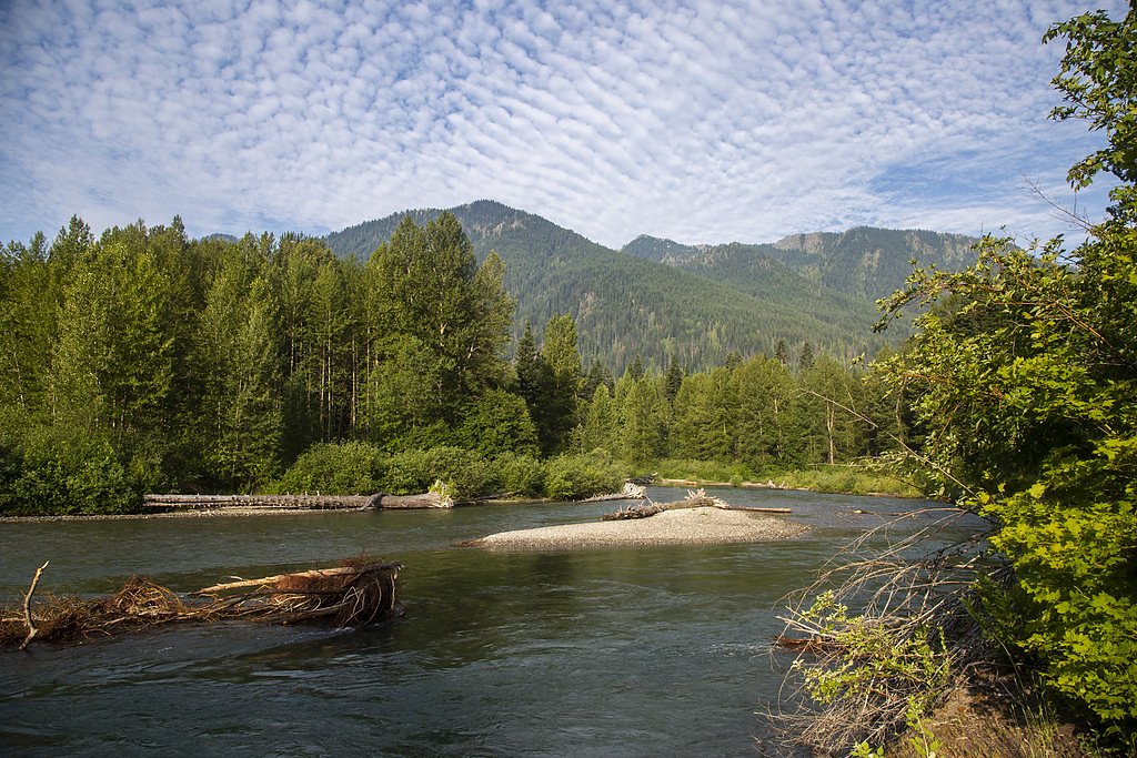
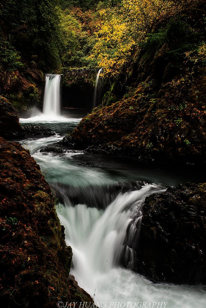
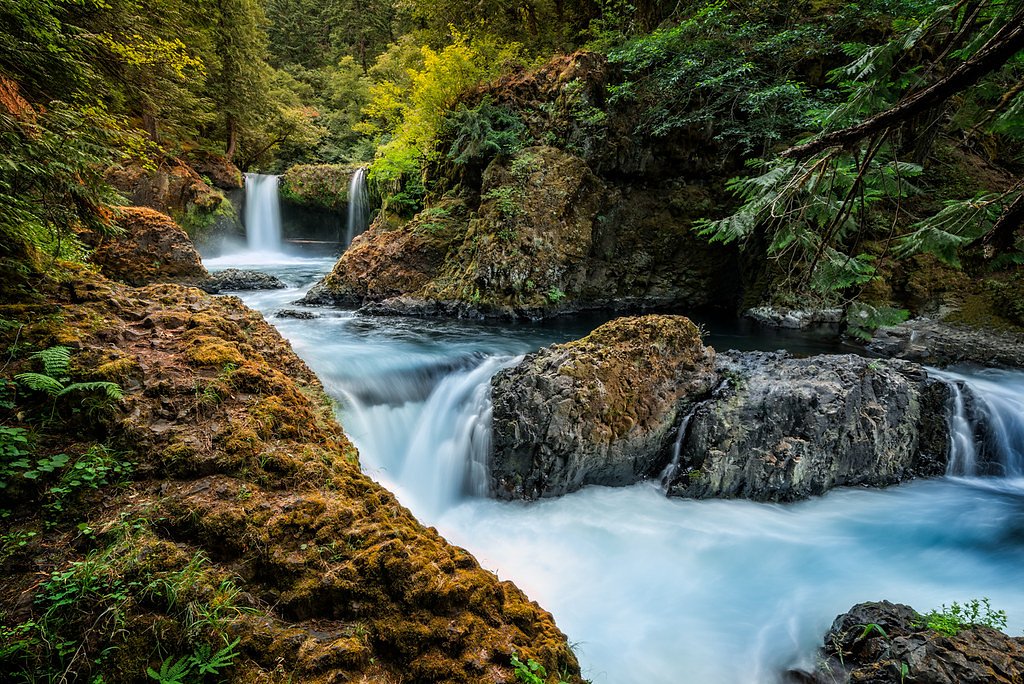
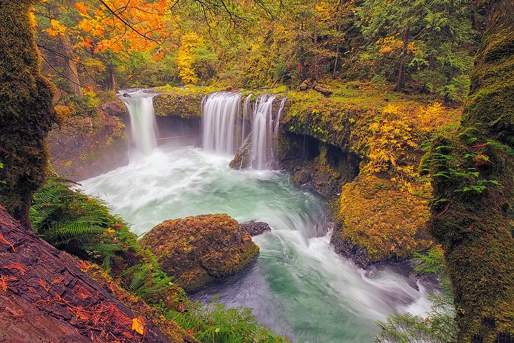

Photo Credits (5)
Difficulty
Moderate
Trail Length
2.4 miles
Trail Type
Out And Back
Elevation Gain
350 ft
About White River Falls
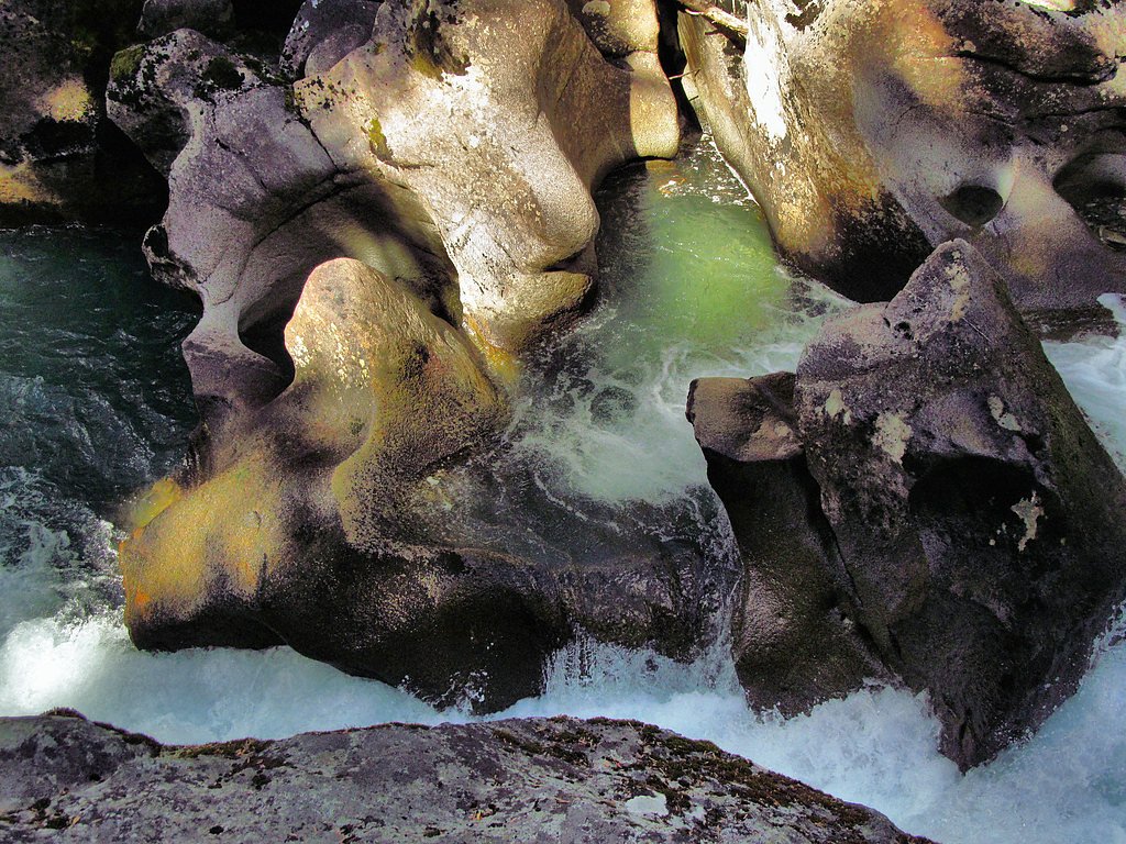
White River Falls is a scenic waterfall located in Washington, known for its cascading beauty and lush surroundings. It is part of the White River, which flows through the Cascade Mountains.
The Setting
White River Falls sits at 2,178 feet within Wenatchee National Forest, fed by the Chiwawa River, in the hills of Washington.
Trail & Hike Details
The Approach
The moderate hike follows White River (#1507), a 2.4-mile out-and-back trail over n/a. Expect 350 feet of elevation gain with grades of N/A.
USFS Trail
WHITE RIVER #1507
Trail Class
Class 0
Surface
Avg Grade
USFS Segment
13.91 miTrail Description
The trail to White River Falls may vary depending on the chosen route. It typically involves forested paths and may include uneven terrain. Visitors should prepare for potential changes in trail conditions due to weather or maintenance.
What to Expect
Visitors can expect a picturesque waterfall surrounded by dense forest and mountain scenery. The area is known for its tranquility and natural beauty.
Accessibility
The trail is not wheelchair accessible. Uneven terrain and elevation changes require steady footing.
Frequently Asked Questions
🐶 Are Dogs Allowed at White River Falls?
❌ Dogs are not allowed
Are There Any Fees or Permits Required?
🆖 No fees required
🏊 Is There Swimming at White River Falls?
❌ Swimming is not allowed
When to Visit
Spring and early summer are ideal for visiting, as the waterfall is typically at its fullest due to snowmelt.
Seasonal Access
The best time to visit is Spring, Summer, and Fall. Winter access may be limited. Check with Wenatchee National Forest for seasonal road closures.
Safety Information
Visitors should be cautious of slippery rocks, swift water currents, and changing weather conditions. Always stay on marked trails and avoid getting too close to the edge of the falls.
Current Water Conditions
Based on a USGS gauge 15.2 miles away
633 ft³/s
Current discharge — how much water is flowing
Lower than usual for this time of year
Based on 53 years of record
5.10 ft
Water depth at gauge
7-Day Discharge Trend
What does this mean for your visit?
Flow is lower than usual for this time of year.
About This Gauge
This gauge is on a regional waterway. Conditions at the falls may differ, especially after local rain.
7-Day Flow Outlook
Based on the USGS gauge CHIWAWA RIVER NEAR PLAIN, WA (24 km away).
Today
Low
667 cfs
4/10Tomorrow
Low
635 cfs
4/10Sat
Low
590 cfs
4/10Sun
Low
596 cfs
4/10Mon
Low
607 cfs
4/10Tue
Low
601 cfs
4/10Wed
Low
548 cfs
6/10Best window: Wed — low flow, mostly sunny (trip score 6/10).
Best time of year: this gauge typically runs highest from mid April to mid July, peaking in June.
How we calculate this
This is a transparent outlook, not a precise forecast. We take the waterfall's current flow strength (how it ranks against its historical normal for today, from the nearest USGS stream gauge), carry that ranking forward along the gauge's seasonal curve, and nudge it for forecast rain. Confidence is highest for the next day or two and falls further out. Always check official conditions and your own judgment before visiting — high flows can be dangerous.
Know when to go.
Get a free email alert when waterfalls near Leavenworth hit peak flow. We only send when conditions are worth the trip — no weekly newsletters, no spam.
Weather Forecast
Location & Access
Getting There
The waterfall is accessible via forest roads in the Cascade Mountains. Specific directions may vary depending on the trailhead used. Visitors are advised to check local maps and trail guides for the most accurate route.
Get Directions on Google MapsParking
Parking availability may vary depending on the trailhead. Some areas may have limited parking, so arriving early is recommended.
Elevation
2,178 feet above sea level
Coordinates
47.952341° N, -120.940932° W
Land Management
Managed by USFS
Visitor Tips & Gear
Check trail conditions before visiting, as weather and seasonal changes can impact accessibility. Bring appropriate footwear and gear for hiking.
As an Amazon Associate, we earn from qualifying purchases.
With 2.4 miles and 350 ft of elevation gain, sturdy boots and trekking poles will help on this moderate trail. Sun exposure on the trail makes good sun protection a must in summer.

Polarized Sunglasses (Knockaround)
Cuts glare off the water so you actually see the falls — and your photos turn out better too.

Columbia Watertight II Rain Jacket
Packs into its own pocket, seam-sealed, and keeps you dry from spray and surprise rain.

Earth Pak Waterproof Dry Bag
Keeps your phone and gear dry when waterfall mist soaks everything else.

Waterproof Phone Pouch (AiRunTech)
Cheap insurance — take photos right next to the falls without killing your phone.

Timberland Euro Sprint Mid Waterproof
Trusted waterproof boot with premium leather and grippy rubber sole — reliable on rocky, wet trails.

TrailBuddy Trekking Poles
Lightweight aluminum, cork grips, and flip-locks that actually hold — a best-seller for good reason.
Where to Stay

Maple Leaf Lodge by NW Comfy Cabins

Leavenworth Cabin w/ Private Hot Tub!

All About the Lake by NW Comfy Cabins

Sweet Retreat Cabin
Browse vacation cabins and private rentals nearby
Unique outdoor stays — tents, yurts, and treehouses
Rent a campervan or RV for your waterfall road trip
Some links are affiliate links. We may earn a commission at no extra cost to you.
Nearby Campground
Nineteenmile Campground
7 miles away · 0 sites
Located along the Chiwawa River, 22 miles from Lake Wenatchee, this campground offers river access.
Book on Recreation.govNearby Hot Springs
Hot springs near Leavenworth, Washington
Gamma Hot Springs
Gamma Hot Springs produces 140-degree water at 5,397 feet elevation in the Mt. Baker National Forest, emerging 104.6 degrees ab...
Kennedy Hot Spring
Kennedy Hot Spring flows at 100 degrees at 3,520 feet elevation in the Mt. Baker National Forest, emerging 58.7 degrees above a...
Garland Mineral Springs
Garland Mineral Springs flows at 84 degrees in the Snoqualmie National Forest, producing water 39.6 degrees above ambient tempe...
Scenic Hot Springs
Scenic Hot Springs delivers genuinely hot water at 122 degrees Fahrenheit at 2,246 feet elevation in the Cascade Mountains near...
Sulphur Creek Hot Springs
Sulphur Creek Hot Springs flows at 99 degrees Fahrenheit at 2,973 feet elevation in Mount Baker National Forest's remote backco...
Goldmeyer Hot Springs
Goldmeyer Hot Springs emerges at 127 degrees in the central Cascades, producing water 78.9 degrees above ambient temperature at...
Looking for a soak after your hike? Explore more hot springs near Leavenworth, Washington on SoakingSprings.
Explore Washington springsAdditional Information
Nearby Attractions
Nearby attractions may include other waterfalls, hiking trails, and scenic viewpoints in the Cascade Mountains.
Wildlife
The area is home to a variety of wildlife, including birds, deer, and small mammals. Visitors should be mindful of their surroundings.
Cities near White River Falls
Other waterfalls named White River Falls
1 other waterfall shares this name across the U.S.
Writing about White River Falls? Embed this waterfall on your site for free.