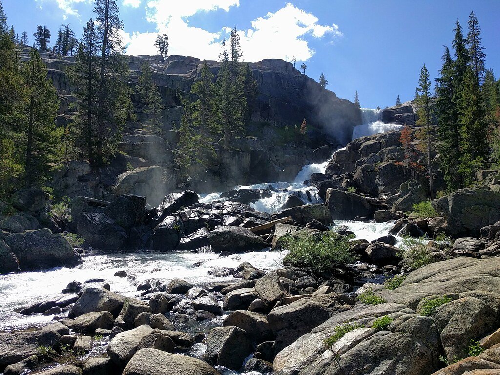
White Cascade
California • Yosemite National Park
By Armen Suny · Last verified Mar 2026
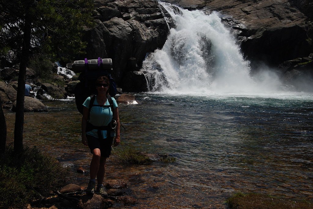
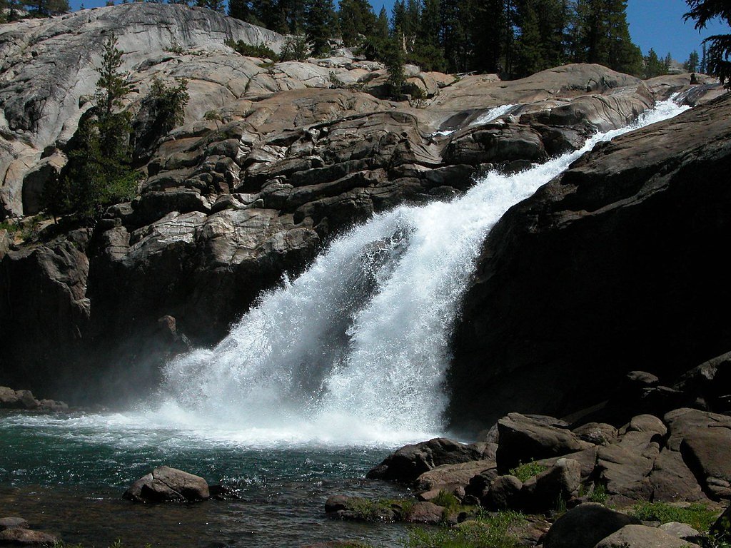
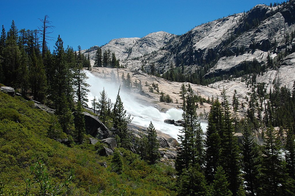
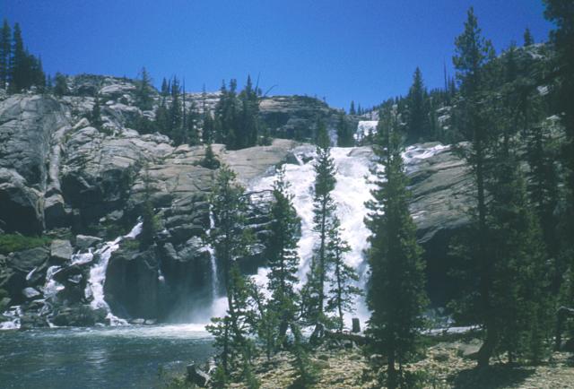
Photo Credits (5)
Difficulty
Moderate
Trail Length
11.0 miles
Trail Type
Out And Back
Elevation Gain
800 ft
About White Cascade
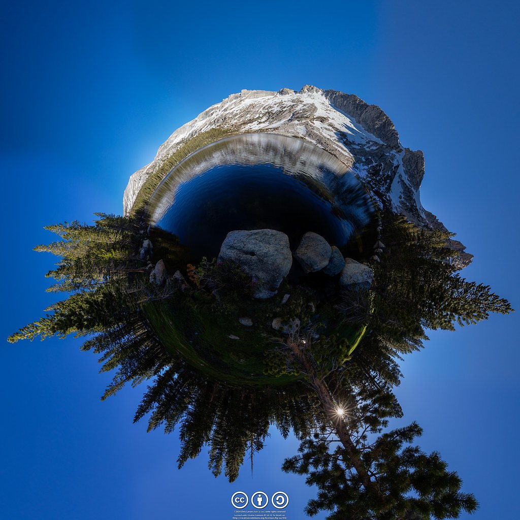
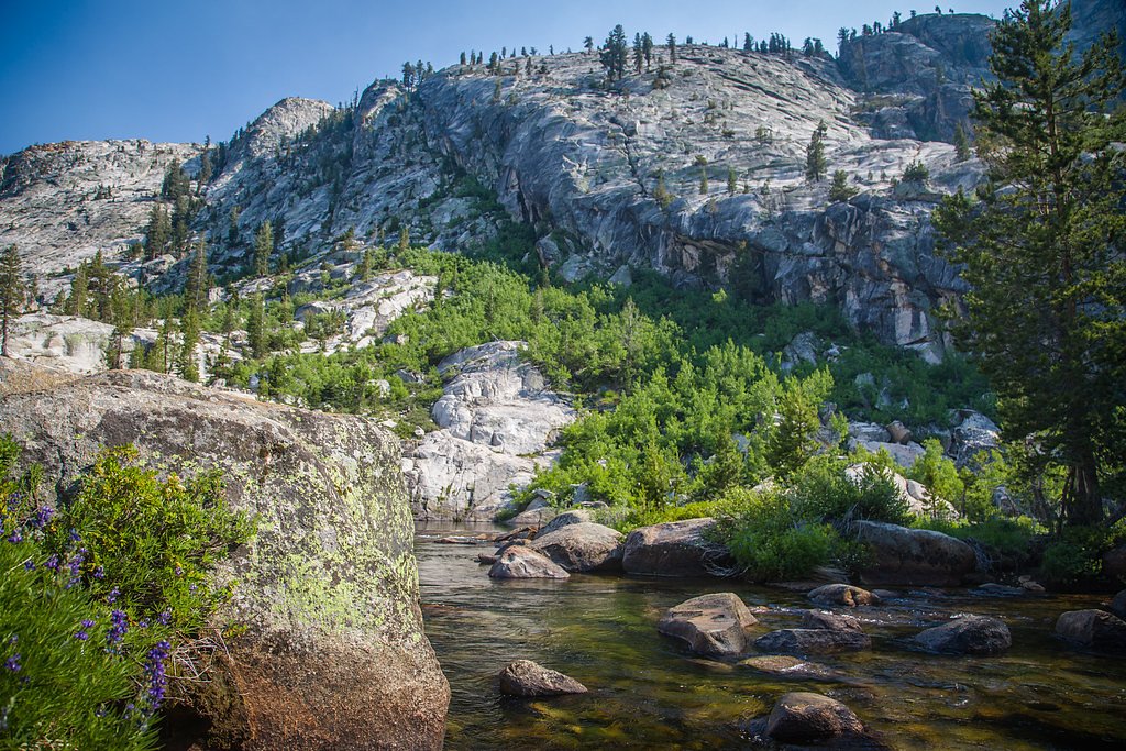
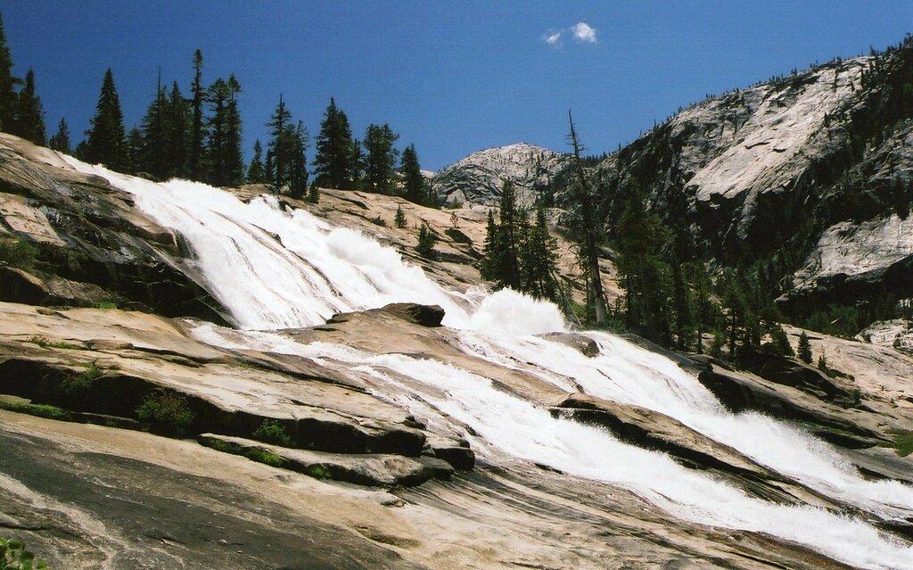
White Cascade is a stunning waterfall located in the Tuolumne Meadows area of Yosemite National Park, California. It is part of the Tuolumne River and is known for its multi-tiered cascades, which are particularly impressive during the spring and early summer when snowmelt increases water flow.
The Setting
White Cascade sits at 7,881 feet within Yosemite National Park, in the high mountains of California.
Trail & Hike Details
The Approach
The moderate 11.0-mile out-and-back trail gains 800 feet of elevation on the way to the falls.
Trail Description
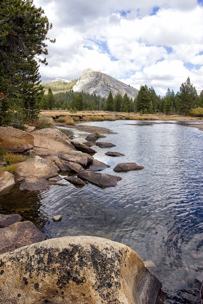
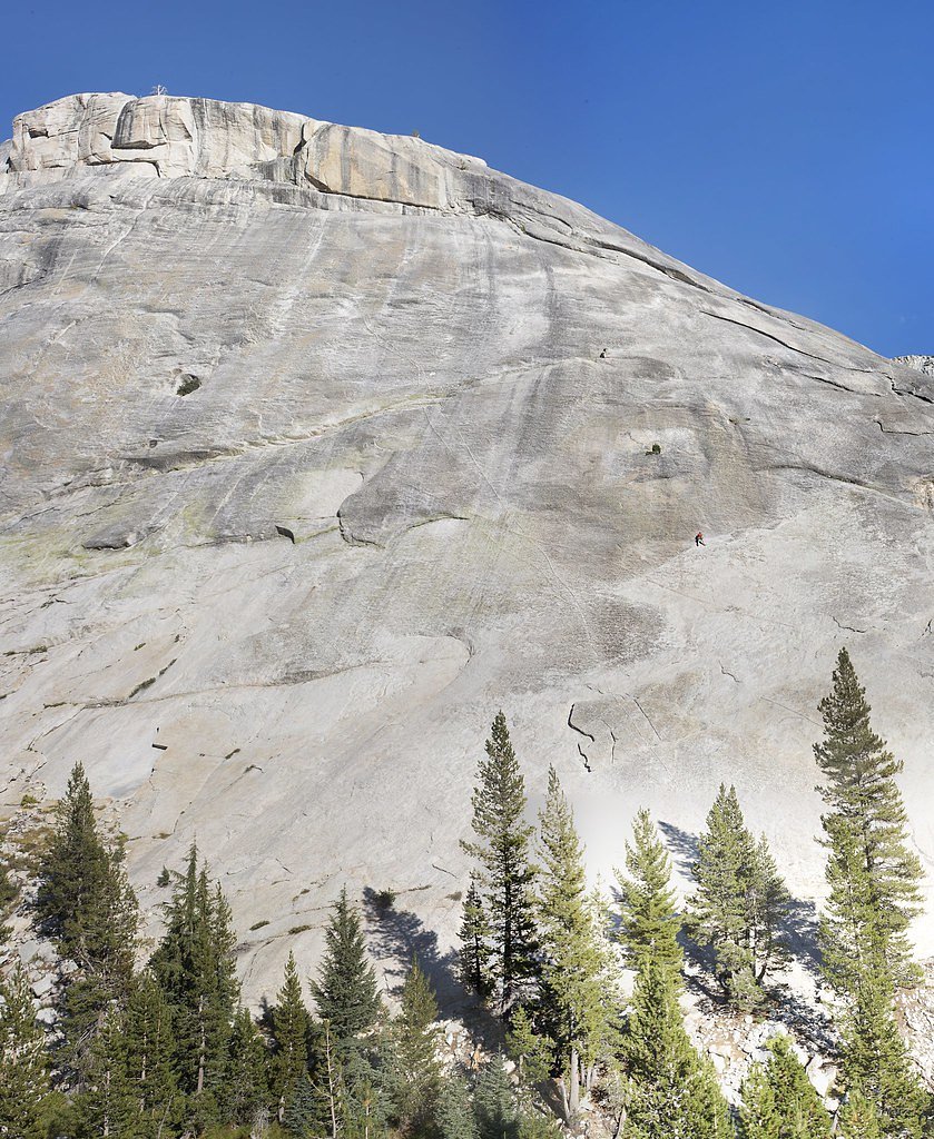
The trail to White Cascade follows the Glen Aulin Trail, which offers scenic views of the Tuolumne River, granite cliffs, and alpine meadows. The trail is well-marked but includes some rocky and uneven sections. Hikers will pass other smaller cascades and pools along the way.
What to Expect
Expect a moderately challenging hike with beautiful views of Yosemite's high country. White Cascade is a highlight of the Glen Aulin area, offering a picturesque spot for photography and relaxation. The water flow is strongest in spring and early summer.
Accessibility
The trail is not wheelchair accessible. Uneven terrain and elevation changes require steady footing.
Frequently Asked Questions
🐶 Are Dogs Allowed at White Cascade?
❌ Dogs are not allowed
Are There Any Fees or Permits Required?
🤑 Fee: $35.00
Permit required
A wilderness permit is required for overnight stays in the Glen Aulin area. Day hikers do not need a permit, but reservations are required to enter Yosemite National Park during peak seasons.
🏊 Is There Swimming at White Cascade?
❌ Swimming is not allowed
When to Visit
The best time to visit White Cascade is in late spring or early summer when the water flow is at its peak due to snowmelt. Fall offers cooler temperatures and fewer crowds, but the water flow may be lower.
Seasonal Access
The best time to visit is Spring, Summer, and Fall. Access roads and trails may close during winter due to snow. Check with Yosemite National Park for current conditions.
Safety Information
Be prepared for changing weather conditions, as temperatures can drop quickly in the high country. Carry a map and stay on marked trails. Watch for slippery rocks near the waterfall.
Current Water Conditions
326 ft³/s
Current discharge — how much water is flowing
About average for this time of year
Based on 19 years of record
9.23 ft
Water depth at gauge
57°F
ColdBracing — limit time in water
7-Day Discharge Trend
What does this mean for your visit?
Flow is about average for this time of year. Water temperature is a bracing 57 degrees F, limit your time in the water. Mineral content is typical.
Water Quality
Conductance
Dissolved minerals in the water
About This Gauge
This gauge is on a nearby waterway and may not reflect exact conditions at the falls.
7-Day Flow Outlook
Based on the USGS gauge TUOLUMNE R A GRAND CYN OF TUOLUMNE AB HETCH HETCHY (21 km away).
Today
Barely Flowing
326 cfs
5/10Tomorrow
Barely Flowing
304 cfs
5/10Mon
Barely Flowing
310 cfs
5/10Tue
Barely Flowing
301 cfs
5/10Wed
Barely Flowing
269 cfs
5/10Thu
Barely Flowing
250 cfs
5/10Fri
Barely Flowing
263 cfs
5/10Best window: Today — barely flowing flow, sunny (trip score 5/10).
Best time of year: this gauge typically runs highest from late March to late June, peaking in May.
How we calculate this
This is a transparent outlook, not a precise forecast. We take the waterfall's current flow strength (how it ranks against its historical normal for today, from the nearest USGS stream gauge), carry that ranking forward along the gauge's seasonal curve, and nudge it for forecast rain. Confidence is highest for the next day or two and falls further out. Always check official conditions and your own judgment before visiting — high flows can be dangerous.
Know when to go.
Get a free email alert when waterfalls near Lee Vining hit peak flow. We only send when conditions are worth the trip — no weekly newsletters, no spam.
Weather Forecast
Location & Access
Getting There
White Cascade is accessible via the Glen Aulin Trail, which begins at the Tuolumne Meadows trailhead in Yosemite National Park. The trailhead is located off Tioga Road (Highway 120).
Get Directions on Google MapsParking
Parking is available at the Tuolumne Meadows trailhead, but it can fill up quickly during peak seasons. Arrive early to secure a spot.
Elevation
7,881 feet above sea level
Coordinates
37.908535° N, -119.419605° W
Land Management
Managed by NPS
Visitor Tips & Gear
Start your hike early to avoid crowds and ensure you have enough daylight for the round trip. Bring plenty of water, as the trail can be exposed to the sun in some sections. Check trail conditions and Tioga Road status before your visit.
This trail sits at 7,881 ft above sea level
Elevated TrailUV radiation is roughly 32% stronger at this elevation than at sea level, and the dry air accelerates dehydration. Extra sun protection and fluids go a long way.
As an Amazon Associate, we earn from qualifying purchases.

Coppertone Sport SPF 50 Sunscreen
UV intensity jumps ~4% per 1,000 ft — at this elevation you can burn in half the time.

Sun Bum SPF 30 Lip Balm (3-Pack)
Lips have almost no natural UV protection and burn fast in thin, dry mountain air.

Liquid I.V. Electrolyte Packets
You lose moisture ~2x faster at elevation — electrolytes help you absorb water efficiently.

ROCKNIGHT Polarized UV400 Sunglasses
High-altitude glare off rock and water is intense — UV400 lenses block 99%+ of UVA/UVB.
As an Amazon Associate, we earn from qualifying purchases.
With 11.0 miles and 800 ft of elevation gain, sturdy boots and trekking poles will help on this moderate trail. Sun exposure on the trail makes good sun protection a must in summer.
America the Beautiful Annual Pass
Covers entrance fees at 2,000+ federal recreation sites — required at most National Parks.

Polarized Sunglasses (Knockaround)
Cuts glare off the water so you actually see the falls — and your photos turn out better too.

Columbia Watertight II Rain Jacket
Packs into its own pocket, seam-sealed, and keeps you dry from spray and surprise rain.

Earth Pak Waterproof Dry Bag
Keeps your phone and gear dry when waterfall mist soaks everything else.

Waterproof Phone Pouch (AiRunTech)
Cheap insurance — take photos right next to the falls without killing your phone.

Timberland Euro Sprint Mid Waterproof
Trusted waterproof boot with premium leather and grippy rubber sole — reliable on rocky, wet trails.

TrailBuddy Trekking Poles
Lightweight aluminum, cork grips, and flip-locks that actually hold — a best-seller for good reason.
Where to Stay

Rush Creek Lodge at Yosemite

Yosemite View Lodge

Evergreen Lodge at Yosemite

Lake View Lodge
Browse vacation cabins and private rentals nearby
Unique outdoor stays — tents, yurts, and treehouses
Rent a campervan or RV for your waterfall road trip
Some links are affiliate links. We may earn a commission at no extra cost to you.
Nearby Campground
Saddlebag Lake Trailhead Group Camp
8.9 miles away · 1 sites
Overview Trailhead Group Campground is located in the eastern high Sierra Nevada Mountains of California at just over 10,000 feet in elevation. Also known as Saddlebag Lake Group Campground, the facility is adjacent to the scenic lake and provides a quiet mountain getaway for groups of up to 25 people. It is within a two-hour drive of Yosemite National Park and Mono Lake, and lies next to the Hoover Wilderness.Recreation Campers might like to relax and unwind by picnicking in the forested camping
Book on Recreation.govNearby Hot Springs
Hot springs near Lee Vining, California

Unnamed Spring Mono County 5
This 72-degree thermal spring near Bridgeport sits at 6,383 feet elevation, requiring a short 160-meter walk from the road in M...

Unnamed Spring Mono County 6
This 91-degree thermal spring near Mammoth Lakes delivers exceptional warmth, running 42 degrees above the cool ambient air whe...
Buckeye Hot Spring
Buckeye Hot Spring flows at 140°F from the eastern Sierra Nevada in Mono County at 6,963 feet elevation on US Forest Service la...
Unnamed Spring Mono County 7
This 97-degree thermal spring sits at 8,159 feet elevation within Inyo National Forest, running an extraordinary 56.7 degrees a...
Paoha Island Springs
Rising from the volcanic island of Paoha in Mono Lake, Paoha Island Springs reaches 181 degrees Fahrenheit—one of California's ...
Hot Spring
Hot Spring near Bridgeport emerges at 151°F just 130 feet from the road, making it perhaps the most accessible high-temperature...
Looking for a soak after your hike? Explore more hot springs near Lee Vining, California on SoakingSprings.
Explore California springsAdditional Information
Nearby Attractions
Other attractions in the Tuolumne Meadows area include Lembert Dome, Soda Springs, and the Tuolumne River. Yosemite Valley is also a must-visit destination within the park.
Wildlife
Wildlife in the area may include deer, marmots, and various bird species. Be cautious of bears and store food properly.
Cities near White Cascade
Nearby Waterfalls
Writing about White Cascade? Embed this waterfall on your site for free.