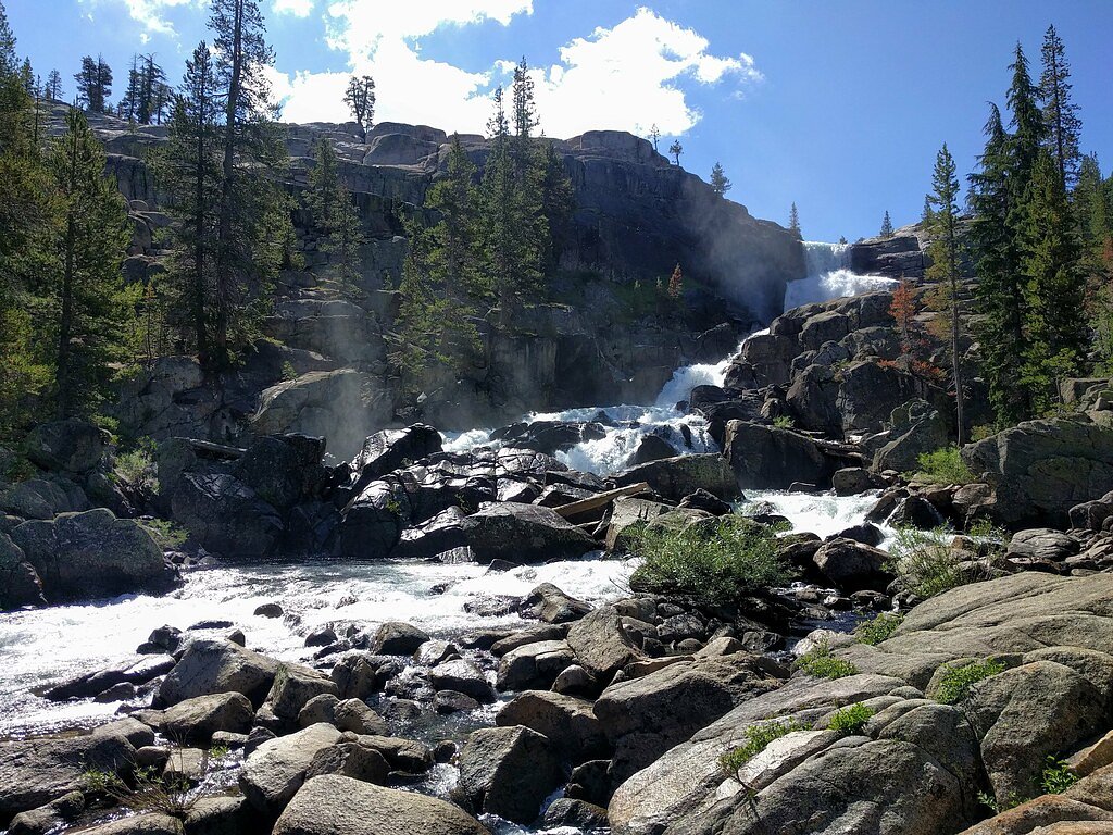
California Falls
California • Yosemite National Park
By Armen Suny · Last verified Mar 2026
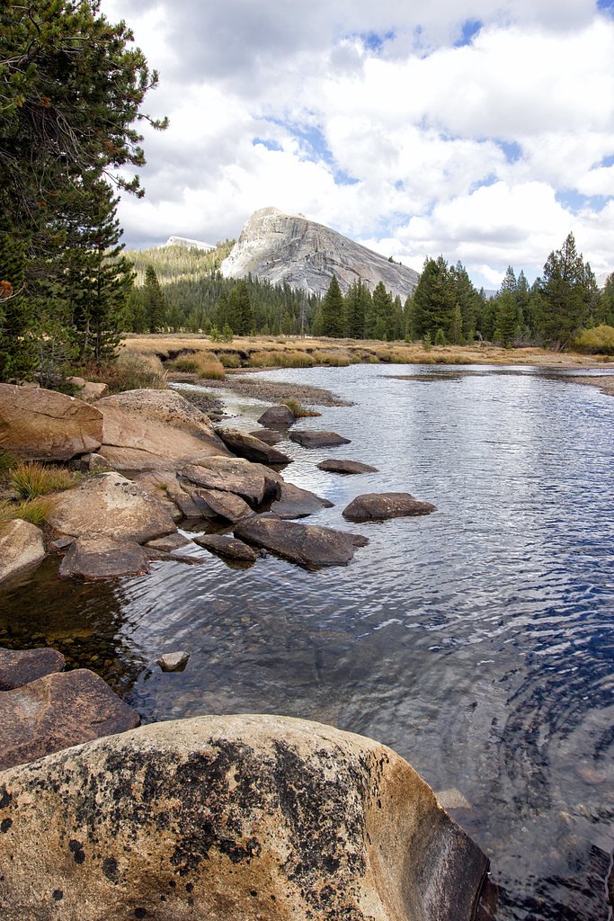
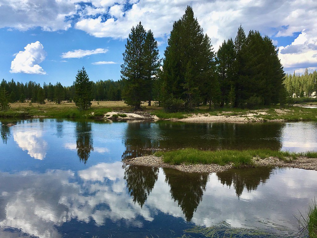
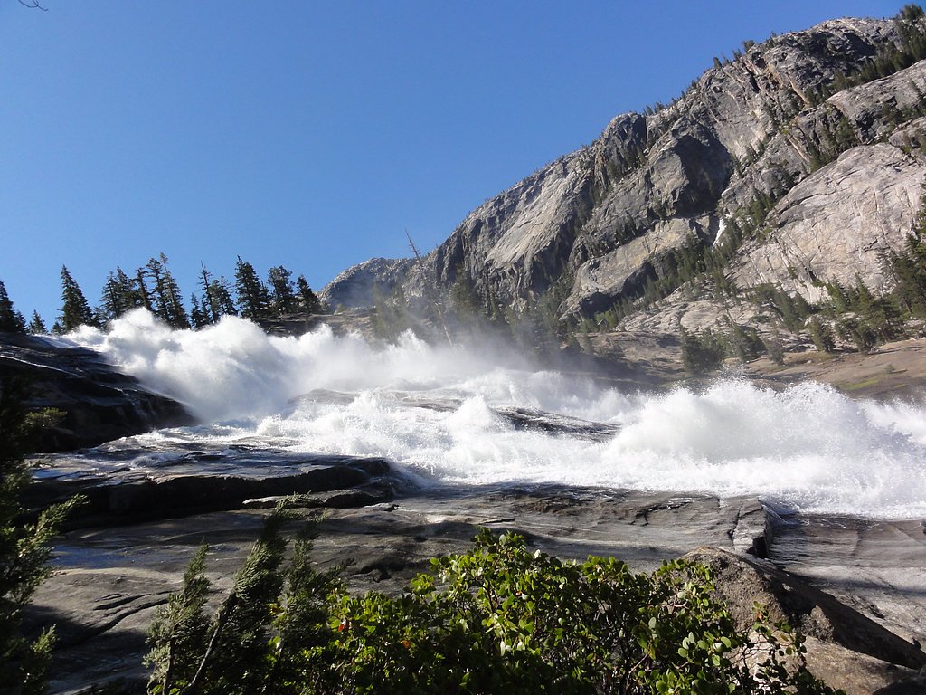
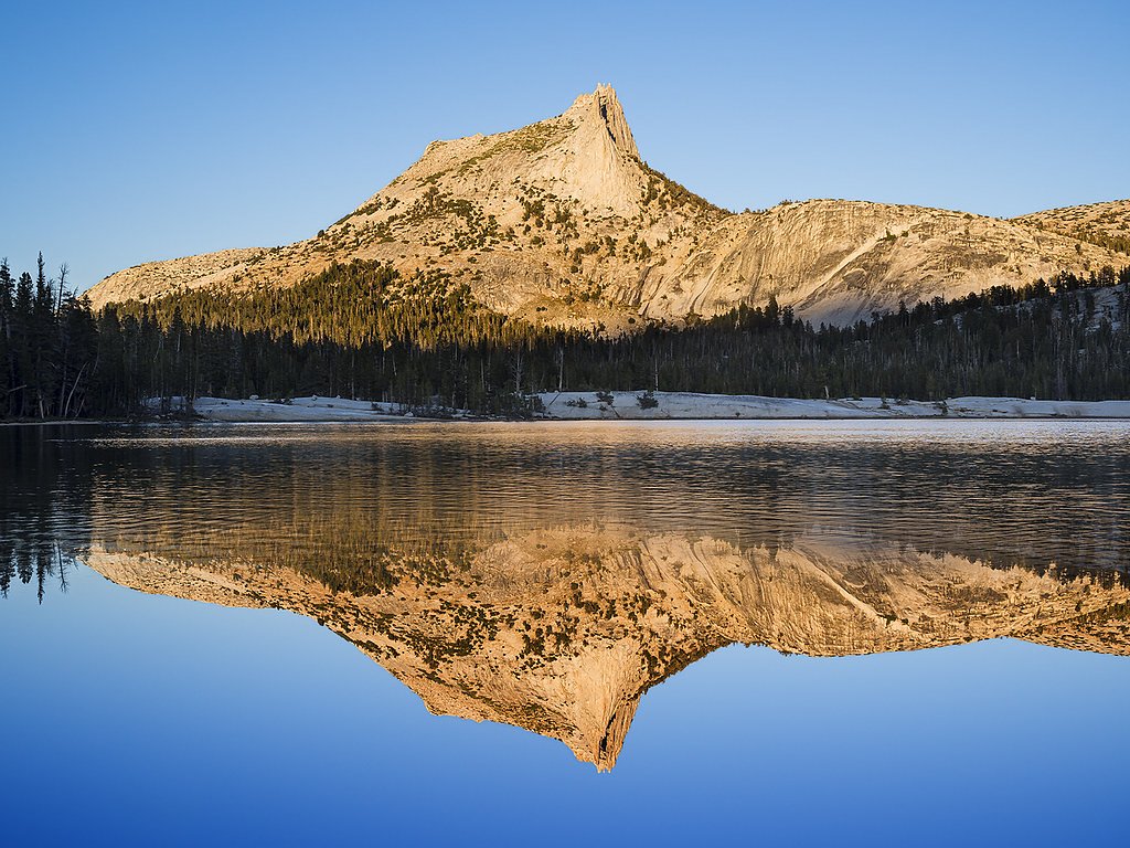
Photo Credits (5)
Difficulty
Hard
Trail Length
15.0 miles
Trail Type
Out And Back
Elevation Gain
2 ft
About California Falls
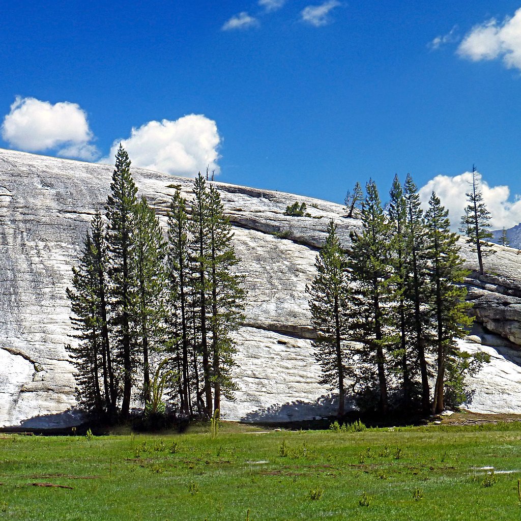
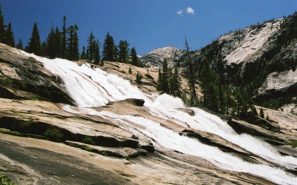
California Falls is a picturesque waterfall located in Yosemite National Park, California. It is part of the Grand Canyon of the Tuolumne River and is known for its cascading flow over granite rocks, offering stunning views in a serene wilderness setting.
The Setting
California Falls sits at 7,743 feet within Yosemite National Park, in the high mountains of California.
Trail & Hike Details
The Approach
The hard 15.0-mile out-and-back trail gains 2 feet of elevation on the way to the falls.
Trail Description
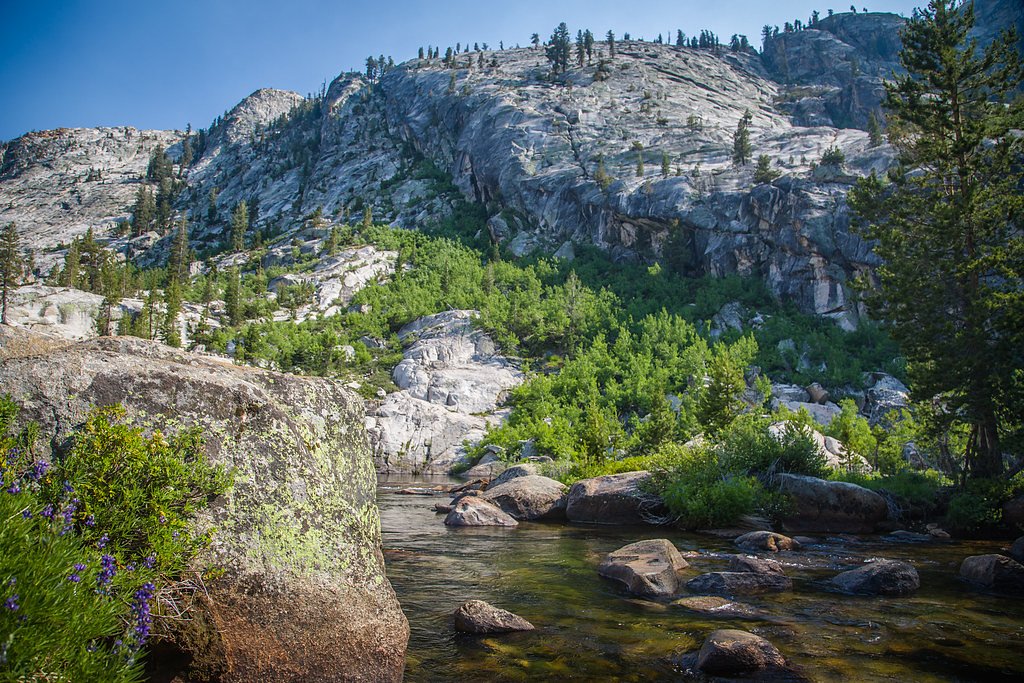
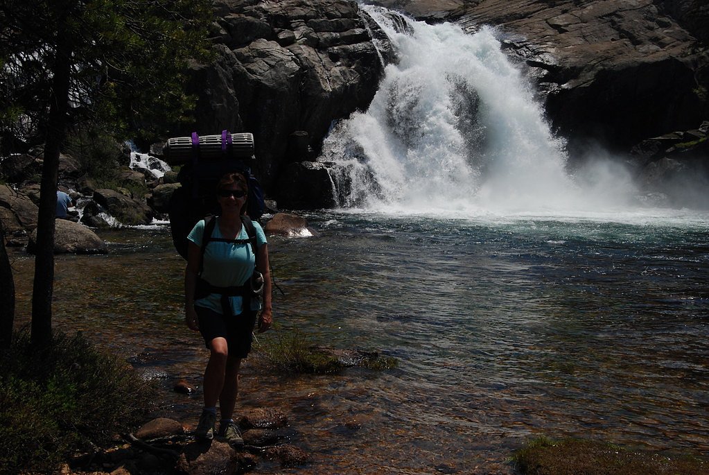
The trail to California Falls is part of the Grand Canyon of the Tuolumne River hike, which features rugged terrain, steep inclines, and breathtaking views of multiple waterfalls, including California Falls. The trail is challenging and requires good physical fitness and preparation.
What to Expect
Visitors can expect a strenuous hike through Yosemite's backcountry with stunning views of granite cliffs, lush forests, and cascading waterfalls. California Falls itself is a multi-tiered waterfall with a powerful flow, especially during spring and early summer when snowmelt is at its peak.
Accessibility
The trail involves steep, uneven terrain with significant elevation change and is not accessible to mobility devices.
Frequently Asked Questions
🐶 Are Dogs Allowed at California Falls?
❌ Dogs are not allowed
Are There Any Fees or Permits Required?
🤑 Fee: $35.00
Permit required
A wilderness permit is required for overnight stays in Yosemite's backcountry. Day hikers do not need a permit but must pay the park entrance fee.
🏊 Is There Swimming at California Falls?
❌ Swimming is not allowed
When to Visit
The best time to visit California Falls is in late spring or early summer when the waterfall is at its fullest due to snowmelt. Fall offers cooler temperatures and fewer crowds, but water flow may be reduced.
Seasonal Access
The best time to visit is Spring, Summer, and Fall. Access roads and trails may close during winter due to snow. Check with Yosemite National Park for current conditions.
Safety Information
The trail is strenuous and includes steep sections and uneven terrain. Be prepared for changing weather conditions and carry sufficient supplies. Watch for slippery rocks near the falls and be cautious of strong currents in the river.
Current Water Conditions
198 ft³/s
Current discharge — how much water is flowing
Lower than usual for this time of year
Based on 19 years of record
8.68 ft
Water depth at gauge
62°F
CoolRefreshing for swimming
7-Day Discharge Trend
What does this mean for your visit?
Flow is lower than usual for this time of year. Water temperature is a refreshing 62 degrees F, good for a quick swim. Mineral content is typical.
Water Quality
Conductance
Dissolved minerals in the water
About This Gauge
This gauge is on a nearby waterway and may not reflect exact conditions at the falls.
7-Day Flow Outlook
Based on the USGS gauge TUOLUMNE R A GRAND CYN OF TUOLUMNE AB HETCH HETCHY (19 km away).
Today
Barely Flowing
198 cfs
5/10Tomorrow
Barely Flowing
185 cfs
5/10Fri
Barely Flowing
194 cfs
5/10Sat
Barely Flowing
189 cfs
5/10Sun
Barely Flowing
156 cfs
5/10Mon
Barely Flowing
137 cfs
5/10Tue
Barely Flowing
132 cfs
5/10Best window: Today — barely flowing flow, sunny (trip score 5/10).
Best time of year: this gauge typically runs highest from late March to late June, peaking in May.
How we calculate this
This is a transparent outlook, not a precise forecast. We take the waterfall's current flow strength (how it ranks against its historical normal for today, from the nearest USGS stream gauge), carry that ranking forward along the gauge's seasonal curve, and nudge it for forecast rain. Confidence is highest for the next day or two and falls further out. Always check official conditions and your own judgment before visiting — high flows can be dangerous.
Know when to go.
Get a free email alert when waterfalls near Yosemite Valley hit peak flow. We only send when conditions are worth the trip — no weekly newsletters, no spam.
Weather Forecast
Location & Access
Getting There
California Falls is accessible via the Grand Canyon of the Tuolumne trail in Yosemite National Park. The trailhead is typically accessed from the White Wolf area or Tuolumne Meadows, depending on the chosen route.
Get Directions on Google MapsParking
Parking is available at the trailheads, such as White Wolf or Tuolumne Meadows. Availability may vary, especially during peak seasons.
Elevation
7,743 feet above sea level
Coordinates
37.916034° N, -119.440162° W
Land Management
Managed by NPS
Visitor Tips & Gear
Start early to allow plenty of time for the hike. Bring a detailed map or GPS device, as the trail can be challenging to navigate. Be prepared for changing weather conditions and carry sufficient water and snacks.
This trail sits at 7,743 ft above sea level
Elevated TrailUV radiation is roughly 31% stronger at this elevation than at sea level, and the dry air accelerates dehydration. Extra sun protection and fluids go a long way.
As an Amazon Associate, we earn from qualifying purchases.

Coppertone Sport SPF 50 Sunscreen
UV intensity jumps ~4% per 1,000 ft — at this elevation you can burn in half the time.

Sun Bum SPF 30 Lip Balm (3-Pack)
Lips have almost no natural UV protection and burn fast in thin, dry mountain air.

Liquid I.V. Electrolyte Packets
You lose moisture ~2x faster at elevation — electrolytes help you absorb water efficiently.

ROCKNIGHT Polarized UV400 Sunglasses
High-altitude glare off rock and water is intense — UV400 lenses block 99%+ of UVA/UVB.
As an Amazon Associate, we earn from qualifying purchases.
This challenging 15.0 miles trail gains 2 ft in elevation — come prepared with proper hiking boots and trekking poles. Sun exposure on the trail makes good sun protection a must in summer.
America the Beautiful Annual Pass
Covers entrance fees at 2,000+ federal recreation sites — required at most National Parks.

Sawyer Squeeze Water Filter
The backcountry standard — filters 99.9% of bacteria and weighs just 3 oz.

Polarized Sunglasses (Knockaround)
Cuts glare off the water so you actually see the falls — and your photos turn out better too.

Columbia Watertight II Rain Jacket
Packs into its own pocket, seam-sealed, and keeps you dry from spray and surprise rain.

Earth Pak Waterproof Dry Bag
Keeps your phone and gear dry when waterfall mist soaks everything else.

Waterproof Phone Pouch (AiRunTech)
Cheap insurance — take photos right next to the falls without killing your phone.

Timberland Euro Sprint Mid Waterproof
Trusted waterproof boot with premium leather and grippy rubber sole — reliable on rocky, wet trails.
Where to Stay

Rush Creek Lodge at Yosemite

Yosemite View Lodge

Evergreen Lodge at Yosemite

Lake View Lodge
Browse vacation cabins and private rentals nearby
Unique outdoor stays — tents, yurts, and treehouses
Rent a campervan or RV for your waterfall road trip
Some links are affiliate links. We may earn a commission at no extra cost to you.
Nearby Campground
Saddlebag Lake Trailhead Group Camp
9.7 miles away · 1 sites
Overview Trailhead Group Campground is located in the eastern high Sierra Nevada Mountains of California at just over 10,000 feet in elevation. Also known as Saddlebag Lake Group Campground, the facility is adjacent to the scenic lake and provides a quiet mountain getaway for groups of up to 25 people. It is within a two-hour drive of Yosemite National Park and Mono Lake, and lies next to the Hoover Wilderness.Recreation Campers might like to relax and unwind by picnicking in the forested camping
Book on Recreation.govNearby Hot Springs
Hot springs near Yosemite Valley, California

Unnamed Spring Mono County 5
This 72-degree thermal spring near Bridgeport sits at 6,383 feet elevation, requiring a short 160-meter walk from the road in M...

Unnamed Spring Mono County 6
This 91-degree thermal spring near Mammoth Lakes delivers exceptional warmth, running 42 degrees above the cool ambient air whe...
Buckeye Hot Spring
Buckeye Hot Spring flows at 140°F from the eastern Sierra Nevada in Mono County at 6,963 feet elevation on US Forest Service la...
Paoha Island Springs
Rising from the volcanic island of Paoha in Mono Lake, Paoha Island Springs reaches 181 degrees Fahrenheit—one of California's ...
Hot Spring
Hot Spring near Bridgeport emerges at 151°F just 130 feet from the road, making it perhaps the most accessible high-temperature...
Unnamed Spring Mono County 7
This 97-degree thermal spring sits at 8,159 feet elevation within Inyo National Forest, running an extraordinary 56.7 degrees a...
Looking for a soak after your hike? Explore more hot springs near Yosemite Valley, California on SoakingSprings.
Explore California springsAdditional Information
Nearby Attractions
Other waterfalls in the Grand Canyon of the Tuolumne, such as White Cascade, Waterwheel Falls, and LeConte Falls. Tuolumne Meadows and Hetch Hetchy Reservoir are also nearby.
Wildlife
The area is home to diverse wildlife, including black bears, deer, and various bird species. Always store food properly to avoid attracting animals.
Cities near California Falls
Nearby Waterfalls
Writing about California Falls? Embed this waterfall on your site for free.