West Quartz Creek Falls
By Armen Suny · Last verified May 2026
Difficulty
Moderate
Trail Length
2.0 miles
Trail Type
Out And Back
Elevation Gain
300 ft
About West Quartz Creek Falls
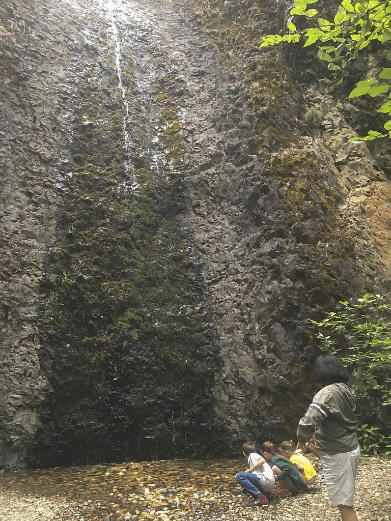
West Quartz Creek Falls tumbles through a quiet, forested stretch of Quartz Creek deep within lands managed by the U.S. Forest Service in the Snoqualmie National Forest. The falls sit in a remote, moss-draped setting that rewards hikers with a peaceful cascade framed by old-growth conifers and thick understory—perfect for photographers or anyone seeking a less-crowded waterfall outing. Access follows the signed QUARTZ MOUNTAIN route (USFS Trail #948), which provides the most direct approach to the creek and falls. The on-trail approach is a moderate 2.0-mile out-and-back with about 300 feet of elevation gain, making it a good half-day hike for most fit day-hikers. The route is managed by the USFS, and although official USFS records note QUARTZ MOUNTAIN Trail #948 with GIS mileage, some surface and grade details are not listed; plan for a natural, sometimes uneven forest tread. If you’d like to camp nearby, the Indian Flat Group Site is roughly 3.08 km from the trailhead—an easy option for those turning the hike into an overnight trip.
The Setting
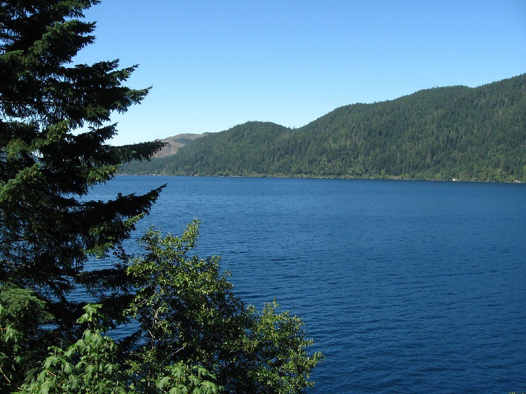
West Quartz Creek Falls sits at 3,025 feet within Snoqualmie National Forest, fed by the American River, in the mountains of Washington.
Trail & Hike Details
The Approach
The moderate hike follows Quartz Mountain (#948), a 2.0-mile out-and-back trail over n/a. Expect 300 feet of elevation gain with grades of N/A.
USFS Trail
QUARTZ MOUNTAIN #948
Trail Class
Class 0
Surface
Avg Grade
USFS Segment
6.49 miTrail Description
Trail: QUARTZ MOUNTAIN (USFS Trail #948). Route type: out-and-back, 2.0 miles round-trip to the waterfall point (reported elevation gain ~300 ft). Difficulty: moderate. USFS trail data: Class: N; Surface: N/A (not listed); Typical grade: N/A (not listed); USFS GIS miles: 6.49 (as recorded in agency data). The hiking corridor winds through dense, moss-covered forest; the tread can be narrow and uneven in places, so expect natural, sometimes rocky or root-strewn surfaces and use careful footing.
What to Expect
Dogs are welcome.
Accessibility
The trail is not wheelchair accessible. Uneven terrain and elevation changes require steady footing.
Frequently Asked Questions
🐶 Are Dogs Allowed at West Quartz Creek Falls?
✅ Dogs are allowed
Are There Any Fees or Permits Required?
🆖 No fees required
🏊 Is There Swimming at West Quartz Creek Falls?
❌ Swimming is not allowed
When to Visit
Spring and early summer are ideal times to visit, as the waterfall is typically at its fullest due to snowmelt. Fall offers beautiful foliage, while summer provides warmer weather for hiking.
Seasonal Access
The best time to visit is Spring, Summer, and Fall. Winter access may be limited. Check with Snoqualmie National Forest for seasonal road closures.
Safety Information
Visitors should exercise caution on the trail, especially near the waterfall, as rocks can be slippery. Check weather and trail conditions before visiting, and be prepared for sudden changes in weather.
Current Water Conditions
136 ft³/s
Current discharge — how much water is flowing
Much lower than usual for this time of year
Based on 86 years of record
72.60 ft
Water depth at gauge
7-Day Discharge Trend
What does this mean for your visit?
Flow is well below normal for this time of year, so the waterfall may be a trickle.
About This Gauge
7-Day Flow Outlook
Based on the USGS gauge AMERICAN RIVER NEAR NILE, WA (3 km away).
Today
Barely Flowing
136 cfs
5/10Tomorrow
Barely Flowing
131 cfs
5/10Tue
Barely Flowing
127 cfs
5/10Wed
Barely Flowing
127 cfs
5/10Thu
Barely Flowing
129 cfs
3/10Fri
Low
125 cfs
4/10Sat
Low
121 cfs
4/10Best window: Today — barely flowing flow, sunny (trip score 5/10).
Best time of year: this gauge typically runs highest from mid April to mid July, peaking in June.
How we calculate this
This is a transparent outlook, not a precise forecast. We take the waterfall's current flow strength (how it ranks against its historical normal for today, from the nearest USGS stream gauge), carry that ranking forward along the gauge's seasonal curve, and nudge it for forecast rain. Confidence is highest for the next day or two and falls further out. Always check official conditions and your own judgment before visiting — high flows can be dangerous.
Know when to go.
Get a free email alert when waterfalls near Cliffdell hit peak flow. We only send when conditions are worth the trip — no weekly newsletters, no spam.
Weather Forecast
Location & Access
Getting There
West Quartz Creek Falls is located in the Gifford Pinchot National Forest. Access typically involves driving on forest roads, which may be rough or unpaved. Visitors should check local conditions before traveling.
Get Directions on Google MapsParking
Parking is available at a trailhead near the falls, but spaces may be limited. Visitors should plan to arrive early, especially during peak seasons.
Elevation
3,025 feet above sea level
Coordinates
47.007339° N, -121.155085° W
Land Management
Managed by USFS
Visitor Tips & Gear
Wear sturdy hiking shoes as the trail may be muddy or slippery, especially after rain. Bring insect repellent during warmer months and check road conditions before heading out.
As an Amazon Associate, we earn from qualifying purchases.
With 2.0 miles and 300 ft of elevation gain, sturdy boots and trekking poles will help on this moderate trail. Sun exposure on the trail makes good sun protection a must in summer.

Columbia Watertight II Rain Jacket
Packs into its own pocket, seam-sealed, and keeps you dry from spray and surprise rain.

Earth Pak Waterproof Dry Bag
Keeps your phone and gear dry when waterfall mist soaks everything else.

Waterproof Phone Pouch (AiRunTech)
Cheap insurance — take photos right next to the falls without killing your phone.

Timberland Euro Sprint Mid Waterproof
Trusted waterproof boot with premium leather and grippy rubber sole — reliable on rocky, wet trails.

TrailBuddy Trekking Poles
Lightweight aluminum, cork grips, and flip-locks that actually hold — a best-seller for good reason.

Polarized Sunglasses (Knockaround)
Cuts glare off the water so you actually see the falls — and your photos turn out better too.
Where to Stay

Secluded Greenwater Cabin with Loft Near Rainier

The Cabin

4006 Suncadia Lodge Pool and Hot-Tub Access with Hotel Amenities

Cozy Studio Apartment
Browse vacation cabins and private rentals nearby
Unique outdoor stays — tents, yurts, and treehouses
Rent a campervan or RV for your waterfall road trip
Some links are affiliate links. We may earn a commission at no extra cost to you.
Nearby Campground
INDIAN FLAT GROUP SITE
1.9 miles away · 1 sites
Overview Indian Flat Group Campground is set on the banks of the Bumping River in the eastern foothills of the Cascades mountain range. Situated beneath a towering mixed conifer forest, this site offers a wonderful setting for large groups looking for a secluded camping experience. Recreation Indian Flat Group Campground is within 10 miles of opportunities to hike, mountain bike, ride horses, ski, raft and enjoy a multitude of outdoor recreational activities throughout the year. Nearby Bumping La
Book on Recreation.govNearby Hot Springs
Hot springs near Cliffdell, Washington
Lester Hot Springs
This 120-degree spring sits within the City of Tacoma Watershed at 1,582 feet elevation, emerging 72.3 degrees above ambient in...

Ohanapecosh Hot Springs
Ohanapecosh Hot Springs flows at 122 degrees within Mount Rainier National Park at 1,920 feet elevation, emerging 74.5 degrees ...

Mt Rainier Fumaroles
Mount Rainier fumaroles reach 162 degrees at 14,217 feet elevation, emerging 154.8 degrees above ambient at Washington's highes...
Goldmeyer Hot Springs
Goldmeyer Hot Springs emerges at 127 degrees in the central Cascades, producing water 78.9 degrees above ambient temperature at...
Scenic Hot Springs
Scenic Hot Springs delivers genuinely hot water at 122 degrees Fahrenheit at 2,246 feet elevation in the Cascade Mountains near...
Simcoe Soda Springs
Simcoe Soda Springs flows at 90 degrees Fahrenheit on Yakama Nation Reservation tribal land in Yakima County near Tieton, with ...
Looking for a soak after your hike? Explore more hot springs near Cliffdell, Washington on SoakingSprings.
Explore Washington springsAdditional Information
Nearby Attractions
Nearby attractions include other waterfalls in the Gifford Pinchot National Forest, such as Lower Lewis River Falls and Curly Creek Falls.
Wildlife
The area is home to a variety of wildlife, including birds, deer, and small mammals. Visitors should be cautious of bears and cougars, which may inhabit the forest.
Cities near West Quartz Creek Falls
Nearby Waterfalls
Writing about West Quartz Creek Falls? Embed this waterfall on your site for free.