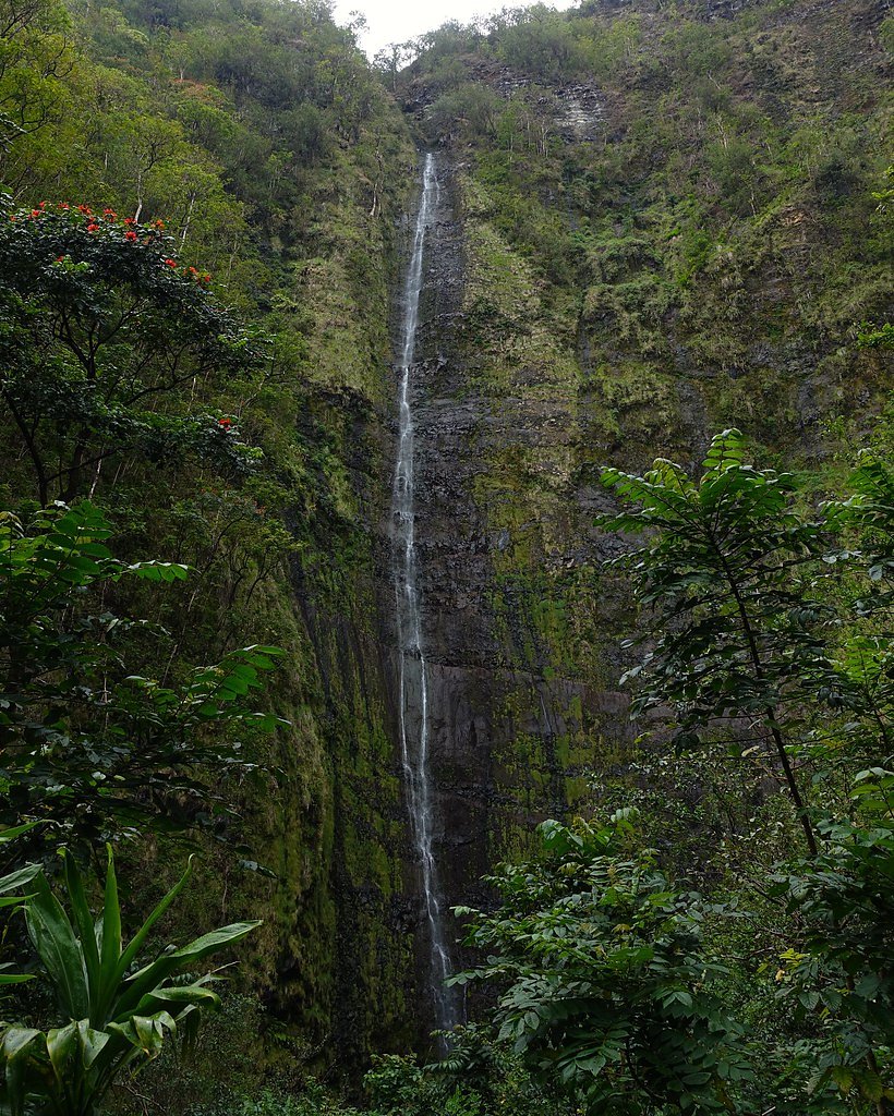
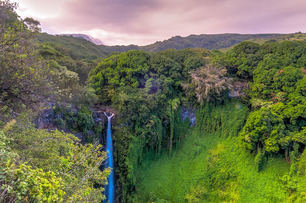
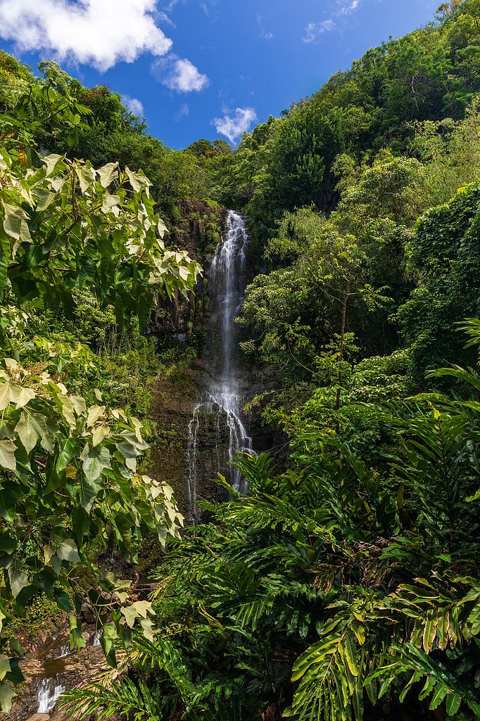
Waimoku Falls
Hawaii • Haleakalā National Park • 400 ft
By Armen Suny · Last verified Mar 2026
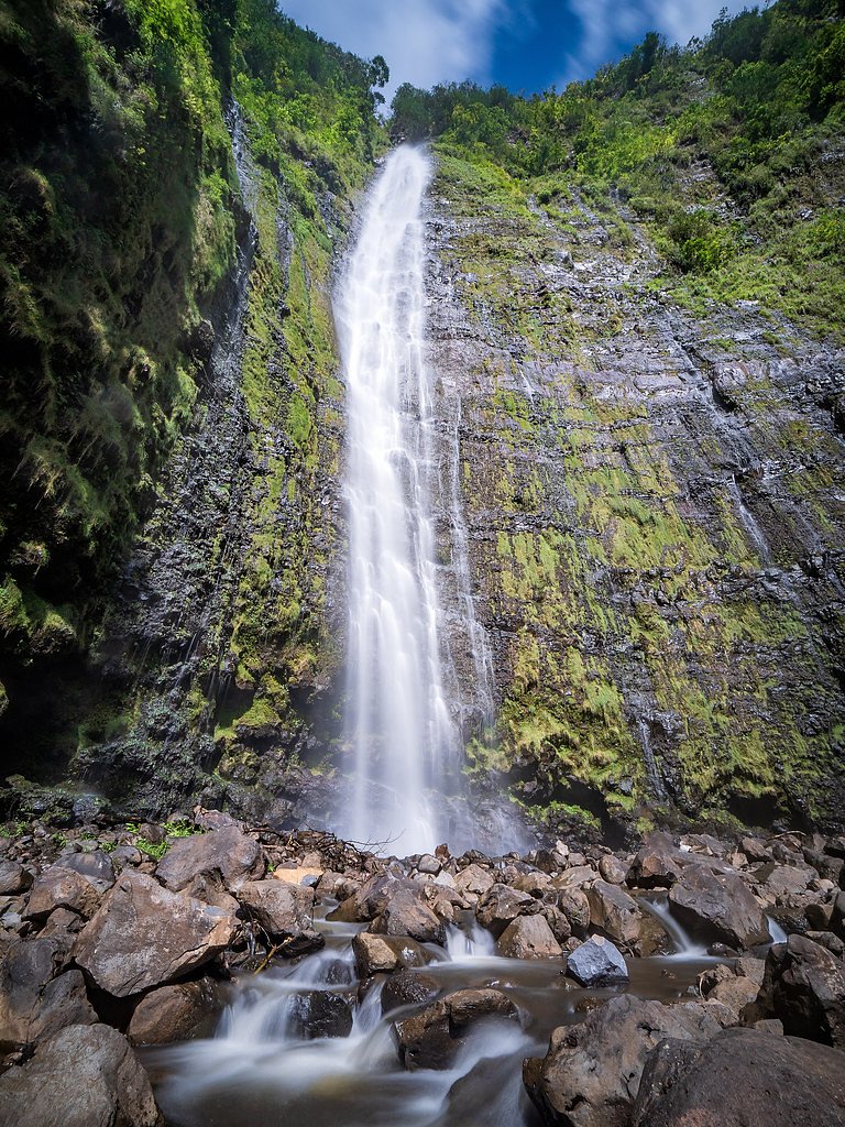
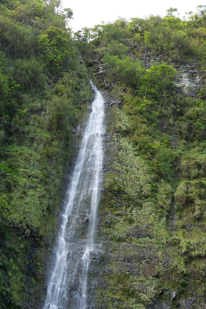
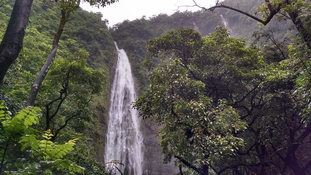
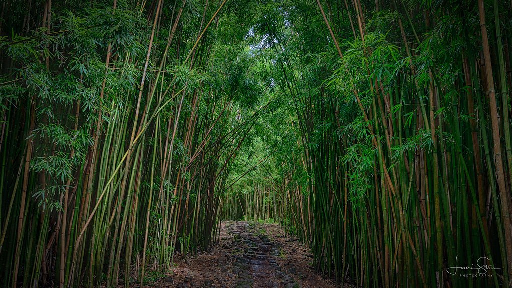

Photo Credits (5)
Difficulty
Moderate
Trail Length
4.0 miles
Trail Type
Out And Back
Elevation Gain
800 ft
About Waimoku Falls
Waimoku Falls is a dramatic 400-foot plunge tucked at the end of the Pipiwai Trail in the Kīpahulu district of Haleakalā National Park. Managed by the National Park Service, the falls tumble down a sheer lava-rock amphitheater and are framed by lush tropical vegetation, making the final view a memorable payoff for hikers and photographers. The setting reflects the raw, verdant beauty of southeastern Maui — Kīpahulu itself is an unincorporated community in the Hāna district — and feels worlds away from the island’s busier western shores. You reach Waimoku Falls via the Pipiwai Trail, a popular 4.0-mile out-and-back route with roughly 800 feet of elevation gain and a moderate difficulty rating. The trail winds through towering bamboo, follows a scenic stream, and passes several smaller waterfalls before opening onto the falls. Conditions can turn muddy and slippery after rain, so plan accordingly; the nearest park cabin permits/camping for Haleakalā National Park are roughly 11.7 km away if you want an overnight option in the park.
The Setting
Waimoku Falls sits at 1,083 feet within Haleakalā National Park, in the foothills of Hawaii. At 400 feet, it is among the taller waterfalls in Hawaii.
Height: 400 feet
Nearby Falls Worth Visiting
Makahiku Falls (200 ft) lies 1.0 miles to the southeast. Also nearby: Wailua Falls (80 ft, 1.7 mi).
Trail & Hike Details
The Approach
The moderate 4.0-mile out-and-back trail gains 800 feet of elevation on the way to the falls.
Trail Description
Pipiwai Trail to Waimoku Falls — 4.0 miles round-trip (out-and-back), ~800 ft elevation gain, moderate difficulty. The trail is a well-maintained NPS route that traverses dense bamboo forest, crosses/skirts a scenic stream, and passes multiple smaller cascades en route to the 400-foot waterfall. Expect a maintained natural tread that can become muddy and slippery after rain; the moderate rating reflects the steady elevation gain over the approach. No USFS trail number applies — this route is managed by Haleakalā National Park (NPS).
What to Expect
The falls plunge a dramatic 400 feet.
Accessibility
The trail is not wheelchair accessible. Uneven terrain and elevation changes require steady footing.
Frequently Asked Questions
🐶 Are Dogs Allowed at Waimoku Falls?
❌ Dogs are not allowed
Are There Any Fees or Permits Required?
🤑 Fee: $30.00
🏊 Is There Swimming at Waimoku Falls?
❌ Swimming is not allowed
When to Visit
The waterfall flows year-round, but the best time to visit is during the morning hours to avoid crowds and enjoy cooler temperatures. Avoid hiking during heavy rain, as the trail can become hazardous.
Seasonal Access
The best time to visit is Spring, Summer, Fall, and Winter. Heavy rains during wet season (November through March) bring higher flow but can make trails slippery. Check with Haleakalā National Park for current conditions.
Safety Information
Hikers should be cautious of slippery and muddy conditions, especially after rain. Falling rocks near the waterfall pose a hazard, so visitors should stay on designated trails and avoid standing directly beneath the falls.
Current Water Conditions
5 ft³/s
Current discharge — how much water is flowing
About average for this time of year
Based on 29 years of record
0.78 ft
Water depth at gauge
7-Day Discharge Trend
What does this mean for your visit?
Flow is about average for this time of year.
About This Gauge
7-Day Flow Outlook
Based on the USGS gauge Oheo Gulch at dam near Kipahulu, Maui, HI (1 km away).
Today
Moderate
5 cfs
5/10Tomorrow
Moderate
4 cfs
5/10Tue
Moderate
5 cfs
5/10Wed
Moderate
4 cfs
5/10Thu
Moderate
5 cfs
5/10Fri
Moderate
8 cfs
5/10Sat
Moderate
7 cfs
5/10Best window: Today — moderate flow, scattered rain showers (trip score 5/10).
Best time of year: this gauge typically runs highest from late November to early December, peaking in April.
How we calculate this
This is a transparent outlook, not a precise forecast. We take the waterfall's current flow strength (how it ranks against its historical normal for today, from the nearest USGS stream gauge), carry that ranking forward along the gauge's seasonal curve, and nudge it for forecast rain. Confidence is highest for the next day or two and falls further out. Always check official conditions and your own judgment before visiting — high flows can be dangerous.
Know when to go.
Get a free email alert when waterfalls near Hana hit peak flow. We only send when conditions are worth the trip — no weekly newsletters, no spam.
Weather Forecast
Location & Access
Getting There
Waimoku Falls is accessed via the Pipiwai Trail, which begins near the Kīpahulu Visitor Center in Haleakalā National Park. The park is located on the southeastern side of Maui, and visitors typically drive the Hana Highway to reach the area.
Get Directions on Google MapsParking
Parking is available at the Kīpahulu Visitor Center, but it can fill up quickly, especially during peak hours. Visitors should arrive early to secure a spot.
Elevation
1,083 feet above sea level
Coordinates
20.679005° N, -156.056757° W
Land Management
Managed by NPS
Visitor Tips & Gear
Start your hike early in the day to avoid crowds and ensure you have enough daylight to complete the trail. Bring plenty of water, snacks, and insect repellent. Be cautious of slippery rocks and muddy sections, especially after rain.
As an Amazon Associate, we earn from qualifying purchases.
With 4.0 miles and 800 ft of elevation gain, sturdy boots and trekking poles will help on this moderate trail. Icy conditions are common in winter — traction cleats are a smart addition.
America the Beautiful Annual Pass
Covers entrance fees at 2,000+ federal recreation sites — required at most National Parks.

Columbia Watertight II Rain Jacket
Packs into its own pocket, seam-sealed, and keeps you dry from spray and surprise rain.

Polarized Sunglasses (Knockaround)
Cuts glare off the water so you actually see the falls — and your photos turn out better too.

Earth Pak Waterproof Dry Bag
Keeps your phone and gear dry when waterfall mist soaks everything else.

Waterproof Phone Pouch (AiRunTech)
Cheap insurance — take photos right next to the falls without killing your phone.

Timberland Euro Sprint Mid Waterproof
Trusted waterproof boot with premium leather and grippy rubber sole — reliable on rocky, wet trails.

TrailBuddy Trekking Poles
Lightweight aluminum, cork grips, and flip-locks that actually hold — a best-seller for good reason.
Where to Stay

This place is different!! Award winning! Oceanfront, View View!

Maui Seaside Hotel

The Hale Pau Hana

Paia Inn
Browse vacation cabins and private rentals nearby
Unique outdoor stays — tents, yurts, and treehouses
Rent a campervan or RV for your waterfall road trip
Some links are affiliate links. We may earn a commission at no extra cost to you.
Nearby Campground
Haleakalā National Park (Cabin Permits)
7.3 miles away · 3 sites
Overview Located on the island of Maui, Haleakalā National Park maintains three wilderness cabins for visitor use-- Hōlua, Palikū, and Kapalaoa. All cabins are accessible only by trail from the summit area and require you to hike a minimum of 3.7 mi (5.9 km). Backcountry users must plan to enter the park entrance for their stay no earlier than 7 am unless they have also obtained a sunrise reservation granting access to the park between 3 and 7 am. Sunrise reservations can be made on recreation.go
Book on Recreation.govAdditional Information
Nearby Attractions
Nearby attractions include the Pools of ʻOheʻo (Seven Sacred Pools), which are also located within the Kīpahulu District of Haleakalā National Park.
Wildlife
Visitors may encounter native Hawaiian birds, such as the ʻapapane and ʻamakihi, as well as various insects and tropical plants along the trail.
Cities near Waimoku Falls
Nearby Waterfalls

Writing about Waimoku Falls? Embed this waterfall on your site for free.