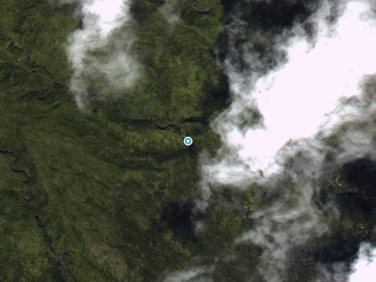
 Aerial view · USGS
Kekuapoʻowai Falls
By Armen Suny · Last verified Oct 2026
3D terrainBefore you go
We found no documented public trail to this waterfall. It is in remote state forest reserve land, not in Haleakalā National Park.
About Kekuapoʻowai Falls
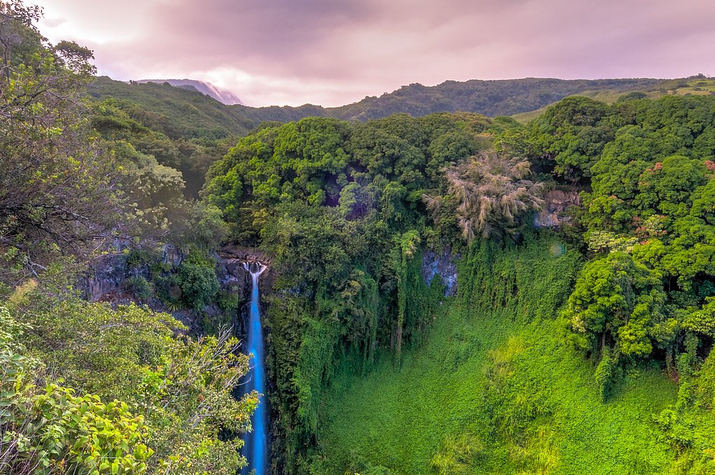
Kekuapoʻowai Falls is a waterfall in the state's Hana Forest Reserve on the slopes above Kīpahulu, on the east side of Maui, about 1.5 km outside the boundary of Haleakalā National Park. We could not find a documented public trail, route description or height for it.
The Setting
Kekuapoʻowai Falls sits at 1,768 feet within Hana Forest Reserve, in the hills of Hawaii.
Nearby Falls Worth Visiting
Waihiʻumalu Falls (400 ft) lies 0.3 miles to the northeast. Also nearby: Waimoku Falls (400 ft, 1.3 mi) and Makahiku Falls (200 ft, 1.9 mi).
Trail & Hike Details
What to Expect
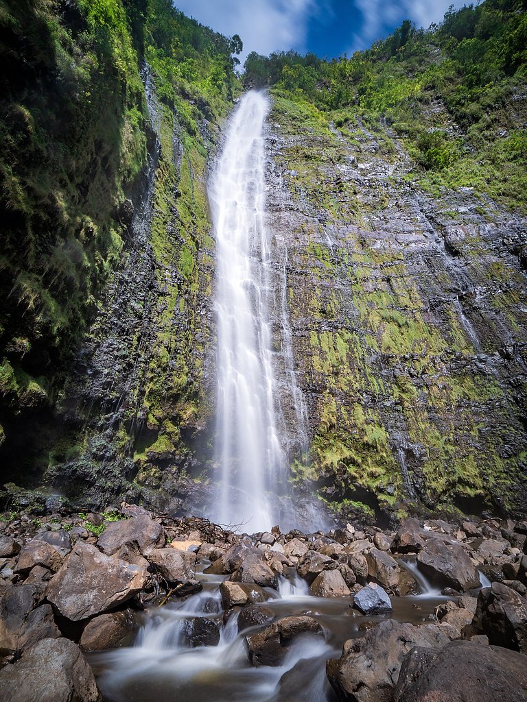
Visitors can expect a secluded and tranquil waterfall surrounded by dense tropical vegetation. The area may be slippery and rugged, so caution is advised.
Accessibility
The trail to Kekuapoʻowai Falls is likely not accessible for individuals with mobility challenges due to rugged terrain and lack of infrastructure.
Frequently Asked Questions
🐶 Are Dogs Allowed at Kekuapoʻowai Falls?
❌ Dogs are not allowed
Are There Any Fees or Permits Required?
🆖 No fees required
🏊 Is There Swimming at Kekuapoʻowai Falls?
❌ Swimming is not allowed
When to Visit
The falls can be visited year-round, but conditions may vary depending on rainfall. Dry seasons may offer easier access.
Seasonal Access
The best time to visit is Spring, Summer, Fall, and Winter. Heavy rains during wet season (November through March) bring higher flow but can make trails slippery.
Safety Information
The trail may be slippery, muddy, and unmarked. Visitors should exercise caution, especially after rainfall. Always inform someone of your plans before heading out.
Current Water Conditions
These readings come from the USGS gauge on Oheo Gulch, 1.8 miles away, not on Kekuapoʻowai Falls's own stream. Use them as a sign of whether the area is running wet or dry.
155 ft³/s
Current discharge — how much water is flowing
Higher than usual for this time of year
Based on 29 years of record
2.10 ft
Water depth at gauge
7-Day Discharge Trend
What does this mean for your visit?
The water is flowing higher than usual for this time of year.
About This Gauge
7-Day Flow Outlook
Based on the USGS gauge Oheo Gulch at dam near Kipahulu, Maui, HI (3 km away).
Today
Moderate
17 cfs
6/10Tomorrow
Moderate
16 cfs
6/10Tue
Moderate
15 cfs
6/10Wed
Moderate
15 cfs
6/10Thu
Moderate
17 cfs
6/10Fri
Moderate
14 cfs
6/10Sat
Moderate
21 cfs
6/10Best window: Today — moderate flow, chance rain showers (trip score 6/10).
Best time of year: this gauge typically runs highest from late November to early December, peaking in April.
How we calculate this
This is a transparent outlook, not a precise forecast. We take the waterfall's current flow strength (how it ranks against its historical normal for today, from the nearest USGS stream gauge), carry that ranking forward along the gauge's seasonal curve, and nudge it for forecast rain. Confidence is highest for the next day or two and falls further out. Always check official conditions and your own judgment before visiting — high flows can be dangerous.
Know when to go.
Get a free email alert when waterfalls near Hana hit peak flow. We only send when conditions are worth the trip — no weekly newsletters, no spam.
Weather Forecast
The Terrain Around Kekuapoʻowai Falls
High-resolution lidar hasn't been flown here yet, so this is the aerial view of the ground around the falls. Open the 3D view to tilt and spin the landscape.
The dot marks the waterfall. The frame is about a mile across.
Aerial imagery: USGS The National Map. Public domain.
Location & Access
Getting There
Kekuapoʻowai Falls is located in a remote area of Hawaii. Access details are not widely documented, and visitors may need to consult local guides or experienced hikers for directions. The falls are not easily accessible by road.
Get Directions on Google MapsParking
Parking availability is unclear. Visitors should plan for limited or no designated parking near the trailhead.
Elevation
1,768 feet above sea level
Coordinates
20.692776° N, -156.042083° W
Land Management
Managed by SDNR
Visitor Tips & Gear
Consult local guides or experienced hikers for accurate directions and trail conditions. Wear sturdy footwear and bring plenty of water. Be prepared for potentially muddy or slippery conditions.
Where to Stay

Maui Kamaole #F-210 Private, Across Kamaole III, Full A/C, Great Location

Heavenly Hana Paradise

Paia Inn

Hana Kai Maui - #106 Kuakahi partial oceanview studio
Browse vacation cabins and private rentals nearby
Unique outdoor stays — tents, yurts, and treehouses
Rent a campervan or RV for your waterfall road trip
Some links are affiliate links. We may earn a commission at no extra cost to you.
Nearby Campground
Haleakalā National Park (Cabin Permits)
8 miles away · 3 sites
Overview Located on the island of Maui, Haleakalā National Park maintains three wilderness cabins for visitor use-- Hōlua, Palikū, and Kapalaoa. All cabins are accessible only by trail from the summit area and require you to hike a minimum of 3.7 mi (5.9 km). Backcountry users must plan to enter the park entrance for their stay no earlier than 7 am unless they have also obtained a sunrise reservation granting access to the park between 3 and 7 am. Sunrise reservations can be made on recreation.go
Book on Recreation.govAdditional Information
Nearby Attractions
The Kīpahulu District of Haleakalā National Park, where the Pīpīwai Trail leads to Waimoku Falls, is nearby.
Wildlife
The area is home to various tropical birds, insects, and other native wildlife. Visitors should be mindful of their surroundings.
Nearby Waterfalls
 Aerial
Writing about Kekuapoʻowai Falls? Embed this waterfall on your site for free.