
Waimea Falls
Hawaii • 45 ft
By Armen Suny · Last verified Sep 2026
LiDAR & 3D terrain


Photo Credits (5)
Difficulty
Easy
Trail Length
1.5 miles
Trail Type
Out And Back
Elevation Gain
200 ft
About Waimea Falls
Waimea Falls (also called Waihi Falls) sits at the heart of Waimea Valley on Oahu’s North Shore, a lush, historically important landscape shaped by volcanic soil and abundant rainfall. The 45-foot cascade is set amid botanical gardens and a valley that played a central role in traditional Hawaiian religion and agriculture; visitors can still see stone terraces and walls erected during the Hawaiian monarchy that hint at the area’s past as one of Polynesia’s most prosperous farming communities. The falls’ accessibility and scenic setting make it a favorite for both first-time visitors and repeat explorers. A short, easy walk brings you through cultivated gardens and cultural sites before the waterfall reveal. The route is family-friendly and well-suited to a relaxed half-day outing, pairing natural beauty with a tangible sense of local history and stewardship that gives Waimea Falls its enduring appeal.
The Setting
Waimea Falls sits at 167 feet in the coastal lowlands of Hawaii. The falls drop 45 feet.
Height: 45 feet
Trail & Hike Details
The Approach
The easy 1.5-mile out-and-back trail gains 200 feet of elevation on the way to the falls.
Trail Description
This is an easy, out-and-back trail of approximately 1.5 miles round-trip with about 200 feet of elevation gain. The path is well maintained and paved as it winds through Waimea Valley’s botanical collections and past historic cultural features like stone terraces and walls. Expect gentle grades and scenic viewpoints en route; the trail culminates at the 45-foot Waimea (Waihi) Falls.
What to Expect
The falls drop 45 feet. Swimming is permitted.
Accessibility
The trail is not wheelchair accessible. Uneven terrain and elevation changes require steady footing.
Frequently Asked Questions
🐶 Are Dogs Allowed at Waimea Falls?
❌ Dogs are not allowed
Are There Any Fees or Permits Required?
🤑 Fee: $25.00
🏊 Is There Swimming at Waimea Falls?
✅ Swimming is allowed
When to Visit
Waimea Falls can be visited year-round, but mornings are generally less crowded. The waterfall flow is typically stronger after rainfall, though swimming may be restricted during high water conditions.
Seasonal Access
The best time to visit is Spring, Summer, Fall, and Winter. Heavy rains during wet season (November through March) bring higher flow but can make trails slippery.
Safety Information
Swimming may be restricted during high water conditions or after heavy rains. Always follow posted signs and lifeguard instructions. The trail is generally safe, but visitors should stay on the designated path to avoid hazards.
Current Water Conditions
These readings come from the USGS gauge on Kamananui Str, 0.8 miles away, not on Waimea Falls's own stream. Use them as a sign of whether the area is running wet or dry.
5 ft³/s
Current discharge — how much water is flowing
About average for this time of year
Based on 51 years of record
2.12 ft
Water depth at gauge
7-Day Discharge Trend
What does this mean for your visit?
Flow is about average for this time of year.
About This Gauge
7-Day Flow Outlook
Based on the USGS gauge Kamananui Str at Maunawai, Oahu, HI (1 km away).
Today
Barely Flowing
5 cfs
3/10Tomorrow
Low
7 cfs
4/10Wed
Low
6 cfs
4/10Thu
Low
5 cfs
3/10Fri
Low
7 cfs
4/10Sat
Low
4 cfs
4/10Sun
Low
8 cfs
4/10Best window: Tomorrow — low flow, occasional rain showers (trip score 4/10).
Best time of year: this gauge typically runs highest from early April to mid April, peaking in November.
How we calculate this
This is a transparent outlook, not a precise forecast. We take the waterfall's current flow strength (how it ranks against its historical normal for today, from the nearest USGS stream gauge), carry that ranking forward along the gauge's seasonal curve, and nudge it for forecast rain. Confidence is highest for the next day or two and falls further out. Always check official conditions and your own judgment before visiting — high flows can be dangerous.
Know when to go.
Get a free email alert when waterfalls near Pupukea hit peak flow. We only send when conditions are worth the trip — no weekly newsletters, no spam.
Weather Forecast
The Terrain, Seen by LiDAR
Aircraft-mounted lasers measured this ground to within inches. Trees and buildings are digitally stripped away, leaving the bare shape of the land the water has carved.
Along the line through the falls, the bare ground drops about 352 feet, most of it in one sheer step, the signature of a plunge waterfall. The falls are listed at 45 feet; the extra comes from the ravine that continues below the base. The ground at the falls is roughly 148 feet above sea level.
The whole reach is steep: about 396 feet of descent in the 500 feet above the falls and another 287 feet in the 500 feet below. The falls face south and sit in full sun for most of the day, best photographed early or late.
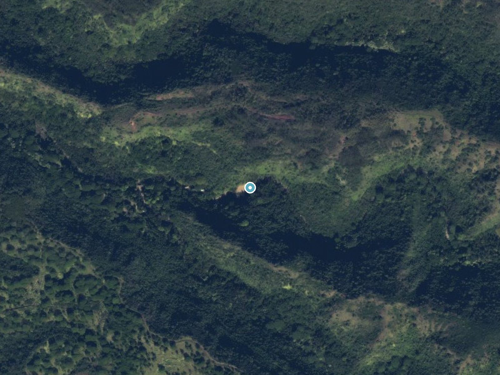
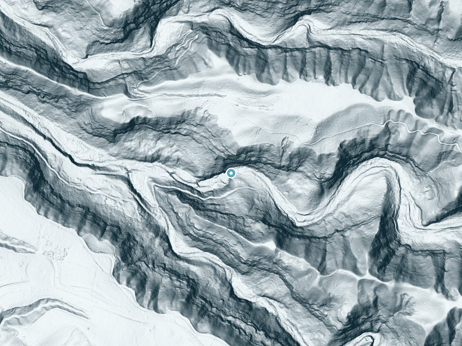
Drag to compare. The dot marks the waterfall. The frame is about a mile across.
- Ground elevation
- 148 feet
- Measured by 1-meter lidar
- Drop at the falls
- About 352 feet
- Change in ground height within ~250 feet of the falls
- Faces
- South
- Sunlit most of the day. Go early or late for softer light.
A slice through the lidar ground surface, from above the falls to downstream (heading south).
Elevation data: USGS 3D Elevation Program. Aerial imagery: USGS The National Map. Public domain.
Location & Access
Getting There
Waimea Falls is located within Waimea Valley, which is accessible via Kamehameha Highway on the North Shore of Oahu. The entrance to Waimea Valley is well-marked, and the waterfall is reached by following a paved trail through the botanical gardens.
Get Directions on Google MapsParking
There is a designated parking lot at Waimea Valley, which is typically spacious but may fill up during peak tourist seasons. Parking fees may apply.
Elevation
167 feet above sea level
Coordinates
21.630767° N, -158.043832° W
Visitor Tips & Gear
Arrive early to avoid crowds, especially during weekends and holidays. Wear comfortable walking shoes and bring water, sunscreen, and insect repellent. If you plan to swim, bring a swimsuit and towel. Check the weather forecast, as heavy rains may affect trail conditions or swimming availability.
As an Amazon Associate, we earn from qualifying purchases.
This easy 1.5 miles hike is straightforward — comfortable trail shoes and plenty of water should do. Icy conditions are common in winter — traction cleats are a smart addition.

Columbia Watertight II Rain Jacket
Packs into its own pocket, seam-sealed, and keeps you dry from spray and surprise rain.

Polarized Sunglasses (Knockaround)
Cuts glare off the water so you actually see the falls — and your photos turn out better too.

Earth Pak Waterproof Dry Bag
Keeps your phone and gear dry when waterfall mist soaks everything else.
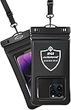
Waterproof Phone Pouch (AiRunTech)
Cheap insurance — take photos right next to the falls without killing your phone.

Kahtoola MICROspikes
Cult-favorite traction cleats that grip ice and wet rock — essential for winter waterfall hikes.

JOBY GorillaPod Starter Kit
Wraps around railings and rocks for long-exposure waterfall shots — no flat surface needed.
Where to Stay

Courtyard by Marriott Oahu North Shore

Breezy Beachfront Bali-Style Haven 180 Degree OceanView

Hilton Hawaiian Village Waikiki Beach Resort

Beach Cozy North Shore Turtle Bay Condo
Browse vacation cabins and private rentals nearby
Unique outdoor stays — tents, yurts, and treehouses
Rent a campervan or RV for your waterfall road trip
Some links are affiliate links. We may earn a commission at no extra cost to you.
Additional Information
Nearby Attractions
Nearby attractions include Waimea Bay Beach Park, the Banzai Pipeline, and the historic town of Haleiwa.
Wildlife
The area is home to a variety of native Hawaiian birds and plants. Visitors may also see fish in the pool at the base of the waterfall.
Cities near Waimea Falls
Writing about Waimea Falls? Embed this waterfall on your site for free.