Photo Credits (1)
Difficulty
Moderate
Trail Length
2.4 miles
Trail Type
Out And Back
Elevation Gain
350 ft
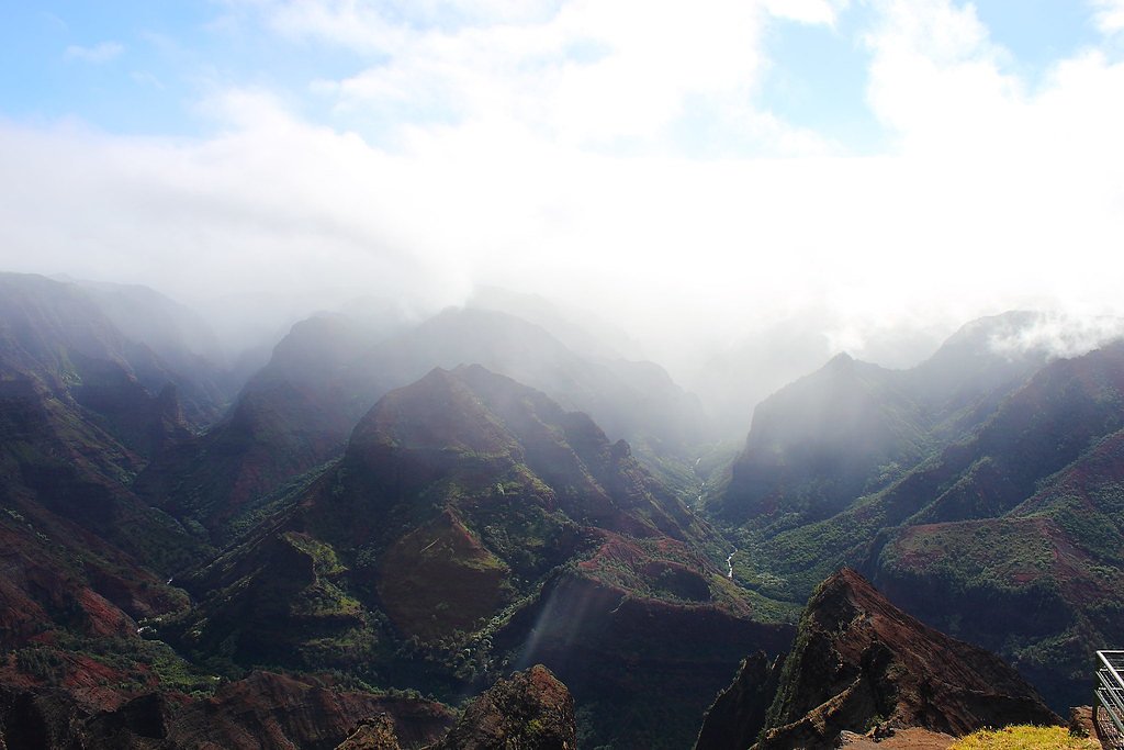
About Waimanu Falls
Waimanu Falls plunges in two dramatic tiers into a secluded pool tucked deep in Waimanu Valley on Molokaʻi. Nestled within the Molokaʻi Forest Reserve and managed by the State of Hawaiʻi Department of Land and Natural Resources (SDNR), the falls are framed by lush tropical vegetation and steep valley walls that reward hikers with a real sense of remoteness and wild beauty. Visitors come for the quiet cascade, the verdant gorge, and the feeling of stepping into an untouched corner of the island. The most common approach is via the historic Muliwai Trail, which traverses coastal ridgelines and rainforest before dropping into the valley floor. Although access is limited and the route requires steady footing, the payoff is a pristine swimming hole beneath the falls and striking views back up the valley. Because the site sits on SDNR-managed lands in the Molokaʻi Forest Reserve, visitors should respect local rules and leave no trace to help preserve this special area.
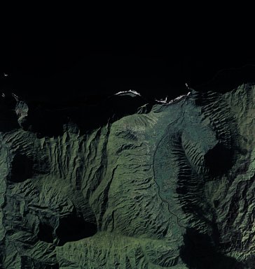
The Setting
Waimanu Falls sits at 2,841 feet within Moloka'i Forest Reserve, in the hills of Hawaii.
Nearby Falls Worth Visiting
Puʻukaʻōkū Falls, the tallest waterfall in Hawaii at 2,756 feet, lies 6.0 miles to the east. Also nearby: ʻOloʻupena Falls (900 ft, 5.7 mi).
Trail & Hike Details
The Approach
The moderate 2.4-mile out-and-back trail gains 350 feet of elevation on the way to the falls.
Trail Description
Muliwai Trail to Waimanu Falls is an out-and-back route of roughly 2.4 miles with about 350 feet of elevation gain and a moderate difficulty rating. The trail moves from exposed coastal ridges into dense tropical forest and includes some steep sections and stream crossings that require careful footing. Expect uneven dirt and root-covered tread rather than developed surfacing; the trail is rugged in places and best suited to hikers prepared for a natural backcountry path. Signage and formal infrastructure are minimal on SDNR-managed lands, so carry essentials (water, rain gear, sturdy shoes) and plan for limited cell service. The route’s moderate overall grade belies occasional short, steeper pitches—take your time on descents into the valley and allow extra time for the return climb.
What to Expect
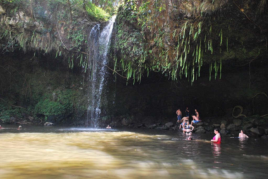
Swimming is permitted.
Accessibility
The trail is not wheelchair accessible. Uneven terrain and elevation changes require steady footing.
Frequently Asked Questions
🐶 Are Dogs Allowed at Waimanu Falls?
❌ Dogs are not allowed
Are There Any Fees or Permits Required?
🤑 Fees are required
Permit required
Permits are required for camping in Waimanu Valley and can be obtained through the Hawaii Department of Land and Natural Resources.
🏊 Is There Swimming at Waimanu Falls?
✅ Swimming is allowed
When to Visit
The falls can be visited year-round, but the best time to visit is during the dry season (May to October) when trail conditions are typically more manageable.
Seasonal Access
The best time to visit is Spring, Summer, Fall, and Winter. Heavy rains during wet season (November through March) bring higher flow but can make trails slippery.
Safety Information
The trail is challenging and includes steep sections, stream crossings, and potentially slippery terrain. Flash floods can occur in the valley, so check weather conditions before visiting. Cell phone service is limited or nonexistent in the area.
Current Water Conditions
8 ft³/s
Current discharge — how much water is flowing
About average for this time of year
Based on 70 years of record
1.31 ft
Water depth at gauge
7-Day Discharge Trend
What does this mean for your visit?
Flow is about average for this time of year.
About This Gauge
7-Day Flow Outlook
Based on the USGS gauge Waikolu Str blw pipe nr Kalaupapa, Molokai, HI (2 km away).
Today
Roaring
8 cfs
9/10Tomorrow
Roaring
9 cfs
6/10Fri
Roaring
9 cfs
6/10Sat
Roaring
9 cfs
9/10Sun
Roaring
8 cfs
9/10Mon
Roaring
9 cfs
9/10Tue
Roaring
9 cfs
9/10Best window: Today — roaring flow, mostly sunny (trip score 9/10).
Best time of year: this gauge typically runs highest from late February to late May, peaking in April.
How we calculate this
This is a transparent outlook, not a precise forecast. We take the waterfall's current flow strength (how it ranks against its historical normal for today, from the nearest USGS stream gauge), carry that ranking forward along the gauge's seasonal curve, and nudge it for forecast rain. Confidence is highest for the next day or two and falls further out. Always check official conditions and your own judgment before visiting — high flows can be dangerous.
Know when to go.
Get a free email alert when waterfalls near Kualapuu hit peak flow. We only send when conditions are worth the trip — no weekly newsletters, no spam.
Weather Forecast
Location & Access
Getting There
Waimanu Falls is located in the Waimanu Valley, which can only be accessed via the challenging Muliwai Trail starting from Waipio Valley. The trail is approximately 9 miles one way and requires crossing streams and navigating steep terrain. Alternatively, access by boat or kayak may be possible, but conditions can be unpredictable.
Get Directions on Google MapsParking
Parking is available near the Waipio Valley Lookout, but spaces are limited. Visitors should plan to arrive early to secure a spot.
Elevation
2,841 feet above sea level
Coordinates
21.149915° N, -156.943474° W
Land Management
Managed by SDNR
Visitor Tips & Gear
Bring plenty of water, snacks, and proper hiking gear, including sturdy shoes. Check weather conditions before starting the hike, as rain can make the trail more dangerous. Consider camping overnight in Waimanu Valley to fully enjoy the experience, but permits are required for camping.
As an Amazon Associate, we earn from qualifying purchases.
With 2.4 miles and 350 ft of elevation gain, sturdy boots and trekking poles will help on this moderate trail. Icy conditions are common in winter — traction cleats are a smart addition.

Columbia Watertight II Rain Jacket
Packs into its own pocket, seam-sealed, and keeps you dry from spray and surprise rain.

Polarized Sunglasses (Knockaround)
Cuts glare off the water so you actually see the falls — and your photos turn out better too.

Earth Pak Waterproof Dry Bag
Keeps your phone and gear dry when waterfall mist soaks everything else.

Waterproof Phone Pouch (AiRunTech)
Cheap insurance — take photos right next to the falls without killing your phone.

Timberland Euro Sprint Mid Waterproof
Trusted waterproof boot with premium leather and grippy rubber sole — reliable on rocky, wet trails.

TrailBuddy Trekking Poles
Lightweight aluminum, cork grips, and flip-locks that actually hold — a best-seller for good reason.
Where to Stay

High-End Resort Condo Nestled on Molokai Shoreline

OUTRIGGER Kāʻanapali Beach Resort

Kahana Beach Vacation Club

Gardens at West Maui
Browse vacation cabins and private rentals nearby
Unique outdoor stays — tents, yurts, and treehouses
Rent a campervan or RV for your waterfall road trip
Some links are affiliate links. We may earn a commission at no extra cost to you.
Additional Information
Nearby Attractions
Waipio Valley, Hiilawe Falls, and the Hamakua Coast.
Wildlife
The area is home to native Hawaiian birds, insects, and other wildlife. Visitors may also encounter wild pigs in the valley.
Cities near Waimanu Falls
Nearby Waterfalls
Writing about Waimanu Falls? Embed this waterfall on your site for free.