Photo Credits (5)
Difficulty
Moderate
Trail Length
3.0 miles
Trail Type
Out And Back
Elevation Gain
500 ft
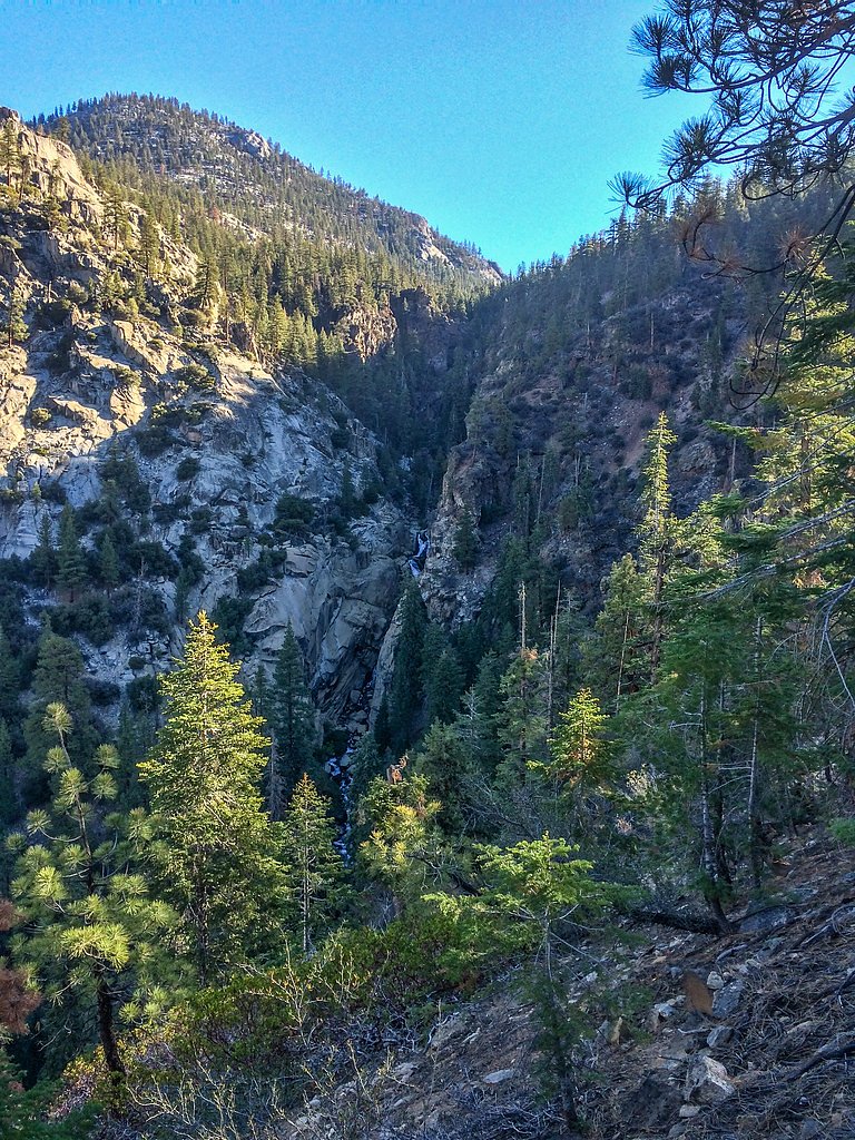
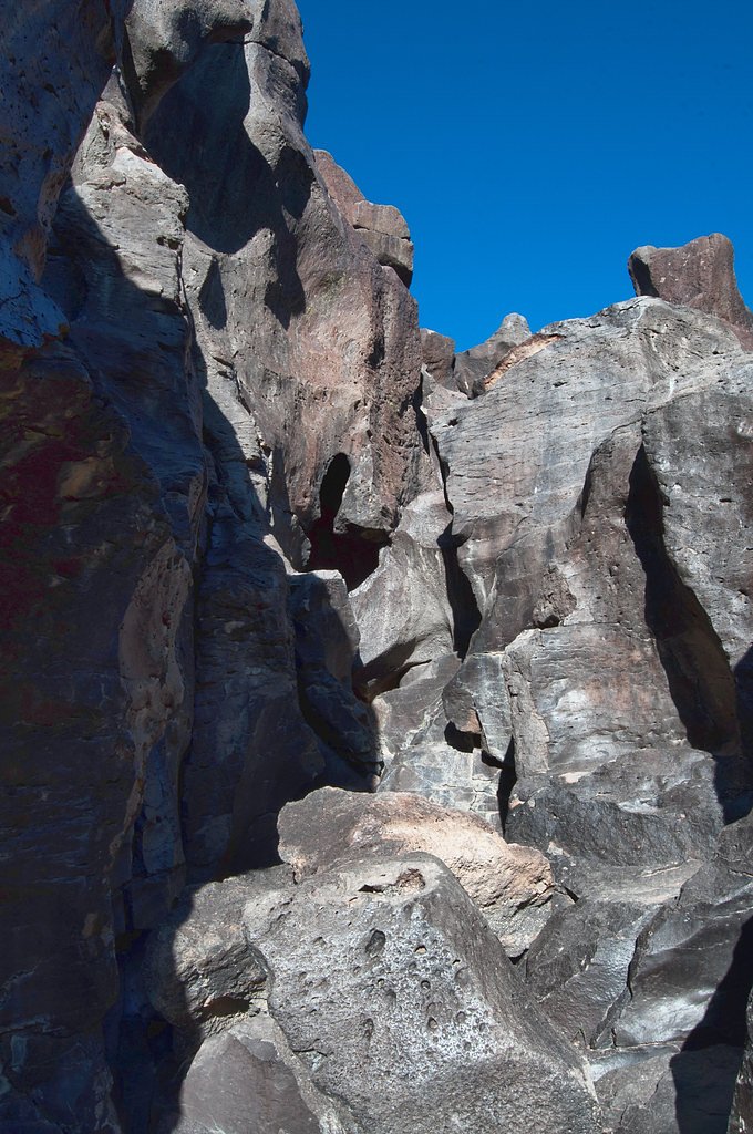
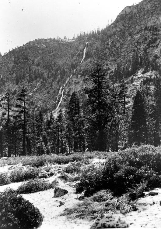
About Volcano Falls
Volcano Falls sits within the Inyo National Forest and is managed by the U.S. Forest Service, offering a peaceful, forested cascade that draws hikers looking for a relatively short, scenic outing. The approach follows the Golden Trout Creek corridor—USFS Trail GOLDEN TROUT CREEK (Trail #3410)—through stands of native vegetation and rocky creekside benches, making it a rewarding spot for photographers and day hikers seeking solitude in a high-desert mountain setting. The route to the falls is generally described as moderate: the full outing is about 3.0 miles round trip with roughly 500 feet of elevation gain. The USFS lists Trail #3410 with a native material surface and typical grades in the 12–20% range, so expect some steep pitches and short scrambling sections; sturdy footwear and readiness for uneven terrain will make the visit much more comfortable.
The Setting
Volcano Falls sits at 6,778 feet within Inyo National Forest, fed by the Marble Fork Kaweah R, in the high mountains of California.
Trail & Hike Details
The Approach
The moderate hike follows Golden Trout Creek (#3410), a 3.0-mile out-and-back trail over natural surface. Expect 500 feet of elevation gain with grades of 12-20%. The trail is developed (Class 3).
USFS Trail
GOLDEN TROUT CREEK #3410
Trail Class
Developed
Surface
Avg Grade
USFS Segment
0.81 miTrail Description
Out-and-back, 3.0 miles total with approximately 500 ft elevation gain; difficulty: moderate. Primary access is via USFS GOLDEN TROUT CREEK, Trail #3410 (GIS miles listed as 0.81). Trail class: 3 (includes short scrambling sections). Surface: native material; typical grade: 12–20%. Expect uneven, rocky footing and steeper pitches—sturdy shoes, careful footing, and basic route-finding are recommended on the native-soil and rock tread.
What to Expect
Visitors can expect a serene hike through nature, culminating in a view of the cascading Volcano Falls. The area around the falls is peaceful, making it a great spot for photography or relaxation.
Accessibility
The trail is not wheelchair accessible. Uneven terrain and elevation changes require steady footing.
Frequently Asked Questions
🐶 Are Dogs Allowed at Volcano Falls?
❌ Dogs are not allowed
Are There Any Fees or Permits Required?
🆖 No fees required
🏊 Is There Swimming at Volcano Falls?
❌ Swimming is not allowed
When to Visit
Spring and early summer are the best times to visit, as the waterfall flow is typically strongest due to snowmelt and seasonal rains.
Seasonal Access
The best time to visit is Spring, Summer, and Fall. Access roads and trails may close during winter due to snow. Check with Inyo National Forest for seasonal road closures.
Safety Information
Visitors should be cautious of slippery rocks near the waterfall and avoid getting too close to the edge. Carry a first aid kit and be prepared for changing weather conditions. Cell phone reception may be limited in the area.
Current Water Conditions
Based on a USGS gauge 24.8 miles away
10 ft³/s
Current discharge — how much water is flowing
About average for this time of year
Based on 12 years of record
7.24 ft
Water depth at gauge
50°F
Very coldExpect numbness within minutes
7-Day Discharge Trend
What does this mean for your visit?
Flow is about average for this time of year. Water temperature is very cold at 50 degrees F, expect numbness within minutes.
About This Gauge
This gauge is on a regional waterway. Conditions at the falls may differ, especially after local rain.
7-Day Flow Outlook
Based on the USGS gauge MARBLE FORK KAWEAH R AB HORSE C NR LODGEPOLE CA (40 km away).
Today
Barely Flowing
10 cfs
5/10Tomorrow
Barely Flowing
9 cfs
5/10Mon
Barely Flowing
8 cfs
5/10Tue
Barely Flowing
7 cfs
5/10Wed
Barely Flowing
6 cfs
5/10Thu
Barely Flowing
8 cfs
5/10Fri
Barely Flowing
7 cfs
5/10Best window: Today — barely flowing flow, sunny (trip score 5/10).
Best time of year: this gauge typically runs highest from late March to late June, peaking in June.
How we calculate this
This is a transparent outlook, not a precise forecast. We take the waterfall's current flow strength (how it ranks against its historical normal for today, from the nearest USGS stream gauge), carry that ranking forward along the gauge's seasonal curve, and nudge it for forecast rain. Confidence is highest for the next day or two and falls further out. Always check official conditions and your own judgment before visiting — high flows can be dangerous.
Know when to go.
Get a free email alert when waterfalls near Cartago hit peak flow. We only send when conditions are worth the trip — no weekly newsletters, no spam.
Weather Forecast
Location & Access
Getting There
Volcano Falls is located in a remote area of California. Access typically requires driving to a trailhead followed by a hike. Exact directions may vary depending on the starting point, so consulting a reliable map or GPS is recommended.
Get Directions on Google MapsParking
Parking is available near the trailhead, but spaces may be limited during peak seasons. Visitors are advised to arrive early to secure a spot.
Elevation
6,778 feet above sea level
Coordinates
36.352574° N, -118.393641° W
Land Management
Managed by USFS
Visitor Tips & Gear
Start your hike early to avoid crowds and ensure you have enough daylight for the return trip. Bring plenty of water, as the trail can be warm during summer months. Check trail conditions before heading out, especially after heavy rains.
This trail sits at 6,778 ft above sea level
Elevated TrailUV radiation is roughly 27% stronger at this elevation than at sea level, and the dry air accelerates dehydration. Extra sun protection and fluids go a long way.
As an Amazon Associate, we earn from qualifying purchases.

Coppertone Sport SPF 50 Sunscreen
UV intensity jumps ~4% per 1,000 ft — at this elevation you can burn in half the time.

Sun Bum SPF 30 Lip Balm (3-Pack)
Lips have almost no natural UV protection and burn fast in thin, dry mountain air.

Liquid I.V. Electrolyte Packets
You lose moisture ~2x faster at elevation — electrolytes help you absorb water efficiently.

ROCKNIGHT Polarized UV400 Sunglasses
High-altitude glare off rock and water is intense — UV400 lenses block 99%+ of UVA/UVB.
As an Amazon Associate, we earn from qualifying purchases.
With 3.0 miles and 500 ft of elevation gain, sturdy boots and trekking poles will help on this moderate trail. Sun exposure on the trail makes good sun protection a must in summer.

Polarized Sunglasses (Knockaround)
Cuts glare off the water so you actually see the falls — and your photos turn out better too.

Columbia Watertight II Rain Jacket
Packs into its own pocket, seam-sealed, and keeps you dry from spray and surprise rain.

Earth Pak Waterproof Dry Bag
Keeps your phone and gear dry when waterfall mist soaks everything else.

Waterproof Phone Pouch (AiRunTech)
Cheap insurance — take photos right next to the falls without killing your phone.

Timberland Euro Sprint Mid Waterproof
Trusted waterproof boot with premium leather and grippy rubber sole — reliable on rocky, wet trails.

TrailBuddy Trekking Poles
Lightweight aluminum, cork grips, and flip-locks that actually hold — a best-seller for good reason.
Where to Stay

Quality Inn Lone Pine near Mount Whitney

Dow Villa Motel

Stargazer Chalet, two bedroom with WiFi

Olancha RV Park and Motel
Browse vacation cabins and private rentals nearby
Unique outdoor stays — tents, yurts, and treehouses
Rent a campervan or RV for your waterfall road trip
Some links are affiliate links. We may earn a commission at no extra cost to you.
Nearby Campground
QUAKING ASPEN
18 miles away · 39 sites
Overview Quaking Aspen Campground is situated in the Giant Sequoia National Monument near numerous distinctive sequoia groves, including McIntyre Grove and Freeman Creek Grove, at an elevation of 7,000 feet. Recreation Visitors can explore nearby sequoia groves. Bear Creek Grove has a trail that winds through the Belknap Complex along Bear Creek and the Tule River. The Freeman Creek Grove is also a popular destination. At 1,425 acres, this immense unlogged grove features several large sequoias, i
Book on Recreation.govNearby Hot Springs
Hot springs near Cartago, California
Kern Hot Spring
Kern Hot Spring emerges at 109°F in Sequoia National Park at 6,908 feet elevation, accessible only via backcountry hiking. Prot...

Jordan Hot Springs
Jordan Hot Springs delivers 124-degree water from the Golden Trout Wilderness at 6,533 feet elevation, ranking among California...
Soda Springs
Soda Springs flows at 100°F in the high Sierra Nevada at 7,857 feet elevation, delivering water 54.5 degrees warmer than the fr...

Dirty Socks Hot Spring
Dirty Socks Hot Spring emerges at 93°F from the Owens Valley floor, named for the distinctive sulfurous odor that has defined t...
Ward Spring
Ward Spring flows at 70 degrees in Tulare County's southern Sierra Nevada foothills, producing water only 9.9 degrees above amb...

Springs
This 86-degree spring emerges at 3,601 feet in the arid Owens Valley, where the City of Los Angeles owns vast tracts of land fo...
Looking for a soak after your hike? Explore more hot springs near Cartago, California on SoakingSprings.
Explore California springsAdditional Information
Nearby Attractions
Nearby attractions may include other hiking trails, scenic viewpoints, and local parks. Visitors can explore the surrounding area for additional outdoor activities.
Wildlife
The area around Volcano Falls is home to a variety of wildlife, including birds, deer, and small mammals. Visitors should respect the natural habitat and avoid feeding animals.
Cities near Volcano Falls
Nearby Waterfalls
Writing about Volcano Falls? Embed this waterfall on your site for free.