Virgin Falls
Tennessee • 110 ft
By Armen Suny · Last verified Mar 2026
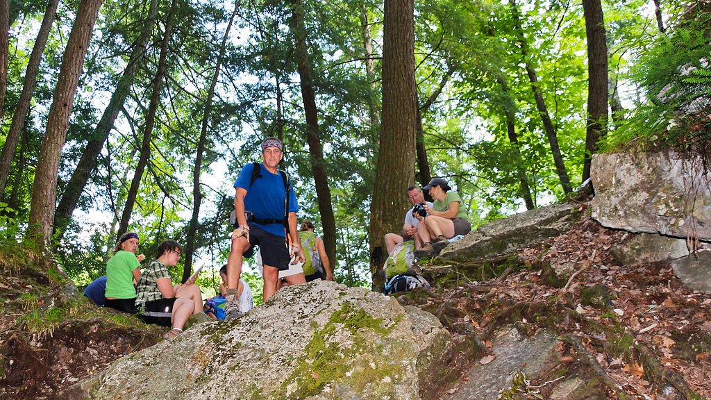
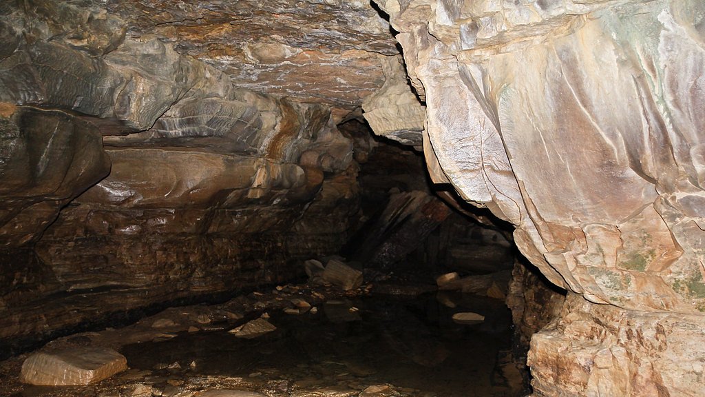
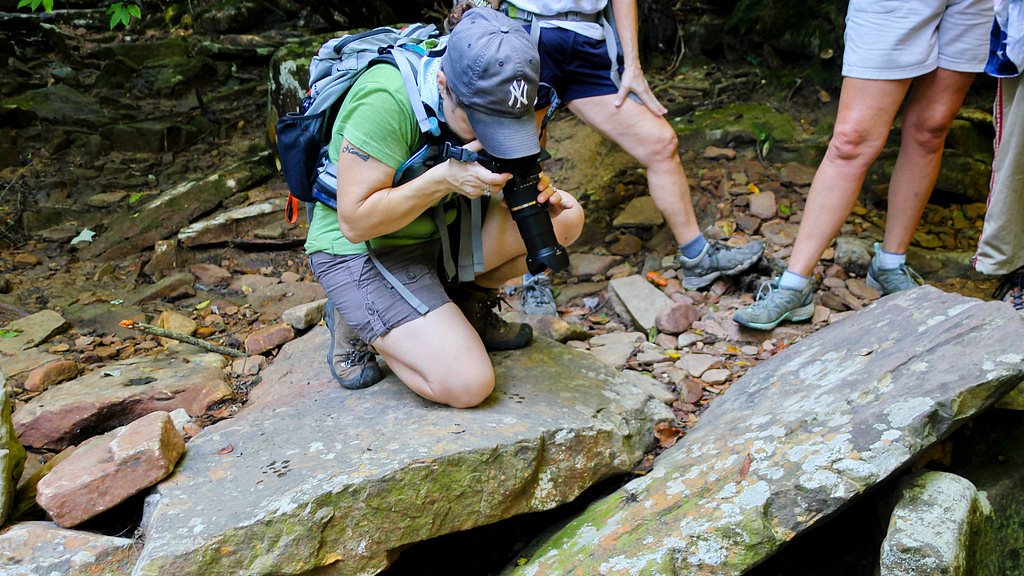
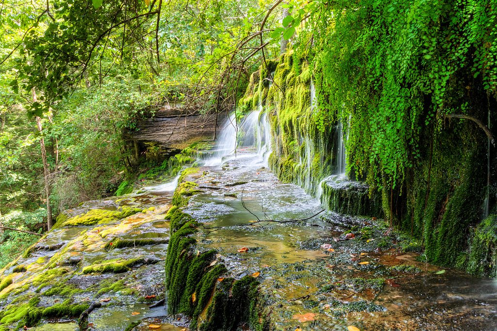

Photo Credits (5)
Difficulty
Hard
Trail Length
8.2 miles
Trail Type
Out And Back
Elevation Gain
1,200 ft
About Virgin Falls
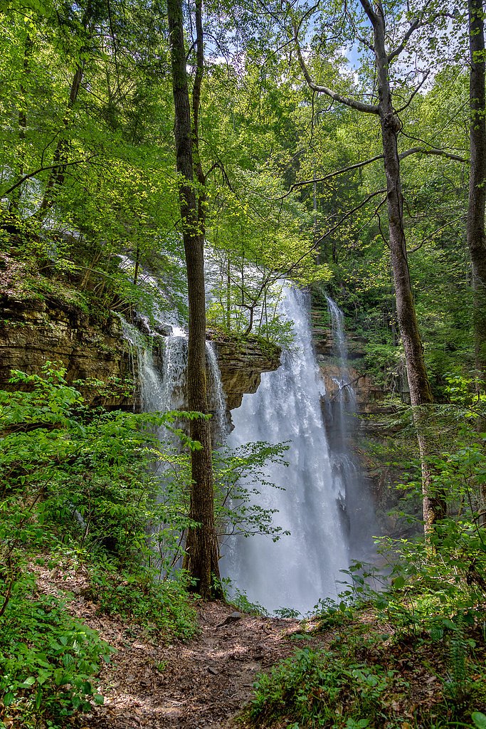
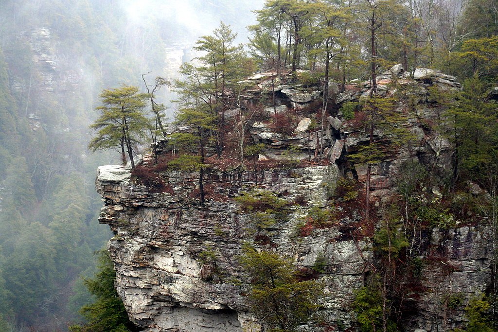
Virgin Falls is a geological curiosity: a 110-foot cascade that appears from an underground spring, plunges over the rim of the Cumberland Plateau, and vanishes into a sink cave below. The falls sit inside the Virgin Falls State Natural Area, part of the Fall Creek Falls land unit (designation: SP) and managed by OTHS. That setting gives the place a remote, cathedral-like feel — the same rugged plateau country that includes nearby canyonlands such as Scott's Gulf, an 18-mile gorge along the Caney Fork River known for its undisturbed deciduous forest, caves and dramatic waterfalls. Reaching the falls rewards hikers with a mix of cliff-line overlooks, forested hollows and karst features like caves and disappearing streams. The natural area’s protected status helps preserve the fragile passages and viewing spots; photographers and experienced day-hikers will find memorable vantage points but should plan carefully and respect signs and barriers around sinkholes and cave openings.
The Setting
Virgin Falls sits at 1,102 feet within Fall Creek Falls, fed by the Calfkiller River, in the foothills of Tennessee. At 110 feet, it is among the taller waterfalls in Tennessee.
Height: 110 feet
Trail & Hike Details
The Approach
The hard 8.2-mile out-and-back trail gains 1,200 feet of elevation on the way to the falls.
Trail Description
The standard route to Virgin Falls is an out-and-back trek of about 8.2 miles round trip with roughly 1,200 feet of elevation gain. The approach is classified as hard: expect sustained climbs, rocky footing, and some narrow or exposed sections as the trail follows ridgelines and descends to karst features. The path is waymarked through the state natural area, but the terrain is rugged and requires good footwear, water and navigation skills. The highlight is the 110-foot drop of Virgin Falls itself; along the route you’ll also pass other caves, overlooks and small cascades typical of this portion of the Cumberland Plateau.
What to Expect
The falls cascade 110 feet. Dogs are welcome.
Accessibility
The trail involves steep, uneven terrain with significant elevation change and is not accessible to mobility devices.
Frequently Asked Questions
🐶 Are Dogs Allowed at Virgin Falls?
✅ Dogs are allowed
Are There Any Fees or Permits Required?
🆖 No fees required
Permit required
A permit is required for overnight camping. Permits can be obtained through the Tennessee State Parks website.
🏊 Is There Swimming at Virgin Falls?
❌ Swimming is not allowed
When to Visit
Spring and fall are the best times to visit due to cooler temperatures and vibrant foliage. The waterfall flow is typically strongest in spring after rainfall.
Seasonal Access
The best time to visit is Spring and Fall. Winter access may be limited.
Safety Information
The trail is strenuous and requires proper preparation. Bring adequate supplies, including water and a first aid kit. Be cautious of slippery rocks, especially near the waterfall. Cell service is limited, so inform someone of your plans before heading out.
Current Water Conditions
49 ft³/s
Current discharge — how much water is flowing
Much lower than usual for this time of year
Based on 9 years of record
4.22 ft
Water depth at gauge
7-Day Discharge Trend
What does this mean for your visit?
Flow is well below normal for this time of year, so the waterfall may be a trickle.
About This Gauge
This gauge is on a nearby waterway and may not reflect exact conditions at the falls.
7-Day Flow Outlook
Based on the USGS gauge CALFKILLER RIVER AT HWY 70 AT SPARTA, TN (16 km away).
Today
Strong
54 cfs
7/10Tomorrow
Strong
58 cfs
7/10Tue
Strong
56 cfs
7/10Wed
Strong
52 cfs
7/10Thu
Strong
58 cfs
7/10Fri
Strong
58 cfs
7/10Sat
Strong
57 cfs
7/10Best window: Today — strong flow, chance showers and thunderstorms (trip score 7/10).
Best time of year: this gauge typically runs highest from early February to early April, peaking in February.
How we calculate this
This is a transparent outlook, not a precise forecast. We take the waterfall's current flow strength (how it ranks against its historical normal for today, from the nearest USGS stream gauge), carry that ranking forward along the gauge's seasonal curve, and nudge it for forecast rain. Confidence is highest for the next day or two and falls further out. Always check official conditions and your own judgment before visiting — high flows can be dangerous.
Know when to go.
Get a free email alert when waterfalls near Bon Air hit peak flow. We only send when conditions are worth the trip — no weekly newsletters, no spam.
Weather Forecast
Location & Access
Getting There
Virgin Falls is located near Sparta, Tennessee, within the Virgin Falls State Natural Area. The trailhead can be accessed via Scott Gulf Road. The area is remote, so ensure you have accurate directions before heading out.
Get Directions on Google MapsParking
There is a designated parking area at the trailhead, but it can fill up quickly on weekends and during peak seasons.
Elevation
1,102 feet above sea level
Coordinates
35.839233° N, -85.330803° W
Land Management
Managed by OTHS
Visitor Tips & Gear
Start early to allow plenty of time for the hike and to avoid crowds. Bring plenty of water, snacks, and a map or GPS device. Wear sturdy hiking boots and be prepared for changing weather conditions. If camping, secure a permit in advance.
As an Amazon Associate, we earn from qualifying purchases.
This challenging 8.2 miles trail gains 1,200 ft in elevation — come prepared with proper hiking boots and trekking poles.

Sawyer Squeeze Water Filter
The backcountry standard — filters 99.9% of bacteria and weighs just 3 oz.

Columbia Watertight II Rain Jacket
Packs into its own pocket, seam-sealed, and keeps you dry from spray and surprise rain.

Earth Pak Waterproof Dry Bag
Keeps your phone and gear dry when waterfall mist soaks everything else.

Waterproof Phone Pouch (AiRunTech)
Cheap insurance — take photos right next to the falls without killing your phone.

Timberland Euro Sprint Mid Waterproof
Trusted waterproof boot with premium leather and grippy rubber sole — reliable on rocky, wet trails.

TrailBuddy Trekking Poles
Lightweight aluminum, cork grips, and flip-locks that actually hold — a best-seller for good reason.
Where to Stay

Gas fireplace, firepit, and cedar Adirondack chair

Lake cottage minutes away from downtown Sparta

Glamping at Deer Camp

#722 Trout Hill Condo at Fall Creek Falls
Browse vacation cabins and private rentals nearby
Unique outdoor stays — tents, yurts, and treehouses
Rent a campervan or RV for your waterfall road trip
Some links are affiliate links. We may earn a commission at no extra cost to you.
Nearby Campground
RAGLAND BOTTOM
23.8 miles away · 57 sites
Overview Ragland Bottom Campground is located on the shores of the scenic Center Hill Lake on central Tennessee's Highland Rim. The lake stretches 64 miles up the Caney Fork River, where visitors come to enjoy boating, fishing and water sports. The 415 miles of forested shoreline provide excellent hiking, hunting and camping opportunities. 2025 Events: The annual Halloween event will be held Saturday, October 25, 2025. Recreation Boating, waterskiing, canoeing and fishing are popular activities
Book on Recreation.govAdditional Information
Nearby Attractions
Other nearby attractions include Fall Creek Falls State Park and Burgess Falls State Park.
Wildlife
The area is home to a variety of wildlife, including deer, birds, and small mammals. Be cautious of snakes, especially in warmer months.
Cities near Virgin Falls
Nearby Waterfalls

Writing about Virgin Falls? Embed this waterfall on your site for free.