
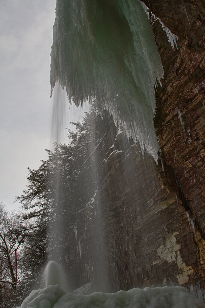
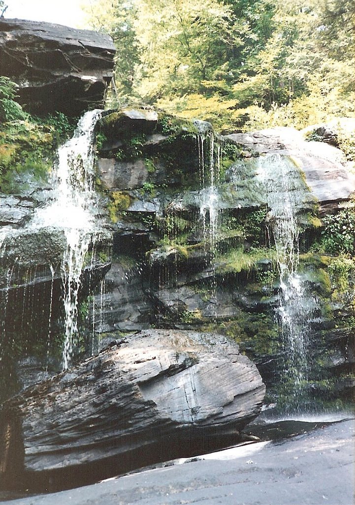
Verkeerder Kill Falls
New York • 187 ft
By Armen Suny · Last verified May 2026
Difficulty
Moderate
Trail Length
6.5 miles
Trail Type
Out And Back
Elevation Gain
700 ft
About Verkeerder Kill Falls
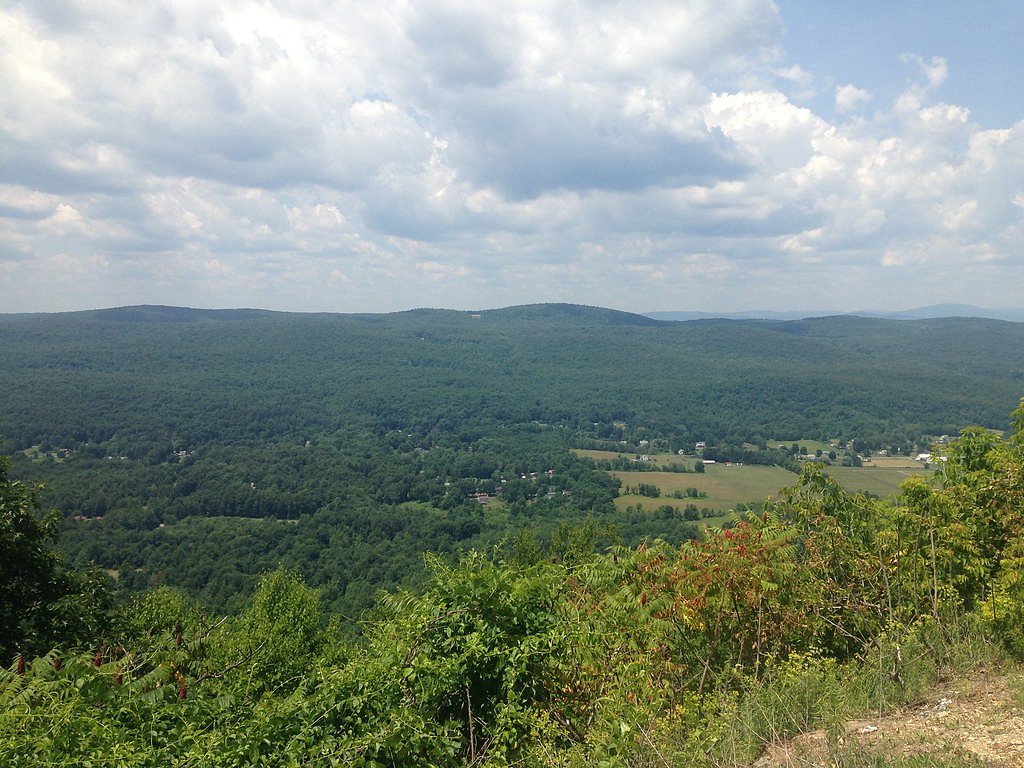
Tucked into the Shawangunk Mountains in the town of Shawangunk, Ulster County, Verkeerder Kill Falls is the signature drop within Sam's Point Preserve, part of the Minnewaska State Park Preserve. Framed by the preserve's dramatic open ridges and rare dwarf pitch pine barrens, the falls have long been celebrated for their scenic presence. Sources have often reported the waterfall's height as 187 feet (57 m), but a 2025 measurement organized by local historian and naturalist Marc B. Fried — using inclinometer readings and trigonometric calculation — found the vertical drop to be 79 feet (24 m), a revised figure that has clarified past estimates without diminishing the site's scenic appeal. The falls are reached via a forested, moderately challenging out-and-back route that rewards hikers with sweeping views of the Shawangunks and close-up encounters with the preserve's unique ecology. Trails here wind across rocky terrain and exposed ridgelines through the dwarf pitch pine barrens that make Sam's Point special; sturdy footwear and good footing are recommended. Whether you're coming for photography, birdwatching, or a peaceful stroll among rare plant communities, Verkeerder Kill offers an inviting, memorable hike within the Minnewaska/Sam's Point landscape.
The Setting
Verkeerder Kill Falls sits at 1,660 feet along the Wallkill River, in the hills of New York. At 187 feet, it is among the taller waterfalls in New York.
Height: 187 feet
Nearby Falls Worth Visiting
Stony Kill Falls (87 ft) lies 3.2 miles to the northeast.
Trail & Hike Details
The Approach
The moderate 6.5-mile out-and-back trail gains 700 feet of elevation on the way to the falls.
Trail Description
Out-and-back, 6.5 miles round trip with approximately 700 feet of elevation gain; rated moderate. The trail is a natural surface with rocky, uneven sections and exposed bedrock on the ridgelines; expect short steep pitches but no technical scrambling. The route is generally well-marked and passes through mixed hardwood forest, open ridges, and the distinctive dwarf pitch pine barrens of Sam's Point Preserve. Allow extra time for slower footing on rock and root-strewn stretches and for stops to enjoy views and interpretive signs.
What to Expect
The falls plunge 187 feet. Dogs are welcome.
Accessibility
The trail is not wheelchair accessible. Uneven terrain and elevation changes require steady footing.
Frequently Asked Questions
🐶 Are Dogs Allowed at Verkeerder Kill Falls?
✅ Dogs are allowed
Are There Any Fees or Permits Required?
🤑 Fee: $10.00
🏊 Is There Swimming at Verkeerder Kill Falls?
❌ Swimming is not allowed
When to Visit
The best time to visit Verkeerder Kill Falls is in the spring or after heavy rainfall when the waterfall is at its fullest. Fall is also a popular time due to the vibrant foliage.
Seasonal Access
The best time to visit is Spring, Summer, and Fall. Winter access may be limited.
Safety Information
The trail can be rocky and slippery, especially after rain. Stay on marked trails to avoid damaging the fragile ecosystem. Be cautious near the edge of the falls, as the rocks can be slippery and there are no barriers.
Current Water Conditions
188 ft³/s
Current discharge — how much water is flowing
About average for this time of year
Based on 101 years of record
2.28 ft
Water depth at gauge
7-Day Discharge Trend
What does this mean for your visit?
Flow is about average for this time of year.
About This Gauge
This gauge is on a nearby waterway and may not reflect exact conditions at the falls.
7-Day Flow Outlook
Based on the USGS gauge WALLKILL RIVER AT GARDINER NY (14 km away).
Today
Moderate
214 cfs
4/10Tomorrow
Moderate
224 cfs
6/10Thu
Moderate
195 cfs
8/10Fri
Moderate
179 cfs
8/10Sat
Moderate
205 cfs
4/10Sun
Moderate
215 cfs
6/10Mon
Moderate
203 cfs
6/10Best window: Thu — moderate flow, sunny (trip score 8/10).
Best time of year: this gauge typically runs highest from mid February to mid May, peaking in March.
How we calculate this
This is a transparent outlook, not a precise forecast. We take the waterfall's current flow strength (how it ranks against its historical normal for today, from the nearest USGS stream gauge), carry that ranking forward along the gauge's seasonal curve, and nudge it for forecast rain. Confidence is highest for the next day or two and falls further out. Always check official conditions and your own judgment before visiting — high flows can be dangerous.
Know when to go.
Get a free email alert when waterfalls near Ellenville hit peak flow. We only send when conditions are worth the trip — no weekly newsletters, no spam.
Weather Forecast
Location & Access
Getting There
Verkeerder Kill Falls is located within the Sam's Point Preserve, which is part of the Minnewaska State Park Preserve in Cragsmoor, New York. Visitors can access the trailhead from the Sam's Point Visitor Center.
Get Directions on Google MapsParking
Parking is available at the Sam's Point Visitor Center, but it can fill up quickly, especially on weekends and during peak seasons. Arrive early to secure a spot.
Elevation
1,660 feet above sea level
Coordinates
41.685093° N, -74.328102° W
Visitor Tips & Gear
Arrive early to secure parking and avoid crowds. Bring plenty of water, as the trail can be exposed in some areas. Be prepared for rocky terrain and wear sturdy hiking shoes.
As an Amazon Associate, we earn from qualifying purchases.
With 6.5 miles and 700 ft of elevation gain, sturdy boots and trekking poles will help on this moderate trail. Sun exposure on the trail makes good sun protection a must in summer.

Polarized Sunglasses (Knockaround)
Cuts glare off the water so you actually see the falls — and your photos turn out better too.

Columbia Watertight II Rain Jacket
Packs into its own pocket, seam-sealed, and keeps you dry from spray and surprise rain.

Earth Pak Waterproof Dry Bag
Keeps your phone and gear dry when waterfall mist soaks everything else.

Waterproof Phone Pouch (AiRunTech)
Cheap insurance — take photos right next to the falls without killing your phone.

Timberland Euro Sprint Mid Waterproof
Trusted waterproof boot with premium leather and grippy rubber sole — reliable on rocky, wet trails.

TrailBuddy Trekking Poles
Lightweight aluminum, cork grips, and flip-locks that actually hold — a best-seller for good reason.
Where to Stay

Americas Best Value Inn New Paltz

Holiday Inn Express and Suites Montgomery by IHG

Moondance Ridge Suites

Tin Brook Bed & Breakfast
Browse vacation cabins and private rentals nearby
Unique outdoor stays — tents, yurts, and treehouses
Rent a campervan or RV for your waterfall road trip
Some links are affiliate links. We may earn a commission at no extra cost to you.
Additional Information
Nearby Attractions
Nearby attractions include Sam's Point Ice Caves, Lake Minnewaska, and Awosting Falls, all located within the Minnewaska State Park Preserve.
Wildlife
The area is home to a variety of wildlife, including deer, black bears, and numerous bird species. Visitors may also encounter unique plant species in the dwarf pitch pine barrens.
Cities near Verkeerder Kill Falls
Nearby Waterfalls
Writing about Verkeerder Kill Falls? Embed this waterfall on your site for free.